Map Brooklyn (16 results)
Published by AMERICAN MAP INC, NEW YORK 1950
- Softcover
Seller: Princeton Antiques Bookshop / Ruffolo Enterprises, Atlantic City, NJ, U.S.A.Princeton Antiques Bookshop / Ruffolo Enterprises
Contact seller4-star sellerCondition: Used - Fair
US$ 50.00
US$ 6.00 shippingShips within U.S.A.Quantity: 1 available
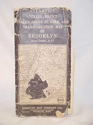
PAPER BACK BLACK. Condition: FAIR-. CIRCA 1950 map no.9451, no date shown, however on front inside cover in pencil is 1946?, map is tattered, folded in many ways with creasing and chipping to edges and map is in 2 sections (torn), cover is rubbed and chipping at edges and corners, map is clean and clear DATE PUBLISHED: 1950 EDIT…ION.

- Map
Seller: Geographicus Rare Antique Maps, Brooklyn, NY, U.S.A.Geographicus Rare Antique Maps
Contact seller4-star sellerVery good. Size 5.25 x 8.75 Inches. Maps of Hawaii and Puerto Rico, published in the 1905 edition of the Brooklyn Daily Eagle Almanac . The maps date to soon after the Spanish-American War, during which both territories were annexed by the United States. A Closer Look The front (recto) is a map of the Hawaiian Islands, including… an inset of Hawaii. Two notable features are the inclusion of sea routes to various points in the Americas and Asia, and indications on the Big Island of the direction of the lava flow of recent volcanic eruptions. The verso (back) is a map of the eastern half of Puerto Rico, that was evidently paired with a map showing the other half of the island on the opposite page. An inset map shows the islands of Culebra, Vieques, and other small islands off the east coast of Puerto Rico. A legend is included showing the notation for country (dirt) roads and 'macadamized roads,' an early form of paved road named for its inventor, John Loudon McAdam. The Height of U.S. Imperialism This map dates to a period, sometimes labeled New Imperialism or High Imperialism, in the late 19th and early 20th centuries when European powers plus the United States and Japan raced against each other to establish colonies, protectorates, mandates, and other forms of control over extant independent regions of the globe. The Spanish-American War was a critical moment for the United States' entry into this contest. Not only did the U.S. seize the Philippines, Puerto Rico, and Cuba (granted nominal independence after the war) during the conflict, it also annexed the recently-established Republic of Hawaii, which had resulted from a U.S.-backed coup d'etat against the Hawaiian Monarchy led by Queen Lili?uokalani in 1893. Publication History and Census These maps appeared in the Brooklyn Daily Eagle Almanac, 1905 , published by the daily newspaper of that name. The maps themselves are not cataloged in the holdings of any institution, while the entire almanac is held by a handful of libraries in the United States and abroad. References: OCLC 1041673845.

- Map
Seller: Geographicus Rare Antique Maps, Brooklyn, NY, U.S.A.Geographicus Rare Antique Maps
Contact seller4-star sellerVery good condition. Part of printed map on verso. Minor toning. Size 13.5 x 10.5 Inches. A scarce example of Fredrick W. Beers' map parts of the region of Canarsie, Brooklyn, New York City. Published in 1873. Detailed to the level of individual properties and buildings with land owners noted. This is probably the finest atlas m…ap these Brooklyn communities to appear in the 19th century. Prepared by Beers, Comstock & Cline out of their office at 36 Vesey Street, New York City, for inclusion in the first published atlas of Long Island, the 1873 issue of Atlas of Long Island, New York. References: New York Public Library, Map Division, 1527274.

- Map
Seller: Geographicus Rare Antique Maps, Brooklyn, NY, U.S.A.Geographicus Rare Antique Maps
Contact seller4-star sellerGood. Light wear along original centerfold. Closed margin tear professionally repaired on verso. Some soiling. Text on verso. Size 16.75 x 26.25 Inches. This is an 1863 Johnson and Ward city plan or map of New York City and Brooklyn, here in its first state. The map depicts the island of Manhattan and the borough of Brooklyn as…well as parts of Jersey City and Hoboken. Central Park is shown in an earlier incarnation than we know today with the lakes in the southern portion of the park being somewhat vaguely displayed. In the central part of the Park, we find the Old Reservoir which is today's Great Lawn. The important ferries running between New York, the boroughs, and New Jersey, are all noted. In Queens we can see the newly built Long Island Railroad leaving Flushing station. At the tip of Roosevelt Island where now stands a decrepit ruin, there is a war hospital. The whole features the strapwork style border used by Johnson in his atlases between 1860 and 1863. Publication History Prior editions of the Johnson atlas (1860 and 1861), including the Johnson and Browning editions, did not contain a New York City plan. It was first issued in 1862 and remained unchanged in the 1863 edition. This particular map was most likely based upon the third state of the Colton New York City map. Published by A. J. Johnson and Ward as plate nos. 29-30 in the scarce 1863 edition of Johnson's Family Atlas . This is the second edition of Johnson's atlas to bear the 'Johnson and Ward' imprint. References: Rumsey 0352.022 (1864 edition). Philips (Atlases) 843. Haskell, D., Manhattan Maps: A Co-operative List, 1119.
 More images
Sign marked Routes to the Triborough and Bronx-Whitestone Bridges / Triborough Bridge Authority Traffic Crossings Linking the Boroughs of Manhattan, Bronx and Queens.
1939 Hagstrom Map of New York City, w/ Never-Built 'Battery-Brooklyn Bridge'
- Map
Seller: Geographicus Rare Antique Maps, Brooklyn, NY, U.S.A.Geographicus Rare Antique Maps
Contact seller4-star sellerLight wear along original fold lines. Images and text on verso. Size 19.5 x 16.25 Inches. This engrossing c. 1939 folding map of New York City was prepared by local cartographic firm Hagstrom for the Triborough Bridge Authority. Meant primarily to inform motorists, it also serves as a celebration of the vision of urban planner a…nd highway enthusiast Robert Moses. At the same time, the map chronicles one of Moses' rare defeats, the never-built 'Battery-Brooklyn Bridge.' A Closer Look Highly practical, the map includes a host of information on highways, major local roads, bridges and tunnels, ferries, airports and airfields, parks (another domain in Moses' kingdom), golf courses, and more. The map also includes some aesthetic flairs, including the ornate text used for waterways, harkening back to the engraved maps of the early modern period. Several important buildings are illustrated or otherwise indicated, including sports stadiums and Manhattan's major train stations (the only nod to the existence of the city's extensive train and subway network). Proposed or ephemeral structures such as the never-built Secaucus Airport and the short-lived Madison Square Garden Bowl in Queens are also included. Another obvious element of the map, marked out in orange, is the site of the 1939 World's Fair. Again, Robert Moses was a major driving force behind this feature of the city's landscape, having desired for years to transform the swamp-like wetlands, which were being used as a dumping ground for coal ash, into a beautiful park. The main purpose of the map, however, is to celebrate the opening of the Triborough and Bronx-Whitestone Bridge, opened in 1936 and 1937, respectively. The Triborough was the crowning achievement of Moses' career, a clear demonstration of the ease and efficiency of movement that could be achieved, even in the urban jungle of New York City, with enough concrete and willpower. While cursorily providing toll rates, most of the verso is occupied by photographs and renderings of the new bridges, including a miniaturized version of Edward Spofford's c. 1936 intricate bird's-eye view (also sold by us TriboroughBridgeAuthority-spofford-1936). Robert Moses and the Triborough Bridge Authority This map, like much else in New York City at the time, was connected to the influential urban planner Robert Moses. The Triborough Bridge (Robert F. Kennedy Bridge) was born of New York City's ambition to modernize its infrastructure and improve transportation during the early 20th century. Initially proposed in the 1920s as a means of connecting Manhattan, the Bronx, and Queens, the project gained momentum with the formation of the Triborough Bridge Authority in 1933, led by Moses. The bridge's construction was envisioned as part of the city's response to the increasing demand for efficient transportation routes and as a strategy to provide jobs during the Great Depression. Funded in part by federal New Deal programs, including the Public Works Administration, the ambitious project faced numerous financial and engineering challenges before construction began in earnest in 1934. The Triborough Bridge opened to traffic on July 11, 1936, and immediately transformed regional connectivity, facilitating commerce and travel between the boroughs while embodying the era's spirit of bold, transformative infrastructure projects. Its completion marked a pivotal moment in New York City's evolution into a modern, car-centric metropolis. When the Power Broker's Power Broke Perhaps the most noticeable and certainly the most unusual feature of this map is the non-existent 'Brooklyn-Battery Bridge,' noted as 'under construction.' To call this an exaggeration would be an understatement; 'under consideration' would be much more accurate. Moses was an ardent proponent of bridges, considering them easier and cheaper to build than tunnels, and more aesthetically pleasing to boot. But even though he had considerable political support at the city, state, and.
 More images
- Map
Seller: Geographicus Rare Antique Maps, Brooklyn, NY, U.S.A.Geographicus Rare Antique Maps
Contact seller4-star sellerGood. Light wear along original fold lines. Soiling. Shows use. Map is printed on both sides so both sides cannot be displayed at once. Size 16.75 x 26 Inches. This is a 1914 C.S. Hammond double-sided road map of Long Island with eastern Suffolk County on the recto and New York City on the verso. Eastern Suffolk County A map of…eastern Suffolk County occupies the recto. Major roads are illustrated and are differentiated between 'good roads' and 'fair roads'. Riverhead, Southold, and Southampton are illustrated. An inset along the upper border continues along South Shore and focuses on East Hampton. A second, smaller inset continues the North Shore and illustrates Orient Point, Gardiners Bay, and Plum Island. Brooklyn and Queens On the verso, a map illustrating New York City and Nassau County, depicting from New Jersey east to Smithtown and Central Islip. Red lines highlight major highways, just as it was on the recto in eastern Suffolk County, but only a handful of other roads are illustrated east of Brooklyn and Queens. The street grid in Brooklyn, Manhattan, and the Bronx is illustrated, along with certain neighborhoods in Queens, including Long Island City, Flushing, and Corona. Towns farther east on Long Island are labeled, many of which have small street grid illustrations as well. The Long Island Railway is depicted, and lines of red dots trace long-distance trolley lines. Both the Atlantic and Long Island Sound coastlines are covered in detail. Publication History and Census This map was created and published by C.S. Hammond in 1914. We note earlier and later examples of Hammond's map of Long Island in OCLC, but the 1914 edition does not appear in the database.

- Map
Seller: Geographicus Rare Antique Maps, Brooklyn, NY, U.S.A.Geographicus Rare Antique Maps
Contact seller4-star sellerVery good. Original coloring, hand color on some roads. Size 24 x 20 Inches. This richly detailed map of Brooklyn was, in its first 1898 issue, the first map to show Brooklyn as a borough, in the aftermath of the city's annexation by New York City. The Brooklyn Eagle continued to include the map in its almanac as late as 1912 an…d possibly later, adding detail to the map as time progressed. Parks and Parkways We are aware of three separate printings of this map, of which this is the third. To its key has been added the following: NOTE: Purple lines indicate Parkways of Streets under Control of the Park Department Green Areas denote parks Among these, Ocean Parkway is prominently marked, along with Bay Shore Parkway and Highland Boulevard. Brooklyn's equestrian history is captured here just as it dwindled: the Brooklyn Jockey Club (between Gravesend and Ocean Parkway) would close in 1910; the Coney Island Jockey Club would be shuttered in 1911. The Brighton Beach Race Course was closed for horse racing in 1908; attempts at keeping the course going with automobile races would continue until the 1920s. (The 1898 issue of the map showed only dotted lines for these features, indicating prospective works.) There are more changes to the map than colored roads and parks, however: for example, the former connection of Seventh Avenue and Shore Parkway, which fell between Fort Hamilton and Dyker Beach Park, has been removed from the map: the lands associated with Fort Hamilton have been expanded and are marked a government reservation. A Wonderful Map of Brooklyn The map is expertly detailed, focusing primarily on all the mass transportation available at the time, showing existing and proposed streets and railroads, elevated lines, cable cars, trolleys and horse-trolley routes. The map shows and names piers, as well as ferry routes to Manhattan and New Jersey. The map was initially issued by the Brooklyn Daily Eagle , for inclusion in that newspaper's Almanac for the year 1900. (This strikes an ironic note, as The Eagle had opposed New York's absorption of the City of Brooklyn in the 1894 vote.) Publication History and Census Though he is not credited on this map, it was drawn by Robert D. Servoss - a New York Lithographer whose work for Edsall and other map publishers appears across a span of over fifty years. OCLC lists six examples of this separate map in institutional collections, albeit insufficiently precisely for determining specific state changes and dating. References: OCLC 58758680.

City and County Map of New-York Brooklyn, Williamsburgh, Jersey City and the adjacent Waters etc.
1853 Colton Large-Scale Map of New York City, Brooklyn, Williamsburg
- Map
Seller: Geographicus Rare Antique Maps, Brooklyn, NY, U.S.A.Geographicus Rare Antique Maps
Contact seller4-star sellerCondition: Used
US$ 16,800.00
US$ 17.00 shippingShips within U.S.A.Quantity: 1 available
Good. Some minor toning and foxing. Light water staines. On original linen. Stable. Size 29.25 x 53.75 Inches. This is J. H. Colton's large and impressive case map of New York City, including Brooklyn and Williamsburg. It is one of the largest and best maps of New York City to emerge in the mid-19th century. A Closer Look This m…ap is a lineal descendent of Colton's New York City map of 1836, one of his first and most influential maps. As such, it follows Burr's engraving in illustrating Manhattan 'on its side' with a northwesterly orientation. Coverages here extends across both the Hudson and East Rivers to incorporate Brooklyn, Williamsburg, Bushwick, Queens (Astoria), Jersey City, and Hoboken. Shading emphasizes those parts of Manhattan with the most development: generally south of 34th St. and north along Third Avenue as far as Yorkville (86th St.) and Harlem (Haerlem; 124th Street). The full street grid is comprehensively laid out according to the 1811 Commissioner's Plan as far north as 154th Street, north of which the grid is tentatively ghosted-in. (This plan for northern Manhattan was ultimately modified due to the hilly terrain.) An inset in the upper left details the city as mapped by Ames Lyne in 1728. Other insets detail Boston and Philadelphia, the nearest large cities. A further inset in the lower right illustrates the greater New York area, extending coverage as far west as Moriston and New Brunswick and as far east as Manhasset. In the upper right, there is a version of the famed Visscher View, here attributed (correctly) to Adrien Van der Donck (Dunk) and dated (maybe accurately) to 1656. The view shows New York under the Dutch, before the construction of its fortifications. A cargo hoist and gallows (empty) are recognizable in the foreground. Publication History and Census This map was engraved by David Griffing Johnson and was likely first issued in 1845. The New York Public Library holds an edition dating to 1849, though largely similar. We see an 1857 example at the Library of Congress (G3804.N4 1857 .J2). We see no other examples of this 1853 edition, though we do see a map of the same title at the New York Public Library issued by Thayer, Bridgman and Fanning. References: Haskell, D., Manhattan Maps A Co-operative List, #808. OCLC 55226720.

- Map
Seller: Geographicus Rare Antique Maps, Brooklyn, NY, U.S.A.Geographicus Rare Antique Maps
Contact seller4-star sellerFair. Mends at junctures of folds; two surface tears with minimal loss; margin chip reinstated with slight loss of border. Else very good. Size 18.5 x 23.5 Inches. This is a handsome example of William Bishop's 1871 pocket map of Brooklyn, New York. It captures Brooklyn as the third-largest city in the United States after a popu…lation boom in the wake of consolidation and the commercialization of the steam ferry. A Closer Look Surrounded with a decorative vine-and-leaf border, this attractive east-oriented map presents Brooklyn during the boom that characterized the second part of the 19th century. The street layout, mimicking the grid system of Manhattan, is shown in detail. The map notes important buildings, ferry crossings, bridges, train lines, and 'plank roads'. Also marked are public buildings and lands such as the Lunatic Asylum, the Hospital, the Alms House, the Military Parade Grounds, the Marine Hospital, and the Navy Yard. Manhattan appears in the lower left. Greenwood cemetery is depicted, as is Prospect Park, then under construction. (This is one of the first maps to show Olmstead's design.) An attractive cartouche includes a portrait of Brooklyn's City Hall. Cartographically this map references and expands upon the 1846 map of Brooklyn surveyed and prepared by Richard Butt. Exodus from Manhattan In the mid-19th century, fueled by the advent of the steam ferry, which made crossing the East River practical, Kings County experienced an explosive population boom. Rich and poor alike abandoned the dirty and claustrophobic Manhattan for the suburban lands across the East River. In 1855, the communities of Brooklyn, Greenpoint, Bushwick, and Williamsburg consolidated into one large city, modern-day Brooklyn. It was around this time that the term 'Kings County' began to fall out of popular usage in favor of 'Brooklyn.' By 1865, Brooklyn had become the third largest city in America, behind New York and Philadelphia. Publication History and Census This map was drawn by A. Brown of 47 Nassau Street, New York, for inclusion in William G. Bishop's 1871 Manual of the City and Corporation of Brooklyn . We see only four examples of this map in OCLC, appearing in Brooklyn, New York, and Queens Public Libraries, as well as the New York Historical Society. References: OCLC 58758634. New York Public Library Map Div. 01-1836. Brooklyn Collection, Brooklyn Public Library, Document 51. Bulletin of the New York Public Library, Vol 4, 1902, Page 86.
 More images
- Map
Seller: Geographicus Rare Antique Maps, Brooklyn, NY, U.S.A.Geographicus Rare Antique Maps
Contact seller4-star sellerVery good. Comes with original binder. Map has been backed on archival tissue. There were a few older repairs on the verso, which causes some slight discoloration on the recto (apparent as brown spots). We have reversed and redone these repairs with archival materials. Original old color. Size 20 x 32 Inches. The rare full-color… edition of Charles Magnus's extraordinary 1855 broadside map of New York City, issued to commemorate the signing of the Declaration of Independence. This is one of the finest and most visually striking maps of New York City to appear in the 19th century. Moreover, the present example is only the 2nd full original color example of this map we have seen. A Closer Look The map depicts the entirety of Manhattan as well as most of Brooklyn, Bedford-Stuyvesant, Williamsburg, Greenpoint, Queens, Ravenswood, Astoria, Jersey City, and Hoboken. An inset map at the bottom center details Long Island. The whole is rendered in detail with special attention given to individual streets, blocks, parks, and important buildings. The map reveals the early growth of Hunters Point, or Long Island City in Queens. Important ferry crossings, canals, and railroads are also included. In Hoboken, Jersey City, and Long Island City, several planned landfills are indicated. Also in Hoboken, we see the Elysian Fields, a park along the Hudson River that hosted the world's first baseball game. Manhattan In Manhattan, the map identifies various districts including Manhattanville, Yorkville, and Harlem. Central Park has yet to manifest and although the grid structure above 155th Street is ghosted in, it was not yet formally approved. Where Columbia University stands today, this map shows the location of the New York Lunatic Asylum. At the bottom center an alphanumerically keyed legend notes 'Universities, Colleges and Scientific and Literary, Benevolent-Institutions,' 'Public Buildings', and 'Places of Amusement.' In the lower left, there is an inset engraved depiction of New York's City Hall. Steamships are shown navigating the Hudson River in both the upper right and upper left quadrants. The Medallion In the lower right an elaborate medallion features the full text of the Declaration of Independence as well as sigils representing each of the original 13 colonies. A bright blue pastedown, unique to this example, declares the purpose of this map, to commemorate the 79th Year of the Independence of these United States . The whole is surrounded by an attractive acanthus leaf motif border. Publication History and Census This map was issued in lithograph in 1855 by the New York publisher Charles Magnus. Most examples are broadsheets, in black and white, intended for framing. At the same time, a few examples were issued as folding pocket maps, as here. These few were elaborated with a full hand-color treatment. While we have seen and handled other examples of the uncolored broadside, this is only the second example we have seen of this, full-color issue (the other one having passed through our hands about 5 years previous). It is unfortunately impossible to identify if examples held in some institutional collections are uncolored broadsides or colored pocket maps, as most are poorly cataloged and not digitized. It is nonetheless of extreme rarity on the market in any state, but particularly this full-color issue. References: OCLC 23876813. Haskell, Daniel Carl, Manhattan Maps; a Co-operative List, 1004.

- Map
Seller: Geographicus Rare Antique Maps, Brooklyn, NY, U.S.A.Geographicus Rare Antique Maps
Contact seller4-star sellerGood. Wear on old fold lines. Laid on archival tissue. Minor infill at some fold intersections. Size 26.75 x 20.25 Inches. A rare 1868 map of Brooklyn, New York, by Matthew Dripps. This is also one of the first general maps of Brooklyn to include Prospect Park, which at the time was still under construction. When this map was is…sued Brooklyn was a bustling city but remained very much in the shadow of Manhattan. Today, Brooklyn is officially the 'Hippest place on earth!' A Closer Look Unlike most earlier maps of Brooklyn, which were oriented to the west, Dripps oriented his map to the northeast - and in doing so established a new convention followed by most subsequent Brooklyn maps. The map covers Brooklyn from Evergreen Cemetery and the Newtown Creek south to roughly 60th street and extends east to Clarkson Avenue and Fort Hamilton Avenue. It includes modern-day Brooklyn Heights, Williamsburg, Greenpoint, Fort Green, Bedford Stuyvesant, Bushwick, Park Slope, Flatbush, Clinton Hill, Boerum Hill, Prospect Heights, and Fort Green. Publication History and Census This map published by Matthew Dripps in 1868. There is a roughly contemporaneous map of the same title, also by Dripps, at 200% scale. The map is held by approximately 5 institutional collections - often in poor condition. References: OCLC 196498535.
 More images
Map of the city of Brooklyn, as laid out by commissioners, and confirmed by acts of the Legislature of the state of New York, made from actual surveys the farm lines and names of original owners being accurately drawn from authentic sources. Containing also a map of the Village of Williamsburgh, and part of the city of New-York: compiled from accurate surveys and documents and showing the true relative position of all.
1852 Colton Commissioners' Plan / Map of Brooklyn and Williamsburg
- First Edition
- Map
Seller: Geographicus Rare Antique Maps, Brooklyn, NY, U.S.A.Geographicus Rare Antique Maps
Contact seller4-star seller1st Edition. Very good. Steel plate printing on onion-skin paper. Wear and toning along some old fold lines. Archival verso reinforcement at most fold intersections - a few minor points of infill at the same. Accompanies original binder. Size 36 x 48 Inches. This is J. H. Colton's impressive large-scale 1852 map of Brooklyn and…Williamsburg. In its 1839 first edition, it is the Brooklyn equivalent to both the 1811 Commissioner' Plan and Colton's great 1836 map of Manhattan, and as such can reasonably be considered the most important and best map of Brooklyn to appear in the 19th century. The present map, 1852, is, in so far as we can tell, the third edition, retaining much of the significance of the first, while also featuring fascinating updates illustrating the break-neck pace with which Brooklyn was then urbanizing. Creating Brooklyn This map was first issued in the wake of a February 28, 1839 New York State legislative act validating the work of Brooklyn Street Commissioners John S. Stoddard (surveyor and engineer), Alonzo. G. Hammond (commissioner), Samuel Cheever (commissioner), and Isaiah Tiffany (commissioner). These individuals were appointed four years earlier, in 1835, and dedicated the intervening years to completing a comprehensive plan for expanding urbanized Brooklyn by breaking up old estates and farms into streets, avenues, and property lots. The Act passed in 1839 confirmed their work as the official map of Brooklyn - this map by Colton closely followed, representing the earliest published official map of Brooklyn. In the first edition, Stoddard, Hammond, Cheever, and Tiffany are named. In subsequent editions, as here, they are named simply as 'the Commissioners'. It is likely that their names were removed due to criticism that made their names unpopular. A Bit of Controversy The publication of this map in 1839 was the cause of considerable controversy. Hammond, who drew the map, initially submitted the copyright on his own behalf, before transferring it to Colton. It was argued that by doing so he violated the rights of the city of Brooklyn. He defended himself in the Long Island Star , While the laying out of the city was in progress, very many highly respectable citizens were in the frequent habit of calling upon Mr. Hammond at his office, and enquiring how they could obtain a map when the work was completed, and if one would be published? Under these influences Messrs Hammond and Stoddard entered into an arrangement by which the former was to secure the copy right for their mutual benefit, and the latter was to furnish a manuscript, and to unite their exertions to procure the publication of such a map In doing this no pecuniary motive had influence and feared they might sustain a loss [believing] that none but a map publisher could safely publish with the prospect of covering expenses they transferred all benefits of the copy right to Mr. Colton of New York, a justly celebrated publisher The city of Brooklyn, as such, could never publish a map for the use of the citizens without expenditure far above their receipts. ('Long Island Star', March 14, 1839) A Closer Look Oriented to the southeast, coverage embraces only a small part of modern-day Brooklyn, including Downtown Brooklyn, Brooklyn Heights, Williamsburg, Bedford-Stuyvesant, Red Hook, Gowanus, Park Slope, Greenwood Cemetery, the Navy Yard, and Sunset Park. Southern Manhattan and Governors islands appear at the base of the map. Concentric circles in quarter-mile increments illustrate distances from the Battery, underscoring Brooklyn's deep and long-standing connection to Manhattan - even though at the time they remained separate cities. The map also meticulously notes swamp lands and drainage areas of natural ponds and rivers, including some that remain (if much changed) like Gowanus Creek and Bushwick Inlet, and others, like Freek and Denton's mill ponds, which have long been drained. Brooklyn Farm Lines Like Manhattan during his same period.

New Map of Kings and Queens Counties New York.
1886 Beers Wall Map of Brooklyn, Queens, and Nassau County, Long Island
- Map
Seller: Geographicus Rare Antique Maps, Brooklyn, NY, U.S.A.Geographicus Rare Antique Maps
Contact seller4-star sellerGood. Laid on linen in two large separate sections. Both exhibit wear on old fold lines and slight loss at some fold intersections. Accompanies original binder. Left and right sections (see image 3) could be joined with a linen binding strip on request. Size 52.5 x 53.25 Inches. A most intriguing large scale 1886 folding wall ma…p of Brooklyn and Queens issued by J. B. Beers. The map reflects enthusiasm for Long Island at the height of the late 19th-century Long Island Real Estate Boom. The map's coverage extends from Manhattan to the modern-day border of Suffolk County, including all of Brooklyn, Queens, and Nassau County (separated from Queens in 1899). Like most Beers maps, it is impressive in its details, marking individual property owners throughout. Advertisements and Insets The large map is surrounded by promotional advertisements for a variety of New York businesses, ranging from monument makers, to plumbing fixtures, to 'reliable dry goods', to farm implements. Most are admittedly quite morbid, with monument makers and undertakers being the most prevalent advertisers. In addition, there are inset maps of Richmond Hill, Long Island City, Morris Park, Hollis, Sea Cliff, Bath, Cedarhurst, Sheepshead Bay, Coney Island, and Rockaway. There is also an interesting inset of the Merrick Camp Grounds - built for annual Methodist revival meetings. Merrick Camp Grounds The Third Great Awakening swept through the United States in the second half of the 19th century, leading to widespread Revivalism. Revivalism assumed that religious devotion goes through periods of decline and renewal. 'Renewal' led to regular religious meets - often at large camps - where in faith leaders would preach and 'correct' the wayward. The Methodist Revival movement gained exceptional momentum in Long Island where, in 1869, the Camp Meeting Association constructed a large revival site in Merrick, New York. The site, occupying some sixty acres, consisted of a large central tabernacle surrounded by concentric circles of houses and cottages that could be rented by the faithful. While the regular population of the camp hovered around 300 people, during revival meetings it could surge to more than 10,000. While revival meetings are no longer held at the Merrick Camp, some of the old cottages remain. Publication History and Census The map was published by J. B. Beers in 1886. We are aware of only one edition. The map is rare and often found in exceptionally poor condition - even in institutional collections. We note perhaps six verifiable holdings, including the Library of Congress and the New York Public Library. Scarce to the market. References: OCLC 878597731. Library of Congress, G3804.N4:3B8 1886 .J2. New York Public Library, Map Div. 16-5970.

Map of the City of Brooklyn showing the railroads, warehouses, horse car lines, Coney Island and Rockaway Beach Depots.
1891 Railway Publishing Company City Plan or Map of Brooklyn, New York
- Map
Seller: Geographicus Rare Antique Maps, Brooklyn, NY, U.S.A.Geographicus Rare Antique Maps
Contact seller4-star sellerAverage. Wear along original fold lines. Areas infill in lower left corner and at several fold intersections not effecting areas of the city. Size 23.75 x 27.25 Inches. This is an 1891 Railway Map and Publishing Company city map of Brooklyn, New York. Published only a few years before consolidation, Brooklyn appears with rich de…tail throughout, including labeled streets, elevated railways, and the Long Island Railroad. A Closer Look The Prospect Park and Coney Island Railroad, South Brooklyn Railroad and Terminal Company, and the Brooklyn, Bath, and Westend Railroad are illustrated. Prospect Park is illustrated in detail as well, with paths throughout. Greenwood Cemetery is shaded green, and a detailed plan of the cemetery is included on the verso. Greenpoint, Williamsburg, South Brooklyn, Flatlands, and East New York are labeled. Piers along the East River are identified by owner, which include steamship companies, mail lines, stores, grain elevators, and other businesses. Ferry routes across the East River appear as dashed lines and are identified. Publication History and Census This map was created and published by the Railway Map and Publishing Company in 1891. This is the only known example of the 1891 edition. In the OCLC, we note two examples of an earlier map by S. D. L. Taunton bearing the same title. This likely represents an earlier edition of the present map, as Taunton worked for the Railway Map and Publishing Company. However, Taunton absconded from New York in 1885 with numerous debts along with funds collected on behalf of the Railway Map and Publishing Company. Ironically, two of the maps on the verso (the plan of Greenwood Cemetery and the map of Coney Island) both bear Taunton copyrights.

- Map
Seller: Geographicus Rare Antique Maps, Brooklyn, NY, U.S.A.Geographicus Rare Antique Maps
Contact seller4-star sellerVery good. Backed on archival tissue for stability. Closed tear extending approximately 1.5 inches into the printed area from left margin along with other minor closed tears along left margin. Light soiling. Blank on verso. Size 18 x 22.5 Inches. An exceptionally scarce 1852 map of New York City by Charles Magnus. Essentially tw…o maps on one sheet. The left-hand map focuses on Manhattan and adjacent parts of Brooklyn. It extends northwards as far as 51st street. The right-hand map focuses on Brooklyn and Williamsburg when they were separate cities. It depicts Williamsburg as far as Morril Street and extends westward south of Division Avenue (current day Broadway) as far as Gowanus Bay and 59th Street. It extends eastward as far as Montgomery Street and Greenwood cemetery. The map is bounded by Bushwick on the north and Flatbush on the east. Throughout, both maps illustrate streets, important buildings, parks, city wards, piers, ferries, and rail lines. Surmounting the map there are three engraved views illustrating the University, Washington Square (future NYU), Manhattan as seen from the south, and New York's City Hall. Publication History and Census This map was engraved and issued by Charles Magnus in 1852. We note approximately 8 examples held institutionally. Scarce to the market. References: Haskell, D., Manhattan Maps: A Co-operative List, 962. OCLC 40996790. Brooklyn Library, MAP_1852-01-01.

Office of the President of the Borough of Brooklyn Bureau of Highways and Sewers Division of Street Plan Records Map of the Borough of Brooklyn City of New York 1939.
1939 Borough of Brooklyn City Map or Plan of Brooklyn w/ Manuscript Railroads
- Map
Seller: Geographicus Rare Antique Maps, Brooklyn, NY, U.S.A.Geographicus Rare Antique Maps
Contact seller4-star sellerVery good. Dissected and mounted on linen in 35 panels. Size 39.75 x 31 Inches. This is a 1939 Bureau of Highways and Sewers city map or plan of Brooklyn, New York featuring manuscript notations highlighting railroad lines in the borough. The map depicts the region from The Narrows and Staten Island (labeled as Borough of Richmo…nd) to Jamaica Bay and from Long Island City to the Atlantic Ocean. Myriad streets throughout Brooklyn are illustrated and labeled, along with the borough's many parks. Both Prospect Park and Greenwood Cemetery are illustrated in detail. Floyd Bennet Field, an airfield near Jamaica Bay, is also labeled. Some detail is present along the East River in Manhattan, including the Brooklyn Bridge, Manhattan Bridge, and Williamsburg Bridge spanning the river between Manhattan and Brooklyn. Manuscript Railroad Lines Several rail lines throughout Brooklyn are highlighted here in manuscript with different colors used to differentiate between the lines and a key is situated in the lower left corner. The orange lines indicate routes and yards owned by the Long Island Railroad (L.I.R.R.), including the Montauk Branch (from Long Island City and Bushwick and originally known as the South Side Railroad of Long Island) and the Bay Ridge Branch (originally opened as the New York, Bay Ridge and Jamaica Railroad in 1876). Today, only freight trains operate along the Bay Ridge Branch. The South Brooklyn Railway, which was founded in 1887, is marked here in purple. This railway operated under several different names and owners until it was acquired by the Brooklyn-Manhattan Transit Corporation in in the mid-1920s. Operation was transferred to the city on June 1, 1940, but use continued to decline throughout the second half of the 20th century. Today, the South Brooklyn Railway runs freight operations from the 36th-38th Street Yard, but most of the traffic is subway connections to the L.I.R.R. Bay Ridge Branch. Two specific rail networks, those used at the Bush Terminal and at the New York Docks are marked as well. Publication History and Census This map is most likely one of a kind. The base map was created and published by the Division of Street Plan Records of the Bureau of Highways and Sewers of the Office of the President of the Borough of Brooklyn in 1939, and we have been unable to locate any other known examples. That said, this example was repurposed by the Pennsylvania Railroad to illustrate railroad routes and ferries, making it a unique find.


