Order Total (1 Item Items):
Shipping Destination:

Map Works (10 results)
Author:
map works
Refine with Advanced Search
Skip to main search results
Search filters
Product Type
- All Product Types
- Books (7)
- Magazines & Periodicals (No further results match this refinement)
- Comics (No further results match this refinement)
- Sheet Music (No further results match this refinement)
- Art, Prints & Posters (1)
- Photographs (No further results match this refinement)
- Maps (2)
- Manuscripts & Paper Collectibles (No further results match this refinement)
Condition Learn more
Binding
Collectible Attributes
- First Edition (3)
- Signed (No further results match this refinement)
- Dust Jacket (3)
- Seller-Supplied Images (6)
- Not Print on Demand (10)
Language (2)
Free Shipping
Seller Location
Seller Rating
-

spiral_bound. Condition: Fair.
-

1994 Greater Buffalo and Niagara Falls, New York map, With Inset Maps of: East Aurora, Lockport, Batavia
Published by Map Works/AAA, 1994
map. Condition: Good. Minimal highlighting on map. Book shows common (average) signs of wear and use. Binding is still tight. Covers are intact but may be repaired. We have 75,000 books to choose from -- Ship within 24 hours -- Satisfaction Guaranteed!
-

Illinois: A Descriptive and Historical Guide (American Gide Series)
Seller: Dorley House Books, Inc., Hagerstown, MD, U.S.A.
Seller rating 4 out of 5 stars

Hardcover. Condition: Near Fine. Dust Jacket Condition: Near Fine. 48 pages b/w Photos; Map (illustrator). Revised edition; dj w/price clipped, in mylar; 775 clean, unmarked pages.
-
CALIFORNIA OFFICIAL HIGHWAY MAP, 1966 *
Published by CALIFORNIA Department of Public Works; H. M. Gousha Company., * * * * *, 1966
Map
Soft cover. Condition: Very Good. H. M. Gousha Company. 1966 Map: Very Good/, (illustrator). Map: Very Good/, $54.53 CALIFORNIA OFFICIAL HIGHWAY MAP, 1966 CALIFORNIA Department of Public Works. CALIFORNIA Department of Public Works; H. M. Gousha Company. 1966 Folding Road Map Of California, 1965, In: Very Good/, Condition, Child`s Scribbling Graffiti On Covers. Description Applies To This Map, ONLY. This Map Is Hard To Find, Will Be Packaged And Shipped Carefully, To Avoid Shipping Damage And Will Make It, An Excellent Addition To Your Own Personal Library Collection, Or As A Gift. WORLD WIDE SHIPPING, AVAILABLE.
-
US$ 20.61
US$ 28.01 shipping
Ships from United Kingdom to U.S.A.Quantity: 1 available
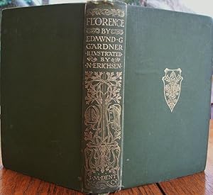
Add to basketHard Cover. With a Folding Map of Florence, 40 Illustrations By Nelly Erichsen & Many Reproductions from the Works of Florentine Painters & Sculptors (illustrator). Fourth Edition Revised & Updated. PAGES: xiii, 436 BINDING: Publishers original cloth with gilt decoration to front cover, gilt decoration & lettering to spine and top edges gilt. CONDITION: Covers a little worn, occasional foxing, otherwise a very good copy. Size: 8 3/4 X 5 3/4 Inche.
-

Finger Lakes, Western NY Atlas
Published by Map Works, 2006
ISBN 10: 1932276890 ISBN 13: 9781932276893
Spiral binding. Condition: Good. Finger Lakes, Western NY Atlas. First edition, 2006. Spiral binding. No markings noted; gentle wear.
-

MAP :"The Matthews-Northrup Company Up-To-date Map of Ohio, with Daily Reminder (Published in Vest Pocket style)
Published by Matthews-Northrop Works, Buffalo, NY, 1897
Seller: Dorley House Books, Inc., Hagerstown, MD, U.S.A.
Seller rating 4 out of 5 stars
Art / Print / Poster First Edition
Unbound. Condition: Very Good. Map (illustrator). 1st. small item to fit in traveler's vest pocket, map folded inside along with a notepad & calendar. The calendar is detached but intact Size: Map Size 20" x 13".
-

Unravelling the Spiral: The Life and Work of Fred Conlon (1943-2005)
Language: English
Published by Scotus Press, Dublin, 2010
ISBN 10: 0956096611 ISBN 13: 9780956096616
First Edition
US$ 48.09
US$ 38.62 shipping
Ships from United Kingdom to U.S.A.Quantity: 1 available
Add to basketSoft cover. Condition: New. Dust Jacket Condition: New. Many plates amny in colour and some full page plus a coloured map showing where his public works are. (illustrator). 1st Edition. New. Very slight marking to the top edge.
-
Connecticut: A Guide to Its Roads, Lore and People (American Guide Series)
Language: English
Published by Houghton Mifflin, Boston, MA, 1938
Seller: Dorley House Books, Inc., Hagerstown, MD, U.S.A.
Seller rating 4 out of 5 stars
First Edition
Hardcover. Condition: Very Good. Dust Jacket Condition: Very Good. B/w Illus; maps on end Papers; Fold-out Map in Rear Pocket (illustrator). 1st. 593 clean, unmarked pages/index; dj w/some hcipping, clipped price, in mylar; red faux-leathere w/gilt spine titles; lite wear at extremities;
-
Carte des Iles Britanniques et d'une partie septentrionale de la France dressee specialement pour servir a? la lecture des Oeuvres de Sir Walter Scott, indiquant exactement les lieux ou? se passent les scenes de ses romans et ceux de ses belles descriptions.
Publication Date: 1831
Seller: Geographicus Rare Antique Maps, Brooklyn, NY, U.S.A.
Association Member: ABAA ESA ILAB
Seller rating 4 out of 5 stars
Map
Excellent condition. Dissected and laid on linen. Accompanied by original casewithgiltgold. Size 24 x 19 Inches. A scarce and handsome folding map focusing on the British Isles and northern France engraved and published by Auguste-Fran�ois Ale?s in 1831. It celebrates the oeuvre of Sir Walter Scott (1771 - 1832) and labels locations that feature in his works. A Closer Look Coverage includes the British Isles, northern France, and part of the Low Countries. An inset at top-left highlights the distance between England and Palestine, while one at bottom-left focuses on Palestine itself. The main map and insets are intended to provide context for Scott's works, several of which are set during the Crusades, including Ivanhoe and The Talisman (translated into French with the title Richard en Palestine ). Particularly close attention is paid to areas around his hometown of Edinburgh. Flourishes are added by an elaborate title cartouche, complete with portrait of Scott, intricate border, and vignettes. A note at bottom discusses the genesis and aims of the map. Scott and His Works Sir Walter Scott was a Scottish writer who worked in several genres. He is especially important for developing the historical novel and for his contributions to Scottish literature and culture. Born and raised in Edinburgh, where he would spend most of his life, Scott studied law at the University of Edinburgh but in the process became deeply interested in literature and poetry. He was strongly influenced by German Romanticism, including its idealization of the Middle Ages and knightly chivalry (like Scott, Ale?s was squarely under the influence of German Romanticism, as seen in his delicate engravings of knightly arms and regalia). By the time of his death the year after this map's publication, Scott had become popular throughout Europe and his work influenced many later 19th century European novelists. Publication History and Census This map was engraved and published by Auguste-Fran�ois Ale?s in 1831, with the engraved portrait of Scott based on a painting by Charles Robert Leslie. Interest in Scott's work would have been high at the time. Aside from translations of individual works, his collected works were published in French by Auguste Wahlen in Brussels over several years in the late 1820s. The only known example of this work in institutional collections is with the Biblioth�que nationale de France. The present example is especially notable for its presentation, dissected and laid on linen for folding into an ornate case. References: OCLC 1353210191.