Order Total (1 Item Items):
Shipping Destination:

Maps Martin Benjamin (1 results)
Skip to main search results
Search filters
Product Type
- All Product Types
- Books (No further results match this refinement)
- Magazines & Periodicals (No further results match this refinement)
- Comics (No further results match this refinement)
- Sheet Music (No further results match this refinement)
- Art, Prints & Posters (No further results match this refinement)
- Photographs (No further results match this refinement)
- Maps (1)
- Manuscripts & Paper Collectibles (No further results match this refinement)
Condition Learn more
- New (No further results match this refinement)
- As New, Fine or Near Fine (No further results match this refinement)
- Very Good or Good (No further results match this refinement)
- Fair or Poor (No further results match this refinement)
- As Described (1)
Binding
- All Bindings
- Hardcover (1)
- Softcover (No further results match this refinement)
Collectible Attributes
- First Edition (1)
- Signed (No further results match this refinement)
- Dust Jacket (No further results match this refinement)
- Seller-Supplied Images (1)
- Not Print on Demand (1)
Language (1)
Price
- Any Price
- Under US$ 25 (No further results match this refinement)
- US$ 25 to US$ 50 (No further results match this refinement)
- Over US$ 50
Free Shipping
- Free Shipping to U.S.A. (No further results match this refinement)
Seller Location
Seller Rating
-
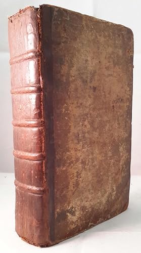
Miscellaneous Correspondence, Containing a Variety of Subjects, relative to Natural and Civil History, Geography, Mathematics, Poetry, Memoirs of Monthly Occurences, Catalogues of New Books, &c. Vol. II. For the Year 1757 and 1758.
Published by W. Owen. London, 1759
Map First Edition
US$ 684.95
US$ 31.92 shipping
Ships from United Kingdom to U.S.A.Quantity: 1 available
Add to basketFirst edition. Pages 461-964 + [8]pp index. Contains the following fold-out maps: Poland, Prussia and Lithuania opp. page 521, torn map of the area of London opp. page 561, Part of Persia opp. page 581, Chart of the English Channel opp. page 621, Commercial map of area around Leipzig opp. page 733 and Accurate map of the West Indies opp. page 937. A fold-out plate, torn in two, opp. page 833 + 18 engraved plates which incl. map of West Africa, a view of Fort St. Louis in Senegal, a path of the comet with the stars and the pictured constellations incl. Leo and Cancer in the bakground, a sailing ship, details of the Cherburg cannon and many natural history plates (incl. enlarged louse). Half brown calf, very worn and rubbed, pages browned, contents and binding sound. Please contact us for more information.