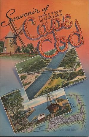
Massachusetts Cape Cod (32 results)

Published by Cape Cod National Seashore Women's Club, Massachusetts 1975
- Softcover
Seller: Bibliomadness, Worthington, MA, U.S.A.Bibliomadness
Contact seller5-star sellerSoft cover. Condition: Good. 96 pages. Stapled binding. Good condition. Some darkening and light soiling to covers and outside page edge with a couple small brown splash spots. All intact. No writing or marking. Not Ex-Library.

- Softcover
Seller: The Maryland Book Bank, Baltimore, MD, U.S.A.The Maryland Book Bank
Contact seller5-star sellerCondition: Used - Very good
US$ 18.97
US$ 4.69 shippingShips within U.S.A.Quantity: 1 available
paperback. Condition: Very Good. Used - Very Good.
- Softcover
Seller: Booksavers of Virginia, Harrisonburg, VA, U.S.A.Booksavers of Virginia
Contact seller5-star sellerCondition: Used - Very good
US$ 18.97
US$ 4.99 shippingShips within U.S.A.Quantity: 1 available
paperback. Condition: Very Good. In very good, unmarked condition. Minor corner bumping Your purchase benefits the world-wide relief efforts of Mennonite Central Committee.

- Softcover
Seller: Majestic Books, Hounslow, , United KingdomMajestic Books
Contact seller4-star sellerCondition: New
US$ 18.26
US$ 8.58 shippingShips from United Kingdom to U.S.A.Quantity: 1 available
Condition: New.
- Softcover
Seller: Books Puddle, New York, NY, U.S.A.Books Puddle
Contact seller4-star sellerCondition: New
US$ 23.01
US$ 3.99 shippingShips within U.S.A.Quantity: 1 available
Condition: New.

Cape Cod Kitchen Secrets
Cape Cod Hospital Aid Association, Yarmouth Branch, Yarmouth Port,Massachusetts
Published by Spaulding-Moss Co., Boston, Mass. 1958
- Softcover
Seller: cookbookjj, Pasadena, CA, U.S.A.cookbookjj
Contact seller4-star sellerCondition: Used - Very good
US$ 18.00
US$ 4.90 shippingShips within U.S.A.Quantity: 1 available
Spiral Bound. Condition: Very Good. Fifth. Plastic Spiral Bound Wraps VERY GOOD w/ a few tiny stains on front cover.
Published by Martha Harris Hastings, Hyannis, Massachusetts 1946
Seller: Peter L. Masi - books, MONTAGUE, MA, U.S.A.Peter L. Masi - books
Contact seller4-star sellerCondition: Used - Very good
US$ 15.00
US$ 5.35 shippingShips within U.S.A.Quantity: 1 available
Plastic comb. Condition: Used - Very Good. Copyright Applied for 1946, printed on Cape Cod. 20 pages. Pictorial map, drawings. 11 x 8.5", plastic comb, pictorial cover. Rhyming children's tale. Cover bit toned, text VG.
REPORT of the COMMITTEE on CAPE COD HARBOR, appointed under Chapter 84 of the Resolves of 1847. Public Document No. 36
Commonwealth of Massachusetts, Committee on Cape Cod Harbor, William P. Parrot, Engineer
Published by Commonwealth of Massachusetts 1857
Seller: Peter L. Masi - books, MONTAGUE, MA, U.S.A.Peter L. Masi - books
Contact seller4-star sellerCondition: Used - Fair
US$ 15.00
US$ 5.35 shippingShips within U.S.A.Quantity: 1 available
Pamphlet. Condition: Used - Acceptable. Boston: William White, Printer to the State, 1857. 26 pages. Folding plate. 9 x 5.75", printed wrapper. Reviews legislature to battle erosion following deforestation, proposes remedies. Lacking lower wrap, sewing gone, sheets loose, split, library marks, toned, corners chipped, fair.
Published by Tichnor Brothers, Boston 1935
- Softcover
- First Edition
Seller: R & A Petrilla, Booksellers & Appraisers, Roosevelt, NJ, U.S.A.R & A Petrilla, Booksellers & Appraisers
Contact seller4-star sellerCondition: Used - Very good
US$ 28.00
US$ 5.00 shippingShips within U.S.A.Quantity: 1 available
Pictorial Stiff Wrappers. Condition: Very Good. First Edition. (48)pp of views from photographs and drawings, including: Sagamore and Bourne Bridges; Quissett Harbor; Wood's Hole; Falmouth; Mashpee; Chatham; Hyannisport; Yarmouith; Provincetown; centerfold of seven lighthouses; &c; map inside back cover. Color-pictorial covers.…10" x 8.5" [WorldCat finds only two holdings: Strong Library and Bowling Green State U.].
- Softcover
Seller: Optimon Books, Gravesend, KENT, United KingdomOptimon Books
Contact seller5-star sellerCondition: Used - Good
US$ 47.60
US$ 23.77 shippingShips from United Kingdom to U.S.A.Quantity: 1 available
Paperback. Condition: Good. Scarce book in the UK, published in the USA. Paperback in Very good condition, no inscriptions, tight binding. A comprehensive guide to birdwatching in Cape Cod, Massachusetts, both on land and at sea. Includes a checklist of birds to be seen there, line drawings, maps of where to go.
Published by Cape Cod Shipbuilding Company, Wareham, Mass 1939
Seller: Peter L. Masi - books, MONTAGUE, MA, U.S.A.Peter L. Masi - books
Contact seller4-star sellerCondition: Used - Very good
US$ 35.00
US$ 5.35 shippingShips within U.S.A.Quantity: 1 available
Pamphlet. Condition: Used - Very Good. (16) pages. Halftones: Senior, Baby Knockabouts, Nimblet, Robin, Seascout, Yacht Tender, Skiffs and Punt, Playboats, Auto Top Boat. 8.5 x 4", pictorial wrapper. VG.
- Softcover
Seller: Revaluation Books, Exeter, , United KingdomRevaluation Books
Contact seller5-star sellerCondition: New
US$ 76.80
US$ 13.21 shippingShips from United Kingdom to U.S.A.Quantity: 1 available
Paperback. Condition: Brand New. 184 pages. 9.25x6.25x0.75 inches. In Stock.
Published by On Cape Publications 1990
- Softcover
Seller: Basement Seller 101, Cincinnati, OH, U.S.A.Basement Seller 101
Contact seller5-star sellerPaperback. Condition: New.

Report of the Commissioners Appointed Under Chapter 86 of the Resolves of 1867 In Relation to Cape Cod Harbor at Provincetown 1868 [LeatherBound]
Massachusetts. Commissioners in Relation to Cape Cod Harbor at Provincetown
- Hardcover
- Print on Demand
Seller: True World of Books, Delhi, , IndiaTrue World of Books
Contact seller5-star sellerLeatherBound. Condition: New. BOOKS ARE EXEMPT FROM IMPORT DUTIES AND TARIFFS; NO EXTRA CHARGES APPLY. LeatherBound edition. Condition: New. Reprinted from 1868 edition. Leather Binding on Spine and Corners with Golden leaf printing on spine. Bound in genuine leather with Satin ribbon page markers and Spine with raised gilt band…s. A perfect gift for your loved ones. Pages: 37 NO changes have been made to the original text. This is NOT a retyped or an ocr'd reprint. Illustrations, Index, if any, are included in black and white. Each page is checked manually before printing. As this print on demand book is reprinted from a very old book, there could be some missing or flawed pages, but we always try to make the book as complete as possible. Fold-outs, if any, are not part of the book. If the original book was published in multiple volumes then this reprint is of only one volume, not the whole set. Sewing binding for longer life, where the book block is actually sewn (smythe sewn/section sewn) with thread before binding which results in a more durable type of binding. Pages: 37.
Published by Washington, D.C.: Government Printing Office , 1908
- Art Print
Seller: Antiquariat Ruthild Jäger, Lueneburg, GermanyAntiquariat Ruthild Jäger
Contact seller3-star sellerCondition: Used
US$ 141.67
US$ 34.39 shippingShips from Germany to U.S.A.Quantity: 1 available
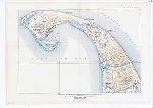
Lithography in three-colour-printing (black, blue, brown), 41 x 28 cm (= 16 x 11 in). In very good state of conservation. (from U. S. Geological Survey, 1908). * The precisely engraved map shows the Northern part of Cape Cod and the surrounding area from Race Point Lighthouse to Highland Life Saving Station and South Truro: with… indication of contour lines and many topographic details. (#6055AG).

- Hardcover
- Print on Demand
Seller: True World of Books, Delhi, , IndiaTrue World of Books
Contact seller5-star sellerLeatherBound. Condition: New. BOOKS ARE EXEMPT FROM IMPORT DUTIES AND TARIFFS; NO EXTRA CHARGES APPLY. LeatherBound edition. Condition: New. Reprinted from 1904 edition. Leather Binding on Spine and Corners with Golden leaf printing on spine. NO changes have been made to the original text. This is NOT a retyped or an ocr'd repri…nt. Illustrations, Index, if any, are included in black and white. Each page is checked manually before printing. Pages: 310 As this print on demand book is reprinted from a very old book, there could be some missing or flawed pages, but we always try to make the book as complete as possible. Fold-outs, if any, are not part of the book. If the original book was published in multiple volumes then this reprint is of only one volume, not the whole set. Sewing binding for longer life, where the book block is actually sewn (smythe sewn/section sewn) with thread before binding which results in a more durable type of binding. Pages: 310 Language: English.

Guide to contamination sources for wellhead protection 1989 [LeatherBound]
Noake, Kimberly D,Massachusetts. Division of Water Supply,Cape Cod Aquifer Management Project
- Hardcover
- Print on Demand
Seller: True World of Books, Delhi, , IndiaTrue World of Books
Contact seller5-star sellerLeatherBound. Condition: New. BOOKS ARE EXEMPT FROM IMPORT DUTIES AND TARIFFS; NO EXTRA CHARGES APPLY. LeatherBound edition. Condition: New. Reprinted from 1989 edition. Leather Binding on Spine and Corners with Golden leaf printing on spine. Bound in genuine leather with Satin ribbon page markers and Spine with raised gilt band…s. A perfect gift for your loved ones. Pages: 360 NO changes have been made to the original text. This is NOT a retyped or an ocr'd reprint. Illustrations, Index, if any, are included in black and white. Each page is checked manually before printing. As this print on demand book is reprinted from a very old book, there could be some missing or flawed pages, but we always try to make the book as complete as possible. Fold-outs, if any, are not part of the book. If the original book was published in multiple volumes then this reprint is of only one volume, not the whole set. Sewing binding for longer life, where the book block is actually sewn (smythe sewn/section sewn) with thread before binding which results in a more durable type of binding. Pages: 360.

- Map
Seller: Geographicus Rare Antique Maps, Brooklyn, NY, U.S.A.Geographicus Rare Antique Maps
Contact seller4-star sellerVery good condition. Size 18 x 21 Inches. This is an unusual 1932 Walter M. Gaffney pictorial map of Cape Cod, Massachusetts. Pictorial symbols, including an airplane, a deer, a windmill, lighthouses, and the Pilgrim Monument at Provincetown, add charm to the piece. Illustrations of the Mayflower, Leif Ericson's ship, and other…boats decorate Cape Cod Bay and the Atlantic. According to his daughter, Gaffney issued this map to make supplemental money while the architecture business suffered a downturn. Pictorial Style Map This is considered a 'pictorial map,' reflecting a style that first began to appear around 1910. As a map, its intention is not so much to provide direction as to illustrate the character, famous places, and historical appeal. Cartographically speaking, this map style most likely draws its inspiration from late 19th century 'tourist maps' and 'railroad maps.' Tourist Maps, common to major cities in Europe (usually Paris or London), included profiles of notable buildings and monuments and were designed to help foreign tourists identify and navigate to the most important sights. 'Railroad Maps' are a related genre more common to the United States. During the latter part of the 19th century railroad boom, railroad companies began issuing decorative route maps extolling the virtues various destinations and their accessibility by rail. Context Standing somewhere between these two map styles, our map combines the decorative aspects of both while reducing cartographic value. It may be hard to get from A to B using this map, but its attractive design and decorative flourishes make it an excellent souvenir and memento of a wonderful Cape Cod vacation. Publication History and Census This map does appear on the market from time to time. References: Rumsey 8170.

- Map
Seller: Geographicus Rare Antique Maps, Brooklyn, NY, U.S.A.Geographicus Rare Antique Maps
Contact seller4-star sellerGood. Exhibits wear along original fold lines. Exhibits areas of infill at fold intersections. Old tape repairs evident on verso. Size 20.25 x 27 Inches. This is a wonderful 1934 Kenneth Morang Art Deco style pictorial map of Cape Cod. Drawn for the tourist market, this decorative map depicts Cape Cod from Race Point and Provinc…etown to Buzzards Bay. The left and right margins feature various notes containing important information for 'Visitors who wish to see the Real Cape Cod' with details on 'Beautiful Trips off the Main Highways.' Important towns, including Monument Beach, Chatham, Barnstable, Hyannis, and Provincetown are labeled, along with lighthouses, yacht clubs, lakes, and airports. Ships are illustrated plying the waters of Vineyard Sound, Nantucket Sound, and Cape Cod Bay and an illustration of the Sacred Cod of Massachusetts is situated prominently within Cape Cod Bay. The title cartouche features a compass rose and a sea gull. A key below the title explains the notations used to differentiate between different types of roads. Several points of interests are marked using amusing notes including 'from a point off here laid the German Submarine which fired the only shot to land on American soil in the World War,' 'near the end (or if you prefer, the beginning) of the state long bridal trail which reaches to the Berkshires,' etc. Publication History and Census This map was created by Kenneth E. Morang and published by the Cape Cod Chamber of Commerce in 1934. We note three examples cataloged in OCLC which are part of the collections at the New York Public Library, the Newberry Library, and the University of Minnesota Twin Cities. We also note an example which is part of the collection at the University of Wisconsin Milwaukee. References: OCLC 434456767.

- Map
Seller: Geographicus Rare Antique Maps, Brooklyn, NY, U.S.A.Geographicus Rare Antique Maps
Contact seller4-star sellerVery good. Repaired tear extending ten inches from left margin. Blank on verso. Still attached to original booklet. Size 20 x 27.5 Inches. This is a 1907 George Walker and Company pocket map of southern Cape Cod, Massachusetts. The map depicts from Marion to Hyannis and from Bourne to Nantucket Sound and Vineyard Sound. Several…counties are labeled, including Marion, Bourne, Falmouth, and Barnstable as well as Cape Cod Bay, Nantucket Sound, Vineyard Sound, and Buzzard Bay. The Cape Cod Division of the New York, New Haven, and Hartford Railroad is depicted, along with numerous roads. Ponds and hills are labeled. Along the bottom border, a legend explains the different notations utilized throughout the map, including the difference between town and county borders and that the abbreviation P.O. after a town name indicates the presence of a post office. This map was published by George H. Walker and Company in Boston in 1907.

A Pictorial and Street Map of the Town of Chatham Cape Cod, Massachusetts Incorporated --- June 11, 1712.
1956 Welt-Brooks Pictorial Map of Chatham, Massachusetts, Cape Cod
- Map
Seller: Geographicus Rare Antique Maps, Brooklyn, NY, U.S.A.Geographicus Rare Antique Maps
Contact seller4-star sellerVery good. Light wear on original folds. Sights and attractions on verso. Size 18.5 x 20 Inches. An attractive 1956 first-edition pictorial map of Chatham, Massachusetts drawn by Welt-Brooks Studio and printed by the Spaulding-Moss Company for the Chatham Chamber of Commerce. It highlights local attractions, from historical site…s to summertime activities. A Closer Look Located at the 'elbow' in the southeast corner of Cape Cod, Chatham is known for its long history, having been visited by Samuel de Champlain in 1606, and for being a favorite summer destination for travelers and seasonal residents. The map covers the town and labels waterways, roads, islands, neighborhoods, and other features. Numbers throughout correspond to an index of 'points of interest' at left, while illustrations on and below the map depict quaint local scenes, including the Chatham Windmill and Chatham Light (like other towns on the coast of Massachusetts, Chatham's long history has endowed it with several historical buildings that are very old by American standards). The verso includes detailed information on directions to Chatham, favorite local activities (summer concerts, fishing, and beaches), institutions, such as the library, schools, and churches. Publication History and Census This map was drawn by Welt-Brooks Studio, a short-lived outfit that included local artist Milton Welt, and printed by the Spaulding-Moss Company for the Chatham Chamber of Commerce in 1956. It was issued several times, but all examples in institutional collections are dated to 1960 (the University of Toronto) and 1961 (the Boston Public Library). References: OCLC 977428204 (1960 edition), 1336963370 (1961 edition).
 More images
Bird's Eye View of Boston Harbor Along the South Shore to Provincetown.
1920 Union News View Map of Boston Harbor and Cape Cod, Massachusetts
- Map
Seller: Geographicus Rare Antique Maps, Brooklyn, NY, U.S.A.Geographicus Rare Antique Maps
Contact seller4-star sellerVery good. Light wear along original fold lines. Light toning. Minor closed margin tears repaired on verso. Reinforced where once attached to original binder. Accompanied by original binder. Size 16 x 19.5 Inches. This is a 1920 Union News view and map of the Boston Harbor from Boston to Provincetown. In the late 19th and early…20th century, such views were popular travel souvenirs sold at newsstands in train and ferry stations, as well as by newsboys onboard the trains and ferries themselves. A Closer Look The view covers all of Cape Cod Bay, Quincy Bay, and Dorchester Bay with the communities of Boston, East Boston, South Boston, Dorchester, Quincy, Hough's Neck, Mingham, Nantucket, Duxbury, Plymouth, Cohasset, Scituate, and Provincetown noted. Many of the islands in Boston Harbor, including Moon Island, Spectacle Island, Thomson's Island, Long Island, Governor's Island, and others are also labeled. An index in the bottom margin identifies 30 locations throughout the region. Ferry and steamboat routes are noted throughout. Publication History This view was copyrighted by the Union News Company and is based upon the late 19th century view of John Murphy. It was engraved and printed by the Federal Engraving Co., and published by the Union News Company, Boston, Massachusetts. 4 examples are cataloged in OCLC: Library of Congress, Boston College, the State Library of Massachusetts, and the Osher Map Library at the University of Southern Maine. References: OCLC 21533422, 656487565.

Barnstable Harbor Massachusetts.
1861 U. S. Coast Survey Map of Barnstable Harbor, Cape Cod, Massachusetts
- Map
Seller: Geographicus Rare Antique Maps, Brooklyn, NY, U.S.A.Geographicus Rare Antique Maps
Contact seller4-star sellerVery good. Minor wear and toning along original fold lines. Professionally flattened and backed with archival tissue. Size 17 x 22.5 Inches. An uncommon and highly appealing U.S. Coast Survey nautical chart or maritime map of Barnstable Harbor, Cape Cod, Massachusetts. The map covers from Great Creak and Sandy Neck south to the…Cape Cod Railroad and Dennis Pond in Yarmouth. Covers the cities of Barnstable, Yarmouth Port, and Yarmouth, with detail to the level of individual buildings and land plots. The map offers a wealth of maritime detail including countless depth soundings, identification of various rocks, shoals, and other undersea dangers, and notes on tides, lighthouses, soundings, and sailing instructions. The triangulation for this chart was completed by C. M. Eaken. The topography is the work of Am M. Harrison. The hydrography is the work of Henry Mitchell. The whole was compiled under the direction of A. D. Bache, Superintendent of the Survey of the Coast of the United States and one of the most influential American cartographers of the 19th century. Published in the 1861 edition of the U.S. Coast Survey Superintendent's Report .

- Map
Seller: Geographicus Rare Antique Maps, Brooklyn, NY, U.S.A.Geographicus Rare Antique Maps
Contact seller4-star sellerVery good condition. Original fold lines with virtually no wear. Size 10.25 x 15.75 Inches. A charming 1946 pictorial map of Cape Cod and its towns, created by New England author and historian Edward Rowe Snow. A lover of all things piratical and nautical, Snow brusquely marks out the towns of Cape Cod with banners, but indulges… himself in his depictions of ships and shipwrecks, sea birds, whales and even a sea monster menacing Provincetown. The shipwrecks are not generic, but rather are specific, named ships ranging from the Pirate ship 'Whidah' (Whydah Gally, a slaver and pirate ship sunk in 1717) to Submarine S-4 (SS-109, a U.S. Submarine sunk in 1927). Camp Edwards (a major WWII training ground) is marked on the map, as is Hyannis Airport. Publication History and Census This piece is scarce on the market. It is neglected in institutional collections: it appears only in the Harvard University library and the Family History Library in Salt Lake City. We see only one example in auction records from 2017. References: OCLC866554733.
 More images
Map of Cape Cod and Vicinity.
1902 Walker Cycling Map of Cape Cod, Nantucket, Martha's Vineyard, Massachusetts
- Map
Seller: Geographicus Rare Antique Maps, Brooklyn, NY, U.S.A.Geographicus Rare Antique Maps
Contact seller4-star sellerVery good. Minor verso reinforcement along some old fold lines and intersections. Light toning along old fold lines. Detached but accompanied by original binder. Size 30.5 x 28 Inches. A charming 1902 map of Cape Cod, Nantucket, Martha's Vineyard, and other points along the coast of Massachusetts, published by George H. Walker a…nd Company. Rich in information, it focuses in particular on cycling routes, reflecting the boom in recreational cycling in the preceding years. A Closer Look The map depicts the region from New Bedford east to the Atlantic Ocean and from Duxbury and Provincetown south to Nantucket. Cycling routes are traced in red, with further connections to Boston, Quincy, Taunton, and Fall River suggested, indicating the main selling point of the map. Other roads, railroad lines, and ferry and steamship lines are also noted, providing comprehensive transportation information to the traveler and local alike. Town borders are outlined in orange. Waterways, swamps, shoals, and other maritime and coastal features are also illustrated. The Bicycle Boom Though invented in the early 19th century, bicycles only became commercially accessible and popular in the closing decades of the 19th century. A range of innovations made the machines more reliable, safe, comfortable, and affordable, and they became fashionable for their applications in transportation, leisure, and sport on both sides of the Atlantic. As would later happen with automobiles, cycling clubs sprang up to scour best routes, advocate for improved roads, and connect enthusiasts (for instance, the Massachusetts Bicycle Club was founded in 1879 in Boston). Cycling was particularly popular among women, as it provided freedom of movement and association (the sexes could intermingle without parental oversight). With regard to the present map, the quaint small towns and seaside roads of Cape Cod, Nantucket, and Martha's Vineyard were especially well-suited for bicycles. Publication History and Census This map was created and published by George H. Walker and Company in 1902, updating an earlier 1892 map. Yale University and the American Antiquarian Society list the 1892 edition among their holdings, but we are unable to locate any examples of the 1902 edition in institutional collections or on the market.

- Map
Seller: Geographicus Rare Antique Maps, Brooklyn, NY, U.S.A.Geographicus Rare Antique Maps
Contact seller4-star sellerVery good. Trimmed to neatline. Size 18 x 26 Inches. This is a beautiful example of the 1930 Frederick Coulton Waugh pictorial map of Cape Cod, Massachusetts, here in its deluxe large edition. A Closer Look Coverage embraces Cape Cod as well as part of the adjacent South Shore, including Plymouth, Buzzard Bay, and Duxbury. The m…ap illustrates towns and roads in addition to offering rich vignettes alluding to the region's nautical heritage. These include the 'old man of the sea' in Buzzard Bay, and a 'horrible sea serpent' reported near Cape Anne, among other local folklore. Shipwrecks and historical events are also noted, including the arrival of the Mayflower . The top and bottom borders include illustrations of ships, lighthouses, and other buildings, while the left and right borders include illustrations of Cape Cod's most famous ships. A columnist in the local weekly writes about Coulton Waugh and this particular map: Coulton Waugh was the son of noted marine painter Frederick Waugh. The two Waughs differed artistically, yet they shared a love of the sea and were on the best of terms personally. Coulton was a professional sailor and made scale drawings of historic ships, designed fabrics, and made decorative maps and charts Coulton Waugh was considered to have revived, if not originated the art of decorative map making when he exhibited a large map of silk in 1918 at the International Silk Show in New York City. His map of Cape Cod is one of the most decorative ever prepared. The central cartouche shows the Mayflower and two Pilgrims in armor. The border was reproduced from a drawing cut with a knife in the wood-block technique. The top and bottom borders are of a stylized Cape Cod landscape and the sides borders are decorated with the images of six famous ships. The Rose Dorothea appears in the lower right-hand corner. Publication History and Census This map was drawn by Colton Waugh and printed in 1930. It is his second map of Cape Cod, following an earlier 1926 pictorial map. It is also the larger deluxe edition of the present map, embellished with rich original color. References: OCLC 41755535. Rumsey 10037.000.

- Map
Seller: Geographicus Rare Antique Maps, Brooklyn, NY, U.S.A.Geographicus Rare Antique Maps
Contact seller4-star sellerVery good. Size 15.5 x 16 Inches. This is a 1936 Crawford Press pictorial map of Cape Cod, Massachusetts. The map celebrates the iconic villages, sights, and maritime history of Cape Cod. A Closer Look Illustrations fill Cape Cod, including herds of deer, golfers, equestrians, windmills, cabins, lighthouses, and airplanes. The P…ilgrim Monument is illustrated in Provincetown. Silhouettes illustrate the profiles of many of the ship-types that visited Cape Cod - here divided into historical vessels and modern-day pleasure craft. The Cape Cod sea serpent makes an appearance above these illustrations, not far from a mermaid. (The 'Sea Serpent' is said to ply the waters from Cape Cod to Cape Ann. There have been numerous sightings and some photographs of 'serpents' caught in fisherman's nets. Both the sightings and the captured fish are almost certainly very real and sea-serpent-like deepwater oarfish). King Neptune overlooks the scene from the upper left corner, just off the coast of Plymouth. Silhouettes of present-day 'pleasure craft' are included along the bottom border. Publication History and Census This map was created and published by the Crawford Press in 1936. We note a single cataloged example in OCLC, which is part of the collection at Harvard University. We also note an example in the collection at the Sturgis Library in Barnstable, Massachusetts. This map appears on the private market from time to time. References: OCLC 45874632.

- Map
Seller: Geographicus Rare Antique Maps, Brooklyn, NY, U.S.A.Geographicus Rare Antique Maps
Contact seller4-star sellerVery good. Mounted on linen. Size 23.75 x 27.5 Inches. This is a 1930 Town Crier Shop pictorial map of Cape Cod, Massachusetts, in its rare full-color large format edition. It is considered one of the best pictorial maps of Cape Cod from the early 20th century. A Closer Look Locations throughout are labeled, including towns, tou…rist sites, and other points of interest: Provincetown, Brewster, Dennis, Chatham, Barnstable, Bourne, and Falmouth among them. Vignettes of mills, clam shanties, lighthouses, and ships are illustrated. Both the art museum and the Town Crier Shop in Provincetown are labeled, along with the Pilgrim Monument, which was completed in 1910. The Cape Cod Railroad, incorporated in 1846, is represented by a train featuring a locomotive, coal tender, and two passenger cars. Several shipwrecks are noted, with one notable exception: the safe arrival of the Mayflower in 1620. Duck hunting, once a popular pastime on the Cape, appears prominently, with vignettes of both hunter and hunted. A decorative border surrounds the whole, with views of typical Cape Cod scenes interspersed with illustrations of fish, anchors, and other nautical instruments. Publication History and Census This map was published by Town Crier Shop in 1930. There were multiple editions and formats including small format (about 12 x 14 in), medium format (about 20 x 22 in), and as here, large format (24.75 x 27.5 in). There are also color variations, including a black-and-white edition. Of this large-format color edition, there are two states. One bears publication information below the bottom border. The publication information is absent on this, the second state. The map is scarce, especially in the large format edition, as here. References: Rumsey 9006.000.

- Map
Seller: Geographicus Rare Antique Maps, Brooklyn, NY, U.S.A.Geographicus Rare Antique Maps
Contact seller4-star sellerVery good. Even overall toning. Closed tear extending one eighth of an inch into the printed area professionally repaired on verso. Wear along bottom margin. Size 22 x 33.5 Inches. This is a c. 1950 F. J. Miller pictorial map of Cape Cod, including Nantucket and Martha's Vineyard. The map celebrates Cape Cod, its history of seam…anship, and the restful qualities of beachfront life: artists painting picturesque scenery, bucolic coastal scenes, and gentlemanly sporting life. A Closer Look The map depicts from central Massachusetts to the Atlantic Ocean and from Provincetown and Duxbury to Woods Hole. Hyannisport, Provincetown, Barnstable, and Otis Air Force Base are identified. New Bedford, noted here as an 'old whaling town', is highlighted by a vignette of a whale knocking two men out of their rowboat. A fisherman taking his catch to shore in a rowboat dominates the center of Cape Cod Bay. The decorative title cartouche features a fishing net and two seagulls. The whole is surrounded by a rope motif border alluding to maritime heritage. Publication History and Census This map is copyrighted to F. J. Miller of 1045 High Street, Westwood, Massachusetts. The OCLC records only one example, located at Harvard. This is only the third example we are aware to have appeared on the private market. The W.E.B. Du Bois Library of UMass Amherst has a nearly identical map ascribed to one Mary E. Murray, but without Miller's copyright. The main difference is that the Miller map has a red border and was printed using a three-color lithograph process whereas the Murray examples use a two-color process. References: OCLC 953099996.

- Map
Seller: Geographicus Rare Antique Maps, Brooklyn, NY, U.S.A.Geographicus Rare Antique Maps
Contact seller4-star sellerGood. Backed on archival tissue for stability. Closed tear extending four (4) inches into the printed area from left margin professionally repaired on verso. Minor reinstatement near Buzzards Bay. Light staining to margins. Size 12.5 x 22.75 Inches. This is a dramatic 1915 Albert E. Downs bird's-eye view map of Cape Cod, Massach…usetts, including the recently completed Cape Cod Canal. This ephemeral style of map became popular in the early 20th century when they were printed and sold by various newsstands operating in train and ferry stations throughout New England, but primarily in Boston. A Closer Look Cape Cod dominates the foreground, with the northern extremes of Martha's Vineyard and Nantucket appearing along the bottom border. Towns and villages throughout are illustrated, some with discernable buildings. Among these are Barnstable, Provincetown (with the Pilgrim Monument clearly illustrated), Woods Hole, and Plymouth. Boston occupies the upper left horizon. Labeled lighthouses appear all along the coastline. Dashed lines mark shipping routes. The Cape Cod Canal The Cape Cod Canal stretches seven miles across the neck connecting Cape Cod with the mainland. Construction began on June 22, 1909, and the canal opened on July 29, 1914, on a limited basis. It was completed in 1916. The canal, part of the Atlantic Intracoastal Waterway, negates the need to travel around the Cape, shortening the journey by 135 miles. Publication History and Census This map was created by Albert E. Downs and published by the New England News Company in 1915. We note three examples cataloged in OCLC which are part of the collections at Harvard University, the State Library of Massachusetts, and the University of Michigan. We note only two other instances when this map has appeared on the private market since 2005. References: OCLC 34049371.


