Order Total (1 Item Items):
Shipping Destination:

Mercators World (11 results)
Skip to main search results
Search filters
Product Type
- All Product Types
- Books (11)
- Magazines & Periodicals (No further results match this refinement)
- Comics (No further results match this refinement)
- Sheet Music (No further results match this refinement)
- Art, Prints & Posters (No further results match this refinement)
- Photographs (No further results match this refinement)
- Maps (No further results match this refinement)
- Manuscripts & Paper Collectibles (No further results match this refinement)
Condition Learn more
- New (No further results match this refinement)
- As New, Fine or Near Fine (2)
- Very Good or Good (7)
- Fair or Poor (No further results match this refinement)
- As Described (2)
Binding
- All Bindings
- Hardcover (No further results match this refinement)
- Softcover (9)
Collectible Attributes
- First Edition (No further results match this refinement)
- Signed (No further results match this refinement)
- Dust Jacket (No further results match this refinement)
- Seller-Supplied Images (9)
- Not Print on Demand (11)
Language (1)
Price
- Any Price
- Under US$ 25 (No further results match this refinement)
- US$ 25 to US$ 50
- Over US$ 50
Free Shipping
- Free Shipping to U.S.A. (No further results match this refinement)
Seller Location
Seller Rating
-
Soft cover. Condition: Good. The Mystery of the Makers, Traditional, Possiblee, and Desirable, Hudson Bay and the Accracy of Old Maps, The Origins of American Atlas Cartography, Into Africa: the Search for the Source of the Nile, The Color of Old Mapss The Mystery of the Makers, Traditional, Possiblee, and Desirable, Hudson Bay and the Accracy of Old Maps, The Origins of American Atlas Cartography, Into Africa: the Search for the Source of the Nile, The Color of Old Mapss By: Mercator's World 6 Articles of Mercator's World (Nov-Dec'1996) Vol.1/6 PRINT Eugene, 1996 WL CODE I7248/1.6 SIZE 80 pp., illus., 215 x 275 mm BOOK WEIGHT 0.250 Kg PACKING WEIGHT 0.200 Kg.
-
Soft cover. Condition: Good. Mercator's World (May-June'1997) Mercator's World (May-June'1997) By: Mercator's World 13 Articles of Mercator's World (May-June'1997) PRINT Eugene, 1997 WL CODE I7248/2.3 SIZE 80 pp., illus., 215 x 275 mm BOOK WEIGHT 0.250 Kg PACKING WEIGHT 0.200 Kg.
-
Soft cover. Condition: Good. Mercator's World (July-Aug'1996) Mercator's World (July-Aug'1996) By: Mercator's World 13 Articles of Mercator's World (July-Aug'1996) PRINT Eugene, 1996 WL CODE I7248/1.4 SIZE 80 pp., illus. in col., 215 x 275 mm BOOK WEIGHT 0.250 Kg PACKING WEIGHT 0.200 Kg.
-
Soft cover. Condition: Good. Mercator's World (Jan-Feb'1997) Mercator's World (Jan-Feb'1997) By: Mercator's World 12 Articles of Mercator's World (Jan-Feb'1997) PRINT Eugene, 1997 WL CODE I7248/2.1 SIZE 80 pp., illus., 215 x 275 mm BOOK WEIGHT 0.250 Kg PACKING WEIGHT 0.200 Kg.
-
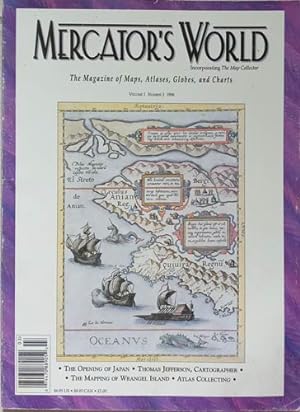
Soft cover. Condition: Good. Early European Adventurers and the Opening of Japan, Thomas Jefferson, Cartographer, Postage Stamps and Politics, Nautical Charts for A New Century, The Book-Bound World, Berard Romans: Cartographer for the U.S. Continental Army, The Mapping of Early European Adventurers and the Opening of Japan, Thomas Jefferson, Cartographer, Postage Stamps and Politics, Nautical Charts for A New Century, The Book-Bound World, Berard Romans: Cartographer for the U.S. Continental Army, The Mapping of By: Mercator's World Wrangel Island, The Socirty for the History of Discoveries, Write or 'ROM, Bids and Pieces, The Befuddling Skies 12 Articles of Mercator's World Vol.1/3, 1996 PRINT Eugene, 1996 WL CODE I7248/1.3 SIZE 80 pp., illus., 215 x 275 mm BOOK WEIGHT 0.250 Kg PACKING WEIGHT 0.200 Kg.
-
Paperback. Condition: Good. Dust Jacket Condition: no dj. Mythical Seas Europe's Stubborn Search for the Northwest Passage, Cartocontroversy Tales of Maps as Weapons of Persuasion & Deception, The Mapmaker as Artst A Cartographic Portrayal of the Early American West, the Line that Divided. Book.
-

Condition: Fine. WLB00100398.
-
Condition: Fine. WLB00100202.
-
A System of Geography Popular and Schientific. Fullarton, 1841, Vol. 1 Only. Leather Binding
Published by A. Fullarton & Co., Edinburgh, 1841
US$ 38.54
US$ 28.06 shipping
Ships from United Kingdom to U.S.A.Quantity: 1 available
Add to basketIllustrated with a Folding Mountains Plate, Folding Chart of the world- Mercators Projection, a Double-page West and East Hemispheres Plus 8 Folding Maps, 4 with a Small View. (illustrator). This volume covers Europe, with the following double page maps (the first 4 with a small view: Russia in Europe; Denmark; Sweden & Norway; Germany (Southern part); Germany Norther part; Europe; Austrian Empire; & Prussia. CONDITION: Light rubbing to covers; occasional foxing. (PLEASE NOT THAT I HAVE FOR SALE VOLS: 1,2,4,5,&6). Size: 8vo.
-
Soft cover. Condition: Good. The Great Sahara Sea, Atlases of the Altiplano, Cartography Litera, and Empire, A Salve Ship Speaks, Limned by Fire, A Model City, Golden Rhumb Lines of Connection, Close to Home, Topo to Go The Great Sahara Sea, Atlases of the Altiplano, Cartography Litera, and Empire, A Salve Ship Speaks, Limned by Fire, A Model City, Golden Rhumb Lines of Connection, Close to Home, Topo to Go By: Mercator's World 9 Articles of Mercator's World Vol. 4.2, March-April 1999 PRINT Eugene, 1999 WL CODE I7248/4.2 SIZE 80 pp., illus. in col, 215 x 275 mm BOOK WEIGHT 0.245 Kg PACKING WEIGHT 0.200 Kg.
-
SHINKAN YOCHI ZENZU: WORLD CHART ON MERCATOR'S PROJECTION WITH NUMEROUS OCEAN RO
Seller: RARE ORIENTAL BOOK CO., ABAA, ILAB, Aptos, CA, U.S.A.
Seller rating 5 out of 5 stars

Edo 1861, Satoh. Green stained cloth covers, color woodblock printed, copper etched outline, sheet 1 meter 35.5 x 1 meter 36 cm., light margin & small center stain, a few old mended worm holes, else solid, grand size wall map. R A R E . *** **** *** . . .GRAND SIZE COLORED WORLD WALL MAP . . . This is a superb example of one of the largest wall maps printed during this period. Of special merit are the 159 flags of foreign nations in color. Sato Masayasu the publisher was a student of Katsu Kaishuu, the celebrated Dutch scholar [Ran Gakusha].His name appears in the introductory text. . * This work represented the end of the Edo period and influenced world maps of the Meiji period. This work is the most up-to-date cartographic view of the world, accurate, with names of countries, cities, mountains, rivers, seas &c. The inside title reads: SHINKAN YOCHI ZENZU. . * A choice large wall map, suitable for wall display. Done in the Mercator projection showing sea routes, oceans, currents with all places of major interest named. An important and valuable historical world map. . *** Color photos are posted to our website. . *** BIBLIOGRAPHY: . BEANS, George H. A LIST OF JAPANESE MAPS OF THE TOKUGAWA ERA: LIST Supplement A, p.31, 1861.1. * Kurita p.23, * Kobe City Museum: AKIOKA KO CHIZU KOLEKUSHYON MEI HIN TEN: EXHIBITION OF THE AKIOKA COLLECTION OF FAMOUS OLD MAPS: and is illustrated as plate 34. . *.