
Order Total (1 Item Items):
Shipping Destination:

Perigord Quercy (9 results)
Skip to main search results
Search filters
Product Type
- All Product Types
- Books (8)
- Magazines & Periodicals (No further results match this refinement)
- Comics (No further results match this refinement)
- Sheet Music (No further results match this refinement)
- Art, Prints & Posters (No further results match this refinement)
- Photographs (No further results match this refinement)
- Maps (1)
- Manuscripts & Paper Collectibles (No further results match this refinement)
Condition Learn more
- New (No further results match this refinement)
- As New, Fine or Near Fine (1)
- Very Good or Good (1)
- Fair or Poor (No further results match this refinement)
- As Described (7)
Binding
Collectible Attributes
- First Edition (No further results match this refinement)
- Signed (No further results match this refinement)
- Dust Jacket (No further results match this refinement)
- Seller-Supplied Images (6)
- Not Print on Demand (9)
Language (1)
Free Shipping
- Free Shipping to U.S.A. (No further results match this refinement)
Seller Location
Seller Rating
-

GEO
Published by Paris
Seller: LibrairieLaLettre2, Villefranche de Lauragais, France
Seller rating 5 out of 5 stars

No 402. Condition: Etat satisfaisant. in-8 Langue : Fran�ais Nb de volumes : 1.
-
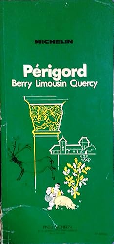
Guide du pneu Michelin : P�rigord - Berry - Limousin - Quercy.
Published by Pneu Michelin, 1977
Seller: Librairie Et C�tera - Sophie Rosi�re, Belin-B�liet, France
Seller rating 3 out of 5 stars

Couverture souple. Livre en fran�ais. Broch�. 190 pages. Couverture verte. Dos r�par�. Limousin. Livre.
-
Guide du pneu Michelin : P�rigord - Limousin - Quercy.
Published by Pneu Michelin, 1961
Seller: Librairie Et C�tera - Sophie Rosi�re, Belin-B�liet, France
Seller rating 3 out of 5 stars
Couverture souple. Livre en fran�ais. Broch�. 194 pages. Couverture verte. Limousin. Livre.
-

Guide du pneu Michelin : P�rigord - Quercy.
Published by Pneu Michelin, 1986
Seller: Librairie Et C�tera - Sophie Rosi�re, Belin-B�liet, France
Seller rating 3 out of 5 stars
Couverture souple. Livre en fran�ais. Broch�. 160 pages. Couverture verte. Limousin. Livre.
-
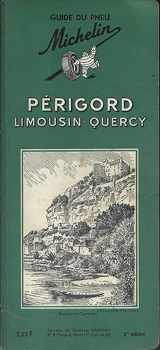
Guide du pneu Michelin : P�rigord - Limousin - Quercy.
Published by Pneu Michelin, 1961
Seller: Librairie Et C�tera - Sophie Rosi�re, Belin-B�liet, France
Seller rating 3 out of 5 stars
Couverture souple. Livre en fran�ais. Broch�. 194 pages. Couverture verte. Limousin. Livre.
-
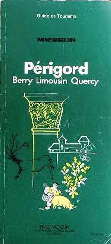
Guide du pneu Michelin : P�rigord - Berry - Limousin - Quercy.
Published by Pneu Michelin, 1980
Seller: Librairie Et C�tera - Sophie Rosi�re, Belin-B�liet, France
Seller rating 3 out of 5 stars
Couverture souple. Livre en fran�ais. Broch�. 194 pages. Couverture verte. Massif Central. Livre.
-

Guide du pneu Michelin : P�rigord - Berry - Limousin - Quercy.
Published by Pneu Michelin, 1971
Seller: Librairie Et C�tera - Sophie Rosi�re, Belin-B�liet, France
Seller rating 3 out of 5 stars
Couverture souple. Livre en fran�ais. Broch�. 186 pages. Couverture verte. Berry. Livre.
-
Ch�teaux de France. Tome X, Quercy & P�rigord. Int�rieurs et ext�rieurs / recueillis et mis en ordre par Hector Saint-Sauveur ; Notices historiques de J. Gauthier
Published by Paris, Charles Massin, Paris, 1930
Seller: Librairie de l'Avenue - Henri Veyrier, Saint-Ouen, FR, France
Seller rating 4 out of 5 stars

Couverture rigide. Condition: Bon �tat. In-folio 44,5 x 34 cm. Reliure demi-chagrin bleu-marine � coins, dos � nerfs encadr�s de filets dor�s, 8 pp. de texte, 40 planches � pleine page mont�es sur onglet. Exemplaire en bon �tat. Contient : Ch�teau de Hautefort - Ch�teau de Montal - Ch�teau de Bories - Ch�teau de Castelnau-Bretenoux -.
-

1776 Li Governi del Limosin, Quercy, e Perigord Di Nuova Projezione
Seller: New World Cartographic, Chicago, IL, U.S.A.
Seller rating 4 out of 5 stars
Map
By:Antonio ZattaDate:1776,VeniceDimensions:15 x 11.5 inches (38 x 29 cm)Antonio Zatta's map of southern France is a fine example of 18th century Italian decorative cartography. Depicting the regions of Limousin, Quercy, and Perigord, among others, this map also includes beautiful pastoral illustrations.This map shows the historical provinces of Perigord and Quercy and the larger region of Limousin. Also depicted are the former provinces of Guyenne, Auvergne, La Marche, Angoumois, and Languedoc, which bordered the region depicted. The capital of Limousin, Limoges, is shown, among other historical provincial capitals. For years, Limoges was a famous exporter of highly-prized porcelain and enamels.In the lower left hand corner is a title cartouche flanked by corn stalks and trees. To the right is a detailed illustration of the rural region, featuring a horse, a bull, and a flock of sheep in front of a farmhouse, conveying the bounty and pastoral character of the regions in the map. Also shown are two distance keys, one in French miles and the other in Italian miles. Using bright color and exquisite detail, Zatta's map is a beautiful work of regional mapmaking from Italy.Condition:This map is in A- condition. A strong impression with wide margins.Inventory #120471200 W. 35th Street #425 Chicago, IL 60609 | P: (312) 496 - 3622.
