
Phelps Ensign (10 results)

Published by Phelps & Ensign, New York 1838
- Hardcover
Seller: Jeffrey H. Marks, Rare Books, ABAA, Rochester, NY, U.S.A.Jeffrey H. Marks, Rare Books, ABAA
Contact seller5-star seller[2] 27, [5]-54 pp. This copy is text only; lacking the map. 16mo (5-3/4 x 3-1/2 inches), publisher's gilt-lettered and embossed cloth. Lacking the map. Foxing; and a small chip at the top of the spine.
Published by Phelps & Ensign, New York 1839
- Hardcover
Seller: Black Cat Books, Shelter Island, NY, U.S.A.Black Cat Books
Contact seller5-star sellerCondition: Used - Very good
US$ 2,000.00
US$ 5.00 shippingShips within U.S.A.Quantity: 1 available
Hardcover. Condition: Very Good. No Jacket. Hardbound with green blind stamped boards with title in gilt. 1839 Edition. Includes a hand-colored map of the Eastern US in excellent condition! Boards show light wear but otherwise in very good condition. Interior clean and binding sound. RARE.
Published by Phelps & Ensign,, New York: 1839
- Hardcover
Seller: Nicholas D. Riccio Rare Books, ABAA, Florham Park, NJ, U.S.A.Nicholas D. Riccio Rare Books, ABAA
Contact seller4-star sellerCopper engraved map, hand colored in outline, of the eastern half of the United States, with 16 insets, 43x58cm (17x22"), folding into embossed leather covers, lettered in gilt, along with 52 pp of text, folded size 5 ½ x 3 ¼ . Slight wear to covers, a few short splits at folds; else very good. Famous little guidebook, first p…ublished the preceding year, with many revised editions. The noteworthy map shows the U.S. to beyond the borders of Iowa, Missouri, and Arkansas, with insets of southern Florida, northern Maine, and 14 cities and ports.

Published by New York, New York 1839
Seller: High Ridge Books, Inc. - ABAA, South Deerfield, MA, U.S.A.High Ridge Books, Inc. - ABAA
Contact seller5-star sellerSmall wall map, lacking rods. Generally good condition, though with some creasing and cracking, particularly near the top. Age-toning, light staining. Shows the Republic of Texas north of Galveston. Extends well west into New Mexico, whose eastern boundary is right up against San Antonio. This is an earlier edition of this map t…han we have seen before, with a copyright notice dated 1837. Many, many differences from the more frequently seen 1841 issue, the most striking of which is that the bottom has, along with small historical scenes, facsimile signatures from the Declaration of Independence in place of a view of the signing. The five historical scenes at the bottom have also been reengraved. Many geographical changes, including a large number in Texas. Of course, the presidential portraits at the bottom corners do not include Harrison, elected in 1840, who appears on the 1841 issue.

Published by New York, New York 1841
Seller: High Ridge Books, Inc. - ABAA, South Deerfield, MA, U.S.A.High Ridge Books, Inc. - ABAA
Contact seller5-star sellerSmall wall map with signing of Declaration of Independence and many other historical vignettes at bottom and left side. Generally very good condition with some wear, with age toning, some wear from rubbing, light staining. Shows Republic of Texas north of Galveston. Extends well west into New Mexico, whose eastern boundary is ri…ght up against San Antonio.
Published by New York, New York 1847
Seller: High Ridge Books, Inc. - ABAA, South Deerfield, MA, U.S.A.High Ridge Books, Inc. - ABAA
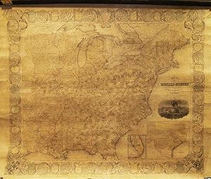
Contact seller5-star sellerModern linen backing, varnish removed. Full color by county, some age toning. Decorative border with information on each state. Small inset map of Oregon, large inset at bottom right of Texas. Shows the United States to eastern Texas. A classic Manifest Destiny-era map, with a wonderful cartouche showing an eagle sitting on top…of a globe with a properous country unfolding behind it. The map of Texas measures 20x23 cm.

Published by New York, New York 1838
- First Edition
Seller: High Ridge Books, Inc. - ABAA, South Deerfield, MA, U.S.A.High Ridge Books, Inc. - ABAA
Contact seller5-star sellerFirst edition of a traveler's guide second only to Mitchell's guides in popularity. This edition is considerably scarcer than later issues. The map is very good, with 2 small holes along folds, with slight loss in North Carolina and the inset map of New Orleans. Outline color by state. 16 small inset maps. 53 pp. text. This is t…he earliest publication we have seen indicating the partnership of Phelps & Ensign, one which survived (with the later participation at various times of Bridgman, Fanning, and Thayer) through the 1850's. Phelps began publishing maps in 1832. The copyright is dated 1837.

Published by New York, New York 1845
Seller: High Ridge Books, Inc. - ABAA, South Deerfield, MA, U.S.A.High Ridge Books, Inc. - ABAA
Contact seller5-star sellerGood condition, some staining and age toning. 5 historical scenes at bottom. Portraits of Presidents as lower corners. Full color. 15 inset maps of city vicinities. Missouri Territory discolored. Shows almost all of Texas.
Published by Phelps & Ensign, New York 1842
Seller: By Books Alone, Woodstock, NY, U.S.A.By Books Alone
Contact seller5-star sellerLarge folded sheet approximately 22 x 16 1/2 inches. Several folds skillfully repaired. Contained in original red embossed portfolio case with leather label (chipped) mounted on front cover. Portfolio case repaired but complete. Map and case very good.
 More images
- Map
Seller: Geographicus Rare Antique Maps, Brooklyn, NY, U.S.A.Geographicus Rare Antique Maps
Contact seller4-star sellerVery good. Full professional restoration. Laid down on linen. Size 29 x 40.75 Inches. This is the spectacular 1841 edition of Phelps and Ensign's pictorial wall map of the United States and the Republic of Texas. The Republic of Texas appears in one of its smaller configurations, with the printed border reflecting not the vast t…racts claimed by the Republic, but rather those lands it effectively controlled, with a border at the Nueces River. A Closer Look A large Missouri Territory dominates the western United States, along with a sizeable Iowa Territory. Roads, railroads, cities, and towns appear throughout the country, providing an overview of the ever-expanding transportation network. Pictorial Elements A small mountains and rivers chart on the Bulla / Darton model appears in the upper left. A large panorama of the Signing of the Declaration of Independence, as well as various scenes from American history, are situated below the map. To either side are illustrations of Metacom (the Pokunoket Sachem called 'King Philip') and James Polk, who had just been elected 11th president of the United States. Portraits of other former presidents fan out on either side of the panorama. Republic of Texas The Republic of Texas was a short-lived nation established in March 1836 when it seceded from Mexico. Following the independence of Mexico from Spain, the American Stephen Fuller Austin led a group of 300 Empresarios to settle Texas, near Austin, where they received a grant from the Mexican government. As more Americans moved to Texas, resentment and strife began to build between the American settlers and Mexican authorities. This and other factors ultimately led to the Texan Revolution in 1835 and the declaration of Texan independence in 1836. Texas remained an independent republic until it joined the United States ten years later in 1846. Texas Borders The borders of the Republic of Texas were in dispute from the earliest days of the Texan Revolution. The Republic-claimed borders followed the Treaties of Velasco between the newly created Texas Republic and Mexican leader, Antonio López de Santa Anna. These treaties adhered to the 1819 Adams-Onís Treaty between the United States and Spain, which established the Sabine River as the eastern boundary of Spanish Texas and the western boundary of the Missouri Territory. The Republic's southern and western boundary with Mexico was more nuanced. Texas claimed the Rio Grande del Norte as its western and southernmost border, while Mexico argued for a boundary much further east at the Nueces River. When Texas was annexed into the United States, the expansionist Polk regime followed the Republic-claimed boundary, thus absorbing Mexican-claimed territory as far west as Santa Fe. This escalated already existing tensions between the United States, the former Republic of Texas, and Mexico, ultimately triggering the Mexican-American War (1846 - 1848). Publication History and Census Phelps and Ensign first issued a map of this title in 1839. That map terminated at the Mississippi. The present example, presaging the Mexican-American War and Texas Annexation, is dramatically expanded to include the Rocky Mountains. Editions were issued in 1840, 1841, and 1845, when Thayer's imprint replaced that of Phelps. Additional publications with major revisions continued until about 1859. The entire series, one of the most decorative in early American map publishing, follows the course of the Westward Expansion and the Mexican-American War, and as such, is of the utmost interest to collectors and historians. While maps from this series do come to market from time to time, the individual states, especially the Republic of Texas and Mexican-American War editions, are uncommon and poorly represented even in institutional collections. References: Boston Public Library, Leventhal Center, G3700 1840.P5. New York Public Library, Map Div. 01-5146. OCLC 47017064.


