Süd Amerika (12 results)

- Softcover
Seller: medimops, Berlin, Germanymedimops
Contact seller5-star sellerCondition: Used - Very good
US$ 3.39
US$ 11.53 shippingShips from Germany to U.S.A.Quantity: 1 available
Condition: very good. Gut/Very good: Buch bzw. Schutzumschlag mit wenigen Gebrauchsspuren an Einband, Schutzumschlag oder Seiten. / Describes a book or dust jacket that does show some signs of wear on either the binding, dust jacket or pages.

Language: German
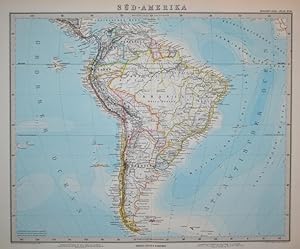
Published by Leipzig, Otto Spamer, um 1885. 1885
- Art Print
Seller: Antiquariat Heinz Tessin, Quickborn, GermanyAntiquariat Heinz Tessin
Contact seller5-star sellerCondition: Used
US$ 11.88
US$ 4.61 shippingShips from Germany to U.S.A.Quantity: 1 available
Add to basket22, x 18,4 cm, mit senkrechtem Falz. [SW - Landkarte, Landkarten].

Language: German
Published by Gotha, Justus Perthes, 1881. 1881
- Map
Seller: Antiquariat Heinz Tessin, Quickborn, GermanyAntiquariat Heinz Tessin
Contact seller5-star sellerCondition: Used
US$ 30.89
US$ 4.61 shippingShips from Germany to U.S.A.Quantity: 1 available
Add to basket38,3 x 47,0 cm. Landkarte aus Stieler`s Hand-Atlas No.89. Mit senkrechtem Mittelfalz. Die Abbildungen zeigen jeweils nur einen Ausschnitt. [SW - Handatlas].
 More images
- Softcover
- Print on Demand
Seller: Forgotten Books, London, United KingdomForgotten Books
Contact seller4-star sellerCondition: New
US$ 20.33
Free ShippingShips from United Kingdom to U.S.A.Quantity: Over 20 available
Paperback. Condition: New. Print on Demand. This book explores the remarkable history of the Moravian mission to the Suriname region of South America in the mid-18th century. The author draws on the journals and letters of the missionaries to tell a vivid and moving story of their efforts to spread Christianity among the indigen…ous people of the region. The book provides fascinating insights into the cultural and religious beliefs of the indigenous people, as well as the challenges and triumphs faced by the missionaries. The author also examines the broader context of European colonialism and the impact it had on the indigenous people of the region. Ultimately, this book offers a valuable contribution to our understanding of the history of Christian missions and the complex relationship between European colonizers and indigenous peoples during this period. This book is a reproduction of an important historical work, digitally reconstructed using state-of-the-art technology to preserve the original format. In rare cases, an imperfection in the original, such as a blemish or missing page, may be replicated in the book. print-on-demand item.

Language: German
Published by Gotha, Justus Perthes, 1824. 1824
- Map
Seller: Antiquariat Heinz Tessin, Quickborn, GermanyAntiquariat Heinz Tessin
Contact seller5-star sellerCondition: Used
US$ 47.52
US$ 4.61 shippingShips from Germany to U.S.A.Quantity: 1 available
Add to basket48,0 x 33,8 cm. Landkarte aus Stieler`s Hand-Atlas No.49. Mit waagerechtem Mittelfalz. Schönes Exemplar in einem kräftigen Abdruck. [SW - Handatlas].
Published by Justus Perthes, Gotha 1882
Seller: Buecherstube Eilert, Versandantiquariat, Dresden, GermanyBuecherstube Eilert, Versandantiquariat
Contact seller5-star sellerCondition: Used
US$ 35.64
US$ 55.37 shippingShips from Germany to U.S.A.Quantity: 1 available
Add to basketKupferstich Karte ca. 40,5 x 33 cm auf Blattgröße 47 x 38,5 cm, Mittelfalte, guter Zustand . Sprache: de.

- Softcover
Seller: Buchpark, Trebbin, GermanyBuchpark
Contact seller5-star sellerCondition: Used - Fine
US$ 9.14
US$ 121.11 shippingShips from Germany to U.S.A.Quantity: 1 available
Condition: Sehr gut. Zustand: Sehr gut | Seiten: 118 | Sprache: Deutsch | Produktart: Bücher | Keine Beschreibung verfügbar.

Published by gez. v. F. v. Stülpnagel: 1858
Seller: Antiquariat Gallus / Dr. P. Adelsberger, Innsbruck, AustriaAntiquariat Gallus / Dr. P. Adelsberger
Contact seller5-star sellerCondition: Used
US$ 35.64
US$ 83.62 shippingShips from Austria to U.S.A.Quantity: 1 available
Add to basketGrenzkolorierte Kupferstichkarte, 30 x 40 cm Aus: Stielers Hand-Atlas über alle Theile der Erde [. ] - Kaum sichtbarer Feuchtigkeitsrand rechts außen. Ansonsten guter Zustand.

Hand-Atlas der Erde und des Himmels. Redaction von A. Gräf. Terrain von Kern.
Amerika / Südamerika - "Süd America".- Grenzkolor., gestochene Karte aus Heinrich Kiepert:
Published by Weimar, Geographisches Institut, (um 1858). 1858
Seller: Antiquariat MEINDL & SULZMANN OG, Wien - Vienna, AustriaAntiquariat MEINDL & SULZMANN OG
Contact seller5-star sellerCondition: Used
US$ 142.57
US$ 40.37 shippingShips from Austria to U.S.A.Quantity: 1 available
Add to basketCa. 56 x 45,5 cm. Im Nordwesten mit den Galapagos Inseln.- Mittelfalz, guter Erhaltungszustand.

Language: German
Published by Gotha, Justus Perthes, 1881. 1881
- Map
Seller: Antiquariat Heinz Tessin, Quickborn, GermanyAntiquariat Heinz Tessin
Contact seller5-star sellerCondition: Used
US$ 118.80
US$ 4.61 shippingShips from Germany to U.S.A.Quantity: 1 available
Add to basketJe 38,3 x 47,0 cm. 6 Landkarten aus Stieler`s Hand-Atlas No.90 bis 95. Mit senkrechtem Mittelfalz. Die Abbildungen zeigen jeweils nur einen Ausschnitt. [SW - Handatlas].

- Art Print
Seller: Antiquariat Martin Barbian & Grund GbR, Saarbruecken, GermanyAntiquariat Martin Barbian & Grund GbR
Contact seller5-star sellerCondition: Used
US$ 53.46
US$ 51.90 shippingShips from Germany to U.S.A.Quantity: 1 available
Add to basketGrenzkolorierter Stahlstich von W. Brückner, Berge u. A. Müller nach J. M. Ziegler aus Stieler: Neuer Atlas der ganzen Welt, um 1860, 48,5x39 cm (Mittelfalte, im Falz leicht stockfleckig).

- Art Print
Seller: Antiquariat Martin Barbian & Grund GbR, Saarbruecken, GermanyAntiquariat Martin Barbian & Grund GbR
Contact seller5-star sellerCondition: Used
US$ 106.92
US$ 51.90 shippingShips from Germany to U.S.A.Quantity: 1 available
Add to basketFarblithographierte Karten umgeben von Holzstich-Dartsellungen mit Szenen aus den jeweiligen Ländern, gedruckt bei Otto Spamer, Leipzig, um 1890, je 31,5x23 cm.


