Order Total (1 Item Items):
Shipping Destination:

Saxton Christopher (212 results)
Feedback
Skip to main search results
Search filters
Product Type
- All Product Types
- Books (130)
- Magazines & Periodicals (No further results match this refinement)
- Comics (No further results match this refinement)
- Sheet Music (No further results match this refinement)
- Art, Prints & Posters (No further results match this refinement)
- Photographs (No further results match this refinement)
- Maps (82)
- Manuscripts & Paper Collectibles (No further results match this refinement)
Condition
Binding
Collectible Attributes
Free Shipping
Seller Rating
-
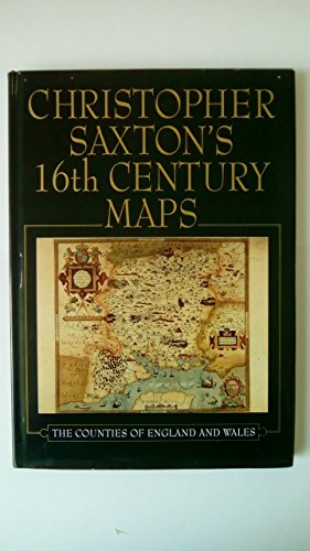
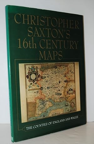
Christopher Saxton's Sixteenth Century Maps
Published by Voyageur Pr, 1992
ISBN 10: 1853103543 ISBN 13: 9781853103544
Condition: USED_GOOD. Used book in good and clean conditions. Pages and cover are intact. Limited notes marks and highlighting may be present. May show signs of normal shelf wear and bends on edges. Item may be missing CDs or access codes. May include library marks. Fast Shipping.
More buying choices from other sellers on AbeBooks
New offers from US$ 68.99
Used offers from US$ 4.75
Also find Hardcover Softcover First Edition
-

Knock, Knock
Published by Dial Books, 2007
ISBN 10: 0803731523 ISBN 13: 9780803731523
Seller: Wonder Book, Frederick, MD, U.S.A.
Seller rating 5 out of 5 stars

Condition: USED_VERYGOOD. Reynolds, Peter C.; Raschka, Christopher; Freymann, Saxton; DePaola, Tomie; Blackall, Sophie (illustrator). Very Good condition. Good dust jacket. A copy that may have a few cosmetic defects. May also contain a few markings such as an owner's name, short gifter's inscription or light stamp.
More buying choices from other sellers on AbeBooks
Used offers from US$ 5.79
Also find Hardcover First Edition
-
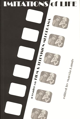
Imitations of Life: A Reader on Film & Television Melodrama (Contemporary Approaches to Film and Media Studies)
Published by Wayne State University Press, 1991
ISBN 10: 0814320651 ISBN 13: 9780814320655
paperback. Condition: USED_FAIR.
-

THE WEERDE
Published by Roc - Penguin Books, London, 1992
ISBN 10: 0140145621 ISBN 13: 9780140145625
First Edition
Soft cover. Condition: USED_VERYGOOD. First Edition. 365 pp. Light edge and corner wear with minor creasing on the spine and a faint crease on the upper right of the front cover; no interior markings. This anthology contains: A Change of Season - a novelette by Storm Constantine; A Strange Sort of Friend by Josephine Saxton; The Lady and/or the Tiger by Neil Gaiman and Roz Kaveney; Sunflower Pump by Paul Cornell; Rain - a novelette by Christopher Amies; What God Abandoned - a novelette by Mary Gentle; To the Bad by Brian Stableford; Railway Mania by Michael Fearn; Blind Fate by Liz Holiday; Going to the Black Bear - a novelette by Colin Greenland; Ancient of Days by Charles Stross; and A Wolf to Man by Roz Kaveney. Book.
-

STOPWATCH
Published by NEL - New English Libray, London, 1974
ISBN 10: 0450021424 ISBN 13: 9780450021428
Seller: Books from the Crypt, N. Potomac, MD, U.S.A.
Association Member: IOBA
Seller rating 5 out of 5 stars
First Edition
Hardcover. Condition: UNSPECIFIED. Dust Jacket Condition: Very Good+. First Edition. [1st printing](1974) Dj art is uncredited. Includes "Introduction"; "The Protocols of The Elders of Britain" by John Brunner; "Are Your Home-Grown Vegetables Radioactive?" by Kathleen Brennan; "Ash, Ash" by Robert P. Holdstock; "All We Have on This Planet" by A. E. Van Vogt; "EA 5000: Report on the Effects of Riot Gas" by Ian Watson; "Intracom" by Ursula K. Le Guin; "A Bedtime Story" by D. Letts; "The Invisible Men" by Christopher Priest; "Now Is Forever" by Edward Allen; "Charley" by Perry A. Chapdelaine; "When the Music's Over" by Andrew Darlington; "In Memoriam, Jeannie" by Josephine Saxton; "Doctor Fausta" by David I. Masson. Lighgt wear; tanning.
-

Espaces inhabitables T.2.
Seller: Librairie-Bouquinerie Le P�re P�nard, Lyon, France
Seller rating 4 out of 5 stars

Condition: UNSPECIFIED. in-8 cartonnage �diteur avec jaquette - 1973 - 318p - Ed. Casterman Bon �tat (l�g�res rousseurs sur la tranche sup�rieure, jaquette frott�e sur les bordures).
-

Galaxies int�rieures: Une anthologie de science-fiction moderne britannique (3)
Published by DENOEL, 1981
ISBN 10: 2207303195 ISBN 13: 9782207303191
Condition: USED_GOOD. Rousseurs sur tranche de t�te. Envoi rapide et soign�.
-
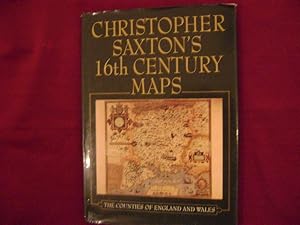
Christopher Saxton's 16Th Century Maps
Published by Chatsworth Library, 1992
ISBN 10: 1853103543 ISBN 13: 9781853103544
Seller: Nugget Box (PBFA), Stafford, United Kingdom
Association Member: PBFA
Seller rating 5 out of 5 stars
Hardcover. Condition: USED_GOOD. Dust Jacket Condition: Fair. Dust Wrapper with edge and corner wear, sunned spine, marks, creasing, scratches. Boards with slight bumps to corners and edge. Internally Good - clean and tidy copy in tight binding. Unclipped dust wrapper will be fitted with removable archive acetate film. **950g** All orders are sent with a tracking /signature service for your peace of mind, so that you can keep tabs on your parcel. For overseas customers - on some sites we use, parcels weighing over the standard rate may incur an additional charge and we will then contact you with the additional shipping fee required. This is for the postage only we do not charge you for our time or our excellent packaging, which we are noted for. Dispatched in cardboard mailers within 24/48 Hours Mon - Friday 2pm, except bank holidays, otherwise next business day - excellent service guaranteed. ; 96 pages.
-

Media, Myth, and Millennials: Critical Perspectives on Race and Culture
Published by Lexington Books, 2021
ISBN 10: 1498577377 ISBN 13: 9781498577373
Condition: UNSPECIFIED.
More buying choices from other sellers on AbeBooks
New offers from US$ 46.99
Used offers from US$ 41.67
Also find Softcover
-
Christopher Sexton's 16th Century Maps. The Counties of England & Wales.
Published by Chatsworth., 1992
First Edition
Gilt decorated hard cover. Condition: UNSPECIFIED. First edition. Illustrated in black, white and color. Important reference work. Very scarce in this condition. Fine copy in fine (very light edge wear) dust jacket (in mylar). 99 pps.
-
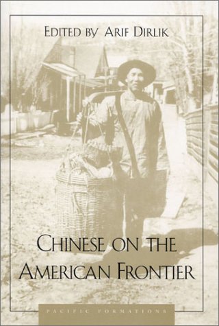
Chinese on the American Frontier (Pacific Formations: Global Relations in Asian and Pacific Perspectives)
Published by Rowman & Littlefield Publishers, 2001
ISBN 10: 0847685322 ISBN 13: 9780847685325
hardcover. Condition: USED_GOOD. Scarce publication. Ex-library; usual treatments. Nice dust jacket and cover. Interior pages are clean throughout. Binding is secure.
-
Saxton's atlas of England 1579 [Leather Bound]
Publication Date: 2023
Leather Bound. Condition: NEW. Language: anglais (english). {Size: 22.22x 29.21 cms} This book is available in 5 different Leather color without any extra cost. Explore More Options by Clicking on 'More Images' and Notify Us of Your Choice via Email within 24 hours of placing the order. Presenting an Exquisite Leather-Bound Edition, expertly crafted by the prestigious organization "Rare Biblio" with Original Natural Leather that gracefully adorns the spine and corners. The allure continues with Golden Leaf Printing that adds a touch of elegance, while Hand Embossing on the rounded spine lends an artistic flair. This masterpiece has been meticulously reprinted in 2023, utilizing the invaluable guidance of the original edition published many years ago in 1579. The contents of this book are presented in classic black and white. Its durability is ensured through a meticulous sewing binding technique, enhancing its longevity. Imprinted on top-tier quality paper. A team of professionals has expertly processed each page, delicately preserving its content without alteration. Due to the vintage nature of these books, every page has been manually restored for legibility. However, in certain instances, occasional blurriness, missing segments, or faint black spots might persist. We sincerely hope for your understanding of the challenges we faced with these books. Recognizing their significance for readers seeking insight into our historical treasure, we've diligently restored and reissued them. Our intention is to offer this valuable resource once again. We eagerly await your feedback, hoping that you'll find it appealing and will generously share your thoughts and recommendations. Lang: - anglais (english), Pages:- 83, Print on Demand. If it is a multi-volume set, then it is only a single volume. Product Disclaimer: Kindly be informed that, owing to the inherent nature of leather as a natural material, minor discolorations or textural variations may be perceptible. Explore the FOLIO EDITION (12x19 Inches): Available Upon Request. 83.
-

Media, Myth, and Millennials: Critical Perspectives on Race and Culture
Published by Lexington Books, 2019
ISBN 10: 1498577350 ISBN 13: 9781498577359
Condition: USED_GOOD. Ships same day or next. Minor shelf wear. Book is unread, never opened and text is like-new. Expedited shipping available at checkout for domestic orders.
More buying choices from other sellers on AbeBooks
New offers from US$ 113.14
Used offers from US$ 75.47
Also find Hardcover
-

Elizabethan Map-Marker by Ifor M. Evans and Heather Lawrence. With also: Christopher Saxton and Tudor map-making.
Published by Wakefield Historical Publications and the Holland Press. Great Britain., 1979
Seller: avelibro OHG, Dinkelscherben, Germany
Association Member: BOEV
Seller rating 5 out of 5 stars
Condition: USED_VERYGOOD. 2 Pieces. XIV, 186 P. Binding in very good condition. This book is the first to be published on the life and work of Christopher Saxton, the first man to survey and map the counties of England and Wales. Saxton's Atlas was published in 1579 and to celebrate the 400th anniversary of its publication the present authors worked to assemble all that is currently known of the man and his work. Their research has brought to light a body of fresh material which is presented in the book.; - With 1 Frontispiece in color and 19 Plates. - In mint condition. - Extra: Christopher Saxton and Tudor map-making by Sarah Tyacke and John Huddy./ Briitsh Library No. 2. 1980. 24,5 x 18 cm. 64 P. Illustr. Original Paperback, faded. Inside in very clean condition. English Language. deu MIG-26-03A Altersfreigabe FSK ab 0 Jahre Sprache: Deutsch Gewicht in Gramm: 444 29 x 22,5 cm. Original Cloth with gilt back and dust jacket (shop-soiled).
-

DUNELMENSIS Episcopatus qui comitatus est Palatinus olim pars BRIGANTUM'. Map of the County of Durham.
Published by c., 1637
Seller: Bristow & Garland, Shaftesbury, United Kingdom
Seller rating 4 out of 5 stars
Condition: UNSPECIFIED. Engraved map with contemporary colouring. 15 x 12 inches, Latin text to the reverse. Some marginal browning, overall light tanning. Generally very good.
-
![Seller image for [Befordshire]. Bedford Comitatus olim pars Cathifuclanorum. for sale by Robert Frew Ltd. ABA ILAB](https://pictures.abebooks.com/inventory/md/md30894927370.jpg)
[Befordshire]. Bedford Comitatus olim pars Cathifuclanorum.
Published by LondonImpensis Georgii Bishop & Ioannis Norton ., 1610
Seller: Robert Frew Ltd. ABA ILAB, London, United Kingdom
Association Member: ABA ILAB PBFA
Seller rating 4 out of 5 stars
Map First Edition
Condition: UNSPECIFIED. Original uncoloured engraved map of Bedfordshire trimmed to neatline and backed onto 18th century laid paper. Map dimensions 27.5 x 33 cm, overall backing-sheet size 32 x 40 cm. Rather soiled along right hand margin (mainly to backing-sheet), small tears to lower margin of backing sheet with old paper repair to verso, a bit unevenly toned, small losses to lower right corner. An early decorative map of Bedfordshire engraved by William Kip based on the earlier maps by Elizabethan cartographer Christopher Saxton first published in the 1607 edition of William Camden's Britannia.* This example is from the first English edition of Camden's Britannia published in 1610, without any text on the verso. Embellished with compass rose and decorative cartouche. *Britannia, first published in 1586, was one of the most popular and influential books of the period. The work of the Elizabethan antiquarian, William Camden (1551-1623), it was a detailed historical and topographical description of Great Britain. Its patriotic sentiments, in particular, both appealed to and generated the growing sense of nationalism that was coursing through late Tudor / early Stuart society. Between 1607 and 1637, county maps engraved by William Kip and William Hole, and based largely on Saxton's surveys, were added. (Skelton, 6).
-
![Seller image for [Essex]. Essexia comitatvs, qvem olim trinobantes tenuerunt continens in se opida marcatoria. for sale by Robert Frew Ltd. ABA ILAB](https://pictures.abebooks.com/inventory/md/md30894930063.jpg)
[Essex]. Essexia comitatvs, qvem olim trinobantes tenuerunt continens in se opida marcatoria.
Published by LondonImpensis Georgii Bishop & Ioannis Norton ., 1610
Seller: Robert Frew Ltd. ABA ILAB, London, United Kingdom
Association Member: ABA ILAB PBFA
Seller rating 4 out of 5 stars
Map First Edition
Condition: UNSPECIFIED. Original uncoloured engraved map of Essex showing parts of London in bottom right corner, trimmed to neatline and backed onto 18th century laid paper. Map dimensions 28.5 x 36.5 cm, overall backing-sheet size 32 x 40 cm. Small losses near upper centre and bottom right corner, a bit toned overall and with a few trivial blemishes. An early decorative map of Essex engraved by William Kip based on the earlier maps by Elizabethan cartographer Christopher Saxton first published in the 1607 edition of William Camden's Britannia.* This example is from the first English edition of Camden's Britannia published in 1610, without any text on the verso. Embellished with decorative cartouche. *Britannia, first published in 1586, was one of the most popular and influential books of the period. The work of the Elizabethan antiquarian, William Camden (1551-1623), it was a detailed historical and topographical description of Great Britain. Its patriotic sentiments, in particular, both appealed to and generated the growing sense of nationalism that was coursing through late Tudor / early Stuart society. Between 1607 and 1637, county maps engraved by William Kip and William Hole, and based largely on Saxton's surveys, were added. (Skelton, 6).
-
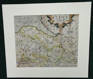
Flint Comitatus
Publication Date: 1637
Seller: Madoc Books (ABA-ILAB), Llandudno, CONWY, United Kingdom
Association Member: ABA ILAB IOBA PBFA
Seller rating 5 out of 5 stars
Map
Boards. Condition: USED_VERYGOOD. William Kip (illustrator). Actual Map size 31.5*26 cm, mounted 42.5*37 cm, copper engraving highlighted in colour by hand, with a decorative title cartouche, Scala Miliarium and shaded seas, center crease. Saxton, Christopher, map maker and in producing a complete set of county maps of England and Wales, brought to fruition an idea that had been long germinating. Map-consciousness had been growing in the minds of statesmen, developing simultaneously with surveying techniques. Saxton's county maps gained instant recognition at the highest political levels?even while they were still in course of production, between 1574 and 1578, Lord Burghley pulled and annotated early proofs. Saxton's maps were planimetrically superior to those of his predecessors. See ODNB for a full Bio.
-

Brecknoc comitatus pars olim Silurum.
Seller: John Windle Antiquarian Bookseller, ABAA, San Francisco, CA, U.S.A.
Association Member: ABAA ILAB IOBA
Seller rating 5 out of 5 stars
Condition: UNSPECIFIED. [circa 1607-1637]. Folio 14 1/2 x 12 3/4", hand-colored engraving 10 1/2 x 12 1/2". Edges and outer margins chipped and slightly darkened, repaired; good. � Early edition, probably for Camden's Britannia, in Latin. An accurate, illustrative map of Brecknock Shire in South Wales.
-
![Seller image for [Staffordshire]. Staffordi� Comitatvs pars olim cornauiorum. for sale by Robert Frew Ltd. ABA ILAB](https://pictures.abebooks.com/inventory/md/md30894927368.jpg)
[Staffordshire]. Staffordi� Comitatvs pars olim cornauiorum.
Published by LondonImpensis Georgii Bishop & Ioannis Norton ., 1610
Seller: Robert Frew Ltd. ABA ILAB, London, United Kingdom
Association Member: ABA ILAB PBFA
Seller rating 4 out of 5 stars
Map First Edition
Condition: UNSPECIFIED. Original uncoloured engraved map of Staffordshire trimmed to neatline and backed onto 18th century laid paper. Map dimensions 27 x 37.5 cm, overall backing-sheet size 32 x 40 cm. Smudged overall and with a bit of browning. An early decorative map of Staffordshire engraved by William Kip based on the earlier maps by Elizabethan cartographer Christopher Saxton first published in the 1607 edition of William Camden's Britannia.* This example is from the first English edition of Camden's Britannia published in 1610, without any text on the verso. Embellished with decorative cartouche and compass dividers. *Britannia, first published in 1586, was one of the most popular and influential books of the period. The work of the Elizabethan antiquarian, William Camden (1551-1623), it was a detailed historical and topographical description of Great Britain. Its patriotic sentiments, in particular, both appealed to and generated the growing sense of nationalism that was coursing through late Tudor / early Stuart society. Between 1607 and 1637, county maps engraved by William Kip and William Hole, and based largely on Saxton's surveys, were added. (Skelton, 6).
-
![Seller image for [Monmouthshire]. Monumethensis comitatus, quem olim incoluerunt silures. for sale by Robert Frew Ltd. ABA ILAB](https://pictures.abebooks.com/inventory/md/md30894930062.jpg)
[Monmouthshire]. Monumethensis comitatus, quem olim incoluerunt silures.
Published by LondonImpensis Georgii Bishop & Ioannis Norton ., 1610
Seller: Robert Frew Ltd. ABA ILAB, London, United Kingdom
Association Member: ABA ILAB PBFA
Seller rating 4 out of 5 stars
Map First Edition
Condition: UNSPECIFIED. Original uncoloured engraved map of Monmouthshire trimmed to neatline and backed onto 18th century laid paper. Map dimensions 27.5 x 34 cm, overall backing-sheet size 32 x 40 cm. A bit toned mainly to bottom right corner, generally very good. An early decorative map of Monmouthshire engraved by William Hole based on the earlier maps by Elizabethan cartographer Christopher Saxton first published in the 1607 edition of William Camden's Britannia.* This example is from the first English edition of Camden's Britannia published in 1610, without any text on the verso. Embellished with royal coat of arms, compass dividers, compass rose, sea galleon, and decorative cartouche. *Britannia, first published in 1586, was one of the most popular and influential books of the period. The work of the Elizabethan antiquarian, William Camden (1551-1623), it was a detailed historical and topographical description of Great Britain. Its patriotic sentiments, in particular, both appealed to and generated the growing sense of nationalism that was coursing through late Tudor / early Stuart society. Between 1607 and 1637, county maps engraved by William Kip and William Hole, and based largely on Saxton's surveys, were added. (Skelton, 6).
-
![Seller image for [Radnorshire]. Radnor Comitatus quem silvres olim Incolucrunt. for sale by Robert Frew Ltd. ABA ILAB](https://pictures.abebooks.com/inventory/md/md30894927364.jpg)
[Radnorshire]. Radnor Comitatus quem silvres olim Incolucrunt.
Published by LondonImpensis Georgii Bishop & Ioannis Norton ., 1610
Seller: Robert Frew Ltd. ABA ILAB, London, United Kingdom
Association Member: ABA ILAB PBFA
Seller rating 4 out of 5 stars
Map First Edition
Condition: UNSPECIFIED. Original uncoloured engraved map of Radnorshire trimmed to neatline and backed onto 18th century laid paper. Map dimensions 27 x 32 cm, overall backing-sheet size 32 x 40 cm. Minimal toning and spotting, generally very good. An early decorative map of Radnorshire engraved by William Kip based on the earlier maps by Elizabethan cartographer Christopher Saxton first published in the 1607 edition of William Camden's Britannia.* This example is from the first English edition of Camden's Britannia published in 1610, without any text on the verso. *Britannia, first published in 1586, was one of the most popular and influential books of the period. The work of the Elizabethan antiquarian, William Camden (1551-1623), it was a detailed historical and topographical description of Great Britain. Its patriotic sentiments, in particular, both appealed to and generated the growing sense of nationalism that was coursing through late Tudor / early Stuart society. Between 1607 and 1637, county maps engraved by William Kip and William Hole, and based largely on Saxton's surveys, were added. (Skelton, 6).
-
![Seller image for [West Riding of Yorkshire]. Eboracensis Comitatus pars Septentrionalis Vulgo West Riding. for sale by Robert Frew Ltd. ABA ILAB](https://pictures.abebooks.com/inventory/md/md30894925645.jpg)
[West Riding of Yorkshire]. Eboracensis Comitatus pars Septentrionalis Vulgo West Riding.
Published by LondonImpensis Georgii Bishop & Ioannis Norton ., 1610
Seller: Robert Frew Ltd. ABA ILAB, London, United Kingdom
Association Member: ABA ILAB PBFA
Seller rating 4 out of 5 stars
Map First Edition
Condition: UNSPECIFIED. Original uncoloured engraved map of West Riding of Yorkshire trimmed to neatline and backed onto 18th century laid paper. Map dimensions 27 x 32 cm, overall backing-sheet size 32 x 40 cm. Faintly smudged and browned to large portion of map. An early decorative map of West Riding of Yorkshire engraved by William Hole based on the earlier maps by Elizabethan cartographer Christopher Saxton first published in the 1607 edition of William Camden's Britannia.* This example is from the first English edition of Camden's Britannia published in 1610, without any text on the verso. Embellished with compass rose, compass dividers, and decorative cartouche. *Britannia, first published in 1586, was one of the most popular and influential books of the period. The work of the Elizabethan antiquarian, William Camden (1551-1623), it was a detailed historical and topographical description of Great Britain. Its patriotic sentiments, in particular, both appealed to and generated the growing sense of nationalism that was coursing through late Tudor / early Stuart society. Between 1607 and 1637, county maps engraved by William Kip and William Hole, and based largely on Saxton's surveys, were added. (Skelton, 6).
-
![Seller image for [Denbighshire]. Denbigh Comitatus pas olim Ordovicvm. for sale by Robert Frew Ltd. ABA ILAB](https://pictures.abebooks.com/inventory/md/md30894927366.jpg)
[Denbighshire]. Denbigh Comitatus pas olim Ordovicvm.
Published by LondonImpensis Georgii Bishop & Ioannis Norton ., 1610
Seller: Robert Frew Ltd. ABA ILAB, London, United Kingdom
Association Member: ABA ILAB PBFA
Seller rating 4 out of 5 stars
Map First Edition
Condition: UNSPECIFIED. Original uncoloured engraved map of Denbighshire trimmed to neatline and backed onto 18th century laid paper. Map dimensions 27 x 32 cm, overall backing-sheet size 32 x 40 cm. 13 cm split down middle, minimal toning and spotting. An early decorative map of Denbighshire engraved by William Hole based on the earlier maps by Elizabethan cartographer Christopher Saxton first published in the 1607 edition of William Camden's Britannia.* This example is from the first English edition of Camden's Britannia published in 1610, without any text on the verso. *Britannia, first published in 1586, was one of the most popular and influential books of the period. The work of the Elizabethan antiquarian, William Camden (1551-1623), it was a detailed historical and topographical description of Great Britain. Its patriotic sentiments, in particular, both appealed to and generated the growing sense of nationalism that was coursing through late Tudor / early Stuart society. Between 1607 and 1637, county maps engraved by William Kip and William Hole, and based largely on Saxton's surveys, were added. (Skelton, 6).
-

Chinese on the American Frontier (Pacific Formations: Global Relations in Asian and Pacific Perspectives)
Published by Rowman & Littlefield Publishers, 2003
ISBN 10: 0847685330 ISBN 13: 9780847685332
Paperback. Condition: NEW. In shrink wrap! Looks like an interesting title!.
-
Flint Comitatus quem ordovices olim incoluerunt
Published by London, 1607
Seller: Clive A. Burden Ltd., Chalfont St. Giles, BUCKS, United Kingdom
Seller rating 2 out of 5 stars

Map
No binding. Condition: UNSPECIFIED. 265 x 320 mm., in good condition. This is from an edition of William Camden's 'Britannia' first published in 1586. It was the last to be published in his lifetime and the first to be illustrated with county maps although this had been contemplated since at least 1589. Camden (1551-1623) was an antiquary and historian. An academic by profession he would become the headmaster of Westminster School in 1593. He spent much of his time travelling and collecting material for his highly respected 'Britannia'. This is engraved by William Kip and is from the first fully illustrated edition of William Camden's classic work, this example from the preferred second edition without text to the verso. Chubb 18; Evans (1964) MCC no. 13 p. 6; Shirley BL T.Camd 1b; Skelton 5; STC 4508; Taylor 'Late Tudor and Early Stuart Geography' pp. 9- 13.
-

No Binding. Condition: USED_VERYGOOD. Original copper engraving. Date: 1637. Sheet size: 34.6cm x 30cm. Early hand-colouring. Close-cropped with very minor age-spotting. Central fold line. In very good, bright, clean condition.
-
![Seller image for [Montgomeryshire]. Mongomery Comitatus qui olim pars Ordouicum for sale by Robert Frew Ltd. ABA ILAB](https://pictures.abebooks.com/inventory/md/md30894931927.jpg)
[Montgomeryshire]. Mongomery Comitatus qui olim pars Ordouicum
Published by LondonImpensis Georgii Bishop & Ioannis Norton ., 1610
Seller: Robert Frew Ltd. ABA ILAB, London, United Kingdom
Association Member: ABA ILAB PBFA
Seller rating 4 out of 5 stars
Map First Edition
Condition: UNSPECIFIED. Original uncoloured engraved map of Montgomeryshire trimmed to neatline and backed onto 18th century laid paper. Map dimensions 27 x 32 cm, overall backing-sheet size 32 x 40 cm. Minimal toning and spotting, generally very good. An early decorative map of Montgomeryshire engraved by William Kip based on the earlier maps by Elizabethan cartographer Christopher Saxton first published in the 1607 edition of William Camden's Britannia.* This example is from the first English edition of Camden's Britannia published in 1610, without any text on the verso. *Britannia, first published in 1586, was one of the most popular and influential books of the period. The work of the Elizabethan antiquarian, William Camden (1551-1623), it was a detailed historical and topographical description of Great Britain. Its patriotic sentiments, in particular, both appealed to and generated the growing sense of nationalism that was coursing through late Tudor / early Stuart society. Between 1607 and 1637, county maps engraved by William Kip and William Hole, and based largely on Saxton's surveys, were added. (Skelton, 6).
-
![Seller image for [Flintshire]. Flint Comitatus quem ordovices olim Incolucrunt. for sale by Robert Frew Ltd. ABA ILAB](https://pictures.abebooks.com/inventory/md/md30894928221.jpg)
[Flintshire]. Flint Comitatus quem ordovices olim Incolucrunt.
Published by LondonImpensis Georgii Bishop & Ioannis Norton ., 1610
Seller: Robert Frew Ltd. ABA ILAB, London, United Kingdom
Association Member: ABA ILAB PBFA
Seller rating 4 out of 5 stars
Map First Edition
Condition: UNSPECIFIED. Original uncoloured engraved map of Flintshire trimmed to neatline and backed onto 18th century laid paper. Map dimensions 27 x 32 cm, overall backing-sheet size 32 x 40 cm. Minimal toning and spotting, generally very good. An early decorative map of Flintshire engraved by William Kip based on the earlier maps by Elizabethan cartographer Christopher Saxton first published in the 1607 edition of William Camden's Britannia.* This example is from the first English edition of Camden's Britannia published in 1610, without any text on the verso. *Britannia, first published in 1586, was one of the most popular and influential books of the period. The work of the Elizabethan antiquarian, William Camden (1551-1623), it was a detailed historical and topographical description of Great Britain. Its patriotic sentiments, in particular, both appealed to and generated the growing sense of nationalism that was coursing through late Tudor / early Stuart society. Between 1607 and 1637, county maps engraved by William Kip and William Hole, and based largely on Saxton's surveys, were added. (Skelton, 6).
-
![Seller image for [East Riding of Yorkshire]. Eboracensis Comitatus.pars Orientalis Vulgo East Riding. for sale by Robert Frew Ltd. ABA ILAB](https://pictures.abebooks.com/inventory/md/md30894930979.jpg)
[East Riding of Yorkshire]. Eboracensis Comitatus.pars Orientalis Vulgo East Riding.
Published by LondonImpensis Georgii Bishop & Ioannis Norton ., 1610
Seller: Robert Frew Ltd. ABA ILAB, London, United Kingdom
Association Member: ABA ILAB PBFA
Seller rating 4 out of 5 stars
Map First Edition
Condition: UNSPECIFIED. Original uncoloured engraved map of East Riding of Yorkshire trimmed to neatline and backed onto 18th century laid paper. Map dimensions 20.5 x 25 cm, overall backing-sheet size 32 x 40 cm. A bit of uneven toning, small hole to backing-sheet not affecting map, generally very good. An early decorative map of East Riding of Yorkshire engraved by William Hole based on the earlier maps by Elizabethan cartographer Christopher Saxton first published in the 1607 edition of William Camden's Britannia.* This example is from the first English edition of Camden's Britannia published in 1610, without any text on the verso. Embellished with compass rose and decorative cartouche. *Britannia, first published in 1586, was one of the most popular and influential books of the period. The work of the Elizabethan antiquarian, William Camden (1551-1623), it was a detailed historical and topographical description of Great Britain. Its patriotic sentiments, in particular, both appealed to and generated the growing sense of nationalism that was coursing through late Tudor / early Stuart society. Between 1607 and 1637, county maps engraved by William Kip and William Hole, and based largely on Saxton's surveys, were added. (Skelton, 6).

![Seller image for Saxton's atlas of England 1579 [Leather Bound] for sale by Gyan Books Pvt. Ltd.](https://pictures.abebooks.com/inventory/md/md30647430167.jpg)