
Order Total (1 Item Items):
Shipping Destination:

Steimatzky (12 results)
Skip to main search results
Search filters
Product Type
- All Product Types
- Books (10)
- Magazines & Periodicals (No further results match this refinement)
- Comics (No further results match this refinement)
- Sheet Music (No further results match this refinement)
- Art, Prints & Posters (No further results match this refinement)
- Photographs (No further results match this refinement)
- Maps (2)
- Manuscripts & Paper Collectibles (No further results match this refinement)
Condition Learn more
- New (No further results match this refinement)
- As New, Fine or Near Fine (No further results match this refinement)
- Very Good or Good (9)
- Fair or Poor (No further results match this refinement)
- As Described (3)
Binding
Collectible Attributes
- First Edition (1)
- Signed (No further results match this refinement)
- Dust Jacket (1)
- Seller-Supplied Images (2)
- Not Print on Demand (12)
Language (2)
Free Shipping
Seller Location
Seller Rating
-
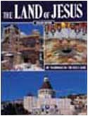
Land of Jesus
Seller: World of Books (was SecondSale), Montgomery, IL, U.S.A.
Seller rating 5 out of 5 stars

Condition: Good. Item in good condition. Textbooks may not include supplemental items i.e. CDs, access codes etc.
-
Condition: Very Good. Pages intact with possible writing/highlighting. Binding strong with minor wear. Dust jackets/supplements may not be included. Stock photo provided. Product includes identifying sticker. Better World Books: Buy Books. Do Good.
-
Condition: Good. Pages intact with minimal writing/highlighting. The binding may be loose and creased. Dust jackets/supplements are not included. Stock photo provided. Product includes identifying sticker. Better World Books: Buy Books. Do Good.
-
Condition: Good. Good condition. A copy that has been read but remains intact. May contain markings such as bookplates, stamps, limited notes and highlighting, or a few light stains.
-
Paperback. Condition: Very Good. It's a well-cared-for item that has seen limited use. The item may show minor signs of wear. All the text is legible, with all pages included. It may have slight markings and/or highlighting.
-
paperback. Condition: Very Good. Connecting readers with great books since 1972! Used books may not include companion materials, and may have some shelf wear or limited writing. We ship orders daily and Customer Service is our top priority!
-

BORN IN BATTLE SERIES: ?ZAHAL, 30 YEARS ISRAEL?S DEFENSE FORCE ARMY? by STEIMATZKY
Published by STEIMATZKY's Agency Limited (1978), 1978
Condition: Very Good. Close to 'like new' condition, large glossy hardcover. 78 pages with lots of mostly color photos, unmarked, very good. Published in 1978.
-
US$ 13.15
US$ 26.18 shipping
Ships from United Kingdom to U.S.A.Quantity: 1 available
Add to basketPaperback. Very Good.
-
Steimatzky's Guides Syria and the Lebanon
Published by Steimatzky's Publishing Co., Jerusalem Beirut, 1941
First Edition
Cloth. Condition: Very Good. First Edition. Very Good ++ in a good jacket with chipped ends. owners name on fep. will present well when protected PP 199, 3 maps in a rear pocket , Damascus, Berut, and Allepo. General map of Syria and lebanon missing.
-
Avigdor Stematzky [Steimatzky]
Published by Sifriat Poalim, Workers' Book Guild (Hashomer Hatzair),, 1960
hardcover, Condition: Very Good, Sifriat Poalim, Workers' Book Guild (Hashomer Hatzair), Tel Aviv, nd., ca.1960s?, mostly plates, 5-1/4"x4-3/4", thin boards, 26pp., 6 color & 10 b&w plates, text in Hebrew. VG-/VG- $.
-

Jerusalem Old and New.
Publication Date: 1942
Seller: Geographicus Rare Antique Maps, Brooklyn, NY, U.S.A.
Association Member: ABAA ESA ILAB
Seller rating 4 out of 5 stars

Map
Very good. Exhibits light wear along original fold lines. Small closed margin tears professionally repaired on verso. Verso repairs to fold intersections. Hebrew text on verso. Accompanied by original binder. Size 27 x 18.25 Inches. This is a 1942 Steimatzky pictorial map of Jerusalem in Hebrew. The map depicts the city from Karem es Sila to El Tur and the Mount of Olives and from the Hadassa Medical Center, the Hebrew University and Mt. Scopus to Meqor Hayim. Illustrating numerous buildings in profile, the Old City and the Temple Mount act as the focal point. Surrounded by walls, several buildings within the Old City, such as the Holy Sepulcre, St. Anne's, the Supreme Muslim Council, and several gates are labeled. On the Temple Mount, the Dome of the Rock and the Al Aksa Mosque are illustrated. Some of the locations illustrated outside the Old City include the Citadel, the Church of Dormition, the Tomb of the Virgin, the Tombs of the Kings, and several monasteries and convents. Neighborhoods throughout the city are labeled, along with streets and the railway which enters the city near the bottom of the map. Publication History This map was drawn by Shlomo Ben David and published by Steimatzky in 1942. Two editions of this map were published in 1942. One was in English and the other in Hebrew.
-

Jerusalem Old and New.
Publication Date: 1949
Seller: Geographicus Rare Antique Maps, Brooklyn, NY, U.S.A.
Association Member: ABAA ESA ILAB
Seller rating 4 out of 5 stars
Map
Very good. Light wear along original fold lines. Attached to original binder. Size 27 x 18 Inches. This is a 1949 Steimatzky pictorial map of Jerusalem. The map boldly illustrates the 1949 'Green Line' (although it's illustrated here in red). The 'Green Line' separated Israeli and Jordanian-controlled areas of Jerusalem following the 1948 Arab-Israeli War. Illustrating Jerusalem's Pre-1967 Borders - The Green Line Known as 'The Green Line', red overprinting highlights territorial divisions within Jerusalem after the 1948 Arab-Israeli War and before the 1967 Six-Day War, when Israel seized East Jerusalem, the West Bank, Gaza Strip, and Golan Heights. The left (or west) side of the map is territory controlled by Israel, while the right (or east) side of the map is controlled by Transjordan, an Arab nation. These zones are separated by a 'No Man's Land' that winds its way through Jerusalem around important sites, including the Old City (which fell on the Arab side of the line) and Dormition Church (which fell on the Jewish side). Two enclaves were controlled by the United Nations, these are circled in red and labeled 'Demilitarized Zone' in both English and Hebrew. 'The Green Line' The 'Green Line' agreement was never meant to signify permanent international borders, only a temporary demarcation line between Israel and Jordan following the 1948 Arab-Israeli War. The 'Green Line' even extended through Jerusalem, dividing the city into East Jerusalem, which was part of the Kingdom of Jordan, and West Jerusalem, the capital of the newly created State of Israel. When the ceasefire was finally declared, an Israeli and Jordanian commander met in an abandoned house to outline the boundaries of the ceasefire. The Israeli commander used a green wax pencil to outline Israeli-controlled positions, while the Jordanian commander used a red pencil to outline positions under Jordanian control, with the area between the two lines becoming a No Man's Land. Neither commander believed that this informally arrived at agreement represented anything more than a temporary ceasefire line, meaning that little notice was given to inaccuracies and errors in their work due to the thickness of the pencils, deviations in the drawings, or segments of discontinuous lines. Later, during the meetings in Rhodes to hammer out the 1949 Armistice Agreements, the map drawn by the commanders was found to be the only official document indicating the line dividing Jerusalem agreed upon by both parties. Thus, the informality and the inaccuracies went from establishing a ceasefire to a binding international border. This meant that neighborhoods, streets, and even houses became contentious international disputes, as the line drawn was rough at best. The border was fortified, with military positions springing up all along the wall. Included in this agreement was an Israeli-controlled area on Mt. Scopus, which is encircled here by the same red line that bisects the city. A bi-weekly convoy to the Israeli enclave on Mt. Scopus crossed the border between the two states through the Mandelbaum Gate. A Closer Look Depicting the city from Karem es Sila to El Tur and the Mount of Olives and from the Hadassa Medical Center, the Hebrew University, and Mt. Scopus to Meqor Hayim, pictorial vignettes highlight important sites throughout the city. Many of these are illustrated in profile, with the Old City and the Temple Mount as the focal point. Surrounded by walls, several buildings within the Old City, such as the Holy Sepulcre, St. Anne's, the Supreme Muslim Council, and several gates are labeled. On the Temple Mount, the Dome of the Rock and the Al Aksa Mosque are illustrated. Some of the locations illustrated outside the Old City include the Citadel, the Church of Dormition, the Tomb of the Virgin, the Tombs of the Kings, and several monasteries and convents. Neighborhoods throughout the city are labeled, along with streets and the railway which enters the city near the bottom of th.
