
Order Total (1 Item Items):
Shipping Destination:

Todeschi Pietro (5 results)
Skip to main search results
Search filters
Product Type
- All Product Types
- Books (3)
- Magazines & Periodicals (No further results match this refinement)
- Comics (No further results match this refinement)
- Sheet Music (No further results match this refinement)
- Art, Prints & Posters (2)
- Photographs (No further results match this refinement)
- Maps (No further results match this refinement)
- Manuscripts & Paper Collectibles (No further results match this refinement)
Condition Learn more
- New (1)
- As New, Fine or Near Fine (No further results match this refinement)
- Very Good or Good (No further results match this refinement)
- Fair or Poor (No further results match this refinement)
- As Described (4)
Binding
- All Bindings
- Hardcover (1)
- Softcover (No further results match this refinement)
Collectible Attributes
- First Edition (1)
- Signed (No further results match this refinement)
- Dust Jacket (No further results match this refinement)
- Seller-Supplied Images (5)
- Not Print on Demand (4)
Language (1)
Price
- Any Price
- Under US$ 25 (No further results match this refinement)
- US$ 25 to US$ 50
- Over US$ 50
Free Shipping
Seller Location
Seller Rating
-
[Nova et accurata totius Americae tabula auct. G. I. Blaeu] America quarta pars orbis quam plerunq, nuvum orbem apellitant primo detecta est anno 1492 a Christophoro Columbo.
Published by Giuseppe Longhi?,, [Bologna,, 1673
Seller: Antiquariaat FORUM BV, Houten, Netherlands
Seller rating 5 out of 5 stars

First Edition
US$ 77,474.31
US$ 28.93 shipping
Ships from Netherlands to U.S.A.Quantity: 1 available
Add to basketLarge, very rare, hand-coloured copy of Willem Blaeu's famous wall map of the Americas, which is considered "one of the most influential maps of America ever made" (Burden). The map is based on the latest explorations and shows everything known at the time about the American continent, as well as the north and south pole, which are included on two inset maps. As the wall map was in great demand, but expensive and difficult to transport, it was also printed by various French and Italian publishers for the local market. Like Blaeu's edition, the French and Italian editions are very scarce, as it is highly unusual for wall maps from this period to survive. We have only been able to trace 4 other copies of the present edition in sales records of the past hundred years, of which only 1 is also hand-coloured.Willem Janszoon Blaeu (1571-1638) first published the wall map in 1608, together with similar maps of Asia, Africa, and Europe. He spared no expenses for this project and hired Hessel Gerritsz (1580-1632), a great cartographer in his own right, to both design the maps and research the latest sources exhaustively, in order to create the most accurate depiction of the continents possible. Although the Americas were drawn too wide due to the inadequate methods of determining longitude at the time, the shapes and most of the coastline are already very well defined. Central and South America were drawn according to Portuguese and Spanish sources, and "Nova Scotia" on the Atlantic coast was based on the voyages of Samuel de Champlain and Pierre Gua de Monts from 1604. After the first edition in 1608, the wall maps were subsequently published in 1612, reissued in 1624 by Hendrik Hondius, and in 1655 by Nicholas Visscher. The Hondius reissue, or the third state, included changes to the Strait of Magellan based on Le Maire's findings from his expedition in 1615-1617.The map has been beautifully decorated with cartouches and illustrations. The cartouche in the lower right tells how the New World was discovered, and is flanked by the figures of Christopher Columbus and Amerigo Vespucci. Below are four roundels containing the portraits of the four circumnavigators: Ferdinand Magellan, Sir Francis Drake, Sir Thomas Cavendish, and Olivier Van Noort. The Atlantic features a beautiful depiction of the King Philip III of Spain riding a sea chariot, supposedly on a figurative visit to his New World possessions, and in the Pacific Poseidon with his wife Amphitrite and son Triton can be found, amidst battle ships and sea monsters. Elephants, rhinoceroses, camels, and ostriches roam the continent. Some copies of the map include a decorative border with illustrations of native people, and sometimes also a textual border with descriptions, which are not present here. These borders were engraved on separate copperplates and were not always included.Blaeu's wall maps were first printed in Italy in 1646, probably by Stefano Mozzi Scolari (1598-1650) in Venice, which were based on the third state from 1624. The present copy was engraved by Pietro Todeschi (dates unknown) around 1670, and published in Bologna in 1673, probably by Giuseppe Longhi (active 1620-1691), who had worked on similar projects with Todeschi before. It closely resembles the Venetian edition, which was most likely used as the model. Todeschi's edition is, however, clearly recognisable because of the misspelling of Mar del Nort as Mar del Noi, and the fact that California has been drawn as an island. It is the only edition known to do so.The map is somewhat browned and stained, the surface has faded, the work has been professionally restored: it has been reinforced on the back, the colouring has been retouched, some of the losses have been filled in, the work has been toned and varnished. Otherwise in good condition.l Burden II, 433; Schilder, Monumenta cartographica Neerlandica V, pp. 195 and 197; cf. Burden I, 156 (Blaeu edition). A hand-coloured engraved wall map, printed on 4 joined sheets.
-
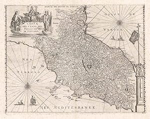
Carta del Stato del Papa et del Gra. Duca di Toscana
Published by Stato della Chiesa - Toscana
Seller: Sergio Trippini, Gavirate, VA, Italy
Seller rating 4 out of 5 stars

Carta geografica raffigurante i territori dello Stato della Chiesa e del Ducato di Toscana. La carta presenta margine graduato solo lungo i lati destro e sinistro, manca cos� l'indicazione della longitudine. L'incisione presenta alcuni elementi decorativi suoi quali merita soffermarsi, si vedano: le due rose dei venti l'una con indicazione dell'orietamento nel mar di Toscana, Tirreno, e la seconda nel golfo di Venezia, Adriatico, nell'angolo in alto a sinistra il decorativo cartiglio vede al centro la raffigurazione allegorica della Santa Chiesa ai cui lati si trovano le figure dei santi Pietro e Paolo. Da notare la nomenclatura in francese. Ottima impressione, leggeri segni di foxing che non compromettono l'ottimo stato di conservazione generale.
-
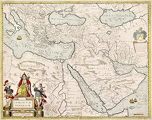
Turcicum imperium.
Published by Bologna, 1670
Seller: libreria antiquaria perini Sas di Perini, Verona, VR, Italy
Seller rating 5 out of 5 stars
Art / Print / Poster
Incisione in rame, 405x513. Rarissima carta non proveniente da atlante, che deriva direttamente dalla raffigurazione dell'impero turco eseguita da Blaeu, il cui nome � anche riportato entro un cartiglio a destra. Todeschi fu editore bolognese specializzato nella ristampa di carte olandesi; la sua produzione, proprio per il mercato limitato e una conseguente limitata produzione, risultano piuttosto rare. Buon esemplare marginoso, con qualche restauro e margine inferiore molto breve successivamente ampliato con carta antica. Nr.cat: P9180019.
-

Nova Europae descriptio
Published by Sabatini, Bologna, 1670
Seller: libreria antiquaria perini Sas di Perini, Verona, VR, Italy
Seller rating 5 out of 5 stars
Art / Print / Poster
Incisione in rame, mm 440x540. Splendida rarissima "carte-?-figures" dell'Europa, copia bolognese della nota stampa di Hondius, pubblicata da Sabatini, editore di cui si conosce pochissimo, se non attraverso le dediche delle carte da lui stampate. Si inserisce nel filone delle riprese bolognesi del 1670-80, che piratavano le belle e celebri carte olandesi del periodo. La bordura che circonda la carta riproduce su ogni lato cinque costumi di coppie di diverse nazioni europee, in alto sei vedute di citt? ed in basso altrettante. In senso orario dall'alto: Venezia, Amsterdam, Roma, Parigi, Vienna, Praga, Germani, Veneziani, Galli, Castigliani, Angli, Costantinopoli, Mosca, Norimberga, Lisbona, Londra, Toledo, Greci, Poloni, Boemi, Ungari e Germani. Ottimo esemplare con professionale restauro ad una mancanza al margine sup. (che in minima parte interessa l'interno della lastra incisa).Stopp, "Die drei Karten vonFrancesco sabatini"; Schilder, Monumenta Cartographica Neerlandici , Vol. VI.
-
Leather Bound. Condition: New. Language: Italian. Language: Italian. Presenting an Exquisite Leather-Bound Edition, expertly crafted with Original Natural Leather that gracefully adorns the spine and corners. The allure continues with Golden Leaf Printing that adds a touch of elegance, while Hand Embossing on the rounded spine lends an artistic flair. This masterpiece has been meticulously reprinted in 2024, utilizing the invaluable guidance of the original edition published many years ago in 1662. The contents of this book are presented in classic black and white. Its durability is ensured through a meticulous sewing binding technique, enhancing its longevity. Imprinted on top-tier quality paper. A team of professionals has expertly processed each page, delicately preserving its content without alteration. Due to the vintage nature of these books, every page has been manually restored for legibility. However, in certain instances, occasional blurriness, missing segments, or faint black spots might persist. We sincerely hope for your understanding of the challenges we faced with these books. Recognizing their significance for readers seeking insight into our historical treasure, we've diligently restored and reissued them. Our intention is to offer this valuable resource once again. We eagerly await your feedback, hoping that you'll find it appealing and will generously share your thoughts and recommendations. Lang: - Italian, Pages: : - 72, Print on Demand. If it is a multi-volume set, then it is only a single volume. We are specialised in Customisation of books, if you wish to opt different color leather binding, you may contact us. This service is chargeable. Product Disclaimer: Kindly be informed that, owing to the inherent nature of leather as a natural material, minor discolorations or textural variations may be perceptible. Explore the FOLIO EDITION (12x19 Inches): Available Upon Request. 72 72.
![Seller image for [Nova et accurata totius Americae tabula auct. G. I. Blaeu] America quarta pars orbis quam plerunq, nuvum orbem apellitant primo detecta est anno 1492 a Christophoro Columbo. for sale by Antiquariaat FORUM BV](https://pictures.abebooks.com/inventory/md/md32284654951.jpg)
![Seller image for Ferrara trionfante, per la coronazione della B.ma Vergine del Rosario celebrata l'anno 1638. Con apparato di teatro, di macchine, e di musica componimento dell'eccellentiss. sig. d. Ascanio Pio di Savoia. Donato dal medesimo signore alla Compagnia del Santiss. Rosario eretta anticamente in Ferrara nella Chiesa di S. Domenico de reuerendi Padri Predicatori 1662 [Leather Bound] for sale by Gyan Books Pvt. Ltd.](https://pictures.abebooks.com/inventory/md/md31423644810.jpg)