West Jerusalem (6 results)
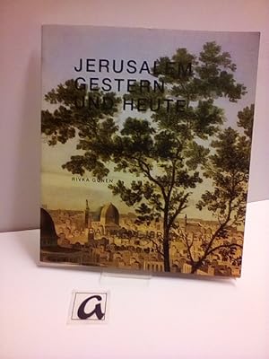
Published by Selbstverlag, Jerusalem (West) 1999
- Hardcover
Seller: AphorismA gGmbH, Berlin-Kreuzberg, , GermanyAphorismA gGmbH
Contact seller5-star sellerCondition: Used
US$ 3.89
US$ 15.67 shippingShips from Germany to U.S.A.Quantity: 2 available
Bro. Condition: Sehr gut erhalten. 62 (2) Seiten; 2 Ex: Ganz leichte Gebrauchsspuren auf Umschlag, sonst sehr gut erhalten KKL-Ausgabe.
 More images
Published by Athenäum, Königstein im Taunus 1978
- Hardcover
Seller: AphorismA gGmbH, Berlin-Kreuzberg, , GermanyAphorismA gGmbH
Contact seller5-star sellerCondition: Used - Good
US$ 3.89
US$ 15.67 shippingShips from Germany to U.S.A.Quantity: 1 available
Ln. Condition: Befriedigender Zustand. o.A. [)&] Seiten; Innen gut, Eiband udn Vorsatz mit Gebrauchsspuren, StaV. Israel Palästina Übersetzung von Peter Wogensteinmit einem Vorwort von: Kaye, Danny / Kollek, Teddy; Einleitung von: Gordon, Ayala; Innen gut, Eiband udn Vorsatz mit Gebrauchsspuren, StaV. Israel Palästina.

Published by Sirkis, (West-)Jerusalem 1994
- Softcover
Seller: AphorismA gGmbH, Berlin-Kreuzberg, , GermanyAphorismA gGmbH
Contact seller5-star sellerCondition: Used
US$ 5.68
US$ 15.67 shippingShips from Germany to U.S.A.Quantity: 1 available
Bro. Condition: Sehr gut erhalten. 128 Seiten; Mit ausfaltbarer Zeittafel - [HEK].

Published by Selbstverlag, West-Jerusalem 2016
Seller: AphorismA gGmbH, Berlin-Kreuzberg, , GermanyAphorismA gGmbH
Contact seller5-star sellerCondition: Used - Fine
US$ 7.78
US$ 15.67 shippingShips from Germany to U.S.A.Quantity: 1 available
Bro. Condition: Sehr gut. 42 Seiten; Bilder einer verlassenen Synagoge in der Slovakei Photos: Dojc, Yuri.
 More images
- Softcover
Seller: suspiratio - online bücherstube lic.phil h.b., Basel, Switzerlandsuspiratio - online bücherstube lic.phil h.b.
Contact seller4-star sellerCondition: Used - Fine
US$ 35.87
US$ 54.57 shippingShips from Switzerland to U.S.A.Quantity: 1 available
Softcover. Condition: Sehr gut. 2 paperbacks, fine - Breaking the Silence, an organisation of Israeli veterans who served during the Second Intifada in 2000, has released a booklet of soldier testimonies of the everyday life routine in the oPt Israel s backyard . The report attests to the mistreatment of Palestinian children, st…ill taking place, years after the peak of the Second Intifada.The testimonies and stories in this booklet portra.

- Map
Seller: Geographicus Rare Antique Maps, Brooklyn, NY, U.S.A.Geographicus Rare Antique Maps
Contact seller4-star sellerVery good. Light wear along original fold lines. Text and images on verso. Size 22 x 16.75 Inches. This is a 1958 Hebrew-language pictorial map of West Jerusalem, prepared by the Jerusalem Institute of Photogrammetry. Intended to highlight the city's bus lines, it also serves as a reminder of the ad hoc boundaries that divided t…he city in the wake of the First Arab-Israeli War. A Closer Look The map depicts West Jerusalem, that is, the Israeli-administered parts of the city which were occupied during the 1948 (First) Arab-Israeli War. At this time, the city was divided between east and west by the 'Green Line' (black here) that separated West Jerusalem from East Jerusalem, and also created several contested zones - 'No Man's Land' - the exclaves seen at right here. Streets are labelled throughout, while bus lines are traced in red and numbered. Schools, synagogues, and parks are indicated according to the legend below the title. Neighborhoods and landmarks throughout the city are labelled and several are illustrated, including Mt. Zion (??? ???????) at right and the Hebrew University of Jerusalem (???? ???????????) at left. The map is surrounded by a grid corresponding to a street index on the verso. Much of the area seen here was of recent construction, initially from scattered settlements in the early 20th century to a 'Jewish colony' (???????) that developed in the 1920s. After 1948, considerable government investment led to much more rapid development, which is evidenced by the text and images on the verso. In addition to a street index and information on bus lines, most of the verso consists of enthusiastic promotional text and images, celebrating progress in infrastructure and new construction in West Jerusalem in recent years, including schools, sewers, water supply, and roads. Jerusalem's Pre-1967 Borders The 'Green Line' agreement was never meant to signify permanent international borders, only a temporary demarcation between Israel and Jordan following the 1948 Arab-Israeli War. The 'Green Line' even extended through Jerusalem, dividing the city into East Jerusalem, which was part of the Kingdom of Jordan, and West Jerusalem, the capital of the newly created State of Israel. When the ceasefire was finally declared, an Israeli and Jordanian commander met in an abandoned house to outline the boundaries of the ceasefire. The Israeli commander used a green wax pencil to outline Israeli-controlled positions, while the Jordanian commander used a red pencil to outline positions under Jordanian control, with the area between the two lines becoming a No Man's Land. Neither commander believed that this informally arrived at agreement represented anything more than a temporary ceasefire line, meaning that little notice was given to inaccuracies and errors included in their work due to the thickness of the pencils, deviations in the drawings, or segments of discontinuous lines. Later, however, during the meetings in Rhodes to hammer out the 1949 Armistice Agreements, the map between these two commanders was found to be the only official document indicating the line dividing Jerusalem that was agreed upon by both parties. Thus, the informality and the inaccuracies went from being a ceasefire agreement between two commanders on the ground to a binding international border. This meant that neighborhoods, streets, and even houses became points of contentious international dispute, as the line drawn on this map was rough at best. The border quickly became fortified, with military positions springing up all along the border and landmines were deployed in the No Man's Land. Included in this agreement was an Israeli-controlled area on Mt. Scopus, beyond the scope of this map to the east. A bi-weekly convoy to the Israeli enclave on Mt. Scopus crossed the border between the two halves of the city through the Mandelbaum Gate, at the meeting point of (?? ????? ?????) and St. George St. (renamed Shivtei Israel St. ???? ???? ????? on the Isr.


