

Order Total (1 Item Items):
Shipping Destination:

Dania Regnum, Used (20 results)
Skip to main search results
Search filters
Product Type
- All Product Types
- Books (9)
- Magazines & Periodicals (No further results match this refinement)
- Comics (No further results match this refinement)
- Sheet Music (No further results match this refinement)
- Art, Prints & Posters (6)
- Photographs (No further results match this refinement)
- Maps (5)
- Manuscripts & Paper Collectibles (No further results match this refinement)
Condition Learn more
- New (No further results match this refinement)
- As New, Fine or Near Fine (1)
- Very Good or Good (3)
- Fair or Poor (1)
- As Described (15)
Binding
- All Bindings
- Hardcover (2)
- Softcover (No further results match this refinement)
Collectible Attributes
- First Edition (1)
- Signed (No further results match this refinement)
- Dust Jacket (No further results match this refinement)
- Seller-Supplied Images (16)
- Not Print on Demand (20)
Language (2)
Price
- Any Price
- Under US$ 25 (No further results match this refinement)
- US$ 25 to US$ 50 (No further results match this refinement)
- Over US$ 50
Free Shipping
Seller Location
Seller Rating
-

Dania Regnum
Published by Francoforte, 1650
Seller: libreria antiquaria perini Sas di Perini, Verona, VR, Italy
Seller rating 5 out of 5 stars

Art / Print / Poster
Incisione in rame, dipinta a mano, mm 280x340. Bellíesemplare in buona impressione e ben conservato, qualche macchia al margine. Tratta da ìNeuwe Archontologia cosmicaî di Johann Gottfried. Copper engraving, hand colour, mm 280x340. Fine copy in good impression and well preserved, some stains in the margin. Taken from "Neuwe Archontologia cosmica" by Johann Gottfried Nr.cat: Cod 2993.
-

Dania Regnum.
Published by Francoforte,, 1638
Seller: libreria antiquaria perini Sas di Perini, Verona, VR, Italy
Seller rating 5 out of 5 stars
Art / Print / Poster
Incisione in rame, 280x334. Tratta da "Neuwe Archontologia cosmica" di Johann Gottfried. Ottimo esemplare ben inchiostrato. Nr.cat: Cod 5164.
-

FLORA FRIDRICHSDALINA Sive Methodica Descriptio Plantarum in Agro Fridrichsdalensi Simulque per Regnum Daniae Crescentium cum Charactereibus Genericis & Specificis; Nominibus Trivialibus, Vernaculis, Pharmaceuticis; Locis Natalibus Specialissimis; Iconibus Optimis Allegatis, ac Speciebus Pluribus in Dania Nuper Detectis
Published by Libraria Joh. Godofr. Baueri, Argentorati, 1767
Hardcover. Condition: Good-. 238 pages in good condition. Pages have some foxing throughout. Some folding plates at the back of the book. Text is in LATIN. Previous owner's signature and stamp on the front endpaper. Page edges have red publisher's stain, lightly smudged. Bound in black hardcovers with a label on the spine. Heavily worn around the edges with chips, tears in the paper, chips on the ends of the spine. Heavily scuffed, bumped on the corners. RARE. G-. Book.
-
LARGE Historical map of Denmark with surroundings Dania Regnum. Dania Regnum In quo sunt Ducatus Holsatia et Slesvicum Insulae Danicae et Provinciae Iutia Scania Blekingia et Hallandia. Dania Regnum, early old coloured antique map of Denmark and the southern parts of Sweden and Norway.
Published by Amsterdam 1696, 1696
Seller: PROCTOR / THE ANTIQUE MAP & BOOKSHOP, DORCHESTER, United Kingdom
Association Member: PBFA
Seller rating 5 out of 5 stars
US$ 300.17
US$ 26.49 shipping
Ships from United Kingdom to U.S.A.Quantity: 1 available
Add to basketDecorative double sheet Copperplate engraved map Uncoloured, The map shows all of Denmark, and the southern parts of Sweden and Norway. The land is fully engraved with mountains, forests and cities. The title cartouche is quite elaborate with a host of livestock, and two wild men with clubs standing guard over the coat of arms in the centre. In very good condition. Strong impression. Held in ivory mount with hard back. Hand coloured. Engraved Size 23 x 20 inches Mount Size 28 x 25 inches.
-
Dania Regnum, Ducatus Holsatia et Slesvicum Insulæ Danicæ et Provinciæ Iutia Scania, etc.
Published by Amsterdam, 1710
Seller: Donald A. Heald Rare Books (ABAA), New York, NY, U.S.A.
Seller rating 5 out of 5 stars
Map
Engraved with period outline colour. Bottom margin trimmed close to neat line. All edges browned. A handsome early 18th century Dutch map of Denmark The de la Feuille family came to Amsterdam from France in 1683. The father, Daniel, was a goldsmith and engraver. Talent in engraving in Amsterdam at that time naturally led to publishing and mapmaking. This map was made by Jacob (originally Jacques) on the basis of several contemporary maps. It is very attractive, very much in the style of late Dutch cartography: emphasizing clarity and readability, handsomely coloured and bearing an interesting and appropriate Baroque style cartouche - here demonstrating the rich agricultural and pastoral aspects of the country. Koeman, La F 16, #83.
-

Dania regnum
Published by Artist: Merian Matthäus ( - 1650 ) Frankfurt aM ca : 1638, 1593
Seller: Antique Sommer& Sapunaru KG, München, Germany
Seller rating 4 out of 5 stars

Technic: Copper print, colorit: original colored, condition: Some restorations at upper centerfold, size (in cm): 28 x 33 cm, Map shows the whole of Denmark with splendid coat of arms, title cartouche and several ship staffages.
-

Dania Regnum
Published by Ausburg. M Seutter, 1740
Seller: Libreria Pontes, Madrid, M, Spain
Seller rating 5 out of 5 stars
Sin Encuadernar. Condition: Muy bien. Double page engraved map.60x54 cms.Original hand colour. Fine codition.large cartocuhe,scales, etc. very decorative map.
-

Dania Regnum in quo sunt Ducatus Holsatia et Slesvicum Iutia, et Insulae dictae Danicae quae noncupantur Zelandia, Fionia, Lalandia, Falstria, Langelandia, Bornholmia etc.
Published by Amsterdam s.d. (1710 ca.), 1710
Seller: Libreria Ex Libris ALAI-ILAB/LILA member, Roma, RM, Italy
Seller rating 5 out of 5 stars
Map
Carta geografica originale (cm. 58x50 più margini bianchi) edita da P. Mortier (1661-1711). Splendida coloritura d'epoca all'acquarello. Esemplare in ottimo stato di conservazione. Rara tiratura.
-
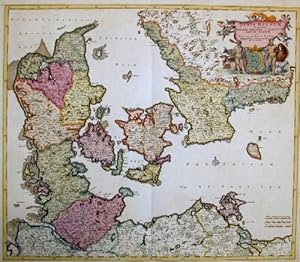
Dania regnum In quo sunt Ducatus Holsatia et Slesvicum Insulae Danicae et Provinciae Jutia, Scania, Blekingia et Hallandia
Published by Artist: Wit de Frederick ( - 1698 ) Amsterdam ca : 1688, 1610
Seller: Antique Sommer& Sapunaru KG, München, Germany
Seller rating 4 out of 5 stars
Technic: Copper print, colorit: original colored, condition: Some restoration at lower centerfold, size (in cm): 50 x 58 cm, Map shows the whole of Denmark with title cartouche and coat of arms.
-
Flora Fridrichsdalina sive Methodica descriptio Plantarum in Agro Fridrichsdalensi simulque per Regnum Daniae crescentium cum Characteribus genericis & specificis.ac Speciebus pluribus in Dania nuper detectis. - [ALL DANISH PLANTS]
Seller: Herman H. J. Lynge & Søn ILAB-ABF, Copenhagen, Denmark
Seller rating 4 out of 5 stars
First Edition
Argentorati (Strassburg), J.G. Bauer, 1767. 8vo. Nice contemporary half calf with five raised bands and gilt lines to spine. Wear to spine and capitaks and slightly split at hinges, but still tight. A bit of brownspotting throughout. Smukt velbevaret samt. hldrbd. med ophøjede bind, rig rygforgyldning og skindtitel. XVIII, 238, (22) pp. + two folded engraved plates (one being the folded map of Furesøen, Lyngby-og Bagsværd Sø). The very rare first edition of Müller?s floral magnum opus, which according to his own statements contains a description of all known plants in Denmark, of which Müller prides himself with having discovered and described no less than 300. Müller participated in the production of the monumental ?flora Danica? with its magnificent plates of all Danish plants, but the present work is the only work of botany that he himself published, namely of the flora of the Schulin Estate. ?Otto Friedrich Muller (1730-1784) was born in Copenhagen, the son of the court trumpeter, a German man who had moved to Denmark. With a ready and lively intelligence, he received an excellent education admitted to the University of his hometown at the age of 18, according to the custom of the time he initially studied theology (the Danish university had only three courses of study: theology, law, medicine), then moved to law he had excellent skills in various fields, including music. However, he did not graduate, because for economic reasons in 1753 he abandoned his studies to enter the service of the Schulin family as a tutor to the heir of the house, who was orphaned at an early age. He lived with the Schulin for about twenty years, mostly on their Friedrichsdalin estate, near Copenhagen. Beginning in 1758, using Linnaeus' books, he began to study natural sciences as a self-taught student, both out of passion and to teach his pupil. Starting in 1761, he procured a microscope. His first scientific publication was a catalogue of insects from the Schulin estate, Fauna insectorum Fridrichsdalina (1764). Between 1765 and 1767, during a trip to Europe with his pupil, he visited many countries in central and southern Europe and was able to attend scientific circles, making contacts and lasting friendships. A man of the world, well accustomed to courtiers since childhood, through a strategy of targeted promotion (knowledge of eminent scientists, publication of previous works in support of his candidacy) he managed to be admitted into many European scientific societies. A Strasbourg published his only work of botany, a catalogue of the flora of the Schulin estate, Flora Fridrichsdalina (1767). During the journey, thanks to the various meetings, his interests finally shifted from botany to zoology, in particular to the study of invertebrates, of which he became perhaps the greatest expert of his time. In 1771 - his pupil was then 24 years old - he left the Schulin and thanks to Oeder's recommendation he was hired at the State Archives the office was renovated in 1772 after the fall of Struensee and Müller and, although he retained a small pension, he lost his place. His marriage to the wealthy Norwegian widow Anna Catharina Paludan resolved his economic problems once and for all from that moment on, he was able to devote himself full-time to scientific work. An important piece of his research was the Estate of Drobak, on the Gulf of Oslo, owned by his wife, where the scientist spent the summers from 1774 to 1778, focusing in particular on the study of marine micro-fauna. He was assisted by a team that included draughtsmen and engravers (one of the best painters was his younger brother, Christian Friedrich, who, in addition to illustrating some of his brother's works, years later collaborated with Vahl on the third tranche of Flora Danica) and a number of students, recruited in an ingenious way. Every year, Müller made an advertisement in the newspapers to recruit them and paid them for the journey from Copenhagen to Oslo. Beginning in 1771, publications also multiplied, mainly dedicated to different classes of invertebrates, before then little known. In the meantime, Müller had presented to the court the project of a Fauna Danica, to pair with Flora Danica, of which he was appointed curator after Oeder's departure. The countryside in Norway and, later, when arthritis forced him to give it up, the coasts of Denmark, including the islands, allowed him to collect specimens for both works. In 1776 he anticipated the content of his great zoological work with Zoologiæ Danicae Prodromus, which listed, classified and briefly described all the animal species of the kingdom of Denmark-Norway, a work of epochal importance for the innovative classification of invertebrates. Two folio volumes of Fauna Danica followed in 1777 and 1786, with 40 plates (the other two volumes would be completed and published by various curators many years after his death). Between 1776 and 1784 five files of Flora Danica were also released. However, an important work on infusers (small single-celled organisms that develop in plant infusions, belonging to various classes, especially protozoa) remained unfinished (and was completed by O. Fabricius). In 1784, after a decade of intense work, Müller died at the age of fifty.? (D. D. Damkaer, The Copepodologist's Cabinet, A Biographical and Bibliographical History).
-

Dania Regnum in quo sunt Ducatus Holastia et Slesvicum Insulae Danicae.
Published by Amsterdam, 1680
Seller: Alexandre Antique Prints, Maps & Books, Toronto, ON, Canada
Seller rating 4 out of 5 stars
Map
Title cartouche in upper right corner held up by five putti, Danish coat of arms defended by two men, surrounded by farm animals., Size : 500x585 (mm), 19.625x23 (Inches), Original Hand Coloring Very Good, some browning. Due to oxidation of the green pigment the map is backed by acid free tissue paper for long term preservation.
-
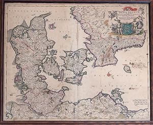
Map: Dania Regnum in quo sunt Ducatus Holsatia et Slesucium Insulae Danic et Provinci, Iutia, Scania, Blekingia et Hallandia
Published by Frederick de Wit, 1650
Seller: James Cummins Bookseller, ABAA, New York, NY, U.S.A.
Seller rating 5 out of 5 stars
Condition: About Fine. Framed and glazed. Contemporary Coloring. With Wonderful Cartouche Upper Right. 1 vols. 23 x 20 inches. Contemporary Coloring. With Wonderful Cartouche Upper Right. 1 vols. 23 x 20 inches.
-
Dania Regnum.
Publication Date: 1640
Seller: BOTTEGHINA D'ARTE GALLERIA KÚPROS, Rosignano Solvay, LI, Italy
Seller rating 4 out of 5 stars
Art / Print / Poster
No legatura. Condition: Discreto. Amsterdam, 1640 circa. Incisione in rame all'acquaforte, colore d'epoca, cm 43,2x 53,7 (alla lastra) più margini, testo francese al verso. Dettagliata carta della Danimarca con parte della Germania e della Svezia. Tracce e aloni di umido, discreto l'inciso.
-

Dania Regnum
Published by Joan Blaeu, 1665
Seller: Antiquariaat Dat Narrenschip, Middelburg, Netherlands
Seller rating 5 out of 5 stars
Map
No Binding. Condition: Good. Antique map of Denmark. Title cartouche top right; vertical scale stick in cartouche at the bottom; various ships. Backside Spanish text. Contemporary colored, gilt copper engraving, published in Amsterdam 1659-1672 by Joan Blaeu in 'Atlas Mayor, O Geographia Blaviana: Que contiene las Cartas, y desripciones De España.' Slight discoloration and color deposits. Dimensions (image): 38 x 50 cm.
-
Dania Regnum.
Seller: Herman H. J. Lynge & Søn ILAB-ABF, Copenhagen, Denmark
Seller rating 4 out of 5 stars
(Amsterdam, ca. 1662). 43x52,5 cm. Kobberstukket generalkort over Danmark i original håndkolorering. Velbevaret og og med brede marginer. Med det danske rigsvåben og stor dekorativ kartouche flankeret af vildmændene, begge i helkolorering. Fint frisk eksemplar af dette dekorative Danmarkskort. Kortet optræder allerede i 1634 i Blaue's "Novus Atlas", og findes uforandret i de forskellige udgaver af "Atlas Maior". Eksemplaret her har spansk tekst på bagsiden. Jyllandsdelens udformning går tilbage til Mercator, mens øerne er gengivet efter Waghenaer.
-
Dania Regnum, Ducatus Holsatia et Slesvicum Insulae Danicae et Provinciae Iutia Scania etc. Kolor. Kupferstichkarte von P. Schenck. Amsterdam, 1706. 49 x 59,5 cm.
Language: German
Publication Date: 1706
Seller: Antiquariat Daniel Schramm e.K., Kiel, Germany
Seller rating 4 out of 5 stars
Condition: 0. Im Falz hinterlegt und etwas gebräunt, wenige kleine Wurmlöchlein.- Dania Regnum, Ducatus Holsatia et Slesvicum Insulae Danicae et Provinciae Iutia Scania etc. Color. Copper engraved map by P. Schenck. Amsterdam, 1706. 49 x 59.5 cm. Backed at fold and somewhat browned, a few small wormholes. Sprache: Deutsch Gewicht in Gramm: 500.
-
Dania Regnum
Language: German
Publication Date: 1640
Seller: Kunstantiquariat Andreas Senger, Hamburg, Germany
Seller rating 5 out of 5 stars
Map
Kein Einband. Condition: Gut. Es handelt sich hierbei um eine originale, kolorierte Kupferstich-Landkarte des Königreichs Dänemark von Willem Janszoon Blaeu (1571 - 1638) aus dem Jahr 1640. *** Titel: Dania Regnum *** Gebiet bzw. Ort: Königreich Dänemark *** Kartograph: Willem Janszoon Blaeu (1571 - 1638) *** Jahr: 1640 *** Größe des Plattenbereichs: 42 x 52 cm *** Technik: Kupferstich *** Zustand (Perfekt/ Sehr gut/ Gut/ Ordentlich/ Mäßig/ Schlecht): In gutem Erhaltungszustand *** Bemerkungen: - *** English description: This map is a genuine copper engraving of the Kingdom of Denmark in decorative colouring. The detailled map is further enriched by a beautiful figurative cartouche, several coats of arms and a milescale. It was published by Willem Janszoon Blaeu in 1640 and measures 42 x 52 cm (platesize). The map is in good condition. The centrefold has been backed with thin Japanese paper. *** - - - International buyers welcome. If you have any questions, please don't hesitate to ask. --- Auf Wunsch stellen wir Ihnen gerne ein kostenfreies Echtheitszertifikat aus --- If you wish, we will gladly provide a certificate of authenticity free of charge ---.
-

DÄNEMARK. - Karte. Dania Regnum
Seller: Peter Bierl Buch- & Kunstantiquariat Inh.: Andrea Bierl, Eurasburg, Germany
Seller rating 5 out of 5 stars
Art / Print / Poster
Kupferstich aus Gottfried, "Archontologia", 1649, 28,5 x 33,5 cm. Gesamtkarte einschließlich Schleswig-Holstein, Rügen und Teil von Schweden. Mit Kartusche und Wappen.
-

DÄNEMARK. - Karte. Dania Regnum
Seller: Peter Bierl Buch- & Kunstantiquariat Inh.: Andrea Bierl, Eurasburg, Germany
Seller rating 5 out of 5 stars
Art / Print / Poster
Altkol. Kupferstich bei Danckerts, um 1690, 49,5 x 58,5 cm. Die flächenkolorierte Gesamtkarte zeigt Dänemark mit Norddeutschland und Teilen von Südschweden (Skane, Halland, Blekinge, Gottland und Smaland). Mit figürlicher Titelkartusche. - Mit schmalem Rändchen um die Einfassungslinie, kleinere hinterlegte Randeinrisse.
-
DÄNEMARK. - Karte. Dania Regnum in quo sunt Ducatus Holsatia et Slesvicum Insulae Danicae et Provinciae Jutia Scania etc
Seller: Peter Bierl Buch- & Kunstantiquariat Inh.: Andrea Bierl, Eurasburg, Germany
Seller rating 5 out of 5 stars
Art / Print / Poster
Altkol. Kupferstich von Frederik de Wit, um 1680, 50 x 58 cm. Karte des westlichen Ostseeraums mit Südschweden und der Küste von Mecklenburg und Pommern mit Rügen. Mit figürlicher, altkolorierter Wappenkartusche rechts oben.


![Seller image for Flora Fridrichsdalina sive Methodica descriptio Plantarum in Agro Fridrichsdalensi simulque per Regnum Daniae crescentium cum Characteribus genericis & specificis.ac Speciebus pluribus in Dania nuper detectis. - [ALL DANISH PLANTS] for sale by Herman H. J. Lynge & Søn ILAB-ABF](https://pictures.abebooks.com/inventory/md/md31807078145.jpg)

