Order Total (1 Item Items):
Shipping Destination:

Descriptive List Printed Maps (68 results)
Skip to main search results
Search filters
Product Type
- All Product Types
- Books (66)
- Magazines & Periodicals (No further results match this refinement)
- Comics (No further results match this refinement)
- Sheet Music (No further results match this refinement)
- Art, Prints & Posters (No further results match this refinement)
- Photographs (No further results match this refinement)
- Maps (2)
- Manuscripts & Paper Collectibles (No further results match this refinement)
Condition Learn more
Binding
Collectible Attributes
- First Edition (7)
- Signed (1)
- Dust Jacket (No further results match this refinement)
- Seller-Supplied Images (24)
- Not Print on Demand (47)
Language (2)
Free Shipping
Seller Location
Seller Rating
-

PAP. Condition: New. New Book. Shipped from UK. Established seller since 2000.
-
A Descriptive List of the Printed Maps of Somersetshire, 15751914 Classic Reprint
Seller: PBShop.store UK, Fairford, GLOS, United Kingdom
Seller rating 5 out of 5 stars

US$ 24.37
Convert currencyUS$ 5.61 shipping from United Kingdom to U.S.A.Quantity: 15 available
Add to basketPAP. Condition: New. New Book. Shipped from UK. Established seller since 2000.
-

HRD. Condition: New. New Book. Shipped from UK. Established seller since 2000.
-
A Descriptive List of the Printed Maps of Somersetshire, 1575-1914 (Classic Reprint)
Seller: PBShop.store UK, Fairford, GLOS, United Kingdom
Seller rating 5 out of 5 stars
US$ 29.81
Convert currencyUS$ 6.77 shipping from United Kingdom to U.S.A.Quantity: 15 available
Add to basketHRD. Condition: New. New Book. Shipped from UK. Established seller since 2000.
-

A Descriptive List Of The Printed Maps Of Somersetshire, 1575 - 1914 ( 1914 )
Published by Kessinger, United States, 2008
ISBN 10: 054888885X ISBN 13: 9780548888858
Language: English
Seller: Clarendon Books P.B.F.A., Leicester, United Kingdom
Association Member: PBFA
Seller rating 5 out of 5 stars
US$ 13.82
Convert currencyUS$ 25.55 shipping from United Kingdom to U.S.A.Quantity: 1 available
Add to basketPaperback. Condition: Very Good. Card covers in bright condition, a facsimile edition Size: 8vo - over 7�" - 9�" tall.
-
A Descriptive List Of The Printed Maps Of Somersetshire, 1575-1914 (1914)
Published by Kessinger Publishing, 2008
ISBN 10: 054888885X ISBN 13: 9780548888858
Language: English
Condition: New.
-

US$ 49.01
Convert currencyUS$ 3.99 shipping within U.S.A.Quantity: Over 20 available
Add to basketCondition: New.
-
Condition: New.
-

A Descriptive List of the Printed Maps of Yorkshire and Its Ridings, 1577-1900
Published by Yorkshire Archaeological Society, 1971
Language: English
Hardcover. Condition: Very Good. No Jacket. Reprint. Brown cloth, 261 pages, 9-in tall, many maps. Reprint of a title published in 1933. Published as Record Series Vol. LXXXVI For the Year 1933. A clean copy with minor edge wear.
-

A Descriptive List of the Printed Maps of Yorkshire and its Ridings, 1577-1900 (Cambridge Library Collection - British and Irish History, General)
Published by Cambridge University Press, 2013
ISBN 10: 1108058825 ISBN 13: 9781108058827
Language: English
US$ 53.98
Convert currencyUS$ 3.99 shipping within U.S.A.Quantity: Over 20 available
Add to basketCondition: New.
-
A Descriptive List of the Printed Maps of Yorkshire and its Ridings, 1577-1900 (Cambridge Library Collection - British and Irish History, General)
Published by Cambridge University Press, 2013
ISBN 10: 1108058825 ISBN 13: 9781108058827
Language: English
Seller: Ria Christie Collections, Uxbridge, United Kingdom
Seller rating 5 out of 5 stars
US$ 48.57
Convert currencyUS$ 16.15 shipping from United Kingdom to U.S.A.Quantity: Over 20 available
Add to basketCondition: New. In.
-
A Descriptive List of the Printed Maps of Yorkshire and its Ridings, 15771900 (Paperback)
Published by Cambridge University Press, Cambridge, 2013
ISBN 10: 1108058825 ISBN 13: 9781108058827
Language: English
Paperback. Condition: new. Paperback. Originally founded in 1863 to promote interest in the history and archaeology of the Huddersfield area, the Yorkshire Archaeological Society expanded its purview in 1870 to cover the whole of Yorkshire. In 1884 it began publishing its Record Series, which aimed to make historical information available through the reprinting of original documents, diaries, letters, and charters. First published in 1933 and reprinted for the society in 1971, this well-illustrated work is an extensive catalogue of maps of the Yorkshire area, drawn between 1577 and 1900. The editor's introduction sets the maps within the history of cartography in Britain, and in the context of pioneering work by previous cartographers. The entries give a description of what each map depicts, along with information on dates and dimensions. This work remains a valuable resource for local historians and geographers. First published for the Yorkshire Archaeological Society in 1933 and reprinted in 1971, this is an extensive and well-illustrated catalogue of maps of the Yorkshire region, drawn between 1577 and 1900, with informative descriptions. It remains of value to local historians and geographers. Shipping may be from multiple locations in the US or from the UK, depending on stock availability.
-
A Descriptive List Of The Printed Maps Of Somersetshire, 1575-1914 (1914)
Published by Kessinger, United States, 2008
Seller: Clarendon Books P.B.F.A., Leicester, United Kingdom
Association Member: PBFA
Seller rating 5 out of 5 stars
US$ 19.38
Convert currencyUS$ 25.55 shipping from United Kingdom to U.S.A.Quantity: 1 available
Add to basketPaperback. Condition: Fine. In as new condition.
-
A Descriptive List of the Printed Maps of Lancashire, 1577-1900. [Remains, Historical and Literary, Connected with the Palatine Counties of Lancaster and Chester. New series 101]
Published by Chetham Society, 1938
US$ 36.31
Convert currencyUS$ 10.79 shipping from United Kingdom to U.S.A.Quantity: 1 available
Add to basketHardcover. Condition: Very Good. pp.xvi, 247 pages, with 19 illustrations, a very good ex-library hardback, publisher's original maroon cloth binding with gold gilt lettering to the spine and black coat of arms & design to the front cover.
-
A Descriptive List of the Printed Maps of Yorkshire and Its Ridings, 1577 1900
Published by Cambridge University Press CUP, 2013
ISBN 10: 1108058825 ISBN 13: 9781108058827
Language: English
Condition: New. pp. 318.
-

Descriptive List of the Printed Maps of Yorkshire and Its Ridings, 1577-1900 (Yorkshire Archaeological Society. Record series)
Published by Yorkshire Archaeological Society, 1971
ISBN 10: 0902122088 ISBN 13: 9780902122086
Language: English
Seller: Books for Libraries, Inc., Santa Clarita, CA, U.S.A.
Seller rating 4 out of 5 stars

Hardcover. Condition: Very Good. 1971 Hardcover. Many fold-out maps intact. No former owner's name or marks. Text is clean, Binding is strong. Nice tan cloth cover with gold lettering & stamped borders, a few light scratches in cloth.
-
A Descriptive List of the Printed Maps of Shropshire A.D. 1577-1900
Published by Salop County Council, 1959
Language: English
First Edition
US$ 52.78
Convert currencyUS$ 26.97 shipping from United Kingdom to U.S.A.Quantity: 1 available
Add to basketHardcover. Condition: Very Good. 1st Edition. Some bumping to extremities o/w very good.
-
A Descriptive List of the Printed Maps of Cheshire 1577-1900.
Published by Chetham Society, Manchester., 1942
Language: English
Seller: Robert F Butterworth, Lytham St.Annes, LANCS, United Kingdom
Seller rating 5 out of 5 stars
US$ 66.67
Convert currencyUS$ 16.18 shipping from United Kingdom to U.S.A.Quantity: 1 available
Add to basketHardcover. Condition: Very Good. No Jacket. 1st ed. Tall 8vo. Purple dec. cloth. xv,220pp. Illus maps. Ex college library with small barely noticeable embossed stamps at the base of the ffep & the title page & a nearly unused borrowing label on the bfep. The boards are sl. rubbed, mainly at the head & tail of spine o/w VG.
-
US$ 21.51
Convert currencyFree shipping from United Kingdom to U.S.A.Quantity: Over 20 available
Add to basketPaperback. Condition: New. Print on Demand. This book is a compilation of maps from the 16th to the 18th century, illustrating the evolution of cartography in Somerset, England. Spanning over two centuries of mapmaking history, the collection provides a unique perspective on the development of geographic knowledge and techniques during that period. The maps showcase the changing understanding of Somerset's topography, revealing how perceptions of the landscape shifted as surveying methods advanced. The book presents a valuable resource for historians, geographers, and anyone interested in the cartographic history of England. This book is a reproduction of an important historical work, digitally reconstructed using state-of-the-art technology to preserve the original format. In rare cases, an imperfection in the original, such as a blemish or missing page, may be replicated in the book. print-on-demand item.
-

A Descriptive List of the Printed Maps of Shropshire, A.D. 1577-1900.
Published by Salop County Council, [Shrewsbury], first edition, 1959, 1959
Seller: Wykeham Books, LONDON, United Kingdom
Association Member: ABA ILAB PBFA
Seller rating 4 out of 5 stars
First Edition
US$ 41.67
Convert currencyUS$ 20.23 shipping from United Kingdom to U.S.A.Quantity: 1 available
Add to basketCloth, gilt cover-title and arms, folio, 26 cm, viii, 234, [2] pp, 751 entries. With detailed descriptions of the maps and an introduction describing the history of Shropshire cartography. Small sticker with number at foot of half-title, lowr fore-edge corners of boards slightly bumped, otherwise Near Very Good.
-
A Descriptive List of the Printed Maps of Yorkshire and its Ridings, 15771900 (Paperback)
Published by Cambridge University Press, Cambridge, 2013
ISBN 10: 1108058825 ISBN 13: 9781108058827
Language: English
US$ 54.84
Convert currencyUS$ 49.89 shipping from United Kingdom to U.S.A.Quantity: 1 available
Add to basketPaperback. Condition: new. Paperback. Originally founded in 1863 to promote interest in the history and archaeology of the Huddersfield area, the Yorkshire Archaeological Society expanded its purview in 1870 to cover the whole of Yorkshire. In 1884 it began publishing its Record Series, which aimed to make historical information available through the reprinting of original documents, diaries, letters, and charters. First published in 1933 and reprinted for the society in 1971, this well-illustrated work is an extensive catalogue of maps of the Yorkshire area, drawn between 1577 and 1900. The editor's introduction sets the maps within the history of cartography in Britain, and in the context of pioneering work by previous cartographers. The entries give a description of what each map depicts, along with information on dates and dimensions. This work remains a valuable resource for local historians and geographers. First published for the Yorkshire Archaeological Society in 1933 and reprinted in 1971, this is an extensive and well-illustrated catalogue of maps of the Yorkshire region, drawn between 1577 and 1900, with informative descriptions. It remains of value to local historians and geographers. Shipping may be from our UK warehouse or from our Australian or US warehouses, depending on stock availability.
-

US$ 47.61
Convert currencyUS$ 57.36 shipping from Germany to U.S.A.Quantity: Over 20 available
Add to basketCondition: New.
-
US$ 73.61
Convert currencyUS$ 33.71 shipping from United Kingdom to U.S.A.Quantity: 1 available
Add to basketHardcover. Condition: New. New. book.
-
A Descriptive List of the Printed Maps of Yorkshire and its Ridings, 15771900 (Paperback)
Published by Cambridge University Press, Cambridge, 2013
ISBN 10: 1108058825 ISBN 13: 9781108058827
Language: English
US$ 72.58
Convert currencyUS$ 37.00 shipping from Australia to U.S.A.Quantity: 1 available
Add to basketPaperback. Condition: new. Paperback. Originally founded in 1863 to promote interest in the history and archaeology of the Huddersfield area, the Yorkshire Archaeological Society expanded its purview in 1870 to cover the whole of Yorkshire. In 1884 it began publishing its Record Series, which aimed to make historical information available through the reprinting of original documents, diaries, letters, and charters. First published in 1933 and reprinted for the society in 1971, this well-illustrated work is an extensive catalogue of maps of the Yorkshire area, drawn between 1577 and 1900. The editor's introduction sets the maps within the history of cartography in Britain, and in the context of pioneering work by previous cartographers. The entries give a description of what each map depicts, along with information on dates and dimensions. This work remains a valuable resource for local historians and geographers. First published for the Yorkshire Archaeological Society in 1933 and reprinted in 1971, this is an extensive and well-illustrated catalogue of maps of the Yorkshire region, drawn between 1577 and 1900, with informative descriptions. It remains of value to local historians and geographers. Shipping may be from our Sydney, NSW warehouse or from our UK or US warehouse, depending on stock availability.
-

A Descriptive List of the Printed Maps of Somersetshire, 1575-1914 (Classic Reprint)
Published by Forgotten Books Mai 2018, 2018
ISBN 10: 1334401071 ISBN 13: 9781334401077
Language: English
US$ 37.32
Convert currencyUS$ 75.06 shipping from Germany to U.S.A.Quantity: 2 available
Add to basketTaschenbuch. Condition: Neu. Neuware.
-

A Descriptive List of the Printed Maps of Somersetshire, 1575-1914
Published by Creative Media Partners, LLC M�r 2019, 2019
ISBN 10: 052665628X ISBN 13: 9780526656288
Language: English
US$ 61.03
Convert currencyUS$ 73.66 shipping from Germany to U.S.A.Quantity: 2 available
Add to basketBuch. Condition: Neu. Neuware.
-
A DESCRIPTIVE LIST OF THE PRINTED MAPS OF NORFOLK, 1574-1916, WITH BIOGRAPHICAL NOTES AND A TABULAR INDEX.
Published by Jarrold & Sons,, Norwich,, 1928
Seller: Burwood Books, Wickham Market, United Kingdom
Association Member: PBFA
Seller rating 5 out of 5 stars
First Edition
US$ 48.61
Convert currencyUS$ 23.60 shipping from United Kingdom to U.S.A.Quantity: 1 available
Add to basketHardcover. Condition: Fair. First Edition. Hardback. No Dust Jacket. 8vo. pp xvi, 289, 26 plates 16 in double page format. Original publisher's red cloth, lettered gilt at the spine. Ex-library copy with the usual markings. A somewhat used copy: rubbing, marks and fading at spine with some splitting at spine hinges - otherwise sound with complete text; good only.
-
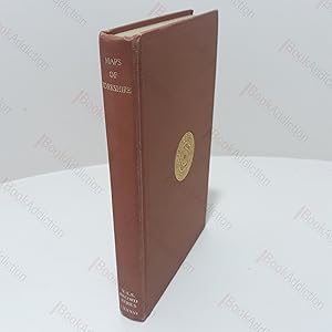
A Descriptive List of the Printed Maps of Yorkshire and its Ridings, 1577-1900 (The Yorkshire Archaelogical Society : The Record Series Vol. LXXXVI for the Year 1933)
Published by The Yorkshire Archaeological Society, Leeds, UK, 1971
Seller: BookAddiction (IOBA, IBooknet), Canterbury, United Kingdom
Association Member: IOBA
Seller rating 5 out of 5 stars
US$ 62.50
Convert currencyUS$ 10.79 shipping from United Kingdom to U.S.A.Quantity: 1 available
Add to basketHardcover. Condition: Very Good. 1971 Reprint. xiv, 262pp, 23 illustrations and fold out maps (including frontispiece) in black and white. Umber cloth-covered boards with gilt titles on spine and gilt design on front. Rubbed spine ends. Some bumping along bottom edge and shelf wear. Evidence of previous labels on front end papers. Slightly loose binding. Otherwise, internally neat, clean and bright. 8vo. A bibliographic examination of printed maps of Yorkshire from around the beginning of the 16th century, with reproductions of some beautifully engraved maps and some curious and rarer ones.
-
A Descriptive list of the printed maps of Lancashire
Published by Chetham Society, 1938
First Edition
US$ 62.50
Convert currencyUS$ 12.14 shipping from United Kingdom to U.S.A.Quantity: 1 available
Add to basketHardcover. Condition: Very Good. No Jacket. 1st Edition. 248 pages + illustrations at the rear. Maroon cloth with gold spine lettering.
-

A Descriptive List of the Printed Maps of Yorkshire and Its Ridings, 1577 1900
Published by Cambridge University Press, 2013
ISBN 10: 1108058825 ISBN 13: 9781108058827
Language: English
US$ 81.18
Convert currencyUS$ 73.29 shipping from Germany to U.S.A.Quantity: 1 available
Add to basketTaschenbuch. Condition: Neu. Druck auf Anfrage Neuware - Printed after ordering - Originally founded in 1863 to promote interest in the history and archaeology of the Huddersfield area, the Yorkshire Archaeological Society expanded its purview in 1870 to cover the whole of Yorkshire. In 1884 it began publishing its Record Series, which aimed to make historical information available through the reprinting of original documents, diaries, letters, and charters. First published in 1933 and reprinted for the society in 1971, this well-illustrated work is an extensive catalogue of maps of the Yorkshire area, drawn between 1577 and 1900. The editor's introduction sets the maps within the history of cartography in Britain, and in the context of pioneering work by previous cartographers. The entries give a description of what each map depicts, along with information on dates and dimensions. This work remains a valuable resource for local historians and geographers.