Order Total (1 Item Items):
Shipping Destination:

Devonshire by Walker (12 results)
Skip to main search results
Search filters
Product Type
- All Product Types
- Books (10)
- Magazines & Periodicals (No further results match this refinement)
- Comics (No further results match this refinement)
- Sheet Music (No further results match this refinement)
- Art, Prints & Posters (No further results match this refinement)
- Photographs (No further results match this refinement)
- Maps (2)
- Manuscripts & Paper Collectibles (No further results match this refinement)
Condition Learn more
- New (No further results match this refinement)
- As New, Fine or Near Fine (1)
- Very Good or Good (5)
- Fair or Poor (No further results match this refinement)
- As Described (6)
Binding
Collectible Attributes
- First Edition (1)
- Signed (1)
- Dust Jacket (No further results match this refinement)
- Seller-Supplied Images (11)
- Not Print on Demand (12)
Language (2)
Free Shipping
- Free Shipping to U.S.A. (No further results match this refinement)
Seller Location
Seller Rating
-
Walker's County Maps: Devonshire
Language: English
Published by J & C Walker, 1842
Seller: YattonBookShop PBFA, Yatton, United Kingdom
Association Member: PBFA
Seller rating 5 out of 5 stars

US$ 16.52
US$ 22.51 shipping
Ships from United Kingdom to U.S.A.Quantity: 1 available
Add to basketHardcover. Condition: Good. c1842. Linen backed Devonshire map folded into 15 and cased within a brown card cover with a hand written title label to the front. FFEP has useful information re population, market days, distance from London etc. Previous owner's mark to both FFEP and reverse of map. Covers are worn (see picture). Additional photos are available upon request. When securely packed this item will weigh in the region of 102g. Unless specifically mentioned, all our books are photographed so you can see what you are buying. ABE may, however, display a stock image whilst processing ours. (YBP Ref: 032295:9b) Size: 32mo - over 4" - 5" tall Language: ENG 102 G. Book.
-

The Story of the Devonshire Association.
Published by Academic Journal Offprint from: - The Transactions of the Devonshire Association, Volume 94, 1962., 1962
Seller: Nar Valley Books & Prints, King's Lynn, United Kingdom
Seller rating 5 out of 5 stars
69pp, plus 1 full-page b/w pls, Printed Card Cover, VGC,
-
The Later Growth of Shiphay Collaton, Torquay | Reprint; Trans. Devonshire Association XCVIII pp 349 - 369
Published by The Devonshire Association, 1966
US$ 27.53
US$ 26.72 shipping
Ships from United Kingdom to U.S.A.Quantity: 1 available
Add to basketSoft cover. Condition: Fine. 1966, 20 pages stapled booklet; with b&w plates | gently read copy - clean and bright, no creases; no name inside; former owner's plan/sketch is faintly visible on back cover (please see image ) | professional booksellers based in the UK | we package with great care and usually dispatch within 24hrs, always within two working days | please request scans or further information on any of our listings, which are all in stock and ready to be dispatched.
-

Devonshire
Language: English
Seller: Roger Collicott Books, Widecombe in the Moor, DEVON, United Kingdom
Seller rating 5 out of 5 stars
Map
US$ 27.53
US$ 42.29 shipping
Ships from United Kingdom to U.S.A.Quantity: 1 available
Add to basketMap. Condition: Very Good. Circa 1830s. Simple uncoloured map. Slightly age discoloured. Size : 235 x 195 mm.
-

James Lyon Widger, 1823 - 1892 and the Torbryan Caves | Reprinted from Vol 99 Trans. Devonshire Association
Published by Devonshire Association, 1967
US$ 41.29
US$ 26.72 shipping
Ships from United Kingdom to U.S.A.Quantity: 1 available
Add to basketSoft cover. Condition: Good. 1967, 60 pages stapled booklet, illus. b&w | this copy shows moderate general wear; some foxing to first page (which is blank); staples have rusted but fortunately without staining text | professional booksellers based in the UK | we package with great care and usually dispatch within 24hrs, always within two working days | please request scans or further information on any of our listings, which are all in stock and ready to be dispatched.
-
Walker's Devonshire
Published by Longman, Orme, Rees & Co., London, 1839
Seller: Wadard Books PBFA, Farningham, KENT, United Kingdom
Association Member: PBFA
Seller rating 4 out of 5 stars

US$ 55.05
US$ 28.06 shipping
Ships from United Kingdom to U.S.A.Quantity: 1 available
Add to basketCloth. Condition: Very Good. Sheet size 345x415mm. Mounted on linen, all folds good. Some light ageing otherwise very good.
-

England IV. Cornwall, Devonshire, Somersetshire & Dorsetshire with small map of Scilly Islands. Antique Map. Landkarte von Cornwall, Devonshire, Somersetshire & Dorsetshire. Grenzkolorierter Original-Stahlstich von Walker bei Baldwin & Cradock 1830
Published by London: Baldwin & Cradock, 1830
Seller: historicArt Antiquariat & Kunsthandlung, Wiesbaden-Breckenheim, Germany
Seller rating 5 out of 5 stars
Map Signed
1. Original-Stahlstich von J. & C. Walker (in der Platte signiert) auf r�ckseitig unbedrucktem Blatt, von alter Hand grenzkoloriert, bildliche Darstellung ca. 25,5 x 39 cm, Blattgr��e ca. 32 x 41 cm, unten im "English Channel" ein kleiner blasser Stockfleck, ansonsten sauber und sehr gut erhalten 2100 gr.
-

Devonshire.
Published by 9 Castle Street, Holborn, London, 1851, 1851
Seller: Pennymead Books PBFA, Knaresborough, United Kingdom
Association Member: PBFA
Seller rating 5 out of 5 stars
US$ 55.00
US$ 20.04 shipping
Ships from United Kingdom to U.S.A.Quantity: 1 available
Add to basketHand coloured engraved folding map on linen, attached to original cloth boards. Small label on reverse for 'Croydon, Bookseller, Torquay' printed in black on yellow paper. Fine. 15 x 13" Note of landslip near Axmouth in 1839.
-
Devonshire
Published by London, London, 1839
Seller: High Ridge Books, Inc. - ABAA, South Deerfield, MA, U.S.A.
Association Member: ABAA ESA ILAB SNEAB
Seller rating 5 out of 5 stars
Original cloth folder with paper label on front. Dissected and linen backed map of this county in Southwestern England. Very good condition. Outline color by borough. Lists towns with populations, as well as polling places, places of election . Railroads, roads and canals highlighted in color. Paste-down slip inside front cover lists towns with their populations, market days, and dates of fairs. Published by Longman, Orme, Rees & Co.
-

ORIGINAL ENGRAVED HAND-COLOURED MAP OF Devonshire. From ?State of Railways.?
Published by London J. & C. Walker. Ca 1840., 1840
Seller: PROCTOR / THE ANTIQUE MAP & BOOKSHOP, DORCHESTER, United Kingdom
Association Member: PBFA
Seller rating 5 out of 5 stars
US$ 60.56
US$ 26.72 shipping
Ships from United Kingdom to U.S.A.Quantity: 1 available
Add to basketLARGE MAP. Double Page Map with centre fold. Size of engraved surface: 15 x 12.5 inches. Overall size: 16.5 x 14 inches. In very good condition. A couple of very small marks, slight fading around edges. Else very clean and bright. - The Map shows the principal roads, rivers, railways and canals. The Walker brothers were publishers and engravers. Later Hand Colouring. With Boroughs, Divisions, and Hundreds.
-
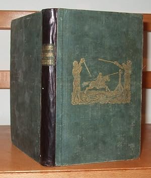
Defensive Exercises; Comprising Wrestling, As In Cumberland, Westmorland, Cornwall, and Devonshire; Boxing, Both in the Usual Mode and in A Simpler One, Defence Against Brute Force, By Various Means .
Published by Thomas Hurst, London, 1840
Seller: George Jeffery Books, HERTFORDSHIRE, United Kingdom
Association Member: PBFA
Seller rating 5 out of 5 stars
First Edition
US$ 227.08
US$ 33.40 shipping
Ships from United Kingdom to U.S.A.Quantity: 1 available
Add to basketCloth. Condition: Good Plus. First Edition. Book measures 18x12.cm. Collation, vi,[2],193pp, 16pp catalogue, 1 folding plates, illustrated within text. Later leather backed spine, retaining the original baords, top board with gilt image. Amatuer reback, boards rubbed, with wear on edges. Internally, occasional light spotting, browning to folding plate. Pages in good clean condition. A good copy, in a amatuer binding. Size: 8vo.
-

Devonshire.
Published by Artist: Walker John/C London dated :, 1837
Seller: Antique Sommer& Sapunaru KG, M�nchen, Germany
Seller rating 4 out of 5 stars
Technic: Lithography, colorit: original colored, condition: Perfect condition, size (in cm): 19 x 23,5, Map shows Devon shire in England with the cities Honiton, Bampton, Barnstaple, Holsworthy, Exeter, Plymouth, etc. and a view of Babicombe Bay.