

Order Total (1 Item Items):
Shipping Destination:

Imperio Giappone (12 results)
Skip to main search results
Search filters
Product Type
- All Product Types
- Books (3)
- Magazines & Periodicals (No further results match this refinement)
- Comics (No further results match this refinement)
- Sheet Music (No further results match this refinement)
- Art, Prints & Posters (2)
- Photographs (No further results match this refinement)
- Maps (7)
- Manuscripts & Paper Collectibles (No further results match this refinement)
Condition Learn more
- New (No further results match this refinement)
- As New, Fine or Near Fine (2)
- Very Good or Good (2)
- Fair or Poor (No further results match this refinement)
- As Described (8)
Binding
- All Bindings
- Hardcover (No further results match this refinement)
- Softcover (No further results match this refinement)
Collectible Attributes
- First Edition (No further results match this refinement)
- Signed (No further results match this refinement)
- Dust Jacket (No further results match this refinement)
- Seller-Supplied Images (11)
- Not Print on Demand (12)
Language (1)
Price
- Any Price
- Under US$ 25 (No further results match this refinement)
- US$ 25 to US$ 50 (No further results match this refinement)
- Over US$ 50
Free Shipping
- Free Shipping to U.S.A. (No further results match this refinement)
Seller Location
Seller Rating
-
![Seller image for [Japan] XI. Imperio del Giappone Governo Monarchico. for sale by Shapero Rare Books](https://pictures.abebooks.com/inventory/md/md31448072190.jpg)
[Japan] XI. Imperio del Giappone Governo Monarchico.
Published by Florence Aniello Lamberti, 1779
Seller: Shapero Rare Books, London, United Kingdom
Association Member: ABA ILAB PBFA
Seller rating 5 out of 5 stars

Map
US$ 483.98
US$ 20.14 shipping
Ships from United Kingdom to U.S.A.Quantity: 1 available
Add to basketEngraved playing card map, fine original hand-colour, cut to or slightly outside platemark, laid down on thin writing paper and tipped-in to contemporary laid paper. Rare playing card map. Designed to play the Florentine version of the tarot game, the 'Minchiate'. The card features a miniature map to its upper part with a table of towns and rivers below. Mann Collection, 1125; Mann, Sylvia & Kingsley, David, 'Map Collectors' Circle No. 87: Playing Cards Depicting maps of the British Isles, and of English and Welsh Counties', p. 23, No.11; King, Geoffrey, 'Minature Antique Maps', p.160.
-
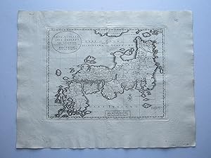
Carta Accurata dell' Imperio del Giappone
Published by Giambatista Albrizzi, Venice, 1740
Seller: Angelika C. J. Friebe Ltd. - MapWoman, Dorking, United Kingdom
Seller rating 5 out of 5 stars
Map
US$ 553.12
US$ 26.85 shipping
Ships from United Kingdom to U.S.A.Quantity: 1 available
Add to basketNo Binding. Condition: Very Good. copper engraved map; overall 36 x 47 cm. plate 25 x 34 cm. fold as issued; some soft creases; hand written annotation top left corner; o/w exc. cond.- A very attractive map of Japan, from Tirion's Italian edition of 'Atlante Novissimo', published by Albrizzi in Venice, 1740. [ref: 4610].
-
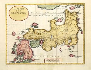
Imperio del Giappone.
Published by Venezia,, 1730
Seller: libreria antiquaria perini Sas di Perini, Verona, VR, Italy
Seller rating 5 out of 5 stars
Art / Print / Poster
Incisione in rame, colorata, 247x317. Edizione italiana della carta di Tirion, tratta da "Atlante novissimo". Ottimo esemplare. Nr.cat: P2010003.
-

Carta Accurata Dell' Imperio Del Giappone Nuovamente tratta dalle nuove relazioini datta in luce in Amsterdam per Isaak Tirion
Published by Isaak Tirion, Amsterdam, 1740
Seller: Alexandre Antique Prints, Maps & Books, Toronto, ON, Canada
Seller rating 4 out of 5 stars

Map
This is a fine map by of Japan after Guillaume Delisle (1675 -1726). Isaak Tirion (1705 - 1765), was a prominent 18th-century publisher from the Netherlands., Size : 251x327 (mm), 9.88x12.87 (Inches), Hand Colored Very Good, laid down on acid free tissue paper for long term preservation.
-

Imperio del Giappone.
Published by Venice, Girolamo Albrizzi, 1740. 250 x 320mm (9¾ x 12½ inches)., 1740
Seller: Tooley, Adams & Co., Wallingford, OXON, United Kingdom
Seller rating 3 out of 5 stars

US$ 663.75
US$ 49.88 shipping
Ships from United Kingdom to U.S.A.Quantity: 1 available
Add to basketUncoloured; light centrefold toning due to guard paste, very light print offset and minor marginal staining, otherwise a fine example. A map of Japan after Isacc Trion and published in 'Atlante Novissimo che Contiene Tutte le Parti del Mondo'.
-

Imperio del Giappone
Published by Giovanni Battista Albrizzi, 1740]., [Venice,, 1740
Seller: Daniel Crouch Rare Books Ltd, London, United Kingdom
Association Member: ABA ILAB PBFA
Seller rating 4 out of 5 stars
Map
US$ 691.40
US$ 26.85 shipping
Ships from United Kingdom to U.S.A.Quantity: 1 available
Add to basketItalian map of Japan Engraved map. The third state of the map, with the title changed to 'Imperio del Giappone' and published in Albrizzi's 'Atlante Novissimo'. Albrizzi (1698-1777) began to publish Salmon's 'Modern Historyor, the present State of all Nations', 'Lo Stato Presente Di Tutti Paesi E Popoli Del Mondo' in 1731, when he issued volume one. The second volume "containing the map of Japan was published only in 1734. By 1738, the popularity of the work forced him into publishing a second edition, probably having exhausted the initial volumes. He continued to add volumes up to a least 1762, by which time he had issued a volume 26" (Hubbard). The map of Japan was a copy of Tirion's version of Kaempfer's map, probably engraved by Giuseppe Filosi (fl1732-1757), with only the title and the names of the seas and major features changed into Italian. The map retains Tirion's mistakes and has inadvertently joined 'Jesso of Jesogasima' Hokkaido with 'Kamtzchata' and placed it further west than in Kaempfer's depiction. Tirion has added the route the Dutch took for their journey between Nagasaki and Edo with a broken line along the sea route and a double line along the land route. In 1740, Albrizzi had Filosi's copperplate altered for inclusion in the Italian-language version of the atlas of Guillaume De L'Isle, 'Atlante Novissimo', with the title changed to 'Imperio del Giappone', with no mention of Tirion's authorship, the town symbols for 'Jedo', 'Miaco', 'Osacca', 'Saccai Satzuma' and 'Nangasacki' were enlarged, and 'Nangasacki' appears erroneously on the east coast of Kyushu. Kaempfer (1651-1716), originally from Lemgo in Germany, was appointed a member of a Dutch trade mission bound for Japan in 1690. His resulting 'History of Japan.' is an encyclopedic, and profusely illustrated, description of the Japanese flora and fauna, government and industries, and it remained the chief source of Western knowledge of Japan for over a century. Sir Hans Sloane acquired Kaempfer's botanical specimens after the author's death, and had an English translation prepared by his librarian Scheuchzer, from the original manuscript. Isaak Tirion (c1705-1765) was granted the privilege in September of 1728 to publish Salmon's work in Dutch, a little over a year after his name appears for the first time in the records of the bookseller's guild. Although he was primarily known as a bookseller, he also made a name for himself in the world of cartography, publishing a number of atlases despite the fact that he was neither a cartographer nor a geographer. His wife continued the business for about 10 years after his death. Guillaume De L'isle (1675-1726) was a French cartographer. He studied under Jean-Dominique Cassini, and was admitted into the Académie Royale des Sciences in 1702. In 1718, he gained full membership of the Académie and was appointed geography tutor to the Dauphin, as well as being appointed chief royal geographer. De L'isle had access to news of the latest discoveries through his membership of the Academy. Hubbard 84.3.
-
![Seller image for Impero della China colle isole del Giappone [Imperio de China con las islas de Japón] for sale by Frame](https://pictures.abebooks.com/inventory/md/md31939284806.jpg)
Impero della China colle isole del Giappone [Imperio de China con las islas de Japón]
Published by Venecia, 1784
Art / Print / Poster
Condition: ACEPTABLE. [Un]Mapa perteneciente al atlas titulado "Atlante Novissimo", obra del cartógrafo y editor italiano Antonio Zatta, y publicado entre los años1775 y 1785. Antonio Zatta (c.1722-c.1804) fue el cartógrafo y editor italiano más destacado de su época en Venecia. Sus principales obras incluyen el mencionado "Atlante Novissimo", un atlas del mundo en cuatro volúmenes; y su gran estudio de la Basílica de San Marcos en Venecia, impreso en 1761. Sus mapas que marcan una transición importante de los estilos cartográficos del siglo XVIII al XIX, y son reconocibles por su característica redefinición de las cartelas, que sustituyen los elementos míticos por costumbristas y representativas de su época. Bellamente iluminado a color y a mano. ["Venezia 1784,Presso Antonio Zatta e Fligli, Con Privilegio dell' Eccmo. Senato."] . Formato (cm): 39x51.
-

Carta accurata dell Imperio del Giappone.
Published by Artist: Tirion Isaak ( - 1765 ) Amsterdam ca : 1735, 1705
Seller: Antique Sommer& Sapunaru KG, München, Germany
Seller rating 4 out of 5 stars
Technic: Copper print, colorit: original colored, condition: Right margin replaced, size (in cm): 24,5 x 32, Map shows total Japan.
-

Carta' Accvrata dell' Imperio del Giappone Nuovamente tratta dalle nuove relazioni datta in luce in Amsterdam per Isaak Tirion.
Published by Giovanni Battista Albrizzi, 1734]., [Venice,, 1734
Seller: Daniel Crouch Rare Books Ltd, London, United Kingdom
Association Member: ABA ILAB PBFA
Seller rating 4 out of 5 stars
Map
US$ 829.69
US$ 26.85 shipping
Ships from United Kingdom to U.S.A.Quantity: 1 available
Add to basketItalian map of Japan after Thomas Salmon Engraved map. The first state of the map, published in the second volume of the Italian translation of Thomas Salmon's 'Modern Historyor, the present State of all Nations', 'Lo Stato Presente Di Tutti Paesi E Popoli Del Mondo', 1734. A copy of Tirion's version of Kaempfer's map, probably engraved by Giuseppe Filosi (fl1732-1757), with only the title and the names of the seas and major features changed into Italian. Albrizzi (1698-1777) began to publish Salmon's work in 1731, when he issued volume one. The second volume "containing the map of Japan was published only in 1734. By 1738, the popularity of the work forced him into publishing a second edition, probably having exhausted the initial volumes. He continued to add volumes up to a least 1762, by which time he had issued a volume 26" (Hubbard). The map retains Tirion's mistakes and has inadvertently joined 'Jesso of Jesogasima' Hokkaido with 'Kamtzchata' and placed it further west than in Kaempfer's depiction. Tirion has added the route the Dutch took for their journey between Nagasaki and Edo with a broken line along the sea route and a double line along the land route. Kaempfer (1651-1716), originally from Lemgo in Germany, was appointed a member of a Dutch trade mission bound for Japan in 1690. His resulting 'History of Japan.' is an encyclopedic, and profusely illustrated, description of the Japanese flora and fauna, government and industries, and it remained the chief source of Western knowledge of Japan for over a century. Sir Hans Sloane acquired Kaempfer's botanical specimens after the author's death, and had an English translation prepared by his librarian Scheuchzer, from the original manuscript. Isaak Tirion (c1705-1765) was granted the privilege in September of 1728 to publish Salmon's work in Dutch, a little over a year after his name appears for the first time in the records of the bookseller's guild. Although he was primarily known as a bookseller, he also made a name for himself in the world of cartography, publishing a number of atlases despite the fact that he was neither a cartographer nor a geographer. His wife continued the business for about 10 years after his death. Hubbard 84.1.
-

Carta Accurata dell' Imperio del Giappone (by Isaak Tirion, 1734)
Publication Date: 1734
Seller: Tmecca Inc., Seoul, Korea, Republic of
Association Member: ILAB
Seller rating 2 out of 5 stars

Map
US$ 350.00
US$ 19.99 shipping
Ships from Korea, Republic of to U.S.A.Quantity: 1 available
Add to basketNo Binding. Condition: As New. 52 x 40cm Detailed map of Japan compiled by Isaac Tirion. Isaak Tirion was a prominent Dutch publisher based in Amsterdam in the eighteenth century. He is best known for historical works that included prints showing scenes from around the world.
-

CARTA ACCURATA DELL' IMPERIO DEL GIAPPONE
Publication Date: 1738
Seller: Tmecca Inc., Seoul, Korea, Republic of
Association Member: ILAB
Seller rating 2 out of 5 stars
Map
US$ 600.00
US$ 19.99 shipping
Ships from Korea, Republic of to U.S.A.Quantity: 1 available
Add to basketNo Binding. Condition: As New. 37.5 x 27.5 cm Albrizzi published this Italian version of Tirion's map of Japan. In the upper part of the map Jesso of Jesogasima Kamtzchatka is shown north of the Noto Peninsula. At the map's lower edge, the tip of the island of Ryukyu is labeled Tanaxima. This version of the Kaempfer/Scheuchzer type map served as a model for the miniature maps in Kaempfer's later editions.
-

CARTA ACCVRATA DELL' IMPERIO DEL GIAPPONE: Nuovamente Trattadalle Move Relazioni
Seller: RARE ORIENTAL BOOK CO., ABAA, ILAB, Aptos, CA, U.S.A.
Seller rating 5 out of 5 stars
[Venice 1738-1740]. Copper-engraved map, sheet size 36 x 31.5 cm., map size 32 x 24.5 cm., very good, outline of of provinces in old, orignial hand-color, directional symbol scale in English & French miles, with longitude & latitude. Also with numbers inside a yellow square border. * A lovely work, bright white paper, old folds, a few old mends on the back near the edges, else very clean, bright copy. * Shows Japan prior to much real Western influence. Illustrates the various provinces, with cities, rivers mountains, lakes and other important places and features cited. Shows Matsumai and Jesso at the extreme North [Hokkaido], Tanaxima [Tanigashima in Nagasaki area] to the South, with the Golfo di Jedo [Tokyo Bay], G A Fusy Jamma [ie Fuji Yama or Mt. Fuji], several islands on Japan's Western side, with Nagasaki, one of the earliest spelling of this famous place cited, along with Firando Island [Hirado], the place the Portuguese first arrived in 1549. * This is a famous map, cited and illustrated in several reference books. * THE CARTOGRAPHER: Isaac Tirion [died 1769] was a cartographer, printer & publisher in Amsterdam. **** BIBLIOGRAPHY: Tony Campbell: JAPAN: European Printed Maps to 1800, page 18, item #58, and plate XXI for a nice picture of this exact map. While the text states that "Naatzgasaki is now lettered Nangasacki" there is a discrepancy here, for in fact, our map does clearly spell it "Nagasaki." **** A lovely example, ready for framing and display. ***.


