
Order Total (1 Item Items):
Shipping Destination:

India by Society Diffusion Useful Knowledge (35 results)
Skip to main search results
Search filters
Product Type
- All Product Types
- Books (19)
- Magazines & Periodicals (No further results match this refinement)
- Comics (No further results match this refinement)
- Sheet Music (No further results match this refinement)
- Art, Prints & Posters (2)
- Photographs (No further results match this refinement)
- Maps (14)
- Manuscripts & Paper Collectibles (No further results match this refinement)
Condition Learn more
- New (No further results match this refinement)
- As New, Fine or Near Fine (2)
- Very Good or Good (14)
- Fair or Poor (No further results match this refinement)
- As Described (19)
Binding
- All Bindings
- Hardcover (No further results match this refinement)
- Softcover (No further results match this refinement)
Collectible Attributes
- First Edition (No further results match this refinement)
- Signed (No further results match this refinement)
- Dust Jacket (No further results match this refinement)
- Seller-Supplied Images (35)
- Not Print on Demand (35)
Language (1)
Free Shipping
- Free Shipping to U.S.A. (No further results match this refinement)
Seller Location
Seller Rating
-
![Seller image for INDIA VI. [Bundelcund to Khandeish and Berar] for sale by Antiqua Print Gallery](https://pictures.abebooks.com/inventory/md/md31254029867.jpg)
US$ 23.96
US$ 13.68 shipping
Ships from United Kingdom to U.S.A.Quantity: 1 available
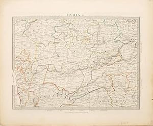
Add to basketCondition: Good. INDIA VI. Bundelkhand-Khandeish Berar. Gujerat. Goondwana Bhopal. SDUK 1851 map. Antique steel engraved map with original outline hand colouring; Engraved by J & C Walker (This edition of the map was first published in 1846. This date is printed on the map. This map was published in 1851). 29.5 x 37.5cm, 11.5 x 14.75 inches. Condition: Good. The image shown may have been taken from a different example of this map than that which is offered for sale. The map you will receive is in good condition but there may be minor variations in the condition from that shown in the image. This map was coloured by hand at the time of publication, thus the colouration may vary slightly between different examples of the map; the colouring applied to the map you receive may differ slightly from that shown in the image. There is nothing printed on the reverse side, which is plain.
-
US$ 23.96
US$ 13.68 shipping
Ships from United Kingdom to U.S.A.Quantity: 2 available
Add to basketCondition: Good. INDIA.Bundelkhand to Khandeish Berar.Gujerat. Goondwana Bhopal.SDUK 1844 map. Antique steel engraved map with original outline hand colouring (coloring); Engraved by J & C Walker (This map was originally published by Baldwin & Cradock in 1833; this date is printed on the map. This edition of the map was printed and published by Chapman & Hall in 1844.). 28.0 x 38.0cm, 11 x 15 inches. Condition: Good. The image shown may have been taken from a different example of this map than that which is offered for sale. The map you will receive is in good condition but there may be minor variations in the condition from that shown in the image. This map was coloured by hand at the time of publication, thus the colouration may vary slightly between different examples of the map; the colouring applied to the map you receive may differ slightly from that shown in the image. There is nothing printed on the reverse side, which is plain.
-

US$ 35.23
US$ 13.68 shipping
Ships from United Kingdom to U.S.A.Quantity: 1 available
Add to basketCondition: Good. RAJASTHAN. India. Delhi Jaipur Marwar Bikaner Mewar Bundelkhand. SDUK 1844 map. Antique steel engraved map with original outline hand colouring (coloring); Engraved by J & C Walker (This map was originally published by Baldwin & Cradock in 1833; this date is printed on the map. This edition of the map was printed and published by Chapman & Hall in 1844.). 28.5 x 37.0cm, 11.25 x 14.5 inches. Condition: Good. The image shown may have been taken from a different example of this map than that which is offered for sale. The map you will receive is in good condition but there may be minor variations in the condition from that shown in the image. This map was coloured by hand at the time of publication, thus the colouration may vary slightly between different examples of the map; the colouring applied to the map you receive may differ slightly from that shown in the image. There is nothing printed on the reverse side, which is plain.
-
US$ 35.23
US$ 13.68 shipping
Ships from United Kingdom to U.S.A.Quantity: 2 available
Add to basketCondition: Good. RAJASTHAN. India. Delhi Jaipur Marwar Bikaner Mewar Bundelkhand. SDUK 1844 map. Antique steel engraved map with original outline hand colouring (coloring); Engraved by J & C Walker (This map was originally published by Baldwin & Cradock in 1833; this date is printed on the map. This edition of the map was printed and published by Chapman & Hall in 1844.). 28.5 x 37.0cm, 11.25 x 14.5 inches. Condition: Good. The image shown may have been taken from a different example of this map than that which is offered for sale. The map you will receive is in good condition but there may be minor variations in the condition from that shown in the image. This map was coloured by hand at the time of publication, thus the colouration may vary slightly between different examples of the map; the colouring applied to the map you receive may differ slightly from that shown in the image. There is nothing printed on the reverse side, which is plain.
-
US$ 38.05
US$ 13.68 shipping
Ships from United Kingdom to U.S.A.Quantity: 1 available
Add to basketCondition: Good. BRITISH INDIA Bombay Mumbai Maharashtra Telangana Goa Hyderabad. SDUK 1857 map. Antique steel engraved map with original hand colouring; Engraved by J & C Walker (1857). 29.5 x 38.5cm, 11.5 x 15.25 inches. Condition: Good. There is nothing printed on the reverse side, which is plain.
-
![Seller image for INDIA IX. [Delhi to Bundelcund] for sale by Antiqua Print Gallery](https://pictures.abebooks.com/inventory/md/md31254032575.jpg)
US$ 38.05
US$ 13.68 shipping
Ships from United Kingdom to U.S.A.Quantity: 1 available
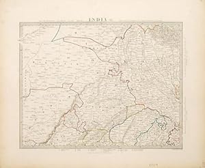
Add to basketCondition: Good. INDIA IX. RAJASTHAN Delhi Jaipur Marwar Bikaner Mewar Bundelkhand. SDUK 1851 map. Antique steel engraved map with original outline hand colouring; Engraved by J & C Walker (1851). 29.0 x 37.0cm, 11.5 x 14.5 inches. Condition: Good. The image shown may have been taken from a different example of this map than that which is offered for sale. The map you will receive is in good condition but there may be minor variations in the condition from that shown in the image. This map was coloured by hand at the time of publication, thus the colouration may vary slightly between different examples of the map; the colouring applied to the map you receive may differ slightly from that shown in the image. There is nothing printed on the reverse side, which is plain.
-
US$ 38.05
US$ 13.68 shipping
Ships from United Kingdom to U.S.A.Quantity: 1 available
Add to basketCondition: Good. INDIA III BOMBAY PRESIDENCY & HYDERABAD. Aurangabad Bijapur Mumbai SDUK 1846 map. Antique steel engraved map with original outline hand colouring; Engraved by J & C Walker (1846. This date is printed on the map). 29.5 x 38.5cm, 11.5 x 15.25 inches. Condition: Good. The image shown may have been taken from a different example of this map than that which is offered for sale. The map you will receive is in good condition but there may be minor variations in the condition from that shown in the image which may include some light spotting. This map was coloured by hand at the time of publication, thus the colouration may vary slightly between different examples of the map; the colouring applied to the map you receive may differ slightly from that shown in the image. There is nothing printed on the reverse side, which is plain.
-

US$ 40.87
US$ 13.68 shipping
Ships from United Kingdom to U.S.A.Quantity: 3 available
Add to basketCondition: Good. INDIA. Cicars; Mouths of the Godavery. Berar; Hyderabad. Orissa. SDUK 1844 map. Antique steel engraved map with original outline hand colouring (coloring); Engraved by J & C Walker (This map was originally published by Baldwin & Cradock in 1832; this date is printed on the map. This edition of the map was printed and published by Chapman & Hall in 1844.). 28.0 x 36.5cm, 11 x 14.5 inches. Condition: Good. The image shown may have been taken from a different example of this map than that which is offered for sale. The map you will receive is in good condition but there may be minor variations in the condition from that shown in the image. This map was coloured by hand at the time of publication, thus the colouration may vary slightly between different examples of the map; the colouring applied to the map you receive may differ slightly from that shown in the image. There is nothing printed on the reverse side, which is plain.
-

US$ 43.69
US$ 13.68 shipping
Ships from United Kingdom to U.S.A.Quantity: 2 available
Add to basketCondition: Good. BOMBAY (MUMBAI) PRESIDENCY AND HYDERABAD. Aurangabad; Bijapur. SDUK 1844 map. Antique steel engraved map with original outline hand colouring (coloring); Engraved by J & C Walker (This map was originally published by Baldwin & Cradock in 1832; this date is printed on the map. This edition of the map was printed and published by Chapman & Hall in 1844.). 28.0 x 38.0cm, 11 x 14.75 inches. Condition: Good. The image shown may have been taken from a different example of this map than that which is offered for sale. The map you will receive is in good condition but there may be minor variations in the condition from that shown in the image. This map was coloured by hand at the time of publication, thus the colouration may vary slightly between different examples of the map; the colouring applied to the map you receive may differ slightly from that shown in the image. There is nothing printed on the reverse side, which is plain.
-
US$ 64.83
US$ 13.68 shipping
Ships from United Kingdom to U.S.A.Quantity: 1 available
Add to basketCondition: Good. INDIA.Allahabad to Bay of Bengal.Bahar. Berar Orissa Ruttunpoor.SDUK 1844 map. Antique steel engraved map with original outline hand colouring (coloring); Engraved by J & C Walker (This map was originally published by Baldwin & Cradock in 1832; this date is printed on the map. This edition of the map was printed and published by Chapman & Hall in 1844.). 29.0 x 37.5cm, 11.25 x 14.75 inches. Condition: Good. The image shown may have been taken from a different example of this map than that which is offered for sale. The map you will receive is in good condition but there may be minor variations in the condition from that shown in the image. This map was coloured by hand at the time of publication, thus the colouration may vary slightly between different examples of the map; the colouring applied to the map you receive may differ slightly from that shown in the image. There is nothing printed on the reverse side, which is plain.
-
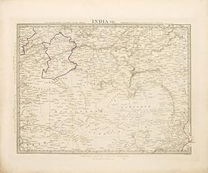
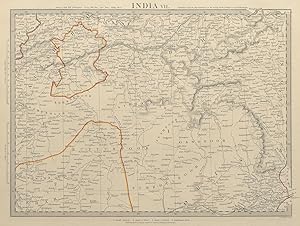
India VII.
Published by London. c.1847, 1847
Seller: Peter Harrington. ABA/ ILAB., London, United Kingdom
Association Member: ABA ILAB PBFA
Seller rating 5 out of 5 stars

US$ 105.70
US$ 30.10 shipping
Ships from United Kingdom to U.S.A.Quantity: 1 available
Add to basketA splendidly informative map of Orissa on the Bengal Bay, showing the Rajahs of Rewah and Berar. Published by Charles Knight for the S.D.U.K. Size: 352 x 430 mm. Steel engraving with original outline colour. Good condition.
-
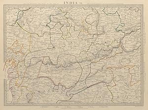
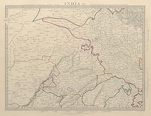
India VI.
Published by London. c.1847, 1847
Seller: Peter Harrington. ABA/ ILAB., London, United Kingdom
Association Member: ABA ILAB PBFA
Seller rating 5 out of 5 stars
US$ 105.70
US$ 30.10 shipping
Ships from United Kingdom to U.S.A.Quantity: 1 available
Add to basketA splendidly informative map of the north-central part of India, extending from Gulf of Cambay, current Gulf of Khambhat in the west to Nagpoor in the east. Published by Charles Knight for the S.D.U.K. Size: 352 x 430 mm. Steel engraving with original outline colour. Good condition.
-
India IX.
Published by London. c.1847, 1847
Seller: Peter Harrington. ABA/ ILAB., London, United Kingdom
Association Member: ABA ILAB PBFA
Seller rating 5 out of 5 stars
US$ 105.70
US$ 30.10 shipping
Ships from United Kingdom to U.S.A.Quantity: 1 available
Add to basketA splendidly informative and detailed map of Delhi and the country around it. Published by Charles Knight for the S.D.U.K. Size: 352 x 430 mm. Steel engraving with original outline colour. Good condition.
-
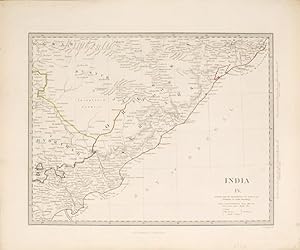
India IV.
Published by London. c.1847, 1847
Seller: Peter Harrington. ABA/ ILAB., London, United Kingdom
Association Member: ABA ILAB PBFA
Seller rating 5 out of 5 stars
US$ 105.70
US$ 30.10 shipping
Ships from United Kingdom to U.S.A.Quantity: 1 available
Add to basketA splendidly informative map of the Eastern coast of Orissa on the Bay of Bengal. Published by Charles Knight for the S.D.U.K. Size: 352 x 430 mm. Steel engraving with original outline colour. Good condition.
-

US$ 74.69
US$ 13.68 shipping
Ships from United Kingdom to U.S.A.Quantity: 2 available
Add to basketCondition: Good. NEPAL AND NORTHERN INDIA. Oude (Awadh) to Allahabad. Gorkha. SDUK 1844 old map. Antique steel engraved map with original outline hand colouring (coloring); Engraved by J & C Walker (This map was originally published by Baldwin & Cradock in 1834; this date is printed on the map. This edition of the map was printed and published by Chapman & Hall in 1844.). 29.0 x 38.0cm, 11.25 x 15 inches. Condition: Good. The image shown may have been taken from a different example of this map than that which is offered for sale. The map you will receive is in good condition but there may be minor variations in the condition from that shown in the image. This map was coloured by hand at the time of publication, thus the colouration may vary slightly between different examples of the map; the colouring applied to the map you receive may differ slightly from that shown in the image. There is nothing printed on the reverse side, which is plain.
-

India VII
Publication Date: 1844
Seller: Art Source International Inc., Boulder, CO, U.S.A.
Seller rating 5 out of 5 stars
This finely detailed map was published in 1844 by the Society for the Diffusion of Useful Knowledge, a British philanthropical group. Cities, towns, regions, rivers and mountain ranges are illustrated. Copper plate engraved with original hand outline coloring. This map measure 13.5 inches by 10.5 inches.
-

India VI.
Publication Date: 1844
Seller: Art Source International Inc., Boulder, CO, U.S.A.
Seller rating 5 out of 5 stars
This finely detailed map was published in 1844 by the Society for the Diffusion of Useful Knowledge, a British philanthropical group. Cities, towns, regions, rivers and mountain ranges are illustrated. Copper plate engraved with original hand outline coloring. This map measure 14 inches by 10.25 inches.
-

India IX
Publication Date: 1844
Seller: Art Source International Inc., Boulder, CO, U.S.A.
Seller rating 5 out of 5 stars
This finely detailed map was published in 1844 by the Society for the Diffusion of Useful Knowledge, a British philanthropical group. Cities, towns, regions, rivers and mountain ranges are illustrated. Copper plate engraved with original hand outline coloring. This map measure 15.5 inches by 12.5 inches.
-

India V
Publication Date: 1844
Seller: Art Source International Inc., Boulder, CO, U.S.A.
Seller rating 5 out of 5 stars
This finely detailed map was published in 1844 by the Society for the Diffusion of Useful Knowledge, a British philanthropical group. Cities, towns, regions, rivers and mountain ranges are illustrated. Copper plate engraved with original hand outline coloring. This map measure 12.5 inches by 15.5 inches.
-

India X.
Published by London. c.1847, 1847
Seller: Peter Harrington. ABA/ ILAB., London, United Kingdom
Association Member: ABA ILAB PBFA
Seller rating 5 out of 5 stars
US$ 204.35
US$ 30.10 shipping
Ships from United Kingdom to U.S.A.Quantity: 1 available
Add to basketA splendidly informative map of North India and Nepal, the Himalayan Mountains and Chinese Tartary. Published by Charles Knight for the S.D.U.K. Size: 352 x 430 mm. Steel engraving with original outline colour. Good condition.
-

Map of Calcutta, India
Published by London, 1857
Seller: Trillium Antique Prints & Rare Books, Franklin, TN, U.S.A.
Seller rating 4 out of 5 stars

Art / Print / Poster
Condition: Fine. This originally hand-colored engraving is from "The Complete Atlas of Modern, Classical and Celestial Maps, together with Plans of the Principal Cities of the World". The work was published in 1857 by Edward Stanford for the Society for the Diffusion of Useful Knowledge. --- The work is in very good to excellent condition. There may be a few minor imperfections to be expected with age. Please review the image carefully for condition and contact us with any questions. --- Paper Size ~ 14" by 16 7/8".
-

Map of the Antilles or West India Islands (West Indies)
Published by London, 1857
Seller: Trillium Antique Prints & Rare Books, Franklin, TN, U.S.A.
Seller rating 4 out of 5 stars
Art / Print / Poster
Condition: Fine. This originally hand-colored engraving is from "The Complete Atlas of Modern, Classical and Celestial Maps, together with Plans of the Principal Cities of the World". The work was published in 1857 by Edward Stanford for the Society for the Diffusion of Useful Knowledge. --- The work is in very good to excellent condition. There may be a few minor imperfections to be expected with age. Please review the image carefully for condition and contact us with any questions. --- Paper Size ~ 14" by 16 7/8".
-

India I. and Ceylon
Publication Date: 1844
Seller: Art Source International Inc., Boulder, CO, U.S.A.
Seller rating 5 out of 5 stars
This finely detailed map was published in 1844 by the Society for the Diffusion of Useful Knowledge, a British philanthropical group. Cities, towns, regions, rivers and mountain ranges are illustrated. Copper plate engraved with original hand outline coloring. This map measure 13.5 inches by 10.5 inches.
-

India III. Bombay Presidency
Publication Date: 1844
Seller: Art Source International Inc., Boulder, CO, U.S.A.
Seller rating 5 out of 5 stars
This finely detailed map was published in 1844 by the Society for the Diffusion of Useful Knowledge, a British philanthropical group. Cities, towns, regions, rivers and mountain ranges are illustrated. Copper plate engraved with original hand outline coloring. This map measure 14 inches by 10.5 inches.
-

India IV.
Publication Date: 1844
Seller: Art Source International Inc., Boulder, CO, U.S.A.
Seller rating 5 out of 5 stars
This finely detailed map was published in 1844 by the Society for the Diffusion of Useful Knowledge, a British philanthropical group. Cities, towns, regions, rivers and mountain ranges are illustrated. Copper plate engraved with original hand outline coloring. This map measure 13.5 inches by 10.75 inches.
-

India XI.
Publication Date: 1844
Seller: Art Source International Inc., Boulder, CO, U.S.A.
Seller rating 5 out of 5 stars
This finely detailed map was published in 1844 by the Society for the Diffusion of Useful Knowledge, a British philanthropical group. Cities, towns, regions, rivers and mountain ranges are illustrated. Copper plate engraved with original hand outline coloring. This map measure 14 inches by 10.5 inches.
-

India X.
Publication Date: 1844
Seller: Art Source International Inc., Boulder, CO, U.S.A.
Seller rating 5 out of 5 stars
This finely detailed map was published in 1844 by the Society for the Diffusion of Useful Knowledge, a British philanthropical group. Cities, towns, regions, rivers and mountain ranges are illustrated. Copper plate engraved with original hand outline coloring. This map measure 14 inches by 10.5 inches.
-

India VI
Publication Date: 1833
Seller: Art Source International Inc., Boulder, CO, U.S.A.
Seller rating 5 out of 5 stars
This finely detailed map was published in 1833 by the Society for the Diffusion of Useful Knowledge, a British philanthropical group. Cities, towns, regions, rivers and mountain ranges are illustrated. Copper plate engraved with original hand outline coloring. This map measure 15.5 inches by 12.5 inches.
-

India III
Publication Date: 1832
Seller: Art Source International Inc., Boulder, CO, U.S.A.
Seller rating 5 out of 5 stars
This finely detailed map was published in 1832 by the Society for the Diffusion of Useful Knowledge, a British philanthropical group. Cities, towns, regions, rivers and mountain ranges are illustrated. Copper plate engraved with original hand outline coloring. This map measure 15.5 inches by 12.5 inches.
-

India II
Publication Date: 1831
Seller: Art Source International Inc., Boulder, CO, U.S.A.
Seller rating 5 out of 5 stars
This finely detailed map was published in 1831 by the Society for the Diffusion of Useful Knowledge, a British philanthropical group. Cities, towns, regions, rivers and mountain ranges are illustrated. Copper plate engraved with original hand outline coloring. This map measure 15.5 inches by 12.5 inches.

