Order Total (1 Item Items):
Shipping Destination:

Map Chicago, First Edition (19 results)
Skip to main search results
Search filters
Product Type
- All Product Types
- Books (16)
- Magazines & Periodicals (No further results match this refinement)
- Comics (No further results match this refinement)
- Sheet Music (No further results match this refinement)
- Art, Prints & Posters (No further results match this refinement)
- Photographs (No further results match this refinement)
- Maps (3)
- Manuscripts & Paper Collectibles (No further results match this refinement)
Condition Learn more
Binding
Collectible Attributes
- First Edition (19)
- Signed (No further results match this refinement)
- Dust Jacket (No further results match this refinement)
- Seller-Supplied Images (11)
- Not Print on Demand (19)
Language (2)
Free Shipping
Seller Location
Seller Rating
-
ILLINOIS CHICAGO & VICINITY Map - Standard Oil - 1973
Published by Standard Oil., 1973
Map First Edition
Soft cover. Condition: Very Good. No Jacket. 1st Edition. Folded map size about 4 by 9 inches. Opens to about 18 by 32 inches. Printed in color on both sides. Light wear. VERY GOOD.
-
ILLINOIS CHICAGO & VICINITY Map - Standard Oil - 1970
Published by Standard Oil., 1970
Map First Edition
Soft cover. Condition: Very Good. No Jacket. 1st Edition. Folded map size about 4 by 9 inches. Opens to about 23 1/2 by 36 inches. Printed in color on both sides. Light wear; soil mark across rear cover. VERY GOOD.
-

Frommer's Chicago 2008 with foldout map
Language: English
Published by Frommers, New York, New York, 2007
ISBN 10: 0470165375 ISBN 13: 9780470165379
First Edition
Soft cover. Condition: As New. 1st Edition. Foldout map detached but included, else AS NEW.
-

MAP OF RAILWAY TRACKS AND CROSSINGS BETWEEN 14TH AND 22ND STREETS, CHICAGO, ALONG SOUTH BRANCH OF CHICAGO RIVER
Published by Engineerng News & Amer Railway Journal, NY, 1893
First Edition
Paperback. Condition: Very Good. 1st Edition. Nov 16, 1893, pp. 389-391+ Large FoldOut Illustration "Map of Railway Tracks and Crossings Between 14th and 22nd Streets, Chicago, Along South branch of Chicago River" 13.5 x 20 Inches, Entire Issue, pp. 385-404, Illus, Folio, else VG, 1st ed (Nice - Suitable for Framing).
-
Fine Books & Collections - Winter, 2018. Mary Shelley's Frankenstein; Medieval Bejeweled Bindings; Charles & Mary Lamb; Rare Chicago Map; Matthew Brady Portrait Photography; 2018 Collector's Resource Guide
Language: English
Published by Journalistic, Inc., Chapel Hill, NC, 2018
Seller: Singularity Rare & Fine, Baldwinsville, NY, U.S.A.
Seller rating 5 out of 5 stars

First Edition
Soft cover. Condition: New. 1st Edition. New, and pristine. See scans and description. Chapel Hill, NC: Journalistic, Inc., 2018. The Winter, 2018 issue of Fine Books & Collections, that being issue number 16.1. Quarto, illustrated perfect-bound wraps, 88 pp. New, and pristine. Removed from its plastic shipping bag for scanning and description, then placed in sealed storage, on premises. Bag (opened) can be included, if requested by purchaser. Top cover banner is close cropped, as issued. See scans. Mary Shelley's Frankenstein; Medieval Bejeweled Bindings; Charles & Mary Lamb; Rare Chicago Map; Matthew Brady Portrait Photography; 2018 Collector's Resource Guide, and quite a bit more. See scan of contents page. Ships in a new, sturdy, protective box - not a bag. LPR37.
-
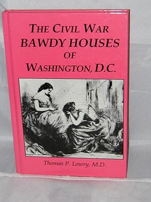
The Civil War Bawdy Houses of Washington, D.C., Including a Map of Their Former Locations and a Reprint of the Souvenir Sporting Guide for the Chicago Illinois, G.A. R. 1895, Reunion
Language: English
Published by Sergeant Kirkland's Musuem and Historical Society, Fredericksburg VA, 1997
ISBN 10: 1887901140 ISBN 13: 9781887901147
First Edition
Hardcover. Condition: Very Good+. 1st Edition. VG+/1st ed./ Includes Map. This interesting and fun little book is 100 pages(53 pages of text, with the Souvenir Sporting Guide taking up the rest of the pages). Some b&w photos, advertisements for the houses, index. Map is in perfect shape, dosen't appear to have been opened. Hot pink cover is in perfect condition, book is tight, square and clean with no markings.
-
Leonard's street guide & map of Chicago Evanston & Oak Park
Published by Chicago, Leonard Publ. Comp. undated map
Seller: Antiquarian Bookshop Klikspaan, Leiden, Netherlands
Seller rating 4 out of 5 stars

First Edition
1st ed. - Softcover.
-
CHICAGO MAPMAKERS - ESSAYS ON THE RISE OF THE CITY'S MAP TRADE
Language: English
Published by The Chicago Historical Society for the Chicago Map Society, Chicago, IL, 1984
ISBN 10: 0916789012 ISBN 13: 9780916789015
Seller: UHR Books, Hollis Center, ME, U.S.A.
Association Member: MABA
Seller rating 5 out of 5 stars
First Edition
Hardcover. Condition: Very Good +. No Jacket. First Edition. 76 pages, well-illustrated, containing 7 essays by various authors. Top edges of half-title page and of the last page have foxing. Book.
-
MORAN''S DICTIONARY OF CHICAGO AND ITS VICINITY, WITH MAP OF CHICAGO AND ITS ENVIRONS. AN ALPHABETICALLY ARRANGED DICTIONARY, COMPROSING ALL OF THE INTERESTS THAT CONTRIBUTE TO CHICAGO'S GREATNESS.
Language: English
Published by GEORGE E. MORAN, CHICAGO, ILLINOIS, 1896
First Edition
Hardcover. Condition: Very Good. No Jacket. 1st Edition. THIS IS AN AMAZING FACT FILLED GUIDE BOOK ABOUT CHICAGO AT THE TURN OF THE 20TH CENTURY. UNFORTUNATELY, THE FRONT COVER AND THE SPINE ARE ABSENT. THE UNATTACHED REAR COVER IS PRESENT. THE TOP AND LEADING EDGES OF THE BOOK'S PAGES ARE GILT, THE CONTENTS OF THE BOOK ARE TIGHT AND CLEAN. THE CONTENTS ARE LISTED ALPHABETICALLY. THERE ARE MULTIPLE PHOTOGRAPHS OF IMPORTANT BUILDINGS, PARKS, CEMETARIES, HOTELS, NEWSPAPERS, DEPARTMENT STORES, HOSPITALS, UNIVERSITIES, COLLEGES, MEDICAL SCHOOLS, CHURCHES, MONUMENTS, MUSEUMS, RAILROAD DEPOTS, THEATRES AND PLACES OF INTEREST. ADVERTISEMENTS AT THE BEGINNING OF THE BOOK FEATURES BUILDINGS SUCH AS THE HOLLAND HOUSE IN NEW YORK, BANKS, HOTEL PFISTER IN MILWAUKEE, THE ARLINGTON HOTEL IN HOT SPRINGS, ARKANSAS, NEW PLANTERS HOTEL IN ST. LOUIS, LEXINGTON HOTEL IN CHICAGO, SOON TO BE AL CAPONE'S HEADQUARTERS, CLIFTON HOUSE, AND HOTEL METROPOLITAN IN CHICAGO. MANY HOTELS ADVERTISE AS BEING FIRE PROOF. THERE ARE MULTIPLE RAILROAD ADS TO VARIOUS CITIES. OBVIOUSLY, THE BOOK SERVED AS A TRAVEL GUIDE FOR VISITORS TO CHICAGO AT THE TURN OF THE 20 th CENTURY. REBINDING WILL PROVIDE A VALUABLE BOOK.
-

Chicago Mapmakers Essays on the Rise of the City's Map TradeConzen Michael P.
Language: English
Published by The Chicago Historic Society for the Chicago Map Society, Chicago, Illonois, 1984
ISBN 10: 0916789012 ISBN 13: 9780916789015
First Edition
Hardcover. Condition: Very Good. No Jacket. 1st Edition.
-
Chicago and the Great Conflagration. With numerous illustrations, by Chapin & Gulick, from Photographic Views taken on the Spot. With folded town map and 35 stereotyped illustrations.
Language: English
Published by C. F. Vent, Cincinnati and New York, 1871
Seller: Antiquariat Rolf Bulang, Dautphetal, Germany
Seller rating 5 out of 5 stars
First Edition
Hardcover. Condition: Befriedigend. Erste Ausgabe. 528 S. Orig.-Leinenband. Der Gro�e Brand von Chicago vom 8.-10. Oktober 1871 zerst�rte ca. 18.000 Geb�ude, forderte etwa 300 Opfer und hinterlie� ungef�hr 100.000 Obdachlose. Der rasche Wiederaufbau beg�nstigte nicht zuletzt die Entwicklung der Stadt zum Laboratorium moderner Hochhausarchitektur. Der R�cken oben und unten bestossen und mit kleinen Fehlstellen im Leinen. Der Stadtplan mit Einri�, sonst trotz der Gebrauchsspuren noch ordentliches Exemplar.
-
![Seller image for [6 items of ephemera pertaining to the Chicago World's Columbian Exposition of 1893] Leaflet with folding map. Program for Children's Day. Mammoth "Garland". Scrap of printed paper. Catalogue of Cliff Dwellers' Exhibit (loose covers). Street in Cairo. for sale by Joseph Burridge Books](https://pictures.abebooks.com/inventory/md/md32427515219.jpg)
[6 items of ephemera pertaining to the Chicago World's Columbian Exposition of 1893] Leaflet with folding map. Program for Children's Day. Mammoth "Garland". Scrap of printed paper. Catalogue of Cliff Dwellers' Exhibit (loose covers). Street in Cairo.
Published by H. Jay Smith Exploring Company, Hunt & Eaton, Midway Publishing et al, Chicago, 1893
Seller: Joseph Burridge Books, Dagenham, United Kingdom
Seller rating 5 out of 5 stars
First Edition
US$ 47.59
US$ 19.80 shipping
Ships from United Kingdom to U.S.A.Quantity: 1 available
Add to basketSoft cover. Condition: Very Good. 1st Edition. Leaflets, guides, ephemera etc.
-
Moran's Dictionary of Chicago and its Vicinity with Map of Chicago and Its Environs
Published by George E Moran, Chicago, 1901
Seller: Old New York Book Shop, ABAA, Atlanta, GA, U.S.A.
Seller rating 5 out of 5 stars
First Edition
Hardcover. Condition: Fine. First Edition. 269p octavo, illustrated preceeded by approx 50 pages of aillustrated ads and after page 269 about 25. A fine copy in blue cloth, lacking the rare map.
-
A Week In Chicago; Containing Descriptions of all Point of Interest . With Full Directions for Reaching Them . Profusely Illustrated, and Accompanied by an Accurate Map of the Central Part of the City
Published by Rand McNally, Chicago, 1887
Seller: Thomas J. Joyce And Company, Chicago, IL, U.S.A.
Seller rating 2 out of 5 stars

First Edition
stapled wrappers. Condition: Fair. First edition. Quarto, 68 pages, lacks rear cover., lacks spine. Includes images of maps, depots, railroad stations, Fort Dearborn, river views, burnt ruins from the Great Chicago Fire, Exposition Building, parks, fountains, street views, monuments, plans of water supply system, post office, Armory, court house, jail, city hall, stock yards, schools, colleges, churches, Foundlings Home, hospital, cemeteries, private clubs, theaters, music hall, insurance buildings, Pullman Building, bank interior and residences. Includes 27 p. of advertisements, in addition to advertisements on insides of both front and back covers and on back cover.Includes map of central Chicago on page opposite inside back cover, and a map of the Calumet Manufacturing District.
-
The Automobile Official 1909 Blue Book. Section No. 2, NEW ENDLAND. Map and Illustrations. Chicago, 1909
Published by The Class Journal Co., Chicago, 1909
First Edition
Condition: Good. Map, Illustrated (illustrator). First Edition. First Edition. Learther covered boards, well-worn, but map still present at front. 794 pages. We could locate no other copies.
-
![Seller image for Rand, McNally & Co.'s Handy Guide to Chicago and World's Columbian Exposition. Illustrated. What to See and How to See It [With] Rand, McNally & Co.'s New and Concise Map of Chicago. Showing the New City Limits and Location of the World's Columbian Exposition [etc.] for sale by Lorne Bair Rare Books, ABAA](https://pictures.abebooks.com/inventory/md/md32427151487.jpg)
Rand, McNally & Co.'s Handy Guide to Chicago and World's Columbian Exposition. Illustrated. What to See and How to See It [With] Rand, McNally & Co.'s New and Concise Map of Chicago. Showing the New City Limits and Location of the World's Columbian Exposition [etc.]
Published by Rand, McNally & Co, Chicago, 1893
Seller: Lorne Bair Rare Books, ABAA, Winchester, VA, U.S.A.
Association Member: ABAA ILAB IOBA
Seller rating 5 out of 5 stars
First Edition
First Edition. 12mo (17cm). Flexible cloth-covered boards; 215,[9]pp; illus; folding map; [36]pp ads inserted before and after text. Some spotting to covers, internally fresh and clean; Very Good or better. Large (30" x 21") double-sided folding map inserted at rear, clean and sound with a few brief splits at folds but no losses; Very Good. Map verso with separate title: "Rand, McNally & Co.'s New Map of Chicago, no.5," dated 1893. BOOKS OF THE FAIRS 1056.
-
Sinclair 1934 road map, Chicago and vicinity. . . .
Published by Sinclair Oil Company, [Rand McNally & Co.],, Chicago:, 1934
Seller: Zephyr Used & Rare Books, Vancouver, WA, U.S.A.
Association Member: ABAA CBA ESA ILAB
Seller rating 5 out of 5 stars
First Edition
8vo. sized 4 x 9 in. which folds out to 19.75 x 26.75 in., colour maps and colour lithograph printing on recto and verso, self-printed cover, w/ panoramic cover art of stylish 1930's Streamline 2-door coupe w/ boy pulling a Sinclair dinosaur model (minor toning & dustsoiling to creases, slight shelfwear), still VG copy. First edition, thus, of this Sinclair souvenir road map for the Chicago area during the final months of the Century of Progress Chicago World's Fair which ran 1933-1934. Sinclair has included an illustrated panorama for their Dinosaur Exhibit at the Fair, a recreational map of the United States, and the Chicago & Vicinity map even identifies all the local golf courses and country clubs. Worldcat locates 3 copies (Newberry, Wisconsin Hist. Soc., Wisconsin Archives).
-
(Map- Railroads) Map of the BURLINGTON & MISSOURI RIVER R.R. IN NEBRASKA and Leased Lines" with a smaller inset map "BURLINGTON ROUTE DENVER TO KANSAS CITY, CHICAGO, ST. LOUIS"
Published by Burlington & Missouri River Rail Road 0, Omaha, Neb., April 1882
Seller: Dale Steffey Books, ABAA, ILAB, Bloomington, IN, U.S.A.
Seller rating 5 out of 5 stars
Map First Edition
One Page. Condition: Near Fine. 1st Edition. Map with text printed verso, 8 1/4" x 5 1/2". Advertising the "BURLINGTON ROUTE, shortest and quickest line to Chicago, St. Louis, Peoria, Des Moines, and Ohio, and especially to all points in Iowa, Wisconsin, Indiana, Illinois, Michigan and Ohio." Also advertising "NEW LINE TO DENVER and all points in Colorado. This extension will be completed and ready for business about July 1, 1882, and the public can then enjoy the advantages of a through line between Denver and Chicago, all under one management." The map was engraved by A. Zeese & Co, Map Eng. Chi(cago) and titled "Map of the BURLINGTON & MISSOURI RIVER R.R. IN NEBRASKA And Leased Lines" with a smaller inset map "BURLINGTON ROUTE DENVER TO KANSAS CITY, CHICAGO, ST. LOUIS". A RARE railroad map, OCLC locates only two copies, at Yale and SMU. Near Fine, two small closed tears at lower margin not affecting text or map. The B. & M. R. R. was incorporated in Iowa in 1852 and began operating across Iowa in 1856, with headquarters in Omaha, Nebraska. It was acquired as a subsidiary of the Chicago, Burlington and Quincy Railroad in 1872. It played a vital role in bringing settlers to Iowa and Nebraska. Map/Print.
-

McNally's 1891 Map of Chicago
Publication Date: 1891
Seller: Art Source International Inc., Boulder, CO, U.S.A.
Seller rating 5 out of 5 stars
First Edition
We are proud to offer this map of Chicago, originally produced as part of Rand McNally's Enlarged Business Atlas dated 1891. Although the table of contents shows different editions starting in 1885, we believe this is the first edition of the Enlarged Atlas. Each of these maps accurately locates all cities, towns, post offices, railroad stations, villages, counties, parishes, islands, lakes, rivers, mountains and more. Until McNally�s enlarged Business Atlas, maps had never been produced that provided as much information as these do. Even today, we use these 130 year old maps to locate small towns, villages, and railroad routes that are no more. This map measures 9.75 inches by 12.75 inches.