Map Long Island (98 results)

Seller: Once Upon A Time Books, Siloam Springs, AR, U.S.A.Once Upon A Time Books
Contact seller4-star sellerCondition: Used - Good
US$ 5.51
US$ 3.95 shippingShips within U.S.A.Quantity: 1 available
map. Condition: Good. This is a used book in good condition and may show some signs of use or wear . This is a used book in good condition and may show some signs of use or wear .
 More images
Published by Esso Oil 1969
- Softcover
- First Edition
- Map
Seller: The Book Scot, mansfield, MO, U.S.A.The Book Scot
Contact seller5-star sellerCondition: Used - Very good
US$ 5.00
US$ 5.50 shippingShips within U.S.A.Quantity: 1 available
Soft cover. Condition: Very Good. No Jacket. 1st Edition. Folded map size about 4 by 8 1/2 inches. Opens to about 34 by 24 inches. Printed in color on both sides. Light wear. VERY GOOD.

Published by NATIONAL GEOGRAPHIC SOCIETY 1957
- Softcover
- Periodical
Seller: Terrace Horticultural Books, St. Paul, MN, U.S.A.Terrace Horticultural Books
Contact seller4-star sellerCondition: Used - Very good
US$ 6.00
US$ 6.99 shippingShips within U.S.A.Quantity: 1 available
Soft cover. Condition: Very Good. Copyright Date: 1957 SM QUARTO, September 1957, PP.295-436, The Complete Issue Of National Geographic Magazine; Lacks Supplement Map Very Good Copy, Light Dust Soiling. COLOR and B & W PHOTOS And Illustrations (illustrator).

Seller: PBShop.store UK, Fairford, GLOS, United KingdomPBShop.store UK
Contact seller5-star sellerCondition: New
US$ 16.71
US$ 4.35 shippingShips from United Kingdom to U.S.A.Quantity: 15 available
UNK. Condition: New. New Book. Shipped from UK. Established seller since 2000.
Published by Sunoco 1939
- Softcover
Seller: Willis Monie-Books, ABAA, Cooperstown, NY, U.S.A.Willis Monie-Books, ABAA
Contact seller5-star sellerCondition: Used - Very good
US$ 10.00
US$ 8.00 shippingShips within U.S.A.Quantity: 1 available
Softcover. Condition: Very Good. Approx. 3 3/4" wide by 7" closed. Road map of northeastern United States and [separate] Long Island on one side. On the other side are separate maps of New York City as a whole, Manhattan, and the fair grounds.
Language: English
Published by Shell Oil, New York 1939
- Softcover
Seller: Mountain Books, Kent, CT, U.S.A.Mountain Books
Contact seller4-star sellerCondition: Used - Very good
US$ 24.99
US$ 5.38 shippingShips within U.S.A.Quantity: 1 available
Soft cover. Condition: Very Good. This is a vintage fold out map. Has lots of New York Worlds Fair information from 1939. Has a few nicks. Overall very good condition. We ship fast. Illustrated with maps (illustrator).
Seller: Grand Eagle Retail, Bensenville, IL, U.S.A.Grand Eagle Retail
Contact seller5-star sellerCondition: New
US$ 24.29
Free ShippingShips within U.S.A.Quantity: 1 available
Folded. Condition: new. Folded. Shipping may be from multiple locations in the US or from the UK, depending on stock availability.
Published by Tide Water Associated Oil Company 1950
- Softcover
Seller: Patina LLC, Charleston, WV, U.S.A.Patina LLC
Contact seller5-star sellerCondition: Used - Good
US$ 12.00
US$ 5.50 shippingShips within U.S.A.Quantity: 1 available
Soft cover. Condition: Good. No Jacket. 1950's road map. In very nice condition. Does show signs of wear at corners of folds. Great front and back cover graphics. Nice coloring and map graphics. Tide Water Associated Oil Co. Tydol.

Seller: WeBuyBooks, Rossendale, LANCS, United KingdomWeBuyBooks
Contact seller5-star sellerCondition: Used - Good
US$ 29.14
US$ 6.19 shippingShips from United Kingdom to U.S.A.Quantity: 2 available
Condition: Good. Most items will be dispatched the same or the next working day. A copy that has been read but remains in clean condition. All of the pages are intact and the cover is intact and the spine may show signs of wear. The book may have minor markings which are not specifically mentioned.
- Map
Seller: Revaluation Books, Exeter, , United KingdomRevaluation Books
Contact seller5-star sellerCondition: New
US$ 22.10
US$ 13.23 shippingShips from United Kingdom to U.S.A.Quantity: 1 available
Map. Condition: Brand New. 2 pages. 8.50x5.50x0.10 inches. In Stock.

Seller: 100POCKETS, Berkeley, CA, U.S.A.100POCKETS
Contact seller4-star sellerCondition: New
US$ 28.75
US$ 7.50 shippingShips within U.S.A.Quantity: 1 available
Laminated Folding Map. Condition: New. Dust Jacket Condition: None as Issued. BRAND NEW Copy. Guide to established commutation systems of New York. Durable, laminated, folding map to Metropolitan New York's commuter rail system. Conveniently sized guide to best linked-usage of the Long Island Railroad, New York City Subway, Metr…o North Trains, New Jersey Transit, Path Trains & Amtrak.

- Softcover
Seller: PBShop.store US, Wood Dale, IL, U.S.A.PBShop.store US
Contact seller5-star sellerCondition: New
US$ 48.39
Free ShippingShips within U.S.A.Quantity: 15 available
PAP. Condition: New. New Book. Shipped from UK. Established seller since 2000.
Language: English
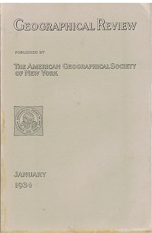
Published by The American Geographical Society of New York, New York 1934
- Softcover
- First Edition
Seller: Tinakori Books, Lower Hutt, , New ZealandTinakori Books
Contact seller5-star sellerCondition: Used - Very good
US$ 16.00
US$ 33.00 shippingShips from New Zealand to U.S.A.Quantity: 1 available
Soft cover. Condition: Very Good. 1st Edition. p. 1- 176. Some articles: Long Beach earthquake; A recent survey in Little Tibet (40 pages, several b/w illustrations and a large coloured map of the Eastern Karakoram); white settlement in Saba Island, Dutch West Indies; the population of the Malay Peninsula; Murray River basin; An… Eskimo discovery of an island North of Alaska; Discovery of a new sketch of Cape Hudson in the Antarctic; Altitude and location of Minya Konka; and other articles.
- Softcover
Seller: PBShop.store UK, Fairford, GLOS, United KingdomPBShop.store UK
Contact seller5-star sellerCondition: New
US$ 41.29
US$ 8.95 shippingShips from United Kingdom to U.S.A.Quantity: 15 available
PAP. Condition: New. New Book. Shipped from UK. Established seller since 2000.
Published by Department of the Interior, Washington, DC 1906
- Softcover
Seller: Willis Monie-Books, ABAA, Cooperstown, NY, U.S.A.Willis Monie-Books, ABAA
Contact seller5-star sellerCondition: Used - Good
US$ 27.50
US$ 8.00 shippingShips within U.S.A.Quantity: 1 available
Softcover. Condition: Good. Lacks the map which was in rear pocket. Disbound. ; Approx. 9" wide by 11 1/2". United States Geological Survey, Professional Paper No. 44. ; 394 pages.
Published by ESSO 1955
Seller: Brentwood Books, Kinnelon, NJ, U.S.A.Brentwood Books
Contact seller5-star sellerMap. Condition: Used, very good. Almost like new. Slightest (barely visible) wear, clean, no marks or writing, no rips. Automotive driving foldout map Issued for use in 1955-1956. ** We are a small family business selling fine new and pre-owned books online since 1999. We provide professional service and individual attention to…your order, daily shipments, and sturdy packaging.

- Hardcover
Seller: PBShop.store US, Wood Dale, IL, U.S.A.PBShop.store US
Contact seller5-star sellerCondition: New
US$ 59.00
Free ShippingShips within U.S.A.Quantity: 15 available
HRD. Condition: New. New Book. Shipped from UK. Established seller since 2000.

Map. Condition: Good. Original vintage map. Please refer to photo for condition. This map presents elevation (contour lines), hydrography, geographic place names, and a variety of cultural features.
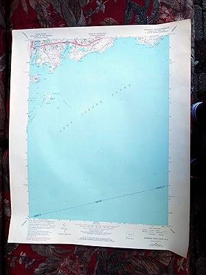
Map. Condition: Good. Original vintage map. Please refer to photo for condition. This map presents elevation (contour lines), hydrography, geographic place names, and a variety of cultural features.
- Hardcover
Seller: PBShop.store UK, Fairford, GLOS, United KingdomPBShop.store UK
Contact seller5-star sellerCondition: New
US$ 50.84
US$ 10.10 shippingShips from United Kingdom to U.S.A.Quantity: 15 available
HRD. Condition: New. New Book. Shipped from UK. Established seller since 2000.

Published by White's Pharmacy, New York 1958
- Map
Seller: Bookshelf of Maine, Franklin, ME, U.S.A.Bookshelf of Maine
Contact seller5-star sellerCondition: Used - Very good
US$ 15.00
US$ 7.95 shippingShips within U.S.A.Quantity: 1 available
Map. Condition: Very Good+. The White's Pharmacy was started in Montauk in 1928. This is a two-sided flyer with a map on one side featuring all the places of unusual interest in the Montauk area, and on the reverse a store layout of White's Pharmacy locating all the various departments. Scarce item. .
Published by The New York American, New York 1913
- Softcover
Seller: David H. Gerber Books (gerberbooks), Austin, TX, U.S.A.David H. Gerber Books (gerberbooks)
Contact seller5-star sellerCondition: Used - Very good
US$ 45.00
US$ 4.50 shippingShips within U.S.A.Quantity: 1 available
Saddle-stapled wrappers. Condition: Very Good+. 24pp + fold-out map Size: 12mo - over 6¾" - 7¾" tall. Fold-out map (illustrator).
 More images
Published by Reclus
- Art Print
Seller: Artisans-lane Maps & Prints, Sidney, BC, CanadaArtisans-lane Maps & Prints
Contact seller4-star sellerCondition: Used - Very good
US$ 10.91
US$ 19.00 shippingShips from Canada to U.S.A.Quantity: 1 available
no binding. Condition: very good. BARNEGAT BAY,LONG ISLAND,NEW JERSEY ,1893,Antique Historical Relief Map BARNEGAT BAY - LONG ISLAND - NEW JERSEY 1893 Historical Map - Wood Engraving Approx Image Size: 4 1/2 x 3 3/4 ins Overall Page Size: 10 1/2 x 7 ins PRINT SHOWS: Barnegat Bay is a small brackish arm of the Atlantic Ocean, app…roximately 30 miles (50 km) long, along the coast of Ocean County, New Jersey in the United States. It is essentially a long estuary formed by Barnegat Peninsula, a long barrier peninsula, as well as by the north end of Long Beach Island. The bay is fed by several small rivers, including the Toms River and Metedeconk River, which empty into the bay through small estuaries along its inner shore. The communities of Toms River, Silverton, and Forked River sit along the river estuaries on the bay.The bay is entered from the ocean through the Barnegat Inlet, along which sits the now defunct Barnegat Lighthouse. The bay is part of the Atlantic Intracoastal Waterway, entered on its north end by the Point Pleasant Canal and connecting on the south end with Little Egg Harbor via the small Manahawkin Bay. In a broader sense, the bay is sometimes considered to stretch to the south end of Long Beach Island and to include Little Egg Harbor.The area surrounding the Barnegat Bay and Barnegat Inlet were described by Henry Hudson, in 1609, as ".a great lake of water, as we could judge it to be . The mouth of the lake hath many shoals, and the sea breaketh on them as it is cast out of the mouth of it." The bay was originally named in 1614 "Barendegat," or "Inlet of the Breakers," by Dutch settlers, referring to the waterway's turbulent channel. During the American Revolutionary War, the bay was used as refuge by American pirates.Excellent Condition. Map Image is clean, clear, sharp with beautiful detail. Intext Bookplate Map with Text on the back. Printed on cream color coated paper. I prefer paypal or money orders. Delivery time for items can be anywhere from 10-28 days depending on your location. Items will be shipped within 2 business days of payment received. Checks will need time to clear before items are sent.
 More images
Published by Encyclopedia Britannica
- Art Print
Seller: Artisans-lane Maps & Prints, Sidney, BC, CanadaArtisans-lane Maps & Prints
Contact seller4-star sellerCondition: Used - Very good
US$ 10.91
US$ 19.00 shippingShips from Canada to U.S.A.Quantity: 1 available
no binding. Condition: very good. CONNECTICUT,Long Island ,Historical Vintage Map,1911 Antique Map 1911 HISTORICAL STATE MAP VINTAGE PRINT CONNECTICUT CLOSEUP One of the original 13 states, Connecticut is known as the "Constitution State." It gets its name from an Algonquian word meaning "land on the long tidal river." Hartford…has been the capital of Connecticut since 1875 and the state flower is the mountain laurel. PUBLISHED DATE 1911 NEW YORK ENGRAVER EMERY WALKER PAGE SIZE: approx 8 1/2 INCHES x 6 1/4 INCHES IMAGE SIZE: approx 7 1/4 X 5 1/4 INCHES CONDITION There is light foxing along with slight rippling.Otherwise in Good Condition. The image is clear and sharp with beautiful detail. Blank on Reverse side. This beautiful print would look great matted and framed. An art supply store can provide you with a selection of frames for old art treasures. from 10-28 days depending on your location. Items will be shipped within 2 business days of payment received.
Language: English
Published by Weed, Parsons, & Company 1883
- Hardcover
- First Edition
Seller: Black Cat Books, Shelter Island, NY, U.S.A.Black Cat Books
Contact seller5-star sellerCondition: Used - Good
US$ 75.00
US$ 5.00 shippingShips within U.S.A.Quantity: 1 available
Hardcover. Condition: Good. No Jacket. 1st Edition. Hardbound, no dust jacket. 1st edition. Rare. Brown buckrum binding shows wear to head & tail of spine with some loss of cloth. Binding cracked at front endpaper but pages holding. 1 fold out map. Minor separation of board at spine, front hinge cracked, but holding, age toning…to pages, otherwise good. [Heavy. Contact for overseas shipping quote.].

Language: English
Published by Weed, Parsons & Company, Printers 1883
- Hardcover
Seller: Yesterday's Muse, ABAA, ILAB, IOBA, Webster, NY, U.S.A.Yesterday's Muse, ABAA, ILAB, IOBA
Contact seller5-star sellerLarge Hardcover. Condition: Fair. No Jacket. Binder's copy. Former library copy - usual marks. Spine backstrip mostly missing. 1883 Large Hardcover. xxxiii, 800 pp. Fold-out map precedes text. A collection of documents relating to Colonial Long Island's history.

- Softcover
Seller: Your Online Bookstore, Houston, TX, U.S.A.Your Online Bookstore
Contact seller5-star sellerCondition: Used - Very good
US$ 84.46
Free ShippingShips within U.S.A.Quantity: 1 available
paperback. Condition: Very Good.
Seller: CitiRetail, Stevenage, United KingdomCitiRetail
Contact seller5-star sellerCondition: New
US$ 22.47
US$ 48.96 shippingShips from United Kingdom to U.S.A.Quantity: 1 available
Folded. Condition: new. Folded. Rand McNally's folded map for New York City Long Island is a must-have for anyone traveling in and around this part of New York, offering unbeatable accuracy and reliability at a great price. Our trusted cartography shows all Interstate, U.S., state, and county highways, along with clearly indicat…ed parks, points of interest, airports, county boundaries, and streets. The easy-to-use legend and detailed index make for quick and easy location of destinations. You'll see why Rand McNally folded maps have been the trusted standard for years.Regularly updatedFull-color mapsClearly labeled Interstate, U.S., state, and county highwaysIndications of parks, points of interest, airports, county boundaries, downtown & vicinity mapsEasy-to-use legendDetailed & full street indexMajor Street indexEnlargements of Manhattan, John F. Kennedy International Airport, LaGuardia Airport, Newark Liberty International AirportConvenient folded sizeCopyright 2025Coverage AreaCommunities Included: Bloomfield, NJ, Bridgeport, CT, Clifton, NJ, Irvington, NY, Jersey City, NJ, Newark, NJ, Paterson, NJ, Stamford, CT, White Plains, Younkers, NYProduct DetailsMeasures 9.5" x 4" and folds out to 40" x 28". Rand McNally's folded map for New York City Long Island is a must-have for anyone traveling in and around this part of New York Shipping may be from our UK warehouse or from our Australian or US warehouses, depending on stock availability.

- Softcover
Seller: 3Brothers Bookstore, Egg harbor township, NJ, U.S.A.3Brothers Bookstore
Contact seller5-star sellerCondition: Used - Very good
US$ 73.14
Free ShippingShips within U.S.A.Quantity: 1 available
Condition: very_good. Cover may have light wear, pages in very good condition and binding is sturdy; may have other light shelf wear or creases. May have notes or highlighting.
 More images
- Softcover
- Map
Seller: RareMapsandBooks, Dover, NH, U.S.A.RareMapsandBooks
Contact seller4-star sellerCondition: Used - Fair
US$ 30.00
US$ 6.95 shippingShips within U.S.A.Quantity: 1 available
Condition: Fair. (Old Brochures, Americana, Travel, Tourism, New York, Long Island, State Parks, Illustrated Brochures, Brochures with Maps). Long Island State Parks. Published 1939, New York by Western PRTG & Litho. Folding brochure issued as a World's Fair promotional. Text in English. Illustrated throughout. Map on rear. Publ…isher's pictorial paper wrappers folded into panels, printed on both sides. Item is over 100 years old and shows some signs of handling and time. Item is not new or in "new" condition. Paper gently age worn, slight rubbing, remains overall clean and attractive as a fragile survival. Paper is lightly toned, signs of handling, small scattered spotting, internally still well preserved, tight, sound. Still attractive on the shelf. The scarce item displays a pleasing and unique age patina and overall is in nice antiquarian condition, any age flaws easy to overlook or forgive. Please review photos for more detail and our best attempt to convey how this offering survives. Covers measures c. 9 1/4" H x 4" W.[B12658].


