Order Total (1 Item Items):
Shipping Destination:

Maps by Society Diffusion Useful Knowledge, Used (7 results)
Skip to main search results
Search filters
Product Type
- All Product Types
- Books (7)
- Magazines & Periodicals (No further results match this refinement)
- Comics (No further results match this refinement)
- Sheet Music (No further results match this refinement)
- Art, Prints & Posters (No further results match this refinement)
- Photographs (No further results match this refinement)
- Maps (No further results match this refinement)
- Manuscripts & Paper Collectibles (No further results match this refinement)
Condition Learn more
- New (No further results match this refinement)
- As New, Fine or Near Fine
- Very Good or Good (3)
- Fair or Poor (1)
- As Described (3)
Binding
- All Bindings
- Hardcover (5)
- Softcover (No further results match this refinement)
Collectible Attributes
- First Edition (No further results match this refinement)
- Signed (No further results match this refinement)
- Dust Jacket (No further results match this refinement)
- Seller-Supplied Images (4)
- Not Print on Demand (7)
Language (3)
Price
- Any Price
- Under US$ 25 (No further results match this refinement)
- US$ 25 to US$ 50 (No further results match this refinement)
- Over US$ 50
Free Shipping
- Free Shipping to U.S.A. (No further results match this refinement)
Seller Location
Seller Rating
-
Maps of the Society for the Diffusion of Useful Knowledge
Language: English
Published by London, Chapman, 1844
Seller: Anah Dunsheath RareBooks ABA ANZAAB ILAB, Auckland, NZ, New Zealand
Association Member: ABA ANZAAB ILAB
Seller rating 5 out of 5 stars

US$ 4,757.73
US$ 25.00 shipping
Ships from New Zealand to U.S.A.Quantity: 1 available
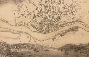
Add to basketHardcover. Condition: Fair. 2 vols. Contain 160 maps of different parts of the world, hand-tinted, and 52 magnificent city plans. Contemporary half morocco, worn, boards detached and no spines. Contains the earlier version of the Australian and NZ maps of 1838.The plans are most attractive, with engraved vignettes throughout.
-
Maps of the Society for the Diffusion of Useful Knowledge.
Language: English
Published by Chapman & Hall, London, 1844
Seller: Anah Dunsheath RareBooks ABA ANZAAB ILAB, Auckland, NZ, New Zealand
Association Member: ABA ANZAAB ILAB
Seller rating 5 out of 5 stars
US$ 9,039.69
US$ 25.00 shipping
Ships from New Zealand to U.S.A.Quantity: 1 available
Add to basketHardcover. Condition: Very Good. 2 vols. Contemporary half morocco. 212 maps and plans and 6 astronomical maps.Some maps folding. Minor faults and marginal damage on some, but generally in good condition. Some maps have attractive engraved vignettes. This is the first publication of the combined maps, which were separately issued by the Society from 1829 to this publication date of 1844. An important collection of maps which continued to have a publication life beyond the 1840s.
-
Maps of the Society for the Diffusion of Useful Knowledge.
Published by London: Charles Knight (1849)., 1846
Seller: Wittenborn Art Books, San Francisco, CA, U.S.A.
Seller rating 5 out of 5 stars
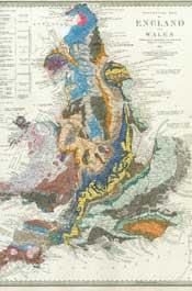
Condition: Good. Vol I. With 112 engraved and partially hand-colored maps. folio. Full contemporary leather, with blind and gilt stamping. Cover split at spine; leather exhibits significant rubbing and scratches. Minor int. foxing and soil. Else very good; many maps/plates fine or near fine. The maps are colored in outline. They are primarily country maps in Europe, the Middle East and Asia. This volume does not have city maps.
-
Maps of the Society for the Diffusion of Useful Knowledge Volume 1
Language: Dzongkha
Published by Chapman and Hall, London, 1844
Hardcover. Condition: Very Good. Dark brown covers one-quarter leatherbound. Boards show some wear, rippling, scuffing, smudges, edgewear. Corners are worn, with exposed board. Top board is detached. See photos. Spine has remnants of gilt text and is worn with chipped ends. See photos. Binding of print block is intact. Top board is off. Pastedowns and feps have some toning, marks from handling. Ex libris Sir Philip Rose, with bookplate on front pastedown. See photos. Maps are bright and clear, plates are printed single-sided, maps are of varying sizes, some fold out. One map with a long closed tear, with old tape repair. Marginal toning and some light edgewear. See photos. Inside pages are free of writing and intentional marks. Interior pages show scattered foxing, some light edgewear, title page and table of maps pages show creasing. See photos.** PS2026.0311** 112 maps. 13.25 x 16 inches** Large folio volume. Publisher's dark brown grosgrain cloth with leather at spine and corners. Top board is detached; binding intact otherwise. Title page, table of contents, and index to places shown, followed by 112 world and country maps printed single-sided. Maps with outline color; geological map of England and Wales hand colored in full color. Maps are Very Good, with scattered foxing at margins and verso; old tape repair to closed tear of one map.** The 112 hand-colored engraved maps that comprise this fine atlas were originally issued in parts by the Society for the Diffusion of Useful Knowledge beginning in 1829. The SDUK, as the Society was known, was first conceived by Henry Brougham (b. 1778), Edinburgh lawyer and member of the House of Commons. The aim of the Society was to reach as many people as possible, which they did by keeping costs of production down and offering a low selling price. Quality was not sacrificed; each of their maps is a handsome work of art, accurate in detail, finely engraved and printed on good quality paper. Over a period of fourteen years the series expanded to 209 plates and two volumes, with over three million maps sold.** Association copy. The handsome bookplate at the front pastedown reads, "The Arms Borne by Sir Philip Rose of Rayners, Co. Bucks, Bt. Probitate ac Virtute." Sir Philip Rose, 1st Baronet (1816-1883) was a British solicitor and political agent. He was a close political associate of Benjamin Disraeli and supported reforms in public health. He is perhaps best-known today as one of the namesakes of the law firm Norton Rose Fulbright.** "Postage for oversized and international shipping will be calculated by size and weight. AbeBooks shipping quotes are ESTIMATES only. Seller Inventory #010425"**.
-

Six Maps Of The Stars
Published by Baldwin And Cradock, London, 1830
Seller: libreria antiquaria perini Sas di Perini, Verona, VR, Italy
Seller rating 5 out of 5 stars
Folio (mm 410x350); pagg. 4 di testo con spiegazioni delle mappe, 6 tavole celesti, incise in rame.Queste sono eseguite in accordo con la proiezione gnomonica in prospettiva, la magnitudine dei corpi celesti viene descritta dalla grandezza del simbolo della stella, vi sono scritte al margine di ogni tav. 5 gradi di magnitudine, i nomi delle stelle rimangono in arabo - latino. Cartoncino verde posteriore con tela ross scuro al dorso e agli angoli. Comprendere e rappresentare i segreti del cosmo Ë un traguardo a cui l'uomo aspira sin dai tempi pi? remoti e gli atlanti celesti gi? dal XVI secolo, epoca in cui inizia l'et? d'oro della cartografia celeste, rappresentano capolavori dell'ingegno umano, realizzati con grande fascino dove arte e conoscenze scientifiche si sono fusi in maniera eccezionale; ovviamente si inseriscono retaggi religioso-culturali nelle interpretazioni pi? o meno fantasiose dei fenomeni celesti e alla evoluzione della conoscenza dell'universo. Nell'Ottocento furono costruiti telescopi ottici, molto pi? efficienti dei cannocchiali galileiani del '600, e furono realizzate nuove scoperte, tra le quali gli asteroidi e il pianeta Nettuno. Con l'invenzione del telescopio l'uomo Ë riuscito ad indagare pi? a fondo sulle dinamiche celesti, aprendo finalmente una finestra sull'universo e le sue regole. Ancora oggi a distanza di secoli dalla loro realizzazione, queste carte sono capaci di trasmetterci lo straordinario messaggio per il quale sono state concepite. Bell'esemplare con minime fioriture, ultima carta anticamente restaurata ad angolo e margine inf. Nr.cat: astronomia.
-
Maps of the Society for the Diffusion of Useful Knowledge. Complete atlas containing 160 maps of the world, continents, regions and countries (without the town-plans, rivers-map and celestial charts, which could be obtained extra).
Seller: Fahrenheit 451 Antiquarian Booksellers, Nieuwerbrug, Netherlands
Seller rating 4 out of 5 stars

US$ 6,518.47
US$ 41.42 shipping
Ships from Netherlands to U.S.A.Quantity: 1 available
Add to basketLondon, Chapman & Hall, 1844, 2 vols., 160 maps, mostly coloured by hand in outlines, engraved by J. & C. Walker, contemporary uniform gilt and blindtooled halfmorocco with tortoise-design cloth covers, all edges dyed red, marbled endpapers, folio (42 x 36 cm.). = These maps are renowned for their stripped-down stylishness.
-
Six Maps Of The Stars.
Published by London: Baldwin And Cradock, 1833., 1833
Seller: D & E LAKE LTD. (ABAC/ILAB), Toronto, ON, Canada
Seller rating 2 out of 5 stars

folio. pp. 4. 6 partly coloured engraved celestial charts. lacking wrs. (some chipping & staining to edges of outer sheets, some light spotting, some chipping along spine & inner margins).