
Underground Railway Map (33 results)
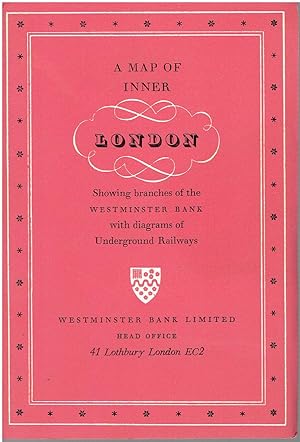
Published by Westminster Bank Limited
Seller: Manian Enterprises, Nashua, NH, U.S.A.Manian Enterprises
Contact seller5-star sellerCondition: Used - Very good
US$ 12.00
US$ 4.75 shippingShips within U.S.A.Quantity: 1 available
No Binding. Condition: Very Good. A vintage folded decorative souvenir map of central London published by the Westminster Bank. Prepared as a promotional piece, it highlights the location of branches of the bank - with a list of branches that had Foreign Exchange (Bureau de Change) departments. Tipped into coral-colored covers.…This map is decorated by Althea Willoughby, and uses drawings and color to highlight various aspects of the city. Only major streets are shown, with important buildings, monuments and sights depicted with drawings of their facades, drawings of green trees show the parks, red highlights the train stations, and blue is for the bank branches. Fully opened, the map measures approx. 23" x 18" and is printed only on one side. Folded into its covers, it measures approx. 4.5" x 6.75". Separate maps of the Underground and Greater London Transport are on the inside covers. In excellent condition with no marks of any kind. Not dated, but probably from the 1950's or 1960's. Althea Willoughby (illustrator).

Published by London Transport 1938
- Softcover
Seller: Recycle Bookstore, San Jose, CA, U.S.A.Recycle Bookstore
Contact seller4-star sellerCondition: Used - Poor
US$ 24.95
US$ 5.75 shippingShips within U.S.A.Quantity: 1 available
Paperback. Condition: Poor. READ THIS!!!! A VERY WORN COPY. Three four inch tears neatly along folds, vertical folds all tape reinforced, some various tiny to small chips usually along folds. still quite readable but very fragile. Photos on request.
 More images
Language: English
Published by Geographica Limited, London 1938
- Softcover
- Map
Seller: Garden City Books, Herts, United KingdomGarden City Books
Contact seller5-star sellerCondition: Used - Good
US$ 16.30
US$ 26.37 shippingShips from United Kingdom to U.S.A.Quantity: 1 available
Soft cover. Condition: Good. vintage fold out paper map that shows the Underground in diagramatic form just prior to WW2. Lines shown are the Metropolitan & District, Picadilly, Bakerloo, Northern and Central. Catchment are covered includes Staines to the West, Hight Barnet to the North , Upney to the East and Mordon to the Sout…h. Rear shows blow up to central brown area, also map of theatres and cinemas.Condition: has a few large tears but not taped . Top margin has small stains but does not impinge on map. Would still look fantastic as a wall hanging.
 More images
Published by Encyclopedia Britannica
- Art Print
Seller: Artisans-lane Maps & Prints, Sidney, BC, CanadaArtisans-lane Maps & Prints
Contact seller4-star sellerCondition: Used - Very good
US$ 10.88
US$ 19.00 shippingShips from Canada to U.S.A.Quantity: 1 available
no binding. Condition: very good. PARIS,City plan,Underground Railway ,Historical Vintage Map,1911 Antique Map 1911 HISTORICAL CITY PLAN VINTAGE PRINT PARIS CLOSEUP PARIS, the capital of France and the department of Seine, situated on both banks of the Seine, 233 m. from its mouth and 285 m. S.S.E. of London by rail and steamer…via Dover and Calais, in 48 50 14 N., 2 20 14 E. (observatory). It occupies the centre of the so-called Paris basin, which is traversed by the Seine from south-east to north-west, open towards the west, and surrounded by a line of Jurassic heights. The granitic substratum is covered by Jurassic, Cretaceous and Tertiary formations; and at several points building materialsfreestone, limestone or gypsumhave been laid bare by erosion. It is partly, indeed, to the existence of such quarries in its neighborhood, and to the vicinity of the grain-bearing regions of the Beauce and Brie that the city owes its development. Still more important is its position at the meeting-place of the great natural highways leading from the Mediterranean to the ocean by way of the Rhone valley and from Spain northwards over the lowlands of western France. The altitude of Paris varies between 80 ft. (at the Point du Jour, the exit of the Seine from the fortifications) and 420 ft. at the hill of Montmartre in the north of the city; the other chief eminence is the hill of Ste Genevieve, on the left bank. Since 1840 Paris has been completely surrounded by a wall, which since 1860 has served also as the limit for the collection of municipal customs dues (octroi). Proposals are constantly being brought forward to demolish this wallwhich, with its talus, is encircled by a broad and deep ditcheither entirely or at least from the Point du Jour, where the Seine intersects the wall below the city, to Pantin, so as to extend the limits of the city as far as the Seine, which runs almost parallel with the wall for that distance. Within the wall the area of the city is 19,279 acres; the river runs through it from east to west in a broad curve for a distance of nearly 8 m. PUBLISHED DATE 1911 NEW YORK ENGRAVER EMERY WALKER PAGE SIZE: approx 8 1/2 INCHES x 6 1/4 INCHES IMAGE SIZE: approx 7 1/4 X 5 1/4 INCHES CONDITION Very Good Condition. The image is clean, clear and sharp with beautiful detail. Blank on Reverse side. This beautiful print would look great matted and framed. An art supply store can provide you with a selection of frames for old art treasures. from 10-28 days depending on your location. Items will be shipped within 2 business days of payment received.
 More images
Published by Encyclopedia Britannica
- Art Print
Seller: Artisans-lane Maps & Prints, Sidney, BC, CanadaArtisans-lane Maps & Prints
Contact seller4-star sellerCondition: Used - Very good
US$ 10.88
US$ 19.00 shippingShips from Canada to U.S.A.Quantity: 1 available
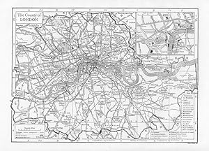
no binding. Condition: very good. LONDON,Underground Railway,Canals,Historical Vintage Map,1911 Antique Map 1911 CITY MAP VINTAGE PRINT COUNTY OF LONDON CLOSEUP The County of London is bounded N. and W. by Middlesex, E. by Essex and Kent, S. by Kent and Surrey. The Metro'politan police area, or " Greater London," however, embrac…es the whole of Middlesex, with parts of the other three counties and of Hertfordshire. Its extent is 443,419 acres or nearly 693 sq. m., and its population is about seven millions. Only here and there upon its fringe the identity of this great area with the metropolis is lost to the eye, where open country remains unbroken by streets or close-set buildings. Site.North of the Thames, and west of its tributary the Lea, which partly bounds the administrative county on the east, London is built upon a series of slight undulations, only rarely sufficient to make the streets noticeably steep. On the northern boundary of the county a height of 443 ft. is found on the open Hampstead Heath. The lesser streams which flow from this high ground to the Thames are no longer open. Some, however, as well as other natural features effaced by the growth of the city, retain an historical interest through the survival of their names in streets and districts, or through their relation to the original site of London (in the present City). South of the Thames a broken amphitheatre of low hills, approaching the river near Greenwich and Woolwich on the east and Putney and Richmond on the west, encloses a tract flatter than that to the north, and rises more abruptly in the southern districts of Streatham, Norwood and Forest Hill. In attempting to picture the site of London in its original condition, that is, before any building took place, it is necessary to consider (i) the condition of the Thames unconfined between made banks, (2) the slopes overlooking it, (3) the tributary streams which watered these slopes. The low ground between the slight hills flanking the Thames valley, and therefore mainly south of the present river, was originally occupied by a shallow lagoon of estuarine character, tidal, and interspersed with marshy tracts and certain islets of relatively firm land. Through this the main stream of the Thames pursued an ill-defined course. The tributary streams entered through marshy channels. The natural process of sedimentation assisted the gradual artificial drainage of the marshes by means' of embankments confining the river. The breadth of this low tract, from Chelsea downward, was from 2 to 3 m. The line of the foot of the southern hills, from Putney, where, it nearly approaches the present river, lies through Stockwell and Camberwell to Greenwich, where it again approaches the river. On the north there is a flat tract between Chelsea and Westminster, covering Pimlico, but from Westminster down to, the Tower there is a marked slope directly up from the river bank. Lower still, marshes formerly extended far up the valley of the Lea. The higher slopes of the hills were densely forested (cf. the modern district-name St John's Wood), while the lower slopes, north of the river, were more open (cf. Moor-gate). The original city grew up on the site of the City of London of the present day, on a slight eminence intersected by the Wal- or Wall-brook, and flanked on the west by the river Fleet. PUBLISHED DATE 1911 NEW YORK ENGRAVER EMERY WALKER PAGE SIZE: approx 8 1/2 INCHES x 6 1/4 INCHES IMAGE SIZE: approx 7 1/4 X 5 1/4 INCHES CONDITION There is some light foxing and slight rippling. The image is clear and sharp with beautiful detail. Blank on Reverse side. This beautiful print would look great matted and framed. An art supply store can provide you with a selection of frames for old art treasures. from 10-28 days depending on your location. Items will be shipped within 2 business days of payment received.
 More images
Language: English
Published by Transport for London., London, England, 2018
- Map
Seller: Tony Hutchinson, Seale, United KingdomTony Hutchinson
Contact seller5-star sellerCondition: New
US$ 23.78
US$ 27.03 shippingShips from United Kingdom to U.S.A.Quantity: 3 available
n/a. Condition: New. Unused, original as used in Underground Railway carriages. in nice clean unfolded condition with peel off self-adhesive backing. Version K. Dec 2018. Fit to 1973 Stock. Part number 28125/236. Will be despatched rolled. See my other listings for more carriage maps - reduced postage on multiple orders).
 More images
Language: English
Published by Transport for London., London, England, 2018
- Map
Seller: Tony Hutchinson, Seale, United KingdomTony Hutchinson
Contact seller5-star sellerCondition: New
US$ 23.78
US$ 27.03 shippingShips from United Kingdom to U.S.A.Quantity: 3 available
n/a. Condition: New. Unused, original as used in Underground Railway carriages. in nice clean condition with peel off self-adhesive backing. Version J. May 2018. Fit to 1973 Stock. Part number 28125/232. Will be despatched rolled in tube. See my other listings for more carriage maps - reduced postage on multiple orders).
Seller: The Guru Bookshop, Hereford, United KingdomThe Guru Bookshop
Contact seller5-star sellerCondition: Used - Fair
US$ 12.22
US$ 15.82 shippingShips from United Kingdom to U.S.A.Quantity: 1 available
Condition: Acceptable. circa 1920's/40's loose binding.

Published by Mc Elfresh
- Softcover
Seller: old aberdeen bookshop, Aberdeen, United Kingdomold aberdeen bookshop
Contact seller4-star sellerCondition: Used - Very good
US$ 32.60
US$ 16.48 shippingShips from United Kingdom to U.S.A.Quantity: 1 available
Soft cover. Condition: Very Good. Map to accompany Book (see listing for Bound for Canaan).

Published by Geographers' Map Co Ltd, London (undated)
- Softcover
- Map
Seller: CURIO, Cleethorpes, North East Lincolnshire, United KingdomCURIO
Contact seller5-star sellerCondition: Used - Very good
US$ 28.52
US$ 39.56 shippingShips from United Kingdom to U.S.A.Quantity: 1 available
Soft cover. Condition: Very Good. No Jacket. Undated, 2/6 printed on front cover. Wear to cover edges, no damage to cloth map, no holes or wear to folds. (22/2).
 More images
Language: English
Published by London Transport., London, England, 2012
- Map
Seller: Tony Hutchinson, Seale, United KingdomTony Hutchinson
Contact seller5-star sellerCondition: New
US$ 32.60
US$ 27.03 shippingShips from United Kingdom to U.S.A.Quantity: 1 available
n/a. Condition: New. Unused original, as used in Underground Railway carriages. in nice clean unfolded condition still with original peel off self-adhesive backing. From Chesham, Amersham, Watford, and Uxbridge to Aldgate. Part number 28124/186 07.12. Approx 150 x 22cm. Will be despatched rolled.
 More images
Language: English
Published by London Transport., London, England, 2017
- Map
Seller: Tony Hutchinson, Seale, United KingdomTony Hutchinson
Contact seller5-star sellerCondition: New
US$ 32.60
US$ 27.03 shippingShips from United Kingdom to U.S.A.Quantity: 1 available
n/a. Condition: New. Unused original, as used in Underground Railway carriages. in nice clean unfolded condition still with original peel off self-adhesive backing. From Chesham, Amersham, Watford, and Uxbridge to Aldgate. Part number 28124/142 04.2017. Approx 155 x 15cm. Will be despatched rolled.
Published by London Transport 1947
- Softcover
Seller: High Barn Books, Lancaster, United KingdomHigh Barn Books
Contact seller5-star sellerCondition: Used
US$ 43.47
US$ 26.37 shippingShips from United Kingdom to U.S.A.Quantity: 1 available
Good paperback (light edgewear, externally grubby, map is clean and unmarked however there are a few closed tears along some of the folds). Fold-out map. The image on this page is of the actual item for sale.
 More images
Language: English
Published by London Transport, London 1937
- Map
Seller: J. R. Young, Birmingham, United KingdomJ. R. Young
Contact seller5-star sellerCondition: Used - Very good
US$ 81.50
US$ 27.69 shippingShips from United Kingdom to U.S.A.Quantity: 1 available
No Binding. Condition: Very Good. Folding map 45x60.5cm, verso with two smaller maps - one indicating locations of listed art galleries & museums, buildings & public halls, and cathedrals & churches, the other indicating locations of listed theatres & cinemas. Printed by the Baynard Press. The whole folding up to 15x8cm. A littl…e wear, with negligible loss, at intersections of a few folds. Clean and unmarked. VERY GOOD condition.

Language: English
Published by Geographia
- Softcover
Seller: Optimon Books, Gravesend, KENT, United KingdomOptimon Books
Contact seller5-star sellerCondition: Used - Good
US$ 129.02
US$ 23.74 shippingShips from United Kingdom to U.S.A.Quantity: 1 available
Paperback. Condition: Good. THERE ARE NO TARIFFS OR CUSTOMS DUTIES ON BOOKS. Published 1937The double-sided sheet has a map with the underground and some other central London lines on one side. On the other side there is a half sheet map of central London and a smaller map of the central London theatres together with other usefu…l information. It is a little worn with small holes at the joins of some of the creases and couple of small tears at the edges, again on the creases and a taped repair at the left hand edge of the theatre map, but still in one piece and overall in good/good condition for the age and type of document.
Published by George Philip & Son London 1935 1935
- Softcover
Seller: Andrew Barnes Books / Military Melbourne, Melbourne, VIC, AustraliaAndrew Barnes Books / Military Melbourne
Contact seller4-star sellerCondition: Used
US$ 150.00
US$ 20.00 shippingShips from Australia to U.S.A.Quantity: 1 available
3rd edition card covers Nice copy octavo map, 'Published by the Great Western, London and North-Eastern, London, Midland and Scottish, and Southern Railways.' Wrappers worn but large map (120 x 95 cms.) is very nice indeed on heavy linen. Scarce.

Published by London: Johnson, Riddle & Co. Ltd. 1935
- Softcover
- First Edition
Seller: MW Books, New York, NY, U.S.A.MW Books
Contact seller5-star sellerFirst Edition. Good folding copy in the original stiff-card wrappers; edges slightly nicked and dust-dulled as with age. Physical description; 1 folding map ; 220 x 145 mm. Subjects; London Underground. LONDON. Transport. Railways (1935-). Genre; cartographic image. 3 Kg.
 More images
- Map
Seller: Lindisfarne Prints, Shrewsbury, SHROP, United KingdomLindisfarne Prints
Contact seller5-star sellerCondition: Used
US$ 38.03
US$ 14.51 shippingShips from United Kingdom to U.S.A.Quantity: 1 available
Antique Map London Underground "Map of London shewing Districts Served by Tube Railways"Published London circa 1925 by George Philip & Son in "Philips' Handy Volume Atlas of London" A highly detailed map ,uncoloured, except for all tube railway lines outlined in red, linking them to the indvidual companies that owned them at tha…t time as shown in the key upper right. The map details the London Underground as it was in The 1920's before nationalisation. Fine, clean condition. The map was printed in two seperate halves which have been conjoined with archival tape (neutral pH) on the back of the map. Due to inconsistencies of the printing process there may be some slight mis-register along the join. There are unrelated maps and text printed on the back. Approx. 8" x 7" (210mm x 180mm) overall. T 2L 1 25.

Published by London: Johnson, Riddle & Co. Ltd. 1935
- Softcover
- First Edition
Seller: MW Books Ltd., Galway, IrelandMW Books Ltd.
Contact seller5-star sellerCondition: Used
US$ 345.22
US$ 15.85 shippingShips from Ireland to U.S.A.Quantity: 1 available
First Edition. Good folding copy in the original stiff-card wrappers; edges slightly nicked and dust-dulled as with age. Physical description; 1 folding map ; 220 x 145 mm. Subjects; London Underground. LONDON. Transport. Railways (1935-). Genre; cartographic image. 1 Kg.
 More images
Language: Ewe
Published by Johnson Riddle & Co, London 1937
- Softcover
- Map
Seller: Malcolm Orchard, Salisbury, United KingdomMalcolm Orchard
Contact seller5-star sellerAssociation member: PBFA
Condition: Used - Good
US$ 101.87
US$ 28.81 shippingShips from United Kingdom to U.S.A.Quantity: 1 available
Soft cover. Condition: Good. Original 1937 London Underground Pocket Map (No. 1 1937) - Designed by Henry 'Harry' Beck. Printed by Johnson Riddle & Co for London Transport. 22.7cm x 15.3cm. Card bi-fold map. Condition is fair to good. The 1937 No.1 pocket map came just 4 years after Harry Becks revolutionary 'diagram' was first…issued in 1933. Having initially rejected Harry Becks design in 1931 on the grounds of being too revolutionary, the Underground Group Publicity Department tentatively published Becks map in January 1933 - to overwhelming enthusiasm from the public. The first distinct series of pocket maps by HC Beck ran from 1933-1938, all strikingly similar to the 1933 edition with their rich blue borders and evolving subtly with each iteration. This edition is almost identical to the 1935 and 1936 editions. However, In 1938 and much to Beck's surprise and frustration, London Transport published an Underground pocket map by another designer, Hans Schleger. Whilst Beck continued to design the map in poster formats, Schlegers pocket map ran for 2 years until responsibility for it returned to Beck in 1941.
 More images
Published by London Transport, London 1937
Seller: Antipodean Books, Maps & Prints, ABAA, Garrison, NY, U.S.A.Antipodean Books, Maps & Prints, ABAA
Contact seller4-star sellerCondition: Used - Very good
US$ 61.00
US$ 10.00 shippingShips within U.S.A.Quantity: 1 available
Condition: Very good condition. Scarce folding color original London Underground map, which includes 2 other maps of important London sites. With the three cover panels offering information on fares, and listing dominion offices and consulates, with the the flip side with a map showing theatres and cinemas in relation to the und…erground lines, in red and blue stars, and lists of art galleries, museums, public halls, and churches and cathedrals. The Tube map extends from Cockfosters in the north, to Morden in the south; Becontree in the east and Uxbridge in the west. Authorized extensions are shown in dotted red lines. Unfolds to 18 x 24"; 3 x 6" folded. Very good + condition, very clean, with the colors on maps bright and fresh.
Published by Dangerfield Printing Company 1920
Seller: Francis Edwards ABA ILAB, Hay on Wye, United KingdomFrancis Edwards ABA ILAB
Contact seller5-star sellerCondition: Used
US$ 134.47
US$ 25.06 shippingShips from United Kingdom to U.S.A.Quantity: 1 available
13.5 x 11 inches. Printed in Colour. With smaller plans to verso. Several sm. splits to folds., some browning, signs of taping to one fold, sm. central hole to fold. US$134.
Published by Johnson Riddle & Co. Ltd 1936
Seller: Francis Edwards ABA ILAB, Hay on Wye, United KingdomFrancis Edwards ABA ILAB
Contact seller5-star sellerCondition: Used
US$ 224.12
US$ 25.06 shippingShips from United Kingdom to U.S.A.Quantity: 1 available
9 x 6 inches. Bi-Fold Colour card map. Sl. chipped to folds. and with sm. stain. Henry Charles Beck (19021974) English technical draughtsman who created the present London Underground Tube map in 1931, the map was first issued a pocket edition in January 1933. It was immediately popular, and the Underground has used topological…maps to illustrate the network ever since. US$223.
 More images
- Map
Seller: Antique Paper Company, ASHFORD, KENT, United KingdomAntique Paper Company
Contact seller2-star sellerCondition: Used
US$ 203.74
US$ 7.91 shippingShips from United Kingdom to U.S.A.Quantity: 1 available
Designed by Henry Harry Beck. Printed by Johnson Riddle Co for London Transport. 22.7cm x 15.3cm. Card bi-fold pocket map. HC Beck Mainline interchange station map to the rear. Condition: excellent withsome wear to folds but otherwise a nice example.The 1938 No.1 pocket map came just 5 years after Harry Becks revolutionary diagr…am was first issued in 1933 and is the last of Becks 1st series of diagrams (more on that below).Having initially rejected Harry Becks design in 1931 on the grounds of being too revolutionary, the Underground Group Publicity Department tentatively published Becks map in January 1933 - to overwhelming enthusiasm from the public. The first distinct series of pocket maps by HC Beck ran from 1933-1938, all strikingly similar to the 1933 edition with their rich blue borders and evolving subtly with each iteration.This 1938 No. 1 is an identical reissue of 1937 No. 2 edition which saw the rather perplexing change of the Metropolitan Line colour to the same as the District line (Green). This Met would remain green until 1949 when it was returned to maroon, the colour it is on todays map.Much to Becks surprise and frustration, London Transport published an Underground pocket map by another designer, Hans Schleger later in 1938. Whilst Beck continued to design the map in poster formats, Schlegers pocket map ran for 2 years until responsibility for it returned to Beck in 1941.
 More images
- Map
Seller: Antique Paper Company, ASHFORD, KENT, United KingdomAntique Paper Company
Contact seller2-star sellerCondition: Used
US$ 475.40
US$ 7.91 shippingShips from United Kingdom to U.S.A.Quantity: 1 available
1928 METROPOLITAN RAILWAY AND CONNECTIONS - METROPOLITAN RAILWAY MAP OF LONDON extending to districts served by the Metropolitan Rly in Middlesedx, Herts and Bucks.Metropolitan Railway And Connections map; a folding geographic style map on paper, issued by the Metropolitan Railway. The map shows the Underground group lines overp…rinted in blue and the Metropolitan Railway in red with a red border. Stations are marked by circles, with only one circle used to represent an interchange between lines, station names are all printed in black. Most of the Metropolitan Railway is shown in its entirety, however it is not to scale with the rest of the lines, and the section to Verney Junction and Brill has been compressed in order to fit it onto the map. Some of the Underground lines are drawn in their entirety, some of the branch lines are ended prematurely, with an arrow used to indicate the continuation of a line. Down Street Station is still shown (closed 1932). Features such as exhibitions, football cricket stadiums and greyhound tracks are marked in red, and roads, the River Thames and parks are also included. The Chiltern Hills have been drawn as a prominent feature on this map and the site of golf courses adjacent to the Metropolitan Railway have been indicated by a red flag symbol. Main line railways routes are marked with brown lines, however some of the lines are incomplete. On the reverse there are details about London theatres, shops and stores, main line railway connections, and places of interest. There are also descriptions and pictures of villages and towns served by the Metopolitan Railway, and information about how the Metro serves London. The front cover is Lilacand has the Metropolitan Railway logo as a heading.The map is attributed to Robert Hope Selbie, who died in 1930.Overall size approx 42.7cm x 34cm. Condition is generally very good with some minor wear to the top central margin.
 More images
- Map
Seller: Antique Paper Company, ASHFORD, KENT, United KingdomAntique Paper Company
Contact seller2-star sellerCondition: Used
US$ 475.40
US$ 7.91 shippingShips from United Kingdom to U.S.A.Quantity: 1 available
1935Original Vintage folding map of the UNDERGROUND RAILWAY MAP of LONDON Published for London Transport, this being Issue No. 1.With three folds as originally published. H C Beck in bottom left corner.The new design for the London Underground map was inaugurated in 1933. Henry Charles Beck (1902 andndash; 1974) was an English t…echnical draughtsman who created the present London Underground Tube map in 1933.It is based on an electrical circuit diagram. As the London Transport system grew in size, Beck realised that maps of the underground based on a geographical layout, were becoming more difficult for the travelling public to use and he set out to find a more user-friendly map that users of the tube would find it easier to navigate their way around the system. Although his design was initially rejected, the Publicity Office of London Transport changed their minds after Beck resubmitted an updated copy and the map was first issued as a pocket edition in January 1933. It was immediately popular, and the Underground has used topological maps to illustrate the network ever since. Harry Beck wanted to make the network easier to understand by colouring each train route and using straight lines and 45 degree angles.

- Softcover
- Print on Demand
Seller: AHA-BUCH GmbH, Einbeck, GermanyAHA-BUCH GmbH
Contact seller5-star sellerCondition: New
US$ 47.49
US$ 69.23 shippingShips from Germany to U.S.A.Quantity: 2 available
Taschenbuch. Condition: Neu. nach der Bestellung gedruckt Neuware - Printed after ordering - High Quality Content by WIKIPEDIA articles! The Central line is a London Underground line, coloured red on the tube map. It is a deep-level 'tube' line, running east-west across London, and has the greatest total length of track of any l…ine on the Underground. Out of the 49 stations served, 20 are below ground. It is the second busiest line on the Underground.
 More images
- Map
Seller: Antique Paper Company, ASHFORD, KENT, United KingdomAntique Paper Company
Contact seller2-star sellerCondition: Used
US$ 679.15
US$ 7.91 shippingShips from United Kingdom to U.S.A.Quantity: 1 available
c1931 METROPOLITAN RAILWAY AND CONNECTIONS - METROPOLITAN RAILWAY MAP OF LONDON extending to districts served by the Metropolitan Rly in Middlesedx, Herts and Bucks.Metropolitan Railway And Connections map; a folding geographic style map on paper, issued by the Metropolitan Railway. The map shows the Underground group lines over…printed in blue and the Metropolitan Railway in red with a red border. Stations are marked by circles, with only one circle used to represent an interchange between lines, station names are all printed in black. Most of the Metropolitan Railway is shown in its entirety, however it is not to scale with the rest of the lines, and the section to Verney Junction and Brill has been compressed in order to fit it onto the map. Some of the Underground lines are drawn in their entirety, some of the branch lines are ended prematurely, with an arrow used to indicate the continuation of a line. Down Street Station is still shown (closed 1932). Features such as exhibitions, football cricket stadiums and greyhound tracks are marked in red, and roads, the River Thames and parks are also included. The Chiltern Hills have been drawn as a prominent feature on this map and the site of golf courses adjacent to the Metropolitan Railway have been indicated by a red flag symbol. Main line railways routes are marked with brown lines, however some of the lines are incomplete. On the reverse there are details about London theatres, shops and stores, main line railway connections, and places of interest. There are also descriptions and pictures of villages and towns served by the Metopolitan Railway, and information about how the Metro serves London. The front cover is red and has the Metropolitan Railway logo as a heading.The map is attributed to Robert Hope Selbie, who died in 1930.Overall size approx 42.7cm x 34cm. Condition is generally very good with a couple of small closed tears in the bottom margin.

- Softcover
- Print on Demand
Seller: AHA-BUCH GmbH, Einbeck, GermanyAHA-BUCH GmbH
Contact seller5-star sellerCondition: New
US$ 58.45
US$ 69.59 shippingShips from Germany to U.S.A.Quantity: 1 available
Taschenbuch. Condition: Neu. nach der Bestellung gedruckt Neuware - Printed after ordering - High Quality Content by WIKIPEDIA articles! Bank and Monument are interlinked stations, officially one station known operationally as the 'Bank-Monument complex', although the separate names are used on station entrances, platforms and t…he tube map. The complex spans the length of King William Street in the City of London. Together they form the eighth busiest station on the network, being served by five London Underground lines and the Docklands Light Railway(DLR). The two parts of the combined station take their names from the nearby Bank of England and the Monument to the Great Fire of London. The complex is in Travelcard Zone 1. The station connects the Central Line, Northern Line, DLR, Circle Line, District Line and Waterloo & City Line.

- Softcover
- Print on Demand
Seller: preigu, Osnabrück, Germanypreigu
Contact seller5-star sellerCondition: New
US$ 110.47
US$ 79.53 shippingShips from Germany to U.S.A.Quantity: 5 available
Taschenbuch. Condition: Neu. Tube Map | Schematic, Transit Map, Northern City Line, Charing Cross, Euston and Hampstead Railway, Brand, City Map, London Underground Ticketing | Frederic P. Miller (u. a.) | Taschenbuch | Englisch | 2026 | OmniScriptum | EAN 9786134148276 | Verantwortliche Person für die EU: preigu GmbH & Co. KG,…Lengericher Landstr. 19, 49078 Osnabrück, mail[at]preigu[dot]de | Anbieter: preigu Print on Demand.


