Order Total (1 Item Items):
Shipping Destination:

Westminster Lambeth: Maps (14 results)
Skip to main search results
Search filters
Product Type
- All Product Types
- Books (No further results match this refinement)
- Magazines & Periodicals (No further results match this refinement)
- Comics (No further results match this refinement)
- Sheet Music (No further results match this refinement)
- Art, Prints & Posters (No further results match this refinement)
- Photographs (No further results match this refinement)
- Maps (14)
- Manuscripts & Paper Collectibles (No further results match this refinement)
Condition Learn more
- New (No further results match this refinement)
- As New, Fine or Near Fine (1)
- Very Good or Good (9)
- Fair or Poor (No further results match this refinement)
- As Described (4)
Binding
- All Bindings
- Hardcover (No further results match this refinement)
- Softcover (No further results match this refinement)
Collectible Attributes
- First Edition (No further results match this refinement)
- Signed (No further results match this refinement)
- Dust Jacket (No further results match this refinement)
- Seller-Supplied Images (14)
- Not Print on Demand (14)
Language (1)
Price
- Any Price
- Under US$ 25 (No further results match this refinement)
- US$ 25 to US$ 50
- Over US$ 50
Free Shipping
- Free Shipping to U.S.A. (No further results match this refinement)
Seller Location
Seller Rating
-
US$ 51.42
US$ 13.49 shipping
Ships from United Kingdom to U.S.A.Quantity: 1 available
Add to basketCondition: Good. LONDON. Lambeth, Westminster, Victoria, Oval, Waterloo, Charing Cross 1928 map. Colour vintage street atlas map; The Geographia map company (1928). 33.0 x 21.5cm, 13 x 8.25 inches. Condition: Good. Light soiling in margin; Light crease in margin. There is printed text and a public library stamp on the reverse side of this map. The paper is relatively thick, and the verso text does not show through to the front of the map. The following rail & underground stations are marked on the map: Victoria, Queens Road, Battersea Park, Vauxhall, Stockwell, Waterloo, St James's Park, Charing Cross, Westminster, Down Street. Notable buildings, features and public spaces marked on the map include: Green Park, St James's Park, Westminster School, Vauxhall Park, The Oval (Surrey County Cricket Ground), Tate Gallery, Millbank Barracks, London County Hall, Lambeth Palace, St Thomas's Hospital, Medical School, Houses of Parliament, Home Office, Buckingham Palace, Archbishop's Park, Victoria Tower Gardens, Board of Education, Board of Trade, Ministry of Health, Treasury, Horse Guards, Colonial Office, New Scotland Yard, Admiralty, War Office, Admiralty Arch, Horse Guards, St James's Palace, Palace Gardens, Army Clothing Depot, Westminster Abbery, Ministry of Transport, Grey Coat Hospital, Queen Alexandra's Military Hospital, Census Office, Westminster Workhouse, Caxton Hall, Wellington Barracks, Royal Mews, Marlborough House.
-
US$ 54.20
US$ 13.49 shipping
Ships from United Kingdom to U.S.A.Quantity: 1 available
Add to basketCondition: Good. LONDON. Lambeth, Westminster, Victoria, Oval, Waterloo, Charing Cross 1923 map. Colour vintage street atlas map; The Geographia map company (1923). 33.0 x 19.5cm, 13 x 7.75 inches. Condition: Good. Verso text quite apparent in margin; The image shown may have been taken from a different example of this map than that which is offered for sale. The map you will receive is in good condition but there may be minor variations in the condition from that shown in the image. There are images and/or text printed on the reverse side of this map. The following rail & underground stations are marked on the map: Victoria, Queens Road, Battersea Park, Vauxhall, Stockwell, Waterloo, St James's Park, Charing Cross, Westminster, Down Street. Notable buildings, features and public spaces marked on the map include: Green Park, St James's Park, Westminster School, Vauxhall Park, The Oval (Surrey County Cricket Ground), Tate Gallery, Millbank Barracks, London County Hall, Lambeth Palace, St Thomas's Hospital, Medical School, Houses of Parliament, Home Office, Buckingham Palace, Archbishop's Park, Victoria Tower Gardens, Board of Education, Board of Trade, Ministry of Health, Treasury, Horse Guards, Colonial Office, New Scotland Yard, Admiralty, War Office, Admiralty Arch, Horse Guards, St James's Palace, Palace Gardens, Army Clothing Depot, Westminster Abbery, Ministry of Transport, Grey Coat Hospital, Queen Alexandra's Military Hospital, Census Office, Westminster Workhouse, Caxton Hall, Wellington Barracks, Royal Mews, Marlborough House.
-

US$ 55.59
US$ 13.49 shipping
Ships from United Kingdom to U.S.A.Quantity: 1 available
Add to basketCondition: Good. LONDON. Lambeth Westminster Victoria Oval Waterloo Charing Cross 1933 old map. Colour vintage street atlas map; The Geographia map company (1933). 30.5 x 18.5cm, 12 x 7.25 inches. Condition: Good. There is another map printed on the reverse side of this map. The paper is thick, and the map on the reverse side does not show through the paper.
-
US$ 56.98
US$ 13.49 shipping
Ships from United Kingdom to U.S.A.Quantity: 2 available
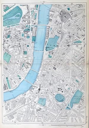
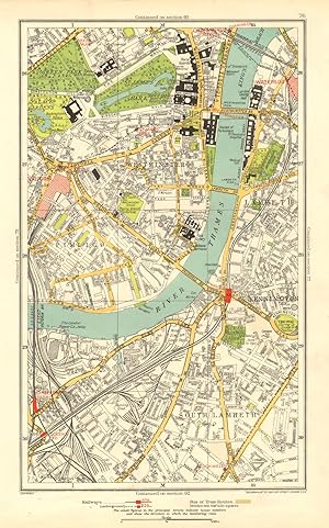
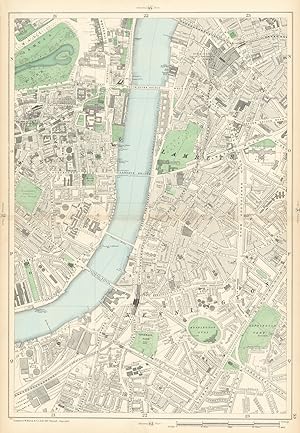
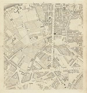
Add to basketCondition: Good. LONDON. Lambeth Westminster Victoria Oval Waterloo Charing Cross 1937 old map. Colour vintage street atlas map; The Geographia map company (1937). 30.5 x 18.5cm, 12 x 7.25 inches. Condition: Good. There is another map printed on the reverse side of this map. The paper is thick, and the map on the reverse side does not show through the paper. Map section #76 This map is one section from a 1937 Street Atlas of Greater London. This section of the map depicts the following suburbs in 1937: Lambeth,South Lambeth,Westminster The maps in this series show London during the rapid interwar suburban expansion. Many areas shown in the outer suburbs as undeveloped land on these maps are now built up. Less frequently, some maps indicate housing developments proposed in 1937 but which were never built on land which is still undeveloped, or which has been built up according to a different street layout from that shown. The inner London maps in this series show London before the damage inflicted by the Blitz during World War 2 and the subsequent redevelopment of the 1950's and 1960's. These maps predate the construction of any motorways (the M1 sections into London having opened between 1966-1977), many major roads, and other post-war urban traffic schemes. The elevated sections of many major roads were constructed after the second world war; for example, the maps predate the construction of the Westway and elevated sections of the A4; the Western Avenue is shown on map sections #142 & #143 as proposed or under construction to the west of Northolt Aerodrome. The London docklands are shown at the height of their scale and glory, a network of large docks and railway lines. The last dock to be built had been completed in 1921. The prosperity of the docklands continued until the advent of containerisation 1960's, whereafter they remained derelict until redevelopment commenced in the early 1980's, centred around the area now known as Canary Wharf These maps show a number of now disappeared features, such as aerodromes which have since disappeared or changed their use, the Brooklands motor racing circuit (shown on map section #157, 2 years before it hosted its last race in 1939), and railways which are now disused. LHR is shown on map section #150 as the modest "Great West Aerodrome"; the original Heathrow Hall is also depicted on this map. The airport at that time was used for aircraft assembly and testing, with Croydon Airport (shown on map sections #163 and #164) being the main airport used for commercial flights.
-
![Seller image for [Sheet C3 - Westminster, Millbank, Vauxhall, Lambeth] for sale by Antiqua Print Gallery](https://pictures.abebooks.com/inventory/md/md31337308382.jpg)
US$ 90.33
US$ 13.49 shipping
Ships from United Kingdom to U.S.A.Quantity: 1 available
Add to basketCondition: Good. Westminster, Millbank, Vauxhall, Lambeth. Sheet C3. After ROCQUE 1971 (1746) map. Vintage facsimile copy of an original eighteenth century map; After the map by John Rocque, engraved by John Pine (1971 facsimile copy of 1746 original). 74.5 x 54.0cm, 29.25 x 21.25 inches; this is a folding map. Condition: Good. There is nothing printed on the reverse side, which is plain.
-
LONDON, 1909 - WESTMINSTER, LAMBETH, KENNINGTON - Original Antique Map from Bacon's London & Suburbs, Large 9" per Mile Scale.
Published by G.W. Bacon, 1909
Seller: End of The World Maps., Penzance, United Kingdom
Seller rating 5 out of 5 stars

Map
US$ 132.02
US$ 13.49 shipping
Ships from United Kingdom to U.S.A.Quantity: 1 available
Add to basketNo Binding. Condition: Very Good. Original Antique Map / Plan of London - WESTMINSTER, LAMBETH, KENNINGTON. DESCRIPTION : Large scale, 9 inches to the mile, street plan / map, sourced from the New Large Scale Atlas of London & Suburbs, published by G.W. Bacon, London. PRINTED IN : 1909. SIZE : Folio : approx 51 x 33 cm, (20" x 13"), IMAGE SIZE: Approx 45 x 30 cm, (18" x 12") NOTES ON CONDITION: A large Original Map in Very Good condition, suitable for framing. Sheet map with centre fold, normal guide remains to verso else clear. Minor aging /marking consistent with light usage only. PACKAGING AND SHIPMENT: - The map is placed in a clear polypropylene protective sleeve, and shipped in an extra strong postal tube. DECLARATION of AUTHENTICITY - We guarantee the map to be an authentic historic map, published at the date stated above. We do not sell reproductions. We include a photograph of the Atlas the map has been sourced from as evidence of its provenance. A Certificate of Authenticity accompanies the map. Important Notes :- - the listing is for the map as described only , any photo's showing the atlas from where the map came from is for information / provenance purposes only. - any watermarking to the photographs above is not , of course, present on the actual map ! - virtually all antiquarian maps and prints are subject to some normal aging due to use and time which is not obtrusive unless otherwise stated. - most higher quality 19th C atlas's mounted maps on "guides" , traces of this will often remain to the back , with no significant detrimental effect to the map itself.
-

Lambeth Westminster Victoria Oval Waterloo - Antique 1930 Map (London)
Seller: Staffordshire Curios, Haughton, United Kingdom
Seller rating 4 out of 5 stars

Map
US$ 44.47
US$ 20.17 shipping
Ships from United Kingdom to U.S.A.Quantity: 1 available
Add to basketAtlas Map. A very attractive original map, originally extracted from a c1930 copy of The Authentic Map Directory of London and SuburbsThird Edition, Revised and Enlarged. Consisting of a large-scale coloured Street Plan of London and Suburbs in 173 sections; a plan of the City of London in 3 sections; Maps showing Parliamentary, Administrative, Police, County Court and Petty Sessional Divisions; Home Counties; Underground Railways Map; Map showing Postal Districts; a Classified Business Directory and a complete Index to the Sectional Street Plan and the Plan of the City containing nearly 40,000 names. Geographia Ltd., London, undated but circa 1930 Original and authenticTotal paper size is approx 34 x 25cmMap has some notable wear with age, mainly to edges where there is significant handling wear and some general fraying and small tears with age. Some browning/marks in places, mainly along borders, and general wear associated with a reasonable well used map. A number of slightly larger tears to right edge/border, and some age related browning and marks to top right corner.Please note this map is double sided with another map to the reverse;
-

'A MAP OF THE NEW ROADS &c. FROM WESTMINSTER BRIDGE'. A detailed plan of Newington, Lambeth and Southwark showing the improved and planned roads. Reaching from Vauxhall Bridge to the Tower. North orientated to the South.
Published by Gentleman's Magazine, May 1753, 1753
Map
US$ 125.07
US$ 40.48 shipping
Ships from United Kingdom to U.S.A.Quantity: 1 available
Add to basketUncoloured copper engraving, 22 x 35 cm. Previously folded.
-
A Plan of the Street, Roads, &c. between Black Fryers Bridge, London Bridge, Westminster Bridge, Lambeth, Newington Butts, & St. Margarets Hill, as they now are; together with the New Intended Streets, Roads, & Communications in Strong Black Lines, as proposed in the Year 1768, but the dotted Lines shew these now Intended in ye Year 1769.
Published by [1769], 1769
Seller: Michael S. Kemp, Bookseller, Sheerness, KENT, United Kingdom
Association Member: PBFA
Seller rating 5 out of 5 stars
Map
US$ 194.56
US$ 26.98 shipping
Ships from United Kingdom to U.S.A.Quantity: 1 available
Add to basketEngraved map, 255 x 365 mm. main roads coloured by hand, old tears and repair to verso. The construction of these new roads over and close to St George's Fields were a new nexus leading to London an Blackfriar's Bridges. The scene of the Gordon Riots of 1780, the centre of this map is now known as The Elephant and Castle, taking its name after a coaching inn of the same name. That inn is not marked on the present map, although a number of others do appear including the Dog and Duck, Lambeth Road, the current site of one of the buildings of the Imperial War Museum.
-
![Seller image for [WESTMINSTER, LAMBETH, KENNINGTON] . Detailed map from Bacon s New Large-scale Atlas of London and Suburbs . for sale by Garwood & Voigt](https://pictures.abebooks.com/inventory/md/md11581326430.jpg)
[WESTMINSTER, LAMBETH, KENNINGTON] . Detailed map from Bacon s New Large-scale Atlas of London and Suburbs .
Published by G. W. Bacon 1908, 1908
Map
US$ 250.14
US$ 40.48 shipping
Ships from United Kingdom to U.S.A.Quantity: 1 available
Add to basketNo Binding. Condition: Fine. 46x32cm. Original colour. Excellent condition.
-
Sheet 53 from Bacon's 1900 London street atlas covering part of South West London including Westminster, Lambeth, Kennington, Waterloo, Vauxhall, Oval, Pimlico, South Lambeth
Publication Date: 1900
Map
US$ 444.70
US$ 13.49 shipping
Ships from United Kingdom to U.S.A.Quantity: 1 available
Add to basketCondition: Good. WESTMINSTER Lambeth Kennington Waterloo Vauxhall Oval Pimlico Lambeth 1900 map. Antique colour atlas map; George W. Bacon & Co (1900). 49.0 x 34.5cm, 19.25 x 13.5 inches; this is a folding map. Condition: Good. The image shown may have been taken from a different example of this map than that which is offered for sale. The map you will receive is in good condition but there may be minor variations in the condition from that shown in the image. There is nothing printed on the reverse side, which is plain.
-
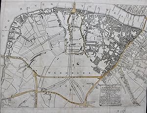
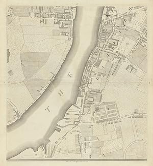
Sheet D3 - Waterloo, Southwark, South Bank, Blackfriar's Road, Westminster Bridge Road, Borough Road, Lambeth North
Publication Date: 1799
Map
US$ 528.08
US$ 13.49 shipping
Ships from United Kingdom to U.S.A.Quantity: 1 available
Add to basketCondition: Good. Horwood London D3 Waterloo Southwark South Bank Lambeth 1799 old antique map. Antique copperplate map; Richard Horwood (1799). 59.0 x 54.5cm, 23.25 x 21.5 inches; this is a folding map. Condition: Good. Please contact us if you would like to arrange to view this map. There is nothing printed on the reverse side, which is plain.
-
Sheet C4 - Westminster, Millbank, Vauxhall, Lambeth, Horseferry Road, Kennington Oval
Publication Date: 1799
Map
US$ 555.87
US$ 13.49 shipping
Ships from United Kingdom to U.S.A.Quantity: 1 available
Add to basketCondition: Good. Horwood London C4 Westminster Millbank Vauxhall Lambeth Oval 1799 old map. Antique copperplate map; Richard Horwood (1799). 59.0 x 54.0cm, 23.25 x 21.25 inches; this is a folding map. Condition: Good. Please contact us if you would like to arrange to view this map. There is nothing printed on the reverse side, which is plain.
-
![Seller image for [Westminster & Lambeth.] for sale by Altea Antique Maps](https://pictures.abebooks.com/inventory/md/md13215282786.jpg)
[Westminster & Lambeth.]
Publication Date: 1799
Seller: Altea Antique Maps, London, United Kingdom
Association Member: ABA ILAB PBFA
Seller rating 5 out of 5 stars
Map
US$ 1,528.65
US$ 47.22 shipping
Ships from United Kingdom to U.S.A.Quantity: 1 available
Add to basketLondon: 1799 Two sheets conjoined, total 570 x 1010mm. Some original outline colour. Top corners repaired with some fill. Two sheets from a map that which Howgego describes as the 'largest and most important London map of the eighteenth century', on a scale of 26 inches to a mile. The western part of the map shows the eastern end of St James's Park, with part of Pall Mall, Charing Cross with the King's Mews, Westminster Abbey and Hall, Great Peter Street and what is now Smith Square. Across Westminster Bridge Lambeth is shown, with St George's Circus and King's Bench Prison. Further north the Thames riverside is filled with timber yards where the South Bank Centre now stands. Near Westminster Bridge is Astley's Theatre, dedicated to equestrian shows. Horwood's intention was to mark each house's number (a practice started in 1735), but this was abandoned as impractical. He started his scheme in 1790, expecting to be finished by 1792: by 1794 he was apologising to his subscribers (including George III); in 1798 he received a loan of �500 from the Phnix Fire-Office, for whom Horwood worked as a surveyor, to finish the map. However this assistance was not enough to stop Horwood dying in poverty in 1803. HOWGEGO: 200, and pp.21-22.