
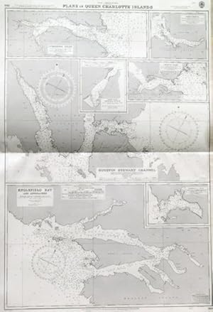
ENGLEFIELD BAY AND APPROACHES , HOUSTON STEWART CHANNEL , CUMSHEWA INLET , and four other sea charts of other Queen Charlotte Islands (off the Canadian West coast) on one double map sheet. Compiled from earlier Canadian Government Charts under the Superintendence of Rear Admiral A. Day at the
Admiralty Charts.
Published by Admiralty 1952
Map
Condition: Fine
From Garwood & Voigt, Sevenoaks, United Kingdom
Seller rating 5 out of 5 stars
![]()
AbeBooks Seller since November 25, 2013