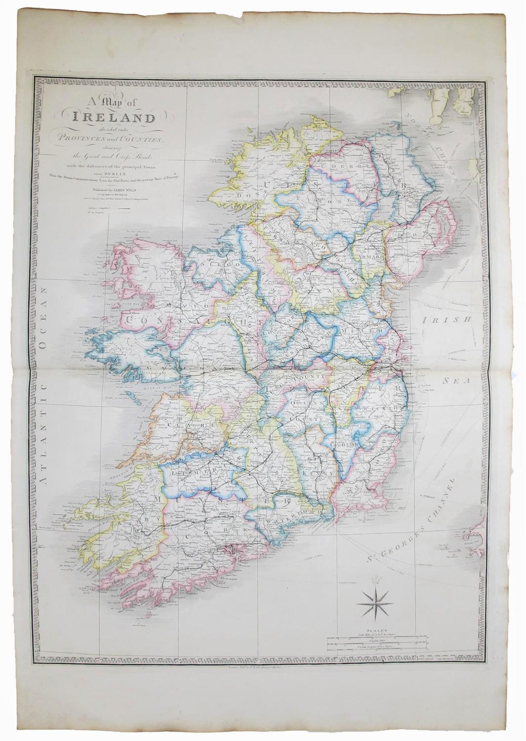
Map of Ireland divided into Provinces and Counties, shewing the great and Cross roads with the distances of the principla Towns from Dublin. Also the Steam Communication from the Out Ports, and the average Time of Passage.
WYLD, James
Published by LondonJames Wyld. Geographer to the Queen 11 & 12 Charing Cross 457 Strand 2 Royal Exchange London. c., 1870
Used
From
Robert Frew Ltd. ABA ILAB, London, United Kingdom
Seller rating 5 out of 5 stars
![]()
Heritage Bookseller
AbeBooks member since 1996
This book is no longer available. AbeBooks has millions of books. Please enter search terms below to find similar copies.
About this Item
Description:
Double page engraved map (70 x 54 cm overall sheet 84 x 67 cm.) engraved map with original outline colour. Seller Inventory # 52943
Bibliographic Details
Title: Map of Ireland divided into Provinces and ...
Publisher: LondonJames Wyld. Geographer to the Queen 11 & 12 Charing Cross 457 Strand 2 Royal Exchange London. c.
Publication Date: 1870
AbeBooks offers millions of new, used, rare and out-of-print books, as well as cheap textbooks from thousands of booksellers around the world. Shopping on AbeBooks is easy, safe and 100% secure - search for your book, purchase a copy via our secure checkout and the bookseller ships it straight to you.
Search thousands of booksellers selling millions of new & used books
New & Used Books

New and used copies of new releases, best sellers and award winners. Save money with our huge selection.
Rare & Out of Print Books

From scarce first editions to sought-after signatures, find an array of rare, valuable and highly collectible books.
