
Order Total (1 Item Items):
Shipping Destination:

Antique Map Turkey (15 results)
Skip to main search results
Search filters
Product Type
- All Product Types
- Books (13)
- Magazines & Periodicals (No further results match this refinement)
- Comics (No further results match this refinement)
- Sheet Music (No further results match this refinement)
- Art, Prints & Posters (No further results match this refinement)
- Photographs (No further results match this refinement)
- Maps (2)
- Manuscripts & Paper Collectibles (No further results match this refinement)
Condition Learn more
- New (No further results match this refinement)
- As New, Fine or Near Fine (No further results match this refinement)
- Very Good or Good (12)
- Fair or Poor (No further results match this refinement)
- As Described (3)
Binding
- All Bindings
- Hardcover (2)
- Softcover (No further results match this refinement)
Collectible Attributes
- First Edition (2)
- Signed (No further results match this refinement)
- Dust Jacket (No further results match this refinement)
- Seller-Supplied Images (3)
- Not Print on Demand (15)
Language (2)
Free Shipping
- Free Shipping to U.S.A. (No further results match this refinement)
Seller Location
Seller Rating
-

TURKEY, AN ANTIQUE MAP, CIRCA 1880
Language: English
Published by WILLIAM MACKENZIE, Edinburgh, 1880
Seller: K Books Ltd ABA ILAB, York, YORKS, United Kingdom
Association Member: ABA ILAB PBFA
Seller rating 5 out of 5 stars

First Edition
US$ 17.89
US$ 26.25 shipping
Ships from United Kingdom to U.S.A.Quantity: 1 available
Add to basketSingle Sheet Engraving. Condition: Very Good. No Jacket. First Edition. TURKEY, AN ANTIQUE MAP, CIRCA 1880, A VERY GOOD MAP . VERY REASONABLY PRICED, . MEASURES 11 X 9 INCHES, 28 X 23 CMS, INCHES, ELABORATE BORDER, CIRCA 1860. DISPATCH WELL PACKED AND ROLLED IN A STRONG TUBE, VERY GOOD CONDITION, SPLENDID VALUE.
-
TURKEY IN EUROPE AN ANTIQUE MAP CIRCA 1860
Language: English
Published by LONDON PRINTING AND PUBLISHING COMPANY, London, 1860
Seller: K Books Ltd ABA ILAB, York, YORKS, United Kingdom
Association Member: ABA ILAB PBFA
Seller rating 5 out of 5 stars
First Edition
US$ 17.89
US$ 26.25 shipping
Ships from United Kingdom to U.S.A.Quantity: 1 available
Add to basketSingle Sheet Engraving. Condition: Very Good. No Jacket. First Edition. TURKEY IN EUROPE, AN ANTIQUE MAP CIRCA 1860, A VERY GOOD MAP . VERY REASONABLY PRICED, . MEASURES 13 X 10 INCHES, ELABORATE BORDER, CIRCA 1860. DISPATCH WELL PACKED ROLLED IN A STRONG TUBE, VERY GOOD CONDITION, SPLENDID VALUE.
-
Map of Turkey in Europe - an Original Engraving
Language: English
Seller: K Books Ltd ABA ILAB, York, YORKS, United Kingdom
Association Member: ABA ILAB PBFA
Seller rating 5 out of 5 stars
US$ 27.73
US$ 26.25 shipping
Ships from United Kingdom to U.S.A.Quantity: 1 available
Add to basketNo Binding. Condition: Very Good. A fine Engraving - printed circa 1870. Mounted and ready to frame. A fine opportunity to purchase an attractive and decorative engraved Map of Turkey in Europe.
-
Map of Turkey - an Original Engraving
Language: English
Seller: K Books Ltd ABA ILAB, York, YORKS, United Kingdom
Association Member: ABA ILAB PBFA
Seller rating 5 out of 5 stars
US$ 27.73
US$ 26.25 shipping
Ships from United Kingdom to U.S.A.Quantity: 1 available
Add to basketNo Binding. Condition: Very Good. A fine Engraving - printed circa 1870. Mounted and ready to frame. A fine opportunity to purchase an attractive and decorative engraved Map of Turkey.
-
TURKEY IN EUROPE - An Original Antique Hand Coloured Map
Language: English
Published by LONDON PRINTING, London, 1857
Seller: K Books Ltd ABA ILAB, York, YORKS, United Kingdom
Association Member: ABA ILAB PBFA
Seller rating 5 out of 5 stars
US$ 48.52
US$ 26.25 shipping
Ships from United Kingdom to U.S.A.Quantity: 1 available
Add to basketNo Binding. Condition: Very Good. Rapkin (illustrator). A fine original antique hand coloured map, colouring not contemporary but delicately and expertly executed . . Mounted (matted) and ready to frame. Central fold otherwise very good condition. A splendid opportunity to acquire an antique original map - decorative, attractive and scarce . A splendid map of Turkey in Europe, with vignettes of Constantinople, Bosphorus, Ali Pasha etc with an inset map of Candia.
-
Map of Turkey & Hungary - an Original Antique Engraving
Language: English
Publication Date: 1820
Seller: K Books Ltd ABA ILAB, York, YORKS, United Kingdom
Association Member: ABA ILAB PBFA
Seller rating 5 out of 5 stars
US$ 41.59
US$ 26.25 shipping
Ships from United Kingdom to U.S.A.Quantity: 1 available
Add to basketNo Binding. Condition: Slight Crease. An original hand-coloured antique engraved map, printed circa 1820. Hand-colouring contemporary. Mounted/matted and ready to frame. A fine opportunity to purchase an attractive and decorative engraving of a Map of Turkey & Hungary - Asia.
-
Turkey with Provinces in Asia Minor - an Antique Map
Language: English
Seller: K Books Ltd ABA ILAB, York, YORKS, United Kingdom
Association Member: ABA ILAB PBFA
Seller rating 5 out of 5 stars
US$ 48.52
US$ 26.25 shipping
Ships from United Kingdom to U.S.A.Quantity: 1 available
Add to basketNo Binding. Condition: Very Good. Engraved By Walker (illustrator). A fine antique map in very good condition - printed in circa 1844. Mounted (matted) and ready to frame. Engraved size approx 16 x 13 Ins, 41 x 33 Cms. Mounted size approx 19 x 16 in, 49 x 41cm. Coloured in outline, hand colouring contemporary. A fine engraved map of Turkey with Provinces in Asia Minor.
-
Turkey and Northern Provinces - an Antique Map
Language: English
Seller: K Books Ltd ABA ILAB, York, YORKS, United Kingdom
Association Member: ABA ILAB PBFA
Seller rating 5 out of 5 stars
US$ 48.52
US$ 26.25 shipping
Ships from United Kingdom to U.S.A.Quantity: 1 available
Add to basketNo Binding. Condition: Very Good. Engraved By Walker (illustrator). A fine antique map in very good condition - printed in circa 1844. Mounted (matted) and ready to frame. Engraved size approx 16 x 13 Ins, 41 x 33 Cms. Mounted size approx 19 x 16 in, 49 x 41cm. Coloured in outline, hand colouring contemporary. A fine engraved map of Turkey and Northern Provinces.
-
Turkey, with North Part of Greece - an Antique Map
Language: English
Seller: K Books Ltd ABA ILAB, York, YORKS, United Kingdom
Association Member: ABA ILAB PBFA
Seller rating 5 out of 5 stars
US$ 48.52
US$ 26.25 shipping
Ships from United Kingdom to U.S.A.Quantity: 1 available
Add to basketNo Binding. Condition: Very Good. Engraved By Walker (illustrator). A fine antique map in very good condition - printed in circa 1844. Mounted (matted) and ready to frame. Engraved Size 14 x 10 Ins 35 x 25 cms. Mount size approx 17 x 13 ins, 43 x33 cms. Coloured in outline, hand colouring contemporary. A fine engraved map of Turkey, with North Part of Greece.
-
Map of Turkey - the Retreat of the Ten Thousand - Fine Detailed Map - an Original Engraving
Language: English
Publication Date: 1840
Seller: K Books Ltd ABA ILAB, York, YORKS, United Kingdom
Association Member: ABA ILAB PBFA
Seller rating 5 out of 5 stars
US$ 55.45
US$ 26.25 shipping
Ships from United Kingdom to U.S.A.Quantity: 1 available
Add to basketNo Binding. Condition: Very Good. A fine engraving - printed circa 1840. Mounted and ready to frame. Hand colouring not contemporary, but delicately and expertly executed. A fine opportunity to purchase an attractive and decorative engraving - Map of Turkey - the Retreat of the Ten Thousand.
-
Turkey Map Antique Map
Language: English
Publication Date: 1790
Seller: K Books Ltd ABA ILAB, York, YORKS, United Kingdom
Association Member: ABA ILAB PBFA
Seller rating 5 out of 5 stars
US$ 55.45
US$ 26.25 shipping
Ships from United Kingdom to U.S.A.Quantity: 1 available
Add to basketNo Binding. Condition: Very Good. Antique map . Hand coloured, engraved map. mounted - matted - and ready to frame .12 x 10 inches. a vg copy of an attractive decorative hand coloured antique map. . A splendid map, colouring not contemporary but delicately and expertly done - a fine map of Turkey.
-
Turkey, with Southern Part of Greece and Candia - with Vignette of Athens - an Antique Map
Language: English
Seller: K Books Ltd ABA ILAB, York, YORKS, United Kingdom
Association Member: ABA ILAB PBFA
Seller rating 5 out of 5 stars
US$ 62.39
US$ 26.25 shipping
Ships from United Kingdom to U.S.A.Quantity: 1 available
Add to basketNo Binding. Condition: Very Good. Engraved By Walker (illustrator). A fine antique map in very good condition - printed in circa 1844. Mounted (matted) and ready to frame. Engraved size approx 16 x 13 Ins, 41 x 33 Cms. Mounted size approx 19 x 16 in, 49 x 41cm. Coloured in outline, hand colouring contemporary. A fine engraved map of Turkey, with Southern Part of Greece and Candia - with Vignette of Athens.
-
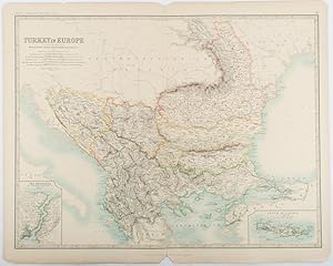
Turkey in Europe.with Rumania, Servia, Montenegro, Bulgaria &c.
Published by W. & A. K. Johnston, Edinburgh & London., 1893
Seller: Asia Bookroom ANZAAB/ILAB, Canberra, ACT, Australia
Association Member: ANZAAB ILAB
Seller rating 5 out of 5 stars
Engraved map with original outline hand-colour, 44 x 57.4 cm (map), two inset maps of the Bosphorus and Crete; central fold, corners chipped with loss, lower edge with several small marginal tears, neatly repaired, head and foot clipped at the fold with loss to the margin, but the map in very good condition. Detailed and finely engraved map also showing submarine telegraph lines and relief by hachures. Re-issue of the map first published in 1863 for "Keith Johnston's Royal Atlas of Modern Geography".
-

1844 Constantinople. Stambool
Seller: New World Cartographic, Chicago, IL, U.S.A.
Seller rating 4 out of 5 stars

Map
By: SDUKDate: 1844 (circa) LondonDimensions: 12.5 x 15.2 inches (31.8 x 38.6 cm)This lovely map of Constantinople, today's Istanbul, was published in 1844 by the Society for the Diffusion of Useful Knowledge also referred to as SDUK.The map shows the only city of the world to occupy territory on two continents, Europe and Asia, and it has long been called the meeting place of the east and west. The great waterway called the Bosphorus divides the two continents, flowing through what once were heavily wooded hills, joining the Black Sea with the Sea of Marmara. A natural moat known as the Golden Horn historically provided extra protection for large areas of the city along its shores.Due to its strategic location Istanbul is an ancient city, dating back countless millennia. Early Greek settlers founded a city which was known as Byzas (later called Byzantium), but more ancient peoples had settled the area long before the colony appeared. Due to its strategic location, the city has been of great importance to a number of empires, including the Eastern Roman Empire under Constantine the Great in 334 CE, who renamed it Constantinople (city of Constantine). From his founding of it as the capital of the Eastern Empire till 1453 when it was captured by the Ottoman Turks under Fatih Mehmet, it was one of the richest and most highly sophisticated cities in the world.The Ottomans had long tried to take the city, and when Mehmet the Conqueror finally succeeded, he tried to prevent his troops from destroying any of its countless architectural edifices. He had been impressed by the city's beauty, enamored from childhood.This map depicts the city as it appeared in the mid-19th century. The Ottoman Empire had been losing ground and strength, and the map concentrates primarily on extant historical sites, including some from Byzantium, and others of the Ottoman grand era, many of which had been converted from their prior Byzantine purposes. It also depicts Ottoman government buildings and ports.The SDUK was founded in 1828 by Henry Peter Brougham, an idealistic British nobleman. The aim of the society was to promote self-education and egalitarian sharing of knowledge by providing instruments of learning such as maps and various other publications. Despite being affiliated with London University and various major publishing houses, the Society ultimately failed to achieve its goal as the publications were too costly for the targeted middle to lower class echelons of British society. At the same time, its publications were not grand enough or fine enough to appeal to the aristocracy.Condition: This map is in A conditionwith outline hand coloring on clean paper with some light toning along the outer margins.Inventory #121971200 W. 35th Street #425 Chicago, IL 60609 | P: (312) 496 - 3622.
-

1636 Natolia, quae olim Asia Minor.
Seller: New World Cartographic, Chicago, IL, U.S.A.
Seller rating 4 out of 5 stars
Map
By:Jan JanssonDate: 1636 (circa) AmsterdamDimensions: 15 x 19.75 inches (38.1 x 50.2 cm)This map of Asia Minor by Jan Jansson was published in Amsterdam circa 1636.The territory covered extends from the Euphrates River to Thrace and the Aegean Islands, and from the Black Sea to the Mediterranean. Included in the map are the islands of Cyprus, Crete, Rhodes and cities such as Antioch, Troy, Constantinople and Smyrna (modern Izmir). The region has been home to countless civilizations throughout history from theancient Paleolithic Era, and some of the earliest known permanent settlements have been found in Anatollia. Empires dating to myriad eras have grown and declined in the region including ancient Greek, Roman, Byzantine and Ottoman, to name a few.Following the conquest of Constantinople by Fatih Mehmet in 1453, the Ottoman Empire increased its power and domain, reaching its apex under the rule of Suleyman the Magnificent in the sixteenth century, when the Empire was one of the most powerful states in the world.At its height the Ottoman Empire includedmost of southeastern Europe, as far as the gates of Vienna. It included present-day Hungary, the Balkans and Greeceand parts ofmodern-day Ukraine. Egypt and much of North Africa including Algeria were controlled by the Ottomans, as was the Arabian Peninsula. In the Middle East it included portions of regions now occupied bySyria, Iraq, Israel and Iran.The map appears to be based on the 1634 Blaeu map of the same territories. It was published almost two hundred years after the conquest of Byzantium, when the decline of the Ottoman Empire was already underway. Over the centuries the power of the Empire would increasingly decline until finally being replaced in the 20th century when Ataturk led the movement that resulted in the founding of the Turkish Republic.Embellishment includes a title cartouche with two cherubs, vignettes of ships at full sail on the sea, a battle at sea, and some friendly sea monsters. A distance scale showing German miles is in the lower right corner of the map.Condition: Map is inB condition with a fine impression, lovely color and full margins. Some offsetting is apparent as a result of the original coloring. A centerfold separation at the bottom has been repaired on the verso.Inventory #125951200 W. 35th Street #425 Chicago, IL 60609 | P: (312) 496 - 3622.
