Order Total (1 Item Items):
Shipping Destination:

Captain Dixon (55 results)
Skip to main search results
Search filters
Product Type
- All Product Types
- Books (53)
- Magazines & Periodicals (1)
- Comics (No further results match this refinement)
- Sheet Music (No further results match this refinement)
- Art, Prints & Posters (No further results match this refinement)
- Photographs (No further results match this refinement)
- Maps (1)
- Manuscripts & Paper Collectibles (No further results match this refinement)
Condition Learn more
- New (No further results match this refinement)
- As New, Fine or Near Fine (6)
- Very Good or Good (25)
- Fair or Poor (1)
- As Described (23)
Binding
Collectible Attributes
Language (3)
Free Shipping
Seller Location
Seller Rating
-
The Hardy Boys' Detective Handbook
Language: English
Published by Grosset & Dunlap, Garden City, NY, 1967
Hardcover. Condition: Very Good. No Jacket. The Hardy Boys' Detective Handbook by Franklin W. Dixon, with Captain D. A. Spina. Published by Grosset & Dunlap, circa 1967 (copyright 1959). Picture cover hardcover in Good condition, with edge wear and name written inside. This classic guide features real-life detective techniquesfrom fingerprinting to surveillanceand was created to bring authenticity to the famous Hardy Boys mysteries. A unique addition to any vintage children's or detective fiction collection.
-

The Bulletin Of The Military Historical Society May 2018 Volume 68 No.272 /. Howard Ripley "The Junior Division Of The Officers Training Corps 1908-1940" / Dixon Pickup "Teo 18th Century Cartouche Badges" / Alan Grosart "Reminders Of Inkerman And The Crimean War" / Denis A Darmanin "Presentation Of The Colours In Malta To His Majesty's Sicilian Regiment" / Anthony Skelsey "Shoulder Belt Plate Of Captain John Innes Bishopsgate Volunteers"
Published by The Military History Society, 2018
Magazine / Periodical
Soft cover. Condition: Very Good. 60 pages. Illustrated. Howard Ripley "The Junior Division Of The Officers Training Corps 1908-1940" / Dixon Pickup "Teo 18th Century Cartouche Badges" / Alan Grosart "Reminders Of Inkerman And The Crimean War" / Denis A Darmanin "Presentation Of The Colours In Malta To His Majesty's Sicilian Regiment" / Anthony Skelsey "Shoulder Belt Plate Of Captain John Innes Bishopsgate Volunteers" (SL#114).
-

The Hardy Boys' Detective Handbook
Published by Grosset & Dunlap ( 1959 ), New York, 1959
Seller: Thomas J. Joyce And Company, Chicago, IL, U.S.A.
Seller rating 2 out of 5 stars

Hardcover. Condition: Very Good. Revised edition. 8vo; [x] , 214 pages, pictorial cloth "This manual is written in story form, based on actual cases. Each chapter illustrates one or more of the latest techniques used by all progressive professional investigators - Foreword by Capt. Spina. Soon after this publication, Capt. Spina was indicted for criminality ( he was eventually acquitted). He was replaced in the next edition, Revised, by FBI agent William F. Flynn. This text is abridged from the original,
-
A MILLION MILES IN SAIL : Being the Story of a Sea Captain Charles C. Dixon
Published by Dodd, Mead &, 1933
Hard Cover. Condition: Very Good. Dust Jacket Condition: Good+. Captain C.C. Dixon (photos by) (illustrator). 263pp. Blue cloth hardback, DJ has small chips and tears along edges, Fourth Printing 1933, b&w photographs, Biography of sea Captain Charles C. Dixon, and of his experiences sailing around the world in windjammers.
-
The Hardy Boys Detective Handbook
Language: English
Published by Grosset & Dunlap, New York, New York, U.S.A., 1959
Seller: Gargoyle Books, IOBA, La Mesa, CA, U.S.A.
Association Member: IOBA
Seller rating 5 out of 5 stars

First Edition
Hardcover. Condition: Very Good. No Jacket. First Edition First Printing. Offers "authentic detective methods for solving mysteries" in an attempt to entice young people into the exciting world of police science. Written in consultation with Police Captain D. A. Spina, with nearly 100 drawings & diagrams throughout the 248 pages of text. The book is written like a Hardy Boys story, based on actual true crime cases. A FIRST EDITION, First Printing, from 1959, this is the Picture Cover Edition with the Hardy Boys on the front cover shaking the police captain's hand. Condition is VG: very clean, binding strong & straight, hinges secure. Pages creamy white & modestly tanned, unmarked save for noticeable foxing to all outside edges of text block. Some rubbing to extremities, heavier at spine tips & all corners. No DJ, as issued (the picture cover editions never came with one; please see our listing #024593 for a hardcover dust jacketed edition). Our photos depict the EXACT book you will receive, never "stock" images of books we don't actually have! Same Day Shipping on all orders received by 2 pm weekdays (Pacific time); later orders, weekends & holidays ship very next business day.
-
The Hardy Boys Detective Handbook
Language: English
Published by Grosset & Dunlap, New York, New York, U.S.A., 1959
Seller: Gargoyle Books, IOBA, La Mesa, CA, U.S.A.
Association Member: IOBA
Seller rating 5 out of 5 stars
First Edition
Hardcover. Condition: Good. Dust Jacket Condition: Fair. First Edition First Printing. Offers "authentic detective methods for solving mysteries" in an attempt to entice young people into the exciting world of police science. Written in consultation with Police Captain D. A. Spina, with nearly 100 drawings & diagrams throughout the 248 pages of text. The book is written like a Hardy Boys story, based on actual true crime cases. A FIRST EDITION, First Printing, from 1959, this hardcover has brown tweed cloth-covered boards with a darker brown image of the Hardys front & center, brown lettering to spine. Condition is VG-: generally quite clean, with light soil & dust dulling to outside page edges. Interior pages clean & unmarked save for former owner's name to ffep. Binding strong & straight, hinges secure. Minor rubbing to extremities. the unclipped DJ is just Fair, with old yellowing tape repairs & missing paper from both ends of spin/top outer edges of front cover; protected in nonreflective mylar to preserve what's left. We are also offering a later reissue of this title (#019755), as well as the First Picture Cover Edition in slightly better condition (#025196) Special: order 2 or more books in this series at the same time & take 15% off, 3 or more, 20% off, & only $1.00 extra shipping for each! Our photos depict the EXACT book you will receive, never "stock" images of books we don't actually have! Same Day Shipping on all orders received by 2 pm weekdays (Pacific time); later orders, weekends & holidays ship very next business day.
-

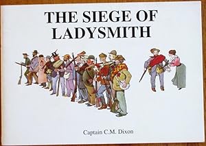
The Siege of Ladysmith
Published by Oribi Books, Pietermaritzburg, 1999
ISBN 10: 0958430020 ISBN 13: 9780958430029
Soft cover. Condition: As New. Centenary reprint of the original printed in 1900, reduced format. 24pp. 18 colour plates. (U-B**).
-
The Siege of Ladysmith
Published by Oribi Books, Pietermaritzburg, 1999
ISBN 10: 0958430020 ISBN 13: 9780958430029
Soft cover. Condition: As New. This work, first published in London in 1900 as 'The Leaguer of Ladysmith', was republished in reduced format to mark the centenary of the famous seige. Three pages of textual descriptions to the eighteen colour illustrations following. "In publishing the following sketches done in the idle hours during the siege, I beg to tender my sincerest apologies to all those who appear in them, and to assure them that they were done in a friendly spirit, and a souvenir of a somewhat trying four months spent together in a beleagured town, borne cheerfully by soldiers and civilians alike for the sake of the Empire." - author. (RA-AT-IW-CtBy).
-
The Leaguer of Ladysmith Nov 2nd 1899 to Feb 28th 1900
Language: English
Published by Eyre & Spottiswode, London, 1900
Seller: Balfour Books, Sidmouth, DEVON, United Kingdom
Seller rating 4 out of 5 stars

US$ 68.15
US$ 39.24 shipping
Ships from United Kingdom to U.S.A.Quantity: 1 available
Add to basketQuarter Bound. Condition: Fair. No Jacket. First British Edition. Copy quarter bound with illustrated paper on boards. Outers a little scuffed. Corners bumped. Page 9 has tear along inside edge. Some light internal cracks. Light offsetting to rear end papers. Clean text and colour illustrations.
-
Narrative of Travels and Discoveries in Northern and Central Africa, in the Years 1822, 1823, and 1824, extending Across the Great Desert to the Tenth Degree of Northern Latitude, and from Kouka in Bornou, to Sackatoo, the Capital of the Felath Empire. Volume II (2)
Published by John Murray, Albemarle-Street., London, 1828
Hardcover. Condition: Good. . . . . Third edition. 8vo, hardcover, no dj. Volume 2. Bound in later black cloth, paper spine label reading simply "Africa". Good condition. Prev. owner's name at corner of title pg. Front & rear hinges cracked w/ front board loosening, first 4 signatures (bound groups of pgs) up to pg. 62 detached, laid in; however interior binding firm. Contents lightly & uniformly toned with just the slightest, very occasional spot of foxing, otherwise clean, unmarked; exterior quite clean, corners & spine ends not bumped. 467 pp., illus., frontispiece, 2 fold-out maps.
-
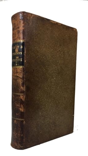
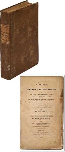
Narrative of Travels and Discoveries in Northern and Central Africa, in the Years 1822, 1823, and 1824 . Extending across the Great Desert to the Tenth Degree of Northern Latitude, and from Kouka in Bornou, to Sackatoo, the Capital of the Felatah Empire
Published by Cummings, Hilliard; Philadelphia: Carey and Lea, Boston, 1826
Seller: McBlain Books, ABAA, Hamden, CT, U.S.A.
Association Member: ABAA ILAB SNEAB
Seller rating 5 out of 5 stars
Hardcover. Condition: Good. 1st Amer. ed. 3 maps (2 folding), folding plate (bound as two plates in this copy), lxiv, 255, 104, 112p. Contemporary leather. 23 cm. Backstrip and cover edges heavily scuffed. First folding map wrinkled but complete. Lower corner of three text leaves torn off (substantial loss of text on one leaf). Archival tape repairs on another text leaf. Bookplates (one from an old Philadelphia institution).
-
A VOYAGE ROUND THE WORLD; BUT MORE PARTICULARLY TO THE NORTH-WEST COAST OF AMERICA: PERFORMED IN 1785, 1786, 1787, AND 1788, IN THE KING GEORGE AND QUEEN CHARLOTTE, CAPTAINS PORTLOCK AND DIXON [SECOND EDITION]
Language: English
Published by Geo. Goulding, Ldn, 1789
Hardcover. Condition: Near Fine. 2nd Edition. 360 pp. & 47 pp. Appendix+ Lge FoldOut Map at Front & 21 Other FoldOut Maps & Illus Plts (Some Folding), Bound in Blk Three-Quarter Leather & Blk Bds, Gilt title & Ruled Spine (Bright), 4to (8.75 x 11 Inches), occasional light foxing but Illustrations & Maps are Very nice & sharp, small owner namestamp ff e.p. & bookplate, Contains Half-title & errata, Near Fine, 2nd ed (Stated on Title page) (Howes #D365 "aa" rating) (Maps & Illus Plts are in Nice Condition).
-
Narrative of Travels and Discoveries in Northern and Central Africa in the Years 1822, 1823, and 1824
Published by Cummings, Hilliard & Carey and Lea, Boston, 1826
Seller: Argosy Book Store, ABAA, ILAB, New York, NY, U.S.A.
Seller rating 5 out of 5 stars
First Edition
hardcover. Condition: very good(-). First. Illustrations including 1 folding plate & 1 folding map (2 maps missing). 8vo, rebound in brown cloth with black leather spine label; library stamp on the title and last page; foxing throughout. Boston: Cummings, Hilliard and Carey & Lea, 1826. First American Edition.
-
THE LEAGUER OF LADYSMITH
Published by London, Eyre and Spottiswoode 1900, 1900
Seller: Chaucer Bookshop ABA ILAB, Canterbury, United Kingdom
Seller rating 5 out of 5 stars
First Edition
US$ 94.05
US$ 33.08 shipping
Ships from United Kingdom to U.S.A.Quantity: 1 available
Add to basketFIRST EDITION Landscape 4to. hardback in quarter green cloth with illustrated paper-covered, bevelled edged boards. All edges red. Decorative endpapers. Pages unnumbered. Features 18 full-page colour lithographed illustrations with captions to facing page. A clean copy with no markings or inscriptions. Occasional light foxing. Light tanning and soiling to endpapers. Covers rather damp-stained and soiled with rubbing to edges. A GOOD+ COPY. (Shelf 5/130) PLEASE NOTE: Buyer is responsible for any additional duties, taxes, or fees required by recipient's country.** Pictures available upon request.** Visit our homepage for our shop opening hours. Over 20,000 books in stock - come and browse. PayPal, credit and most debit cards welcome. Books posted worldwide. For any queries please contact us direct.
-
The Leaguer of Ladysmith
Published by Eyre & Spottiswoode, London, 1900
Seller: Rooke Books PBFA, Bath, United Kingdom
Association Member: PBFA
Seller rating 5 out of 5 stars
First Edition
US$ 115.85
US$ 26.45 shipping
Ships from United Kingdom to U.S.A.Quantity: 1 available
Add to basketCloth. Condition: Very Good. Captain C. M. Dixon (illustrator). First edition. A first edition of this collection of humorous sketches chronicling the Siege of Ladysmith during the Second Boer War. First edition. Illustrated with eighteen full-page colour scenes. Collated complete. A collection of humorous sketches following the 16th Lancers during the Siege of Ladysmith in the Second Boer War. Being a collection of caricatures and observations, this work captures the experiences of soldiers and civilians in the besieged town from November 1899 to February 1900, offering a record of this challenging period in the conflict. Written and illustrated by Major Clive MacDonnell Dixon, an English illustrator and soldier best known for this work. In the original quarter cloth binding with pictorial paper covered boards. Externally, sound with light rubbing and minor chipping to the extremities. Sunning to the board edges with the odd small mark. Internally, firmly bound. Pages are very bright with the odd small spot or handling mark. Light age toning to the endpapers. Very Good. book.
-
The Leaguer of Ladysmith. November 2nd, 1899, to February 28th, 1900
Published by Eyre & Spottiswoode, London, 1900
Seller: Karol Krysik Books ABAC/ILAB, IOBA, PBFA, Toronto, ON, Canada
Association Member: ABAC ILAB IOBA PBFA
Seller rating 5 out of 5 stars
First Edition
Hardcover. Condition: Good. First Edition. Tall 8vo, oblong. [235 x 300 mm]. Pictorial paper boards, beveled edges, with green cloth spine strip. Floral patterned endpapers, with previous owner's bookplate to the front endpaper. The boards a little darkened and scuffed, with a few very faint and small stains, the corners and edges with light wear, upper fore-edge corners with a harder bump. The text block is a little shaky but still tight and functional. Complete with 18 plates in colour by the author, Captain Dixon of the 16th Lancers, illustrating the siege of Ladysmith with accompanying text. Plates throughout are clean, overall a good clean copy.
-
The Leaguer of Ladysmith; Nov. 2nd 1899 to Feb. 28th 1900
Published by Eyre and Spottiswoode, London, 1900
Seller: White Fox Rare Books and Antiques, ABAA/ILAB, New York, NY, U.S.A.
Association Member: ABAA ESA ILAB PBFA
Seller rating 3 out of 5 stars

First Edition
Paper on Boards. Condition: Very Good. First Edition. Oblong, 12 by 9.25 inches, 30 by 23 cm. Dixon, member of the 16th Lancers during the Boer War, did these 18 humorous sketches during the siege of Ladysmith. With color illustration and caption on recto, a brief textual explanation or commnetary on verso. Quite an unusual production. Paper on boards with considerable wear and soiling. Generally clean within.
-
NARRATIVE OF TRAVELS & DISCOVERIES IN NORTHERN & CENTRAL AFRICA : IN THE YEARS 1822, 1823 & 1824. EXTENDING ACROSS THE GREAT DESERT TO THE TENTH DEGREE OF NORTHERN LATITUDE & FROM KOUKA IN BORNOU TO SACKATOO, THE CAPITAL OF THE FELATAH EMPIRE.
Published by CUMMINGS, HILLIARD & CO, BOSTON, 1826
Seller: Elder Books, Ross on Wye, Herefordshire, United Kingdom
Seller rating 5 out of 5 stars
First Edition
US$ 184.00
US$ 15.81 shipping
Ships from United Kingdom to U.S.A.Quantity: 1 available
Add to basketHardcover. Condition: Very Good. No Jacket. 1st Edition. FIRST AMERICAN EDITION. HARDBACK BOUND IN A 19TH CENTURY FULL LEATHER BINDING, COMPLETE COPY WITH 3 MAPS INCLUDING FRONTIS MAP OF WHICH TWO ARE FOLDING, TWO FULL PAGE PLATES WITH ONE FOLDING. BOOK MEASURES APPROX 9 x 6 INCHES WITH 64 + 255 + 104 PAGES + 122 PAGE APPENDIX. MINOR AGE REALATED RUBBING & BUMPS TO COVER, SMALL SPRINGFIELD LIBRARY COMPANY PLATE TO INNER FRONT BOARD, FRONTIS MAP IS WORN & HEAVILY CREASED WITH SOME CLOSED TEARS & OLD REPAIRS [SEE IMAGE] CHIPS TO MARGIN OF TITLE PAGE, OCCASIONAL BROWNING, MARKS OR FOXING TO PAGES, OCCASIONAL CREASE TO PAGES. EXTERNALLY THE BOOK IS VERY GOOD WITH BOARDS WELL ATTACHED, INTERNALLY SOME FAULTS & IN GOOD - VERY GOOD CONDITION. EXTRA POSTAGE MAY APPLY FOR OVERSEAS ORDERS. ALL BOOKS ARE POSTED IN A STURDY BOOK BOX.
-
Narrative of Travels and Discoveries in Northern and Central Africa, in the Years 1822,1823, and 1824
Published by Cummings, Hilliard & Co, Boston, 1826
Hardcover. Condition: Very Good. First American edition. Bound with the Narrative of Captain Clapperton's Journey from Kouka to Sackatoo and an appendix; "Translations from the Arabic, of various letters and documents, brought from Bornou and Soudan by Major Denham and Captain Clapperton". With three maps (two folding, including the large map of Northern and Central Africa. Octavo contemporary full calf with a black morocco spine label. Front outer hinge cracked, but sound. Light foxing to preliminaries, plates and text block edges, else a clean, bright copy.
-
Narrative Of Travels And Discoveries In Northern And Central Africa, In The Years 1822, 1823, And 1824,.extending Across The Great Desert To The Tenth Degree Of Northern Latitude, And From Kouka In Bornou, To Sackatoo, The Capital Of The Felatah Empire.
Published by John Murray, London, 1826
Seller: poor man's rare books (mrbooks) IOBA NJB, Vineland, NJ, U.S.A.
Association Member: IOBA
Seller rating 4 out of 5 stars
First Edition
Leather. Condition: Very Good with no dust jacket. First Edition. 4to 11.5"; 2 volumes in one, 4to (268 x 211 mm). Engraved frontispiece, 32 engraved plates (one hand-colored) , 11 in-text woodcut illustrations (2 plans) , 6 engraved maps (5 full-page, one folding). (Some occasional spotting or offsetting. ) Modern half calf over green cloth gilt, smooth spine gilt, 3 black morocco lettering-pieces gilt, edges faintly marbled, marbled endsheets (chipping to lettering-piece, some small scuffs). Provenance: W. Conway (signature). FIRST EDITION of important explorations in Africa. The first volume is an official expedition to discover the course of the Niger from the starting point of Tripoli, rather than West Africa. Clapperton and Oudney were the original members of the party, to which Denham was added, but whose "arrogance, malice, and contempt for his colleagues from the start soured relations between them" (DNB). This famous "Bornu Mission" provided the earliest European report on the Central Sudan and Northern Nigeria. From the Mediterranean they reached Murzuk and Bornu on the west of Lake Chad, and eventually Sokota. Failing to ascertain the source and termination of the Niger, Denham explored Lake Chad, and Oudney and Clapperton journeyed westward to the Niger. Clapperton continued alone after Oudney's death at Murmur, reaching Sokota and rejoining Denham at Kuka. On the second expedition Clapperton had been promoted to Commander and was sent back to Sokota to open up trade with the west coast. He died in 1827, having crossed Yoruba Country and the Niger. He was survived by his "servant" Richard Lander who carried on alone. Lander brought Clapperton's journals back to England and wrote the "Life of Clapperton" which appears in this second work. Hilmy, p. 172 (Narrative). Property from the Estate of Professor Ethan D. Alyea, Jr. , Bloomington, Indiana. Modern calf spine backing.
-
Narrative of Travels and Discoveries in Northern and Central Africa, in the Years 1822, 1823, and 1824.
Published by John Murray, London, 1826
Seller: Jeffrey H. Marks, Rare Books, ABAA, Rochester, NY, U.S.A.
Seller rating 5 out of 5 stars
First Edition
Extending across the Great Desert to the Tenth Degree of Northern Latitude, and from Kouka in Bornou, to Sackatoo, the Capital of the Fellatah Empire. xlviii, 335 + 269 [2] pp. One color plate; folding map; 36 engraved plates. 4to, modern full calf; gilt-lettered spine labels. First edition. There is a light tidemark affecting all of the plates and some of the text. Tight and sound.
-
Narrative of Travels and Discoveries in Northern and Central Africa in the years 1822, 1823, and 1824, by Major Denham, Captain Clapperton, and the late Dr. Oudney
Published by Cummings, Hilliard & Co, Boston, 1826
Seller: Between the Covers-Rare Books, Inc. ABAA, Gloucester City, NJ, U.S.A.
Association Member: ABAA ESA ILAB IOBA
Seller rating 5 out of 5 stars
First Edition
Hardcover. Condition: Very Good. First American edition. 255;104;112pp., 3 maps (two folding), one folded plate. Original quarter cloth and papercovered boards with printed paper spine label. Rebacked, slight wear to the label, old library label contemporary with the book on the front pastedown, owner's signature dated 1842, small tears on the title page, stain and old paper repair on a couple of pages, still a pleasing near very good copy.
-
A Voyage Around The World But More Particularly To The North - West Coast of America: Performed In 1785, 1786, 1787, and 1788 In the King George And Queen Charlotte Captains Portlock And Dixon
Published by Geo. Goulding [George], London, 1789
Seller: Long Brothers Fine & Rare Books, ABAA, Seattle, WA, U.S.A.
Seller rating 3 out of 5 stars
Full Leather. Condition: Very Good. Second Edition. 4to. Pp. xxix, [1pp. errata], 360 + 45pp. second appendix. Lacks half-title. Frontis. folding map plus 21 engraved charts and plates (some folding). Gilt decorated spine with red leather title label lettered in gilt, letters "M . C." in gilt at foot of spine. Boards reinforced at spine, one re-attached, minor worm holes to front board and upper margins a few pages, bookplate, owner names, scuffs and rubbing to spine. All maps and plates are clean and near-fine. A handsome, presentable copy. From the noted maritime collection formed by Frederick Ellis, with his Shaw Island bookplate. In 1785 Dixon and fellow trader Nathaniel Portlock set sail with Portlock in command of the King George, with a crew of 59. Dixon commanded the Queen Charlotte, with a crew of 33. Collects 49 descriptive letters by William Beresford, Dixon's cargo officer. An early Northwest Coast and maritime fur trade narrative concerning the first non-Native to encounter the Queen Charlotte Islands and the key figure in the Dixon-Meares controversy that nearly led to a world war.
-
Narrative of Travels and Discoveries in Northern and Central Africa, in the years 1822, 1823, and 1824. Extending across the great desert to the tenth degree of northern latitude, and from Kouka in Bornou, to Sackatoo, the capital of the Fellatah empire. With an Appendix.
Published by London John Murray, 1826
Seller: Shapero Rare Books, London, United Kingdom
Association Member: ABA ILAB PBFA
Seller rating 5 out of 5 stars
First Edition Signed
US$ 4,770.44
US$ 19.85 shipping
Ships from United Kingdom to U.S.A.Quantity: 1 available
Add to basketFirst edition; 4to (28 x 23.5 cm); presentation inscription to title, engraved frontispiece, 36 engraved plates, 1 of which hand-coloured, 6 engraved vignettes, all by Finden after the authors, large engraved folding map at rear, bookplate to paste-down, a little offsetting from plates; contemporary full green calf with joints professionally repaired, gilt rules to board borders, edges, and turn-ins, spine in six gilt compartments with gilt morocco lettering piece, all edges gilt, a touch of toning to boards, a very good copy; xlviii, 335, [iv], 269, [ii]pp. Inscribed presentation copy of the most important African travel narrative at the time of its publication, with superb provenance. Presentation copies of this important work are rare with only around twenty thought to exist. Inscribed on the title-page: 'John G. Children Esq FRS / British Museum / with the author's best / wishes / D. Denham', and with the bookplate of Halstead Place, Children's home. John George Children (1777-1852) was a British natural historian who was Keeper of the Zoology Department of the British Museum from 1837 to 1840. In 1833 he was founding president of what became the Royal Entomological Society of London. He was however much more comfortable with mineralogy than zoology: he constructed a large galvanic cell with Sir Humphry Davy in 1813, conducting several experiments, and invented a method to extract silver from ore without the need for mercury in 1824. The official expedition to discover the course of the Niger from the starting point of Tripoli, rather than West Africa. Denham and Clapperton were part of the expedition led by the Scottish doctor Walter Oudney to open relations with the Fulani kingdom, whose legendary trading centre was Kano, in order to discover the source of the Niger, which was widely believed to flow into Lake Chad. Having crossed the Sahara and found no rivers entering Lake Chad, the party divided with Denham exploring the Shari River and Oudney and Clapperton (who shared a mutual loathing of Denham) proceeding to Kano. Oudney died enroute but Clapperton was received by the ruler of Kano, Mohammed Bello who, having first supplied an accurate map of the course of the Niger, later backtracked and supplied a different, more misleading, map when he realised the dangers of opening up his kingdom to foreigners. Clapperton rejoined Denham at Lake Chad and back across the Sahara. Gay 337; Hilmy I, 172; Lowndes I, 629; cf. Playfair, Tripoli, 154 (3rd ed.).
-
A Voyage Round The World; but more particularly to the North-West Coast of America; performed in 1785, 1786, 1787, and 1788, in the King George and Queen Charlotte, Captains Portlock and Dixon. Dedicated, by Permission, to Sir Joseph Banks, Bart
Published by George Goulding, London, 1789
Seller: Hordern House Rare Books, Potts Point, NSW, Australia
Association Member: ANZAAB ILAB
Seller rating 4 out of 5 stars
First Edition Signed
Quarto, with 23 engraved maps and plates, including nine folding and seven of natural history subjects plates, with the half-title; a fine uncut copy with generous margins in the original boards, preserved in a bookform box. First edition: a remarkable copy in fine original condition. Dixon's account of his voyage in the Queen Charlotte is dedicated to Joseph Banks, and is a companion to Portlock's account of the same voyage; both men had voyaged with Cook, Dixon as armourer aboard Discovery. They sailed together as far as Prince William Sound, Dixon then following the coast making a series of landfalls. He discovered and closely observed Queen Charlotte's Island, and entered Dixon's Straits, before ultimately arriving at Nootka where he joined both Portlock and Meares. The book is "an excellent authority for the early days of fur trading on the northwest coast." (Streeter). "Dixon's voyage is important as a supplement to Captain Cook and for its contributions to the natural history of the Pacific Northwest. The work previously done by Cook along the northwest coast of America was mapped more definitely by Dixon, who discovered the Queen Charlotte Islands, Port Mulgrave, Norfolk Bay, and Dixon Entrance and Archipelago while continuing down the coast and trading with the Indians" (Hill). The Queen Charlotte made visits to Hawaii in 1786 and 1787, trading at Oahu and Kauai. The book also includes a long account of commercial transactions at Canton. Though often catalogued as the work of William Beresford, whose letters to a friend signed W.B. form the basis of the work, Dixon added substantially to the text and edited the whole. . Provenance: Original bookseller's ticket of Thomas Hookham, bookseller and publisher with premises on the corner of New Bond Street and Bruton Street, London.
-
A VOYAGE ROUND THE WORLD; BUT MORE PARTICULARLY TO THE NORTH-WEST COAST OF AMERICA: PERFORMED IN 1785, 1786, 1787, AND 1788, IN THE KING GEORGE AND QUEEN CHARLOTTE, CAPTAINS PORTLOCK AND DIXON
Published by Geo. Goulding, Haydn't Head, No. 6, James Street, Covent Garden, London, 1789
Seller: Aardvark Rare Books, EUGENE, OR, U.S.A.
Seller rating 5 out of 5 stars
First Edition
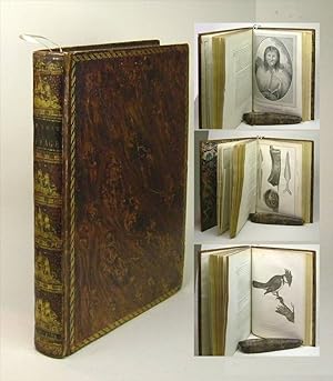
Leather-bound. Condition: Very Good. First Edition. Quarto. Full speckled leather bordered by gilt roll. Past conservation evident -- rebacked with original spine laid down.Lacks half-title. Only the frontis map (A Chart of the North West Coast of America") is in facsimile; all others original. 21 folding charts and full page illustrations, including the famous 'Young Woman of Queen Charlotte's Isles'. Errata page and (its verso) Instructions For The Binder, present. Two ships were outfitted and sent out to gather furs from the Northwest and establish a market. Dixon had served under Captain Cook on his third voyage and Dixon's maps improved upon Cook's. Dixon's ship was the Queen Charlotte and the other ship, The King George sailed independently under Captain Nathaniel Porlock. Dixon discovered Queen Charlotte Island, Port Mulgrave, Norfolk Bay, and Dixon Entrance and Archipelago while continuing down the coast and trading with the Indians. The accounts of this expedition relate largely to the geography, ethnology and natural history of the American coast." "A series of letters signed 'W.B.' {i.e. William Beresford] supercargo* on board the Queen Charlotte to his friend Hamlen; edited, with introduction and 2 appendices, by George Dixon. Appendix Number 1: National History (pp. 353-360); Appendix No. II: Tables of the route of the King George and Queen Charlotte: 47 pp. at end. "Dixon's voyage is important as a supplement to Captain Cook and for its contributions to the natural history of the Pacific Northwest. Captain Dixon's itinerary also included: the Isle of Guernsey, Cape Verde Islands, Falkland Islands, Cape Horn, Sandwich Islands (3 times), Cook's River, King George's Sound, Prince William Sound, Macao, Canton, and St. Helena. (Hill 23, 352 (Vol. II); Forbes 161; Howgego D58. An Attractive, Clean Copy -- and affordable! *a representative of the ship's owner on board a merchant ship, responsible for overseeing the cargo and its sale.".
-
A voyage round the world; but more particularly to the north-west coast of America: performed in 1785, 1786, 1787, and 1788, in the King George and Queen Charlotte, Captains Portlock and Dixon. Dedicated, by permission, to Sir Joseph Banks, Bart
Published by George Goulding, London, 1789
First Edition
Hardcover. Condition: Very good. First. THE FIRST COMMERCIAL VOYAGE TO THE PACIFIC NORTHWEST -- THE BAILLIE-HADDINGTON-BENTTINEN COPY. First edition. London: George Goulding, 1789. Quarto (11" x 8 15/16", 280mm x 211mm). [Full collation available.] With 22 engravings: 15 plates of which 1 is folding, 5 folding maps and 2 folding coastal views. Bound in contemporary polished calf. On the spine, five raised bands. Author and title gilt to red morocco in the second panel. Blind dashed roll to the edges of the boards. All edges of the text-block sprinkled red. Rubbed at the extremities, with small patches of wear. Strengthening to the upper hinges and to the head. Preliminaries and end-matter tanned from the turn-in. Mild sporadic foxing. Tear and creasing to the map of the Norfolk Sound. Repaired tears to a handful of plates. Armorial bookplate of "The Hon.ble George Baillie Esq.r one of the Lords of the Treasury" dated 1724 (see below) to the front paste-down. Ink manuscript press-mark ("D . 2 . 3") to the verso of the front free end-paper. Ownership signature of "G. Baillie" to the title-page. The King George's Sound Company (a k a Richard Cadman Etches and Co.) was established in 1785 to oversee British commercial activity (particularly fur trading) with the Pacific Northwest, which was mapped and described by Captain Cook. George Dixon (1748-1795) and Nathaniel Portlock (1748-1817) were on Cook's third and final voyage, and so before commanding their own ships had practical experience of the Pacific and of the American Northwest. Portlock commanded the King George and Dixon the Queen Charlotte, setting out west in early 1785, round Cape Horn (the southern tip of South America) and then up to the Sandwich Islands (Hawaii) and finally up toward Alaska, before finally sailing back to England via Macao and the Cape of Good Hope in 1787, arriving in early 1788. Dixon's Voyage -- Portlock published his own account with a nearly identical title in the same year --is therefore the first account of the Pacific Northwest through a practical commercial lens, refining and fleshing out the account of Cook -- including, interestingly, a new account of the death of Cook as told by a Hawaiian -- for curious speculators back in Britain. The form of the volume is epistolary, and the letters are signed by W.B. or William Beresford. In addition to maps and views, there are several natural history plates (birds, marine life, scenes) as well as some interesting anthropological portraits in the style of Cook. The 1724 armorial bookplate at the front paste-down is that of George Baillie of Jerviswood (1664-1738), a Scottish politician who was a member of Parliament in Edinburgh (till its dissolution in 1707) and then in Westminster till 1734. He rose at court, being named Commissioner for Trade and Plantations by Queen Anne and then a Lord of the Admiralty by George I. The bookplate dates to his period as a Lord of the Treasury, a position he held 1717-1725. He cannot, of course, have owned the book as he died before its publication; the plate was doubtless applied by George Baillie(-Hamilton; 1721-1797), grandson to the originator of the bookplate and grandfather of the 10th Earl of Haddington. The Earls of Haddington (the younger George Baillie's grandson became the 10th Earl in 1858) have long been prominent in the politics and military of Scotland and Britain generally. The present volume was lot 71 in the sale of books from that library at Sotheby's London (12 November 2019). From the collection of Theodore "Ted" Benttinen (1948-2023), an MIT-educated oceanographer and explorer who went to both poles on research missions. Benttinen amassed a formidable collection of books of exploration, particularly strong in Pacific voyages as well as in polar accounts. The present volume was lot 89 in the Sotheby's New York 9 December 2024 sale of his library. ESTC T82170; Hill, Pacific Voyages 117; Howes D 365; Sabin 20364; Streeter sale VI.3484.
-
A Voyage Round the World; but More Particularly to the North-West Coast of America: Performed in 1785, 1786, 1787, and 1788, in the King George and Queen Charlotte, Captains Portlock and Dixon
Published by Published by George Goulding, Haydn's Head, No. 6, James Street, Covent Garden, London, 1789
Seller: Donald A. Heald Rare Books (ABAA), New York, NY, U.S.A.
Seller rating 5 out of 5 stars
First Edition
Large 4to. (11 1/2 x 9 inches). First edition. [a]-d4 A-Yy4 A-F4. [i]-xxix [3] [1]-360 [1]-47 [1]. 440 pp. 22 engraved maps, charts, plates, and views after G. Dixon, J. Hogan, William Lewin, Collings, and others, by Barlow, P. Mazell, J. Reid, E. F. Burney, and others, including 7 hand-colored natural history plates; 7 folding maps and views; 1 plate of sheet music; 1 folding plate; and 6 others. Half-title, Title, Dedication to Joseph Banks, Introduction, Contents, Errata, Binder directions, Letters I-XLIX, Appendices I-II, Tables I-XIII. Contemporary full calf rebacked, spine lettered and ruled gilt, neat repairs to corners A Deluxe hand-coloured first edition on large and thick paper of this important account of an early exploratory voyage to Hawaii and the Pacific Northwest. "An excellent authority for the early days of fur trading on the northwest coast." [Streeter] "Dixon's voyage is important as a supplement to Captain Cook and for its contribution to the natural history of the Pacific Northwest. The purpose of the expedition was to establish a trade in furs in North America, but the itinerary also includes the Isle of Guernsey, Cape Verde Islands, Falkland Islands, Cape Horn, Sandwich Islands (three times), Cook's River, King George's Sound, Prince William Sound, Macao, Canton, and St. Helena. The voyage was sent out by the King George's Sound Company, which owned both the King George, commanded by expedition leader Captain Nathaniel Portlock, as well as the Queen Charlotte. The two ships sailed independently of each other for part of the expedition. Both Portlock and Dixon had served on Cook's third voyage. The work previously done by Cook along the northwest coast of America was mapped more definitely by Dixon, who discovered the Queen Charlotte Islands, Port Mulgrave, Norfolk Bay, and Dixon Entrance and Archipelago, while continuing down the coast and trading with the Indians. The accounts of this expedition relate largely to the geography, ethnology, and natural history of the American coast from Nootka Sound northward." [Hill] The bulk of the text is in the form of a series of forty-nine letters from Beresford, who was aboard the Queen Charlotte, but is supplemented by tables and observations from Dixon himself, who also edited and corrected the whole work. Dixon was directly responsible for a number of the maps, charts, and plates which are engraved after his original drawings. The regular issue, published at 1£.1s, contains no hand-colored plates and is less than ten and a half inches in height; but a small number of copies were printed on larger, thicker paper with the natural history plates hand-colored, as in the exceptional present copy. Bell B204. Buck 35. ESTC T82170. Forbes 161. Hill 118 (2004). Howes D365. JCB II, 3270. Judd 53. Lada-Mocarski 43. Lande 960. Nissen ZBI 1120. Pilling, Proof-Sheets 1042. Reese, Best of the West 16. Sabin 20364, 64390. Smith 779. Story, p. 217. Strathern and Edwards 37. Streeter Sale 3484. TPL 593. Wagner I, 207; II, 732-735. Wickersham 6574.
-
A Voyage Round The World; but more particularly to the North-West Coast of America; performed in 1785, 1786, 1787, and 1788, in the King George and Queen Charlotte, Captains Portlock and Dixon. Dedicated, by Permission, to Sir Joseph Banks, Bart. Translated into English by E. Stone, F.R.S.
Published by Geo. Goulding, London, 1789
Seller: Brainerd Phillipson Rare Books, Holliston, MA, U.S.A.
Association Member: SNEAB
Seller rating 5 out of 5 stars
First Edition
Hardcover. First Edition. A quarto bound in original contemporary leather; With gilt florettes and thistle and shell designs bordering the front and rear boards. With faded gilt decorations on the spine, but with a bright red moroccan lable stamped in gilt. The leather is speckled in design and has a vintage patina.The boards are heavily edge-worn and abraded at the corners and have been re-glued. With marvelous folding plates with a large folding map at the beginning of the volume.Quarto, title, v - xxix, [1] errata, directions to Binder. 358pp 47pp appendix [1]. large engraved folding map, 6 folding charts and 15 plates, views, natural history subjects and music. [Portlock and Dixon set out to establish a trade in furs on the northwest coast of America on behalf of the King George's Sound Company, but their major accomplishment was the more detailed exploration and mapping of the coast and improving of Cook's charts of the region. Both had previously sailed with Cook on the third voyage. The two ships separated and sailed independently for a major part of the expedition: Portlock explored north along the Alaskan coast, Dixon proceeded south to Nootka Sound and discovered Queen Charlotte Island, Port Mulgrave, Norfolk Bay, as well as Dixon Entrance and Archipelago. The account is largely composed of forty-nine letters written by William Beresford, who acted as supercargo on board the Queen Charlotte; Dixon edited the text, provided the maps and added an introduction detailing previous voyages to the North-West coast, and two appendices, on natural history, and navigational details.]Sabin 64390.
-
VOYAGE ROUND THE WORLD: but more Particularly to the North-West Coast of America :Performed in 1785, 1786, 1787, and 1788, in The King George and Queen Charlotte, Captains Portlock and Dixon. Dedicated, by Permission, to Sir Joseph
Published by Geo. Goulding, London, 1789
Seller: TBCL The Book Collector's Library, Montreal, QC, Canada
Association Member: IOBA
Seller rating 5 out of 5 stars
First Edition Signed
Hardcover. 1st Edition. 1st Edition. Hardcover. Dixon, Captain George. VOYAGE ROUND THE WORLD: but more Particularly to the North-West Coast of America: Performed in 1785, 1786, 1787, and 1788, in The King George and Queen Charlotte, Captains Portlock: London Geo. Goulding, 1789. Excellent example. First Edition. Tall copy, 11" 1/8. Quarto pp.xxix, [1]blank, [1 leaf]errata & directions to binder, 360, 47. with half-title. 5 folding engraved maps & bound with 17 engraved plates, 3 of which are folding & 1 of which [Cape St. James p.214] was never originally bound in & now supplied in excellent facsimile. Large [24.5 x 35 inches] folding frontispiece chart. Half-title page present. Errata on recto and instructions to binder on verso of unpaged leaf following introduction. Account of the voyage of the "Queen Charlotte" in a 4-year expedition from England to the Sandwich Islands (Hawaii) and China via the Pacific Northwest. Contemporary calf sumptuously bound with an ornately decorated & tooled spine with 5 ship devices in compartments, black leather labels, tree calf boards with braided rope gilt border. Beautiful marbled endpapers. An excellent example showing minimal use & wear at the tips. "Portlock and Dixon, who had been with Captain Cook, made this expedition to the northwest coast of America to collect furs for a group of London merchants. Portlock, the Commander-in-Chief, was on the King George. The expedition left Gravesend August 29, 1785, and arrived at the Sandwich Islands via Cape Horn in May 1786. The mouth of Cook's River in Alaska was reached July 18 and the rest of the summer was spent in sailing down the Coast as far as Nootka Sound. The expedition wintered in the Sandwich Islands and in 1788 proceeded to Prince William Sound where they met Captain Meares. The vessels parted company in May, with Portlock exploring the Alaskan coast and Dixon sailing again for Nootka Sound, where he named 'Dixon's Entrance' and the 'Queen Charlotte Islands.' The furs were sold in Canton, China, and both ships, after a most successful voyage, arrived back in England by way of Cape Good Hope in the summer of 1788. "The account, except for the introduction by Dixon and the two appendices, is in a series of forty-nine letters signed 'W.B.' The writer was William Beresford, a Quaker who, says Dixon in his introduction, 'has been totally unused to literary pursuits, and equally so to a sea-faring life.' Notwithstanding this, his letters, corrected by Dixon on nautical points, make good reading and the book is an excellent authority for the early days of fur trading on the northwest coast" (Streeter). Dixon also contributed the valuable maps. The work is sometimes confused with Portlock's account of the voyage, published the same year under the same title. Bell B204. Howes D-365. JCB II 3270. Sabin 64390 [vide PORTLOCK]. JCB II 3270. Smith 779. Strathern & Edwards 37. TPL 593. Hill p. 23. Lada-Mocarski 43. Lande 960. Streeter VI 3484. Story p. 217. A superior, beautiful copy. Fine entry slipcase supplied.