

Order Total (1 Item Items):
Shipping Destination:

Commander Denham (6 results)
Skip to main search results
Search filters
Product Type
- All Product Types
- Books (6)
- Magazines & Periodicals (No further results match this refinement)
- Comics (No further results match this refinement)
- Sheet Music (No further results match this refinement)
- Art, Prints & Posters (No further results match this refinement)
- Photographs (No further results match this refinement)
- Maps (No further results match this refinement)
- Manuscripts & Paper Collectibles (No further results match this refinement)
Condition Learn more
- New (No further results match this refinement)
- As New, Fine or Near Fine (No further results match this refinement)
- Very Good or Good (4)
- Fair or Poor (No further results match this refinement)
- As Described (2)
Binding
- All Bindings
- Hardcover (5)
- Softcover (No further results match this refinement)
Collectible Attributes
- First Edition (4)
- Signed (No further results match this refinement)
- Dust Jacket (No further results match this refinement)
- Seller-Supplied Images (6)
- Not Print on Demand (6)
Language (2)
Price
- Any Price
- Under US$ 25 (No further results match this refinement)
- US$ 25 to US$ 50 (No further results match this refinement)
- Over US$ 50
Free Shipping
- Free Shipping to U.S.A. (No further results match this refinement)
Seller Location
Seller Rating
-
Sailing Directions from Point Lynas to Liverpool with Charts, Coast-views, River-Sections. for navigating the Dee and Mersey WITH Remarks. The Sea-Reach of Wyre up to Port Fleetwood
Language: English
Published by J. & J. Mawdsley, Liverpool, 1840
Seller: Madoc Books (ABA-ILAB), Llandudno, CONWY, United Kingdom
Association Member: ABA ILAB IOBA PBFA
Seller rating 5 out of 5 stars

First Edition
US$ 551.50
US$ 40.16 shipping
Ships from United Kingdom to U.S.A.Quantity: 1 available
Add to basketHardcover. Condition: Very Good. CHEFFINS C.F. (illustrator). 1st Edition. Uncommon, 24 plates (of 25), 1840. In contemporary green cloth, gilt title to upper board. Re-spined, old laid down, gilt titles. Internally, engraved title page with vignette, [2], [1], (ii-xx), [2], [1], 2-169 pp, [1]. With Remarks and Sailing directions for approaching and navigating The Sea-Reach of Wyre up to Port Fleetwood, with some account of Wyre Lighthouse & Estury, DENHAM, 1840, [3], 4-26 pp. Total of 24 pls (of 25), most folding, 1 coloured in outline, includes vignettes, plans, charts & maps, ink name to tp (Plant), occasional discreet small blind stamp of Royal Museum & Library Salford Borough, new fep, a few small invisible paper repairs. A superb production. (226*139 mm). I can only see 4 other copies having been sold at auction, none online.
-
Sailing Directions from Point Lynas to Liverpool, with Charts, Coast-views, River-sections, Tidal Courses and Tide Gauge Table, for Navigating the Dee and Mersey, Including the Latest Alterations.
Published by H.M. Denham, by J. & J. Mawdsley, Liverpool, 1840
Seller: Rooke Books PBFA, Bath, United Kingdom
Association Member: PBFA
Seller rating 5 out of 5 stars
First Edition
US$ 544.61
US$ 25.42 shipping
Ships from United Kingdom to U.S.A.Quantity: 1 available
Add to basketLeather. Condition: Good. None Stated (illustrator). First edition. The first edition of Denham"s Admiralty-sanctioned Liverpool sailing guide, with twenty-four folding plates and the separately paginated Port Fleetwood directions, smartly rebound. Rebound in a later half morocco binding with cloth boards, endpapers renewed. First edition. Illustrated with a folding map frontispiece, vignette title page, and a further twenty three linen backed folding plates, one of which is hand-coloured, and one mounted vignette. Collated, complete. To the rear of the work, as called for, is Denham's 'Remarks and Sailing Directions for Approaching and Navigating the Sea-Reach of Wyre up to Port Fleetwood', with its own title page and individual pagination. The preface states that the volume grew out of the Admiralty survey of the Port of Liverpool, begun in 1833, and records Denham"s concern with the safe navigation of one of Britain"s busiest commercial approaches. It discusses the opening and buoying of the New Channel, the scale of the official survey, tidal observations, pilotage, local soundings, and the need for improved lighthouse and beaconage provision. Commander Henry Mangles Denham (1800-1887) was a Royal Navy officer, hydrographer, and surveyor, later Admiral Sir Henry Mangles Denham, closely associated with the survey of the Mersey and Dee. A highly detailed nautical guide to the approaches to Liverpool, issued under Admiralty sanction. Rebound in a later half morocco binding with cloth boards, endpapers renewed.Externally, smart. Internally, a little worn. Generally firmly bound. The odd stamp throughout, including to verso of title page, largely erased with institutional origins illegible. Pages slightly age toned, more so to fore edge of first and last few leaves. Edge wear to first and last few leaves and folding plates, with the odd chip, closed tear, and crease, not affecting the text or images. Small ink annotation to head of title pages. The odd folding plate folded incorrectly, resulting in slight creasing. Good. book.
-
Sailing Directions from Point Lynas to Liverpool
Published by H.M. Denham, by J. & J. Mawdsley, Liverpool, 1840
Seller: Rooke Books PBFA, Bath, United Kingdom
Association Member: PBFA
Seller rating 5 out of 5 stars
First Edition
US$ 544.61
US$ 25.42 shipping
Ships from United Kingdom to U.S.A.Quantity: 1 available
Add to basketCloth. Condition: Good. Not Stated (illustrator). First edition. The very scarce first edition of H.M. Denham's richly illustrated guide to sailing from Point Lynas to Liverpool. A very scarce first edition from Vice Admiral Sir Henry Mangles Denham, a Royal Navy officer who went on to be Commander-in-Chief, Pacific Station.Illustrated with a folding map frontispiece, vignette title page, and a further twenty three folding plates, including one hand coloured, and one mounted vignette. Collated, complete.To the rear of the work, as called for, is Denham's 'Remarks and Sailing Directions for Approaching and Navigating the Sea-Reach of Wyre up to Port Fleetwood', with its own title page and individual pagination.With the original endpapers renewed, and the library bookplate of the City of Cardiff Public Libraries to the front pastedown. With library stamp to rear pastedown, title page and the margins of a number of text leaves, and also to the reverse of a small number of folding maps. Stamps to folding frontispiece.A smart example of this very scarce mid nineteenth century work on navigation and sailing, from an expert in the subject. Rebacked, with the publisher's original cloth covered boards restored, and back strip laid down. Endpapers renewed. Bump to spine tail, with age toned library label to back strip tail. Library bookplate to front pastedown, and stamp to rear pastedown. Internally, firmly bound. Stamp to title page, the margins of a number of text leaves, and also to the reverse of a small number of folding maps. Pages lightly age toned to perimeters, with only the odd spot. Tape repair to folding frontispiece and one further plate. Stamps to frontispiece. Good. book.
-
Sailing Directions from Point Lynas to Liverpool with Charts, Coast-views, River-Sections, Tidal Courses and Gauge Table, for Navigating the Dee and Mersey. [Bound with:] Remarks and Sailing Directions for Approaching and Navigating the Sea-Reach of Wyre up to Port Fleetwood, with some Account of Wyre Lighthouses & Estuary. By Commander H. W. Denham.
Published by Liverpool: Printed & Published as the Act Directs for H. M. Denham by J. & J. Mawdsley, 1840
Seller: Forest Books, ABA-ILAB, Grantham, LINCS, United Kingdom
Association Member: ABA ILAB PBFA
Seller rating 5 out of 5 stars
First Edition
US$ 930.66
US$ 33.46 shipping
Ships from United Kingdom to U.S.A.Quantity: 1 available
Add to basketFirst edition, 8vo, two parts in one, [2], xx, [2], 169, [1]; 26pp., engraved title page, 25 engravings and large folding maps (some coloured), all mounted on linen and hence in very good condition, marbled endpapers, contemporary smooth calf, a little rubbed, spine compartments ruled in gilt, second compartment with red leather label lettered in gilt, first compartment with the 'Northern Light Board' motif stamped in gilt.
-
Sailing Directions from Point Lynas to Liverpool------Dee and Mersey
Published by J&J Mawdsley Liverpool, 1840
Seller: Borderland Books, Llanfihangel Glyn Myfyr, CONWY, United Kingdom
Seller rating 5 out of 5 stars
US$ 723.85
US$ 26.71 shipping
Ships from United Kingdom to U.S.A.Quantity: 1 available
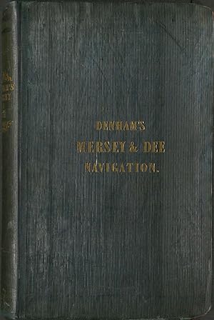
Add to basketHardcover. Condition: Very Good. Original Blue/grey ribbed cloth gilt.Small owner's bookplate, no inscriptions Illustrated title page plus 23 folding plates. XX+1+169+26pp(sailing directions Wyre and Fleetwood. All very bright tight clean.
-
Sailing Directions From Point Lynas to Liverpool with Charts, Coast-Views, River-Sections, Tidal Courses and The Gauge Table for Navigating the Dee and Mersey &c. / Remarks and Sailing Directions for Approaching and Navigating The Sea-Reach of Wyre.
Published by Liverpool: Printed and Published as the Act Directs for H. M. Denham, by J. & J. Mawdsley, 1840
Seller: Colin Page Books, Storrington, United Kingdom
Association Member: ABA ILAB PBFA
Seller rating 5 out of 5 stars
US$ 482.56
US$ 53.54 shipping
Ships from United Kingdom to U.S.A.Quantity: 1 available
Add to basketFirst edition. Octavo (23 x 14.5cm), published at 21s. Two works bound in one, with two titles, as usually found. pp. [2],xx,[2],169,[1]; [1-2],26. The main title-page engraved. With 25 plates, many of which folding, including maps, charts & views of bouys & lighthouses, coastlines &c., some with colour. A couple of the large folding maps with small closed tears to the hinge, but no loss. 20th C. half calf, gilt, teg, marbled endpapers & engraved armorial bookplate of Alan Waterworth. Vg. [Fishwick 88; BMC 7, 57].


![Seller image for Sailing Directions from Point Lynas to Liverpool with Charts, Coast-views, River-Sections, Tidal Courses and Gauge Table, for Navigating the Dee and Mersey. [Bound with:] Remarks and Sailing Directions for Approaching and Navigating the Sea-Reach of Wyre up to Port Fleetwood, with some Account of Wyre Lighthouses & Estuary. By Commander H. W. Denham. for sale by Forest Books, ABA-ILAB](https://pictures.abebooks.com/inventory/md/md31720636241.jpg)

