Order Total (1 Item Items):
Shipping Destination:

Crone Gerald Roe (34 results)
Skip to main search results
Search filters
Product Type
- All Product Types
- Books (34)
- Magazines & Periodicals (No further results match this refinement)
- Comics (No further results match this refinement)
- Sheet Music (No further results match this refinement)
- Art, Prints & Posters (No further results match this refinement)
- Photographs (No further results match this refinement)
- Maps (No further results match this refinement)
- Manuscripts & Paper Collectibles (No further results match this refinement)
Condition Learn more
- New (5)
- As New, Fine or Near Fine (4)
- Very Good or Good (14)
- Fair or Poor (No further results match this refinement)
- As Described (11)
Binding
Collectible Attributes
- First Edition (5)
- Signed (No further results match this refinement)
- Dust Jacket (12)
- Seller-Supplied Images (12)
- Not Print on Demand (31)
Language (2)
Free Shipping
Seller Location
Seller Rating
-

Hardcover. Condition: Good. No Jacket. Pages can have notes/highlighting. Spine may show signs of wear. ~ ThriftBooks: Read More, Spend Less.
-

Hardcover. Condition: Good. Tear in dust jacket.
-
Hardcover. Condition: Very Good.
-

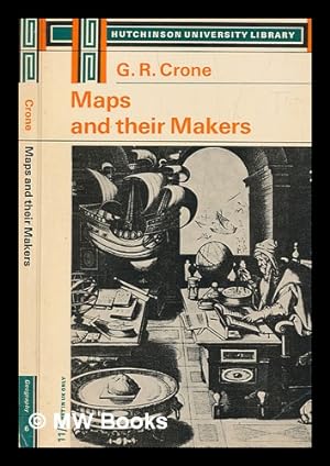
Maps and Their Makers : An Introduction to the History of Cartography
Language: English
Published by Penguin Random House, 1968
ISBN 10: 0090347943 ISBN 13: 9780090347940
Condition: Good. Former library copy. Pages intact with minimal writing/highlighting. The binding may be loose and creased. Dust jackets/supplements are not included. Includes library markings. Stock photo provided. Product includes identifying sticker. Better World Books: Buy Books. Do Good.
-

The Discovery of America
Language: English
Published by Penguin Books, Limited, 1969
ISBN 10: 0241015111 ISBN 13: 9780241015117
Condition: Good. Former library copy. Pages intact with minimal writing/highlighting. The binding may be loose and creased. Dust jackets/supplements are not included. Includes library markings. Stock photo provided. Product includes identifying sticker. Better World Books: Buy Books. Do Good.
-

Maps and Their Makers: an Introduction to the History of Cartography
Language: English
Published by Hassell Street Press, 2021
ISBN 10: 1014710472 ISBN 13: 9781014710475
Condition: New.
-
Maps and Their Makers: an Introduction to the History of Cartography
Language: English
Published by Hassell Street Press, 2021
ISBN 10: 1014710472 ISBN 13: 9781014710475
Condition: As New. Unread book in perfect condition.
-

Modern geographers: an outline of progress in geography since 1800 A.D.
Published by Royal Geographical Society; J. Murray, 1951
Wraps. 56p., ill., 22 cm. Small tear in top edge of wrap and frontispiece. Stamped and signed by previous owner. Price sticker on front. Pages are clean and unmarked. Very good in very good dust jacket.
-

The Hereford World Map
Language: English
Published by Royal Geographical Society, London, 1949
Seller: Dorley House Books, Inc., Hagerstown, MD, U.S.A.
Seller rating 4 out of 5 stars

First Edition
Paperback. Condition: Very Good. 1 plate and 1 centerfold Illustration (illustrator). 1st. cream wraps with string-tied spine, lite foxing; 16 clean, unmarked pages.
-

Maps And Their Makers: An Introduction To The History Of Cartography (University Library Geography Series)
Published by Hutchinson, 1962
Seller: World of Rare Books, Goring-by-Sea, SXW, United Kingdom
Seller rating 5 out of 5 stars

Condition: Good. 1962. 1964 Reprint. 192 pages. This is an ex-Library book. Beige and brown pictorial dust jacket over black cloth. Ex-Library copy, with expected inserts, stamps and inscriptions. Pages are lightly tanned and thumbed at the edges. Binding has remained firm. Boards are a little rub worn, slight shelf wear to corners, spine and edges. Corners are a little bumped. Spine ends are mildly crushed. Light wear to unclipped dust jacket with tears, nicks and creases to spine, edge and corners. Light tanning to spine and edges. Dust jacket attached to boards and protected by plastic wrapper.
-
![Seller image for Maps and their makers / [by] G. R. Crone for sale by MW Books](https://pictures.abebooks.com/inventory/md/md31239427181.jpg)
Reprint. Near fine paperback copy; wrapper edges very slightly dulled. Remains particularly well-preserved overall; tight, bright, clean and especially sharp-cornered. Physical description; 184 pages 5 plates, facsimiles, maps (1 color). 22 cm. Subjects; History of cartography. ; [Literature]. Cartography History. Mapmaking; history. 1 Kg.
-

Maps and their makers : an introduction to the history of cartography
Published by London : Hutchinson, 1966
Third Edition. Very good paperback copy; edges somewhat slightly dust-dulled and nicked. Remains particularly well-preserved overall; tight, bright, clean and strong. Physical description; xiv, 15-192 pages : color frontispiece, maps ; 22 cm. Notes; Includes bibliographies and index. Subject; Cartography History. 1 Kg.
-
![Seller image for Maps and their makers / [by] G. R. Crone for sale by MW Books Ltd.](https://pictures.abebooks.com/inventory/md/md31217384734.jpg)
Reprint. Near fine paperback copy; wrapper edges very slightly dulled. Remains particularly well-preserved overall; tight, bright, clean and especially sharp-cornered. Physical description; 184 pages 5 plates, facsimiles, maps (1 color). 22 cm. Subjects; History of cartography. ; [Literature]. Cartography History. Mapmaking; history. 1 Kg. Item is Shipped from Ireland or US locations.
-
Maps and their makers : an introduction to the history of cartography
Published by London : Hutchinson, 1966
Third Edition. Very good paperback copy; edges somewhat slightly dust-dulled and nicked. Remains particularly well-preserved overall; tight, bright, clean and strong. Physical description; xiv, 15-192 pages : color frontispiece, maps ; 22 cm. Notes; Includes bibliographies and index. Subject; Cartography History. 1 Kg. Item is Shipped from Ireland or US locations.
-
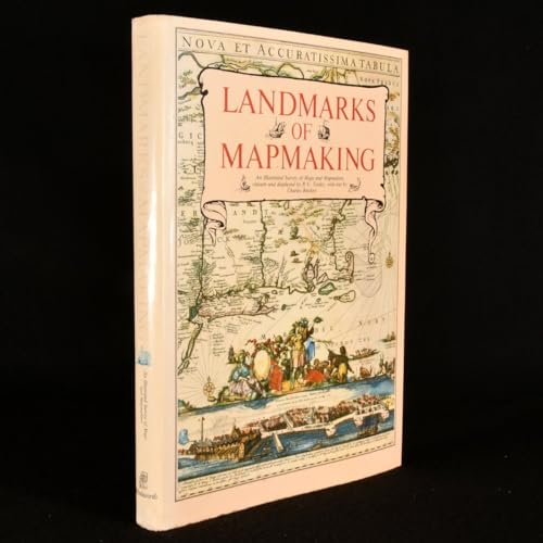
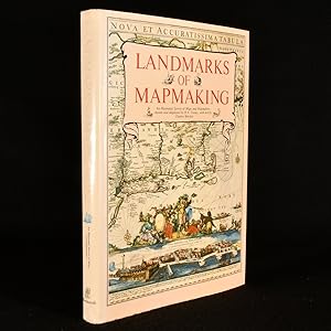
Landmarks of Mapmaking: An Illustrated Survey of Maps and Mapmaking
Language: English
Published by Wordsworth Editions Ltd, Hertfordshire, 1989
ISBN 10: 1853269360 ISBN 13: 9781853269363
Seller: Fahrenheit's Books, Denver, CO, U.S.A.
Association Member: RMABA
Seller rating 5 out of 5 stars
First Edition
Hardcover. Condition: Very Good. Dust Jacket Condition: Very Good. 1st Edition Thus. First edition thus, hardcover featuring fold out maps, has a shallow lean to the binding, light bumps to the spine ends and cover corners, some mild edge wear with a hint of rubbing to the covers, and a very small, thin scrape to the fore edge of about half of the text block, otherwise a solid, tight Very Good copy in a like dust jacket, which has light bumps to the spine ends and corners, mild sunning to the spine, and a touch of shelfwear to the edges. Jacket is wrapped in a Mylar cover.
-
Maps and Their Makers: an Introduction to the History of Cartography
Language: English
Published by Hassell Street Press, 2021
ISBN 10: 1014710472 ISBN 13: 9781014710475
Seller: GreatBookPricesUK, Woodford Green, United Kingdom
Seller rating 5 out of 5 stars
US$ 32.09
US$ 20.12 shipping
Ships from United Kingdom to U.S.A.Quantity: Over 20 available
Add to basketCondition: As New. Unread book in perfect condition.
-
36.0 c 26.0cms 276pp b/w & colour illusts including 20 foldout maps very good hardback & dustwrapper (chip at base of spine) The chapters are: the mapmaker's skills; Europe the rise of map publishing; Asia seaway to the Indies; Africa the mysterious continent; the Americas a New World; Australia the Southern Land.
-
Landmarks of Mapmaking; an Illustrated Survey of Maps and Mapmakers. Maps Chosen and Displayed by R.V. Tooley. Preface by Gerald Roe Crone
Published by Elsevier, Amsterdam, Netherlands, 1968
Hardcover. Condition: Very Good. Dust Jacket Condition: Good+. 1968. Nice Firm Clean copy ! Light general wear. 276 pages. 6503L.
-
Maps and Their Makers: an Introduction to the History of Cartography
Language: English
Published by Hassell Street Press, 2021
ISBN 10: 1014710472 ISBN 13: 9781014710475
Seller: GreatBookPricesUK, Woodford Green, United Kingdom
Seller rating 5 out of 5 stars
US$ 37.85
US$ 20.12 shipping
Ships from United Kingdom to U.S.A.Quantity: Over 20 available
Add to basketCondition: New.
-
Landmarks of Mapmaking: an Illustrated Survey of Maps ad Mapmakers.
Language: English
Published by Amsterdam : Elsevier, 1968
Seller: Antiquariat Thomas Haker GmbH & Co. KG, Berlin, Germany
Association Member: GIAQ
Seller rating 5 out of 5 stars
Cloth. Condition: Gut. 276 p., with num. coloured fold-out maps, 41 x 28 cm. Good. Ex-library with stamps and small label on spine. Otherwise Clean pages. Without dust jacket. Shipping only to EU countries. Sprache: Englisch Gewicht in Gramm: 2800.
-
MAPS AND THEIR MAKERS - AN INTRODUCTION TO THE HISTORY OF CARTOGRAPHY
Published by HUTCHINSON UNIVERSITY LIBRARY, LONDON, 1966
Rilegato. Condition: condizioni quasi ottime. Dust Jacket Condition: come nuovo. terza edizione. SOVRACCOPERTA EDITORIALE CON TITOLI E FREGI. LEGATURA IN TUTTA TELA EDITORIALE MARRONE CON TITOLI ORO AL DORSO. PP.192 CON UNA CARTA GEOGRAFICA A COLORI E FIGURE NEL TESTO.
-

Landmarks of Mapmaking. An Illustrated Survey of Maps and Mapmaking.
Language: English
Published by New York, Dorset Press [Marboo Books Corporation]. 1989, 1989
ISBN 10: 0880293497 ISBN 13: 9780880293495
Seller: Antiquariaat Schot, Hendrik-Ido-Ambacht, Netherlands
Seller rating 5 out of 5 stars
Original publisher's brown paper-covered boards, gilt lettering spine, pictorial dustjacket, folio: frontispiece tipped-in, 276pp., very richly illustrated [several plates folding & double-page large], notes & references, general bibliography, credits illustrations, index, colophon.
-

Landmarks of Mapmaking: an Illustrated Survey of Maps ad Mapmakers
Published by Amsterdam, etc. : Elsevier Sequoia, 1968
Condition: Good. Original gilt lettered and decorated cloth, dust jacket, (foldable) maps in colour and b/w, folio.; Small tears dust jacket repaired.
-
First Edition. Good copy in original gilt-blocked cloth with some wear and tear as with age. Remains well-preserved overall; bright and clean.Library marks remain. Series; Geographical handbook series ; B.R.549. Physical description; xv, 756 pages, plates (some folded) : illustrations, maps (some colour) ; 22 cm. Notes; "October 1944". 2 folded maps in pocket inside back cover. Includes bibliographical references and index. Folded map in back pocket. Subjects; Physical geography Netherlands. Netherlands Description and travel. Netherlands ; Handbooks, manuals, etc. Netherlands Economic conditions. Netherlands Social life and customs 20th century. Netherlands Description and travel. Genres; Bibliography. Illustrated. 1 Kg.
-
First Edition. Good copy in original gilt-blocked cloth with some wear and tear as with age. Remains well-preserved overall; bright and clean.Library marks remain. Series; Geographical handbook series ; B.R.549. Physical description; xv, 756 pages, plates (some folded) : illustrations, maps (some colour) ; 22 cm. Notes; "October 1944". 2 folded maps in pocket inside back cover. Includes bibliographical references and index. Folded map in back pocket. Subjects; Physical geography Netherlands. Netherlands Description and travel. Netherlands ; Handbooks, manuals, etc. Netherlands Economic conditions. Netherlands Social life and customs 20th century. Netherlands Description and travel. Genres; Bibliography. Illustrated. 1 Kg. Item is Shipped from Ireland or US locations.
-
Geschiedenis van de Cartografie
Published by Atrium 1975, 1975
Seller: Antiquariaat Schot, Hendrik-Ido-Ambacht, Netherlands
Seller rating 5 out of 5 stars
Geb., hardcover, groot formaat, fraai exemplaar, 275 pagina's.
-
Landmarks of Mapping; an Illustrated Survey of Maps and Makers
Published by Elsevier, Amsterdam & Brussels, 1968
Cloth Over Board. Condition: Good. No Jacket. Tooley, R. V. {compiled maps} (illustrator). This very large book is bound in a light 'oatmeal' cloth with gilt lettering and design framed in white on spine and front cover, back cover is plain. Bottom corners are lightly bumped, fraying cloth at tail of spine. Some discoloration bottom edge of front board, tail of spine, very light on back board and text sheets due to a spill. Very slight forward cocking of the binding. Hinges and gutters are solid, very light early foxing of endpapers and edges. 'Dirt' mark near center fore-edge of the half-title page. Numerous illustrations: Black and white, full color plates and duo-folds. An interesting look at the development of mapping and knowledge. Due to the large size and weight of this book, it will require additional shipping. Size: Elephant Folio - over 15" - 23" tall.
-
US$ 96.73
US$ 33.54 shipping
Ships from United Kingdom to U.S.A.Quantity: 1 available
Add to basketPaperback. Condition: Very Good. Dust Jacket may NOT BE INCLUDED.CDs may be missing. SHIPS FROM MULTIPLE LOCATIONS. book.
-

A History of Cartography: 2500 Years of Maps and Mapmakers
Published by Thames and Hudson, 1969
First Edition
Hardcover. Condition: Very Good. Dust Jacket Condition: Fair. First Edition. The jacket is shelf worn with creasing, tears, chips and marks. The boards are tidy overall with little edge wear. The binding is secure. Ex-libris plate on the back of the front end page. Browning along the edges of the pages, There are no ink inscriptions or annotations. Protected in cellophane. Tall, extra postage required unless posted within South Africa. JHK. Our orders are shipped using tracked courier delivery services.
-
Landmarks of Mapmaking
Published by Wordsworth, London, 1989
Seller: Rooke Books PBFA, Bath, United Kingdom
Association Member: PBFA
Seller rating 5 out of 5 stars
US$ 81.53
US$ 20.11 shipping
Ships from United Kingdom to U.S.A.Quantity: 1 available
Add to basketCloth. Condition: Fine. Dust Jacket Condition: Near Fine. Not Stated (illustrator). A flawless copy of this colourfully illustrated work on the history of mapmaking and cartography, stretching over 2,000 years. A fascinating and comprehensive history of mapmaking and cartography, stretching over 2,000 years. Including chapters on cartographic history in Europe, Asia, Africa, the Americas, and Australia.Including over three hundred and fifty in-text illustrations, many of which are in colour, along with fifteen folding maps. Collated and complete.Maps edited and chosen by R.V. Tooley, text written by Charles Bricker, and preface by Gerald Row Crone.Containing a previous owner's ink signature to the front free-endpaper, dated 1989.A fine copy of this work enclosed in the original dust wrapper. In the publisher's original cloth binding. Externally, excellent. Original unclipped dust wrapper is lovely and bright, with just a few spots to the front flyleaf. Previous owner's ink inscription to the front free-endpaper. Internally, firmly bound. Pages are bright and clean. Fine. book.