Order Total (1 Item Items):
Shipping Destination:

Cyanotype (12 results)
Author:
cyanotype
Refine with Advanced Search
Skip to main search results
Search filters
Product Type
- All Product Types
- Books (5)
- Magazines & Periodicals (No further results match this refinement)
- Comics (No further results match this refinement)
- Sheet Music (No further results match this refinement)
- Art, Prints & Posters (No further results match this refinement)
- Photographs (1)
- Maps (6)
- Manuscripts & Paper Collectibles (No further results match this refinement)
Condition Learn more
- New (1)
- As New, Fine or Near Fine (1)
- Very Good or Good (2)
- Fair or Poor (No further results match this refinement)
- As Described (8)
Binding
Collectible Attributes
- First Edition (1)
- Signed (2)
- Dust Jacket (No further results match this refinement)
- Seller-Supplied Images (10)
- Not Print on Demand (12)
Language (2)
Price
- Any Price
- Under US$ 25 (No further results match this refinement)
- US$ 25 to US$ 50
- Over US$ 50
Free Shipping
- Free Shipping to U.S.A. (No further results match this refinement)
Seller Location
Seller Rating
-

US$ 32.21
US$ 13.41 shipping
Ships from United Kingdom to U.S.A.Quantity: 1 available
Add to basketPaperback. Condition: Brand New. Cyanotype (illustrator). 140 pages. 8.10x5.30x0.60 inches. In Stock.
-

Soft cover. Condition: Very Good. Spiral bound softcover. 3rd edition. Nice copy with just minor wear. Pages of text are clean, bright and free of markings. Binding is tight and secure. ***Shipped within 24 hours from the beautiful Baltimore inner harbor area. First class service; accurate descriptions. Most items packed in boxes, not envelopes.***.
-
![Seller image for The Great Gallery: A Genesis Alternative [Artist's Book] for sale by Arroyo Seco Books, Pasadena, Member IOBA](https://pictures.abebooks.com/inventory/md/md9651789726.jpg)
The Great Gallery: A Genesis Alternative [Artist's Book]
Language: English
Published by Fountainblue Press / Scripps College Press, Claremont, California, 1988
Seller: Arroyo Seco Books, Pasadena, Member IOBA, Pasadena, CA, U.S.A.
Association Member: IOBA
Seller rating 4 out of 5 stars

First Edition Signed
Cream Wrappers. Condition: Near Fine. Solar Cyanotype on Each Page (illustrator). First Edition. One of 25 copies printed on Fabriano Artistico on a Vandercook Universal III proof press in Spring 1988 at Scripps College Press. Pages set in 18/30 pt. Centaur. Binding structure is an unsupported link stitch with a reinforced paper cover. One of the books produced in the Claremont College program. A story of an alternative view of genesis, beginning when "she" created the world. Scarce, as are all artist's books from the Claremont program; one copy located in WorldCat, at Claremont Colleges Library. Signed by Author(s).
-
Artist's (or Architect's) Photo Album
Published by c. 1900, 1900
Seller: Sanctuary Books, A.B.A.A., New York, NY, U.S.A.
Seller rating 5 out of 5 stars

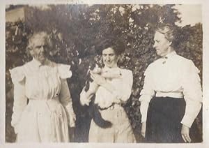
Hardcover. Condition: Very Good+. Mottled cloth; oblong (170 x 140 mm); contains 50 photographs mounted direct to the recto and verso of black leaves. Most are silver prints, plus a platinum (a large image of breaking waves) and a cyanotype; average size about 4 x 2.75 inches, with some a bit smaller or larger. Backstrip torn; a few leaves detached. Taken by (or related to) an artist who appears to have specialized in architectural ornamentation. Includes snapshots depicting figures and buildings from different vantage points, views of the studio (including a close-up of drawings pinned to the wall), a besmocked artist in front of an easel, scenes of family, a besmocked artist in front of an easel. And kittens! Plus a cyanotype of a classroom.
-

Composite Cyanotype Collage of the Cripple Creek Gold District, Depicting the Morning Glory, Victor, and Portland Mines, Printed on Cloth
Published by Teller County, Colorado, 1910
Seller: Auger Down Books, ABAA/ILAB, Marlboro, VT, U.S.A.
Association Member: ABAA ESA ILAB
Seller rating 5 out of 5 stars
A composite cyanotype printed directly onto fabric, presenting a series of mining views from the Cripple Creek district arranged within rounded rectangular and circular panels. The individual images are captioned in the negative and include identifiable views of the ?Morning Glory Mine,? ?Victor Mine,? and ?Portland Mine,? along with a central panoramic view labeled ?Cripple Creek.? The scenes show headframes, mills, smokestacks, tailings piles, and dense clusters of buildings, capturing both the industrial infrastructure and townscape of the district at its height. Discovered in 1891, the Cripple Creek gold district quickly became the most productive mining region in Colorado and one of the most important in the United States. Operations such as the Portland and Victor mines were among the leading producers and were widely circulated in promotional imagery during the boom years of the 1890s and early twentieth century. The use of cyanotype on cloth is unusual and points to a souvenir or commemorative function. A highly uncommon format; we have only encountered this and one other example. Some creasing and evidence of prior mounting at edges; very good. Large cyanotype photographic collage printed on cloth, approximately 20 x 20 inches.
-

Lincoln, Nebr.
Publication Date: 1929
Seller: Geographicus Rare Antique Maps, Brooklyn, NY, U.S.A.
Association Member: ABAA ESA ILAB
Seller rating 4 out of 5 stars
Map
Hardcover. Very good. Closed margin tears professionally repaired on verso. Light dampstaining in bottom left corner not effecting printed image. Size 30.25 x 116.5 Inches. Measuring just short of ten feet, this is an impressive 1929 Omaha, Lincoln and Beatrice Railway cyanotype or blueprint map of part of Lincoln, Nebraska, including all of the modern-day City Campus of the University of Nebraska-Lincoln. A Closer Look The University of Nebraska appears near the left edge of the printed image, with 'State University' and 'University Addition' marking where the university had been and illustrating how it had grown. Both Memorial Stadium and the Nebraska Coliseum are illustrated and labeled, underscoring the importance of Nebraska Athletics. Both had been built only a few years before this map was printed. Curiously, no other buildings on campus are labeled, but businesses throughout the city are identified. Below the title, a notation advises the viewer that the present edition is 'Correct to June 12, 1947'. The Railroads While this map was made by the Omaha, Lincoln and Beatrice Railway and traces its tracks through the city, four other railways are illustrated as well. These are the Chicago, Burlington and Quincy Railroad; the Chicago and North Western Railroad; the Chicago, Rock Island, and Pacific Railroad; and the Missouri Pacific Railroad. Notations differentiate between the railroads. The Omaha, Lincoln and Beatrice Railway Founded in 1903, the Omaha, Lincoln and Beatrice Railway was created in an attempt to create passenger rail service between the three cities. The rails never extended outside of Lincoln, however it still operates as a private company to this day as a Class III switching railroad. Cyanotype: Why so Blue? Cyanotype is a photo-reprographic technique developed in 1842 by the British astronomer John Herschel (1792 - 1871). Sometimes called a 'sunprint', the technique employs a solution of ferric ammonium citrate and potassium ferricyanide , which painted on white paper or cloth, reacts when exposed to sunlight to dye the object a brilliant blue. Areas blocked from ultraviolet exposure remain undyed and white. Herschel developed the technique to reproduce his astronomical notes, but others quickly realized that any object capable of blocking light could be used to create a cyanotype image quickly and easily. By the late 19th century, the process became popular with designers, military, architects, and engineers (blueprints), who used the cheap and effective technique to quickly and exactly reproduce images in the field. Cyanotyping is limited in that only a single copy can be made at one time, so it was only practical for short-term field work. It is also of note that cyanotypes remain extremely reactive to light and, over time, fade or degrade, making them extremely ephemeral. The process fell out of fashion in most places by the 1920s but remains in use in some parts of the world, such as India and Nepal, to this day. Publication History and Census This map was created and published by the Omaha, Lincoln, and Beatrice Railway, on June 10, 1929, with corrections to June 12, 1947. This is the only known cataloged example of either edition of the map.
-

Map of the City of San Jose and Environments.
Publication Date: 1901
Seller: Geographicus Rare Antique Maps, Brooklyn, NY, U.S.A.
Association Member: ABAA ESA ILAB
Seller rating 4 out of 5 stars
Map
Hardcover. Very good. Laid down original old linen. Some edge wear and loss. Else very clean. Size 56.5 x 54 Inches. This is the only surviving example of Curtis M. Barker's unrecorded 1901 cyanotype or blueprint city planning wall map of San Jose, California - today's 'Capital of Silicon Valley'. It presents the city during an explosive period of expansion, as new developments and neighborhoods were being added continuously. Given the size and precision of this map, it can only be an official city planning map used by the administration for urban management. A Closer Look The map is oriented towards the east-northeast, with the Coyote River at top and the Guadalupe River and Los Gatos Creek in the middle towards bottom. The City Limits here are far smaller than the city's eventual extent; in the following decades, the unincorporated territory to the west (bottom), including the posh Alameda neighborhood built along the old Camino Real, north, and south, would be annexed. A small legend at right explains symbols used for schools, notes the size of the city's population, and mentions the area of its largest downtown plaza and park. In addition to schools and parks, streets, planned but still undeveloped blocks (at bottom-right), hotels (including the opulent Hotel Vendome), libraries, civic buildings, rail lines and stations, a racetrack and fairgrounds at bottom, waterways, and other features are noted. Naglee Park at the top is not a public park but the estate of the Union Civil War General Henry Morris Naglee (1815 - 1886). Around the time of this map's production, the estate, which was sprawling and contained sumptuous gardens and vineyards, was sold to developers and subdivided for single-family home lots. Retaining the name Naglee Park, it became home to many large and architecturally significant homes (mostly built after the 1906 earthquake) designed in the Tudor and Mission Revival styles. Other developments on the periphery of the city (Hyde Park, Cottage Grove, East San Jose) also hint at its expansion at this time. City of Schools San Jose played an important role in the early history of education in California, perhaps the reason for schools being highlighted so prominently here. The State Normal School, namesake for the square (also known as Washington Sq.), was founded in San Francisco in 1857, moved to San Jose in 1871, and is now San Jose State University. The University of the Pacific - founded 1851 in Santa Clara, also moving to San Jose in 1871 - is noted at bottom-left at College Park. The university relocated to Stockton in 1923 and the Jesuit Bellarmine College Preparatory school took over the campus, but the area retains the name 'College Park.' Perhaps most notable of all is the College de Notre Dame near center, the first college chartered in California in 1851, an all-girls Catholic institution that is the basis for today's Notre Dame de Namur University located in Belmont on the San Francisco Peninsula, while another part of the institution relocated in the 1920s to a different location in downtown San Jose and became Notre Dame High School. Rail Interchange Several railways are noted, including the Southern Pacific Railroad, the narrow-gauge South Pacific Coast Railroad running to Santa Cruz (whose depot is the basis for today's Diridon Station, a major interchange for Amtrak and Caltrain), and the Central Pacific Railroad's Niles Division, which linked nearby Fremont with Sacramento and the original Transcontinental Railroad. The city also had a nascent streetcar and interurban electric trolley system, not indicated here. The trolleys eventually ran as far south as Los Gatos and as far north as Palo Alto (by 1910, independent lines were consolidated as the Peninsular Railway, a subsidiary of the Southern Pacific). Attempts at Chinese and Japanese Exclusion Most of the land north of Taylor St. at left belonged to James D. Phelan (1861 - 1930), a banker who was the Mayor of San Francisco when this map was produc.
-

Map of the Corita Vineyard. Being Lots 3 and 4 of the Briones Partition of the La Purissima Conception Chanco. The Property of A. B. Blanco.
Publication Date: 1912
Seller: Geographicus Rare Antique Maps, Brooklyn, NY, U.S.A.
Association Member: ABAA ESA ILAB
Seller rating 4 out of 5 stars
Map
Hardcover. Very good. Cyanotype. Size 28.25 x 33.25 Inches. This is a c. 1912 printing of a 1905 Curtis M. Barker map of the Foothills Preserve and Foothills Park in Los Altos and Los Altos Hills, California. It is a window into the early development of each from early land grants. A Closer Look Then known as the Corita Vineyard, the map depicts the immediate vicinity of the intersection of Moody Road and Page Mill Road. Course tables detail both Page Mill Road and Moody Road, providing distances. Contour lines present the topography in twenty-five-foot intervals. Two notations, just above the intersection of the two roads, mark proposed sites for a residence and tanks. This map includes the addition of a private road not on the 1905 original. The road was surveyed by J. V. Neuman and constructed in 1912, hence our dating. Paul Shoup, an executive of the Southern Pacific Railroad, and his colleagues formed the Altos Land Company in 1906, leading to the urban development of modern Los Altos. Corita Vineyard: Some Historical Context No record of the Corita Vineyard appears online, but we have been able to piece together some of the historical context. The story began in 1840 when 4,439 acres of land were given in grant to Jos� Gorgonio and his son Jos� Ramon by Governor Juan Alvarado of Mexico, which they named La Purissima Conception Rancho. Gorgonio sold Rancho La Purisima Concepcion to Juana Briones Miranda in 1844. In 1861, Briones (1802 - 1889) sold three-quarters of her rancho to Martin Murphy Jr. of Sunnyvale. She gave the remaining 1,130 acres to her children, who went by their father's name, Miranda. A. B. Blanco acquire ownership of the Corita Vineyard by 1905. Paul Shoup, an executive of the Southern Pacific Railroad, and his colleagues formed the Altos Land Company in 1906, leading to the urban development of modern Los Altos. Los Altos Hills followed shortly after when the adjacent estates of La Purissima Conception Rancho and Rancho San Antonio were consolidated. The 2 large ranchos were eventually parceled and sold as smaller ranches for cattle grazing and vineyards, mostly of Zinfandel grapes. Cyanotype: Why So Blue? Cyanotype is a photo-reprographic technique developed in 1842 by the British astronomer John Herschel (1792 - 1871). Sometimes called a 'sunprint,' the technique employs a solution of ferric ammonium citrate and potassium ferricyanide , which painted on white paper or cloth, reacts when exposed to sunlight to dye the object a brilliant blue. Areas blocked from ultraviolet exposure remain undyed and white. Herschel developed the technique to reproduce his astronomical notes, but others quickly realized that any object capable of blocking light could be used to quickly and easily create a cyanotype image. By the late 19th century, the process became popular with designers, military, architects, and engineers (blueprints), who used the cost effective technique to quickly and accurately reproduce images in the field. Cyanotyping is limited in that only a single copy can be made at a time, so it was only practical for short-term fieldwork. It is also of note that cyanotypes remain extremely reactive to light and, over time, fade or degrade, making them inherently ephemeral. The process fell out of fashion in most places by the 1920s, but remains in use in some parts of the world, such as India and Nepal, to this day. Publication History and Census After studying the map, we believe Curtis M. Barker conducted the original survey in 1905, likely for A.B. Blanco himself. Since Barker died in 1908, Blanco could not rehire him to survey the new road he wanted to be built in 1912. Hence the other surveyor's name, and, from the way the cyanotype has been printed, we believe this new road was added directly to the original map created by Barker. Then this cyanotype was reproduced from that original. This is the only known example.
-

Road Department. Boston and Albany R.R. Sheet No. 1045.
Publication Date: 1881
Seller: Geographicus Rare Antique Maps, Brooklyn, NY, U.S.A.
Association Member: ABAA ESA ILAB
Seller rating 4 out of 5 stars
Map Signed
Hardcover. Good. Backed on archival tissue for stability. Parts of top and bottom right corner reinstated. Closed tear extending one (1) inch into printed area from lower margin professionally repaired on verso. Size 28.25 x 27.5 Inches. This is an 1881 cyanotype route map of the Boston and Albany Railroad created by William H. Russell, the railroad's Chief Engineer. The route map occupies the bottom quarter of the sheet and illustrates the Boston and Albany's Main Line along with numerous branch lines. Stops are identified along the lines with small lines illustrating and identifying connecting railroads. A table above the route map details the Boston and Albany's four divisions. Route Profiles Route profiles occupy the upper three-quarters of the sheet. Each profile marks milage and stops. Inclines and elevations are also noted. The Boston and Albany Railroad The Boston and Albany Railroad was chartered on June 23, 1831 as the Boston and Worcester Railroad to compete with the recently completed Erie Canal (1825).Boston businessmen saw the Erie Canal as a threat to their regional trade hegemony. The Berkshires Mountains of western Massachusetts made constructing a competing canal impractical, thus a railroad was planned. Construction began in August 1832 and service to Worcester began on July 4, 1835. (Importantly, the Boston and Worcester introduced season passes to West Newton in 1843, effectively creating a commuter rail.) The Western Railroad, created to connect the Boston and Worcester with the Hudson and Berkshire Railroad, was incorporated on March 15, 1833, and full service began on October 4, 1841. A third railroad, the Castleton and West Stockbridge Railroad, began construction in New York in 1840 as the New York section of the Western Railroad. It reached Massachusetts in September 1842 and was leased for 50 years to the Western Railroad in November 1843. Two mergers, one on September 4, 1867, and another on December 28, 1870, combined the three companies as well as the Hudson and Boston Railroad, into the Boston and Albany Railroad. At the time, the Boston and Albany was the longest and most expensive point-to-point railroad constructed in the United States. The New York Central and Hudson River Railroad signed a ninety-nine year lease of the Boston and Albany beginning on July 1, 1900, which then transferred to the New York Central in 1914. Cyanotype: Why so Blue? Cyanotype is a photo-reprographic technique developed in 1842 by the British astronomer John Herschel (1792 - 1871). Sometimes called a 'sunprint', the technique employs a solution of ferric ammonium citrate and potassium ferricyanide , which painted on white paper or cloth, reacts when exposed to sunlight to dye the object a brilliant blue. Areas blocked from ultraviolet exposure remain undyed and white. Herschel developed the technique to reproduce his astronomical notes, but others quickly realized that any object capable of blocking light could be used to quickly and easily create a cyanotype image. By the late 19th century, the process became popular with designers, military, architects, and engineers (blueprints), who used the cheap an effective technique to quickly and exactly reproduce images in the field. Cyanotyping is limited in that only a single copy can be made at one time, so it was only practical for short-term field work. It is also of note that cyanotypes remain extremely reactive to light and, over time, fade or degrade, making them extremely ephemeral. The process fell out of fashion in most places by the 1920s but remains in use in some parts of the world, such as India and Nepal, to this day. Publication History and Census This map was created by William H. Russell for the Boston and Albany Railroad and published in Springfield as Sheet No. 1045 in 1881. This is the only known surviving example. Signed by Author(s).
-

Philippine Islands
Publication Date: 1945
Seller: Geographicus Rare Antique Maps, Brooklyn, NY, U.S.A.
Association Member: ABAA ESA ILAB
Seller rating 4 out of 5 stars
Map
Hardcover. Very good. Minor wear on original fold lines. Size 28.5 x 21.25 Inches. An unusual and unique c. 1945 cyanotype or blueprint map of the Philippines issued by the Japanese, probably during the Philippine Campaign. This is an enigmatic map of which we can deduce little. The map covers all of the Philippine islands. The presence of Japanese text suggests that the map is most likely related to World War II, a fact belied by its crudity. The cyanotype seems to be derived from a crude manuscript copy of a western map - to which a Japanese title has been appended. An inset in the upper right details the Luzon Strait and Bashi Channel (between Taiwan and Luzon), an important region for Japanese forces. Part of Northern Luzon, and an area continuing into the inset, is highlighted in red manuscript and coincidently illustrates the primary zone of Japanese influence in 1944 - 45. The Philippine Campaign Launched on October 20 of 1944, the Philippine Campaign was a World War II joint American and Filipino military operation intended to liberate the Philippine Islands from occupying Imperial Japanese forces. The Japanese Army overran most of the Philippines during the first half of 1942, retaining it for the subsequent 2 years. American General Douglas MacArthur began the campaign by announcing on Philippine radio 'This is the Voice of Freedom, General MacArthur speaking. People of the Philippines: I have returned.' The campaign progressed rapidly, driving the Japanese out of one island after another. Although by this time the Japanese were clearly losing the war, they gave no sign of capitulation and refused to surrender. During the course of the campaign Japan suffered nearly half a million casualties compared to only about 50,000 Americans. The campaign continued until Japanese forces in the Philippines were ordered to surrender by Tokyo on August 15, 1945, after the dropping of atomic bombs on Hiroshima and Nagasaki. Cyanotype: Why so Blue? Cyanotype is a photo-reprographic technique developed in 1842 by the British astronomer John Herschel (1792 - 1871). Sometimes called a 'sunprint', the technique employs a solution of ferric ammonium citrate and potassium ferricyanide , which painted on white paper or cloth, reacts when exposed to sunlight to dye the object a brilliant blue. Areas blocked from ultraviolet exposure remain undyed and white. Herschel developed the technique to reproduce his astronomical notes, but others quickly realized that any object capable of blocking light could be used to quickly and easily create a cyanotype image. By the late 19th century the process became popular with designers, military, architects, and engineers (blueprints), who used the cheap an effective technique to quickly and exactly reproduce images in the field. Cyanotyping is limited in that only a single copy can be made at one time, so it was only practical for short-term field work. It is also of note that cyanotypes remain extremely reactive to light and, over time, fade or degrade, making them extremely ephemeral. The process fell out of fashion in most places by the 1920s, but remains in use in some parts of the world, such as India and Nepal, to this day. Publication History and Census This map appears to be cyanotype issue of a one-off manuscript copy of a western map - most likely made during World War II. The cyanotype form underscores that very few could have been issued, typically only 2 or 3, and suggests that it may have been a field map of some kind. Probably the only known example.
-

Gold Placer Map of Oregon.
Publication Date: 1956
Seller: Geographicus Rare Antique Maps, Brooklyn, NY, U.S.A.
Association Member: ABAA ESA ILAB
Seller rating 4 out of 5 stars
Map
Very good. Light wear along original fold lines. Light creasing. Size 16.5 x 21 Inches. This is a c. 1956 Walter J. Robertson map of Oregon illustrating placer gold deposits. Dashed lines encircle the two principal gold districts: one in eastern Oregon and one in southwestern Oregon near the California border. Deposits are marked by clusters of blue dots. Rivers, creeks, and major cities and towns near these deposits are illustrated and labeled. Apart from these two regions, very little detail appears. Major lakes are depicted, including Crater Lake and Upper Klamath Lake. A few cities outside the gold-producing regions are noted, such as Portland, Albany, and Corvallis. Gold Mining in Oregon Gold was first discovered in Oregon in 1850. Fortune seekers rushed into Oregon, staking claims along the Rogue, Applegate, and Illinois Rivers. In 1861, gold was discovered in Baker County in eastern Oregon, sparking another rush. It took ten years for the placer gold deposits to be exhausted, which led to the implementation of lode mining. Gold mining in Oregon lasted through the mid-20th century but returns consistently diminished. Diazo Print or Whiteprint The diazo print (whiteprint or diazo for short) is a photo reproductive technique best understood as a reverse cyanotype or blueprint. The process yields distinctive blue lines on white paper. Like cyanotypes, the diazo process gained popularity in architecture circles, where it was a simple and effective way to duplicate documents in the field. The earliest diazotypes appeared around 1880 and were adopted for military and field cartographic use from about 1895. The diazo process was commercialized in 1923, when the German firm, Kalle and Company, developed Ozalid, a patented diazo paper that made diazotyping even easier. By the 1950s, it supplemented cyanotypes as the reprographic technique of choice for technical drawings. Publication History and Census This map was created and published by Walter J. Robertson c. 1956. This is the only known cataloged example.
-
Spokane, Washington Cyanotype Photo Archive, 1890s
Publication Date: 1890
Seller: Max Rambod Inc, Woodland Hills, CA, U.S.A.
Association Member: ABAA ILAB PADA
Seller rating 5 out of 5 stars
Photograph
[Early Photography] Spokane, Washington photographs from the late 19th century. This archive consists of 6 original cyanotype photographs capturing dramatic views of the Spokane River and its falls in Spokane, Washington, around the 1890s. These early photographic prints, with their signature Prussian blue tonality, depict the dynamic natural force of the river cascading beneath iron bridges and past industrial buildings-structures that hint at the city's rapid development during the late 19th century. One cyanotype, labeled verso "Old Monroe Street Bridge," captures a striking angle of the original span that predates the 1911 replacement. Other scenes showcase the "Main Falls" of the Spokane River and extensive waterworks infrastructure, placing these images at the intersection of natural grandeur and urban modernization. Handwritten notations on the reverse of each image identify the location, including "Spokane River, 1895." The cyanotype process, invented in 1842 by the English scientist Sir John Herschel, uses a solution of iron salts to create a photographic image that develops in sunlight and washes out in water. The rich blue hue-resulting from the light sensitivity of ferric ammonium citrate and potassium ferricyanide-makes cyanotypes instantly recognizable and prized today. These images document the Spokane River during a period of industrial expansion. The city of Spokane, incorporated in 1881, was shaped by its proximity to this river, which powered mills, attracted railroads, and facilitated commerce. By the 1890s, Spokane was emerging as a major hub in the Inland Northwest, leveraging hydroelectricity generated from the river's falls. The Spokane River's dramatic course through basalt gorges and under steel truss bridges made it a frequent subject of photography, representing both scenic beauty and industrial promise. This archive is significant not only for its format but also as a visual record of Spokane's urban and environmental history at the close of the 19th century. Overall very good condition.