Order Total (1 Item Items):
Shipping Destination:

Emma Down Adrian Webb (5 results)
Skip to main search results
Search filters
Product Type
- All Product Types
- Books (5)
- Magazines & Periodicals (No further results match this refinement)
- Comics (No further results match this refinement)
- Sheet Music (No further results match this refinement)
- Art, Prints & Posters (No further results match this refinement)
- Photographs (No further results match this refinement)
- Maps (No further results match this refinement)
- Manuscripts & Paper Collectibles (No further results match this refinement)
Condition Learn more
- New (No further results match this refinement)
- As New, Fine or Near Fine (3)
- Very Good or Good (1)
- Fair or Poor (No further results match this refinement)
- As Described (1)
Binding
- All Bindings
- Hardcover (5)
- Softcover (No further results match this refinement)
Collectible Attributes
Language (2)
Price
- Any Price
- Under US$ 25 (No further results match this refinement)
- US$ 25 to US$ 50
- Over US$ 50
Free Shipping
- Free Shipping to U.S.A. (No further results match this refinement)
Seller Location
Seller Rating
-
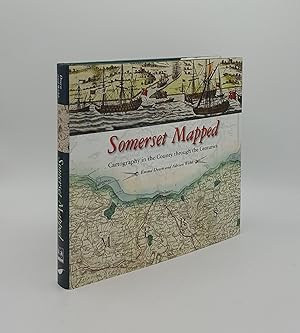
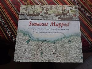
SOMERSET MAPPED Cartography in the County Through the Centuries
Language: English
Published by Halsgrove, 2016. 9780857042873, 2016
ISBN 10: 0857042874 ISBN 13: 9780857042873
Seller: Rothwell & Dunworth (ABA, ILAB), Dulverton, United Kingdom
Seller rating 5 out of 5 stars

First Edition
US$ 40.93
US$ 16.56 shipping
Ships from United Kingdom to U.S.A.Quantity: 1 available
Add to basket1st edn. Oblong 4to. Original gilt lettered green cloth (Fine), dustwrapper (Fine). Pp. xxv + 230, illus with coloured and b&w plates (no inscriptions).
-

Somerset Mapped: Cartography in the County Through the Centuries
Language: English
Published by Halsgrove Publishing, Wellington, 2016
ISBN 10: 0857042874 ISBN 13: 9780857042873
First Edition
US$ 68.02
US$ 25.10 shipping
Ships from United Kingdom to U.S.A.Quantity: 1 available
Add to basketHardcover. Condition: Very Good. Dust Jacket Condition: Very Good. 1st Edition. xxv / 230 pp colour illustrated, green cloth with gilt title. Pages a little cockled otherwise clean sound book, clipped dust wrapper shows slight edge wear. Over 1.5Kg will need extra postage outside UK.
-

Somerset Mapped: Cartography in the County Through the Centuries
Language: English
Published by Halsgrove Publishing, 2016
ISBN 10: 0857042874 ISBN 13: 9780857042873
Seller: Widney Manor Books, Solihull, MIDLA, United Kingdom
Seller rating 5 out of 5 stars
US$ 81.87
US$ 26.49 shipping
Ships from United Kingdom to U.S.A.Quantity: 1 available
Add to basketHardcover. Condition: Near Fine. Book is in very good condition. 230pp with colour illustrations.
-
Somerset Maps - Cartography in the County through the Centuries
Language: English
Published by Somerset Archaeological and Natural History Society, 2016
ISBN 10: 0857042874 ISBN 13: 9780857042873
Seller: Wildside Books, Eastbourne, United Kingdom
Association Member: PBFA
Seller rating 5 out of 5 stars
First Edition Signed
US$ 102.33
US$ 15.90 shipping
Ships from United Kingdom to U.S.A.Quantity: 1 available
Add to basketHardcover. Condition: Near Fine. Dust Jacket Condition: Near Fine. 1st Edition. Landscape quarto, i-xxv, 230 pp, maps of the County reproduced in chronological order. Slight adhesion issue where the previous owner's book plate on the front paste down has at one time stuck to the inner flap of the dust wrapper but this is barely evident. A signed presentation copy from Adrian Webb. Signed by Author(s).
-
Somerset Mapped: Cartography in the County Through the Centuries Signed by Authors
Published by Halsgrove Publishing, Wellington Somerset UK, 2016
Seller: Creaking Shelves Books, Spean Bridge, United Kingdom
Association Member: PBFA
Seller rating 5 out of 5 stars
First Edition Signed
US$ 307.00
US$ 17.88 shipping
Ships from United Kingdom to U.S.A.Quantity: 1 available
Add to basketHardcover. Condition: Near Fine. Dust Jacket Condition: Near Fine. 1st Edition. 230p profusely and beautifully illustrated. "Somerset Mapped explores the different depictions of the ancient county of Somerset and its districts as it has been shown by mapmakers and cartographers across the centuries. Arranged chronologically, this volume includes examples of maps, plans and charts showing aspects of Somersets past from the Bronze Age to the present. Maps have been selected from archives, libraries and private collections from across the country. One of the finest collections of maps of the county is owned by the Somerset Archaeological and Natural History Society, who have published this volume in association with Halsgrove. This book brings together a wide range of cartographic treasures from all periods of Somersets history. Different types of map are included: from thematic maps and charts, and maps resulting from national schemes, such as the tithe surveys, to those produced by singleton surveyors, such as the spectacular Elizabethan map of the Mendips. Manuscript and printed maps are included in this volume. The work of obscure surveyors and map makers is brought to light, alongside examples of well-known publishers such as the Ordnance Survey. Maps produced as evidence in court cases as aids to historic texts, some used for navigation in the air, and others showing the breadth of the countys prehistoric sites, can all be found in this highly attractive volume. Presented in a large format and generously illustrated, Somerset Mapped provides a unique insight into the County of Somerset and its rich history. In near fine condition with the signature of both authors on the title page and a gift inscription opposite, See scans. Signed by Author(s).