
Order Total (1 Item Items):
Shipping Destination:

Hellyer Oliver (13 results)
Skip to main search results
Search filters
Product Type
- All Product Types
- Books (12)
- Magazines & Periodicals (No further results match this refinement)
- Comics (No further results match this refinement)
- Sheet Music (No further results match this refinement)
- Art, Prints & Posters (No further results match this refinement)
- Photographs (No further results match this refinement)
- Maps (1)
- Manuscripts & Paper Collectibles (No further results match this refinement)
Condition Learn more
- New (4)
- As New, Fine or Near Fine (5)
- Very Good or Good (4)
- Fair or Poor (No further results match this refinement)
- As Described (No further results match this refinement)
Binding
Collectible Attributes
Language (2)
Free Shipping
- Free Shipping to U.S.A. (No further results match this refinement)
Seller Location
Seller Rating
-

Ordnance Survey of England and Wales : Indexes to the 1/2500 and 6-inch maps.
Published by Kerry: David Archer, 1991., 1991
Seller: Cornell Books Limited, Tewkesbury, United Kingdom
Association Member: PBFA
Seller rating 5 out of 5 stars

Map
US$ 13.73
US$ 19.93 shipping
Ships from United Kingdom to U.S.A.Quantity: 1 available
Add to basketCondition: Near Fine. Reprinted from the circa 1905/6 edition (softcover). 4to (29cm by 21cm), x, 118pp. Original laminated card wrappers. Tthis book is in very good condition. ISBN 0951757911.
-
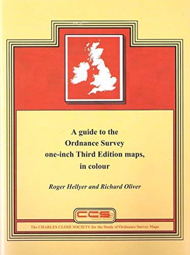
A Guide to the Ordnance Survey One-inch Third Edition Maps, in Colour: England and Wales, Scotland, Ireland.
Language: English
Published by Charles Close Society., United Kingdom., 2004
ISBN 10: 1870598210 ISBN 13: 9781870598217
Seller: Anthony Vickers Bookdealer PBFA, Selby, United Kingdom
Association Member: PBFA
Seller rating 5 out of 5 stars
US$ 16.48
US$ 40.00 shipping
Ships from United Kingdom to U.S.A.Quantity: 1 available
Add to basketHard Laminated Cover. Condition: Very Good +. Dust Jacket Condition: No Jacket as Issued. 160pp, bw & col illus.
-

Military Maps - The one-inch series of Great Britain and Ireland
Language: English
Published by Charles Close Society, London, 2004
ISBN 10: 1870598229 ISBN 13: 9781870598224
Seller: St Paul's Bookshop P.B.F.A., Peterborough, United Kingdom
Association Member: PBFA
Seller rating 4 out of 5 stars

First Edition
US$ 48.07
US$ 40.00 shipping
Ships from United Kingdom to U.S.A.Quantity: 1 available
Add to basketHardcover. Condition: Near Fine. 1st Edition. 1st 2004. Near-fine hardback copy in glazed covers. Quarto size. BOOKS SENT IN DURABLE CARD BOXES. LISTING PHOTO DOES NOT NECESSARILY MATCH THIS COPY.
-

A Guide to the Ordnance Survey One-inch Third Edition Maps,in Colour: England and Wales, Scotland, Ireland
Language: English
Published by London : The Charles Close Society, 2004
ISBN 10: 1870598210 ISBN 13: 9781870598217
Seller: Joseph Burridge Books, Dagenham, United Kingdom
Seller rating 5 out of 5 stars
US$ 54.94
US$ 36.00 shipping
Ships from United Kingdom to U.S.A.Quantity: 1 available
Add to basketHardcover. Condition: New. 3rd Edition. viii, 160 pages : illustrations (some colour), maps (some colour) ; 31 cm This book contains a detailed history and description of these maps by Richard Oliver. It builds on the original monographs by the late Guy Mesenger, and includes much new information, both historical and cartobibliographical. Roger Hellyers meticulous cartobibliography covers all the third edition coloured maps series.
-
![Seller image for The Rose Annual 1952. [Winter Hardiness; The Rose & the Poppy; Rose Men of Canada; Rose Diseases & their control; North of England; Drainage, pH & Manures; Shrub Roses at Bulkeley Mill; South Africa; New Zealand; First Pruning; etc] for sale by Joseph Valles - Books](https://pictures.abebooks.com/inventory/md/md1362950550.jpg)
The Rose Annual 1952. [Winter Hardiness; The Rose & the Poppy; Rose Men of Canada; Rose Diseases & their control; North of England; Drainage, pH & Manures; Shrub Roses at Bulkeley Mill; South Africa; New Zealand; First Pruning; etc]
Published by Croydon : The Croydon Advertiser Ltd, 36 High Street, 1952., 1952
Seller: Joseph Valles - Books, Stockbridge, GA, U.S.A.
Seller rating 5 out of 5 stars
Hardcover. Condition: Very Good. 194 pp. ; illustrated ; green cloth with gold lettering and embossed designs ; no dustjacket ; "Produced by the Publications Committee of the National Rose Society of Great Britain" ; numerous articles on a variety of subjects, all pertaining to the rose and its culture ; Contents: Patrons and Officers and Council -- Report of the Council -- Balance Sheets -- Arrangements, 1952 -- Presidents, N.R.S.; Dean Hole Medallists -- The President's Page -- Great Roses / A. Norman -- The Problem of Winter Hardiness / Wilhelm Kordes -- Dog-Days / Oliver Mee -- "-Her Infinite Variety." / Constance Wheatcroft -- An Exceptionally Wet Season -- The Rose and the Poppy -- Rose Shows and Displays of Roses / A. J. Macself -- Roses and Rose Men of Canada / A. J. Webster -- A Heterogeneous Rose Garden / Mrs. F. Stoneman -- Some Rose Diseases and their control / Bertram Park -- Spring in the Rose Garden / Dr. R. C. Allen -- Roses in the North of England / Oliver Mee -- The Relationship of Drainage, pH and Manures / Dr A. S. Thomas -- Green Mannring / Robert L. Scarlett -- The Great Summer Show / Roy Hay -- Rose Ceremonies / Leonard Hollis -- Artistic Show Work / Julia Clements -- The Provincial Rose Show / A. G. L. Hellyer -- George Dickson (H.T.) / Alan Gibbs -- The Great Autumn Show / Gordon Forsyth -- Shrub Roses at Bulkeley Mill / A. T. Johnson -- Roses in South Africa / Charles W. Smith -- The Bristol Group of N.R.S. Members / A. E. Griffith -- Is it so Difficult? / V. J. Sanday -- Has the Rose lost its Fragrance? / N. P. Harvey -- The First Pruning of Maiden Plants / Vera F. P. Day -- Life is a Bed of Roses? / A. T. Barnes -- Round the Nurseries / D. L. Flexman -- Rose Lovers / Charles F. Warren -- A Letter from New Zealand / W. H. Wilson -- My First Medal Bloom / W. J. Burkey -- The Trial Ground / H. Edland -- The Rose Analysis / H. Edland -- Illustrations -- An Asymmetrical Decoration -- A Corner of the President's Garden -- R. Kordesii -- Maid of Honour Schleswig -- A Fine Plant of Alberic Barbier -- A Fine Plant of Elizabeth of York -- The Municipal Rose Garden, Alexandra Park, Stockport -- Tzigane -- Wellworth -- A Decorative Vase -- A Delightful Arrangenient of Roses -- Border King -- Tantau's Delight -- Rudolph Timm -- Elfe -- The Trial Ground Committee makes Awards -- Ida McCracken -- Sutters Gold -- Masquerade Grandmaster -- Cocorico -- Coloured Plates ; foxing, else VG. Book.
-
![Seller image for The Rose Annual 1956. [Roses At Buckingham Palace & Harewood House; Roses At Eayfordeury; Multiflora Shock Absorber; Pennsylvania Rose Gardens; Parc Dr La Grange Rose Garden At Geneva; Paris Geneva Baden London; Old Garden Roses] for sale by Joseph Valles - Books](https://pictures.abebooks.com/inventory/md/md1362950602.jpg)
The Rose Annual 1956. [Roses At Buckingham Palace & Harewood House; Roses At Eayfordeury; Multiflora Shock Absorber; Pennsylvania Rose Gardens; Parc Dr La Grange Rose Garden At Geneva; Paris Geneva Baden London; Old Garden Roses]
Published by Croydon : The Croydon Advertiser Ltd, 36 High Street, 1956., 1956
Seller: Joseph Valles - Books, Stockbridge, GA, U.S.A.
Seller rating 5 out of 5 stars
Hardcover. Condition: Very Good. 196 pp. ; illustrated ; green cloth with gold lettering and embossed designs ; no dustjacket ; "Produced by the Publications Committee of the National Rose Society of Great Britain" ; numerous articles on various subjects pertaining to the rose and its culture ; Contents: Patrons, Officers And Council -- Arrangements For 1956 -- The President's Page, By Oliver Mee -- Roses At Buckingham Palace And Harewood House -- Roses At Eayfordeury, By Gordon Rowley -- Roses And Rosarians, By Sam Mcgredy -- How Roses Live And Grow, By G. J. Von Abrams -- Multiflora Shock Absorber, By N. P. Harvey -- Two Pennsylvania Rose Gardens, By Catherine E. Meikle -- Miscellany, By A. Norman -- The Parc Dr La Grange Rose Garden At Geneva, By Brie Bois -- Lady Mary Fitzwilliam, By James Alexander Gamble -- Paris-Geneva-Baden-London, By Louise Bechtel -- "Old Garden Roses", By Sacheverell Sitwell And James Russell, Reviewed By W. H. Sumpster -- =Strains Produced In Rose Hybridizing, By E. B. Le Grice -- Roses To Be, By Mr. And Mrs. Walter D. Brownnell -- "Poulsen On The Rose", By Svend Poulsen, Reviewed By W. J. W. Sanday -- Research On Black Spot Disease, By Freeman A. Weiss -- From The Annals Of Penicuik -- "My Masterpiece", By Math. Tantau -- Are We Getting Too Many New Roses1 By N. P. Harvey -- Observations On The Shafter Stock (Dr. Huey), By Andr� Leroy -- A Rose By Any Other Name, By G. D. Rowley -- How I Grow My Roses, By R. F. B. Naylor, C.B., D.S.O., B. R. C. Tizard, B. W. W. Sampson, A. A. Norton, Nigel Raban, Sam Carson -- Rose Notes From Queensland, By Fred Armbrust -- Roses In Regent's Park, By Leonard Hollis -- "The Old Shrub Roses", By C. S. Thomas, Reviewed By A. J. Huxley -- Keeping Cut Flowers Fresh -- Warm Or Cold? By Fred J. Nesbit -- The Summer Rose Show, By A. C. L. Hellyer -- Orthocide And Karathane, By F. Fairbrother -- The Decorative Classes At The Summer Show, By Arbel M. Aldous -- The Bristol Group Of Tile National Rose Society, By A. B. Griffith -- The Prov1ncial Rose Show, Leeds, By J. C. Watson -- The Autumn Show, By Roy Hay -- The Trial Ground In 1955, By H. Edland -- The Rose Analysis, By H. Edland -- Dean Hole Medallists, Accounts And Reports Of Council -- Monochrome Plates -- 'Peace'-- H.R.H. The Princess Royal, C.I., G.C.Y.O., G.E.E., E.E.C., T.D. -- Forms Of The Japanese Rosa Multiflora, Bayfordbury -- Hybrid Musks And Wichueaianas, Bayfordbury -- Rosa Jundzillii, Bayfordbury -- Rose Stock Trials, Bayfordbury -- Moss And French Roses In The Old Rose Garden, Bayfordbury -- Bourbon Roses, Bayfordbury -- View Of The Hershey Rose Garden -- Early Hybrid Tea Roses, Bayfordbury -- The Hershey Rose Garden -- Frau Karl Druschki" Hedge At Breeze Hill -- Central Terrace At Parc La Grange, Geneva -- View From The Upper Terrace At Parc La Grange, Geneva -- Colour Plates -- Sir Winston Churchill -- King Midas -- Red Wonder -- Beaute -- Message -- La Jolla -- Belle Blonde -- Sweet Repose -- Soraya -- Poulsen's Supreme And Salmon Perfection -- Yellowhammer -- Firecracker -- Cleopatra -- Lilac Time -- Sandringham -- People ; foxing, else VG. Book.
-
Military Maps: The One-Inch Series of Great Britain and Ireland
Language: English
Published by London : The Charles Close Society, 2004
ISBN 10: 1870598229 ISBN 13: 9781870598224
Seller: Joseph Burridge Books, Dagenham, United Kingdom
Seller rating 5 out of 5 stars
First Edition
US$ 96.14
US$ 36.00 shipping
Ships from United Kingdom to U.S.A.Quantity: 1 available
Add to basketHardcover. Condition: New. 1st Edition. x, 294 pages : illustrations, maps ; 31 cm Military maps contains listings by Roger Hellyer of all the gridded one-inch military map series of England and Wales, Scotland and Ireland, and, since the second world war, Great Britain and Northern Ireland. It is organised in two completely separate sections, the first describing those series carrying the War Office Cassini Grid, the second those carrying the National Grids of Great Britain and Ireland. There is a special section describing the military mapping of London in each part of the book. Richard Oliver's essay unifies the whole, bringing us first to the point where in the 1920s the War Office was provided with its own separate set of plates for the one-inch map. It then describes how civilian and military versions of the map diverge, reaching perhaps their widest point of separation in War Revision, then Second War Revision, then gradually come together again as National Grid one-inch mapping develops, finally to reunite in the present 1:50,000 Landranger. The history of one-inch military mapping in Ireland and later Northern Ireland is similarly described. The book is graphically illustrated by sixteen colour plates, eight monochrome plates, and seven index diagrams designed by Chris Higley. It has appendices including previously unpublished tables showing editions of GSGS 3907 and 3908, also sales copies, civilian printers and military printing units. This is supplemented by a concordance of military map numbers, a chronology, a bibliography and a diagram briefly showing the organisation of Military Survey, its predecessors and its successors, from 1791 to the present day.
-

One-inch Engraved Maps: Of the Ordnance Survey from 1847
Language: English
Published by London: The Charles Close Society, 2009., Lympne Castle, Kent, UK., 2009
ISBN 10: 187059827X ISBN 13: 9781870598279
Seller: Cocksparrow Books, Salisbury, WILTS, United Kingdom
Seller rating 5 out of 5 stars
First Edition
US$ 120.79
US$ 15.73 shipping
Ships from United Kingdom to U.S.A.Quantity: 1 available
Add to basketHardcover. Condition: F/F/ND. No Jacket. 1st Edition. HARDBACK "CHARLES CLOSE SOCIETY," SHIPPED FROM THE UK* Edition: 1st. * Impression: 1st ?* Date of Publication: 2009. * Publisher: The Charles Close Society. * Binding and cover condition: Glossy laminated paper covered boards, Rust red titles to spine & white titles to front. Map and outline of the British Isles to front. No bumps or rubs to corners, edges or to head or tail of spine. FINE (AS NEW).* Jacket condition: No dust wrapper. (Probably as issued.) ND. * Contents condition: PRIVATE COPY NOT EX-LIBRARY. Clean, crisp, tight and bright with no reading wear, no marks to text, slight marks, otherwise no visible faults. FINE (AS NEW).* Illustrations: NONE. * Pages: 698 pp. text. xviii pp. List of collections of maps, chronology, bibliography, index & blank pages at rear.* Description: In choosing the starting date of 1847 for this wide-ranging work, the authors cover the full history of the one-inch engraved map in Scotland and Ireland, while in England and Wales, where publication of the Old Series had been in progress since 1805, Old Series sheets 91 to 110 are included. These latter sheets, north of the 'Preston to Hull line', differ from those published earlier, being demonstrably on Cassini's Projection on the origin of Delamere and based on survey at six-inch or larger scales. Their quarter sheets form the basis of the system of regular sheet lines that would be extended south to cover all of England and Wales as the Old Series was superseded by what became known as the New Series. The book charts the long history of the subsequent editions of the engraved map, culminating in the last sheets in Ireland going out of print in 1999. * A FINE TEXT copy of the 1st./1st. with no visible faults. No dust jacket (as issued).*.
-

The First Ordnance Survey Map: A History and Cartobibliography of the One-Inch Old Series of England and Wales
Language: English
Published by London : The Charles Close Society, 2015
ISBN 10: 1870598334 ISBN 13: 9781870598330
Seller: Joseph Burridge Books, Dagenham, United Kingdom
Seller rating 5 out of 5 stars
US$ 123.60
US$ 36.00 shipping
Ships from United Kingdom to U.S.A.Quantity: 1 available
Add to basketHardcover. Condition: New. x, 421 pages : illustrations, maps ; 31 cm This book is the outcome of many years study of what for many was for long 'the Ordnance map'. It includes a 95,000-word historical account of the development of the maps by Richard Oliver, and a 265-page cartobibliography by Roger Hellyer that has drawn on the libraries of three continents. There is a foreword by Yolande Hodson. It complements the same authors' One-inch engraved maps of the Ordnance Survey from 1847 (2009). The story of the Old Series is in many ways also the story of the first half-century or so of the Ordnance Survey. The first sheets that were completely independent Ordnance survey productions were only published in 1805, though they incorporate field survey work going back to the 1780s. The last sheets of the 'true Old Series' were published in 1844; all the sheets remained in print, with various amounts of updating, until 1903. The introductory essay covers the survey of the mapping, and describes influences on its development and, ultimately, its demise. The cartobibliography disentangles the often complicated plate-history for each sheet. The book includes index diagrams, a list of map collections, chronology, bibliography and a comprehensive index to the essay, as well as numerous illustrations of details on the maps themselves.
-

One-inch Engraved Maps: Of the Ordnance Survey from 1847
Language: English
Published by London : The Charles Close Society, 2009
ISBN 10: 187059827X ISBN 13: 9781870598279
Seller: Joseph Burridge Books, Dagenham, United Kingdom
Seller rating 5 out of 5 stars
US$ 137.34
US$ 36.00 shipping
Ships from United Kingdom to U.S.A.Quantity: 1 available
Add to basketHardcover. Condition: New. vi, 714 pages : illustrations, maps ; 31 cm. In choosing the starting date of 1847 for this wide-ranging work, the authors cover the full history of the one-inch engraved map in Scotland and Ireland, while in England and Wales, where publication of the Old Series had been in progress since 1805, Old Series sheets 91 to 110 are included. These latter sheets, north of the 'Preston to Hull line', differ from those published earlier, being demonstrably on Cassini's Projection on the origin of Delamere and based on survey at six-inch or larger scales. Their quarter sheets form the basis of the system of regular sheet lines that would be extended south to cover all of England and Wales as the Old Series was superseded by what became known as the New Series. The book charts the long history of the subsequent editions of the engraved map, culminating in the last sheets in Ireland going out of print in 1999. The authors are two of the leading experts in the field and this newly published work is the product of many years of painstaking research. It follows the pattern of their other joint monographs. First we have a substantial 106 page 'essay' from Dr Oliver, giving not only an indepth history of the map including its conception, birth, youth and maturity, but also an extensive chapter on the map content, covering both marginalia and also the interpretation of the map itself and the instructions given to the surveyors and draughtsmen. Dr Hellyer then takes over and provides a comprehensive cartobibliography of every known state of each sheet of each edition of the map based on meticulous examination of collections ranging geographically from the University of British Columbia to the Royal Library in Copenhagen. A particularly strong feature of the cartobibliography is the information on railway alterations and other detailed changes to the face of the map. This should allow the exact identification of the many sheets which are encountered with their margins trimmed. The book is completed with a section of index diagrams for each edition, a gazetteer of map collections, chronology, bibliography and a comprehensive index to the essay.
-

A Guide to the Ordnance Survey 1:25,000 First Series.
Published by London: The Charles Close Society, 2003., 2003
Seller: Cornell Books Limited, Tewkesbury, United Kingdom
Association Member: PBFA
Seller rating 5 out of 5 stars
First Edition
US$ 61.80
US$ 19.93 shipping
Ships from United Kingdom to U.S.A.Quantity: 1 available
Add to basketCondition: Near Fine. First edition (hardback). 4to (30cm by 21cm), vii, 334pp. 8 colour plates. Original laminated boards, no dustwrapper (as issued). This book is in very good condition. ISBN 1870598202.
-

A Guide to the Ordnance Survey 1:25,000 First Series.
Published by London: The Charles Close Society, 2003., 2003
Seller: Cornell Books Limited, Tewkesbury, United Kingdom
Association Member: PBFA
Seller rating 5 out of 5 stars
First Edition Signed
US$ 68.67
US$ 19.93 shipping
Ships from United Kingdom to U.S.A.Quantity: 1 available
Add to basketCondition: Near Fine. First edition (hardback). 4to (30cm by 21cm), vii, 334pp. 8 colour plates. Original laminated boards, no dustwrapper (as issued). This book is in very good condition. This copy is signed by both authors on a bookplate pasted to the half-title page, and numbered "copy no. 23". ISBN 1870598202.
-
One-Inch Engraved Maps of the ordanance survey from 1847
Published by The Charles Close Society for the Study of Ordnance Survey Maps, London, 2009
Seller: Scrivener's Books and Bookbinding, Derbyshire, United Kingdom
Seller rating 4 out of 5 stars
First Edition
US$ 123.60
US$ 46.67 shipping
Ships from United Kingdom to U.S.A.Quantity: 1 available
Add to basketHardcover. Condition: Very Good. 1st Edition. Cream decorative boards with red, white and black titles, titles in red to spine, white epps, 714pp, pp1-122 comprehensive essays by the authors, followed by cartobibliography of maps in England, Wales, Scotland, and Ireland, followed by chronology, bibliography and index. Head and tail of spine is slightly bumped, light shelf wear to edges, otherwise a very good clean copy. This is a heavy book that may require extra postage.

