Order Total (1 Item Items):
Shipping Destination:

Jackson Map (23 results)
Skip to main search results
Search filters
Product Type
- All Product Types
- Books (17)
- Magazines & Periodicals (No further results match this refinement)
- Comics (No further results match this refinement)
- Sheet Music (No further results match this refinement)
- Art, Prints & Posters (No further results match this refinement)
- Photographs (No further results match this refinement)
- Maps (6)
- Manuscripts & Paper Collectibles (No further results match this refinement)
Condition Learn more
- New (1)
- As New, Fine or Near Fine (2)
- Very Good or Good (9)
- Fair or Poor (No further results match this refinement)
- As Described (11)
Binding
Collectible Attributes
Language (2)
Free Shipping
- Free Shipping to U.S.A. (No further results match this refinement)
Seller Location
Seller Rating
-
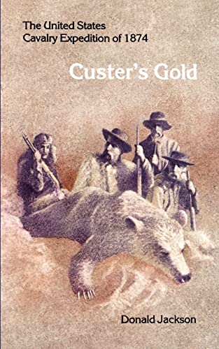
Custer's Gold: The United States Cavalry Expedition of 1874
Language: English
Published by University of Nebraska Press/Bison Book, Lincoln, NE, 1972
ISBN 10: 0803257503 ISBN 13: 9780803257504
Seller: Prairie Creek Books LLC., Torrington, WY, U.S.A.
Seller rating 4 out of 5 stars

Soft cover. Condition: Very Good. No Jacket. Photographs, Map (illustrator). Reprint Edition. VG/used pb, 152pp. Perfect bound, illustrated stiff paper wraps with orange colored text on upper and white text on orange spine; slight edge wear; no chips or tears. Interior pages clean, unmarked. Binding is tight.
-

Hanging on (Homesteading in Cook County)
Language: English
Published by The Cook County Historical Society, Grand Marais, Minnesota
Soft cover. Condition: Good. No Jacket. Betsy Bowen (Map illustrator) (illustrator). This is a nice nonfiction Cook County Minnesota history booklet called Hanging On (Homesteading in Cook County), copyright unknown with no date found, soft cover, written by Eleanor Jackson Stone with map drawn by Betsy Bowen. The booklet has small soiling mark on front cover, otherwise in good plus condition with tight binding, nice black and white photographs, clean and unpaginated. Size: 8vo - over 7�" - 9�" tall 0.
-
Hardcover. Condition: Used: Very Good. Book Club Edition/Book of the Month Club. A nice copy with a tight and square binding. No names, no marks, no stickers. Text is clean. Cloth boards are very good. Dust jacket is good but lightly yellowed. Careful packaging and fast shipping. We recommend EXPEDITED MAIL for even faster delivery.
-
The Romance of Historic Alexandria: A Thrilling Narrative of Events founded on Facts and Traditions
Published by Harry W Wade, Alexandria, VA, 1923
Soft cover. Condition: Good. Photographs and City Map (illustrator). 2nd Edition. Some minor damage to the title page-cover stuck. Affecting a couple of lines of title text. Otherwise in decent shape for a 100 year old pamphlet.
-

Suez: The Forgotten Invasion
Language: English
Published by Airlife Publishing Ltd, Shrewsbury, 1996
ISBN 10: 1853107743 ISBN 13: 9781853107740
First Edition
Soft cover. Condition: New. Plates and a map (illustrator). 1st (thus). New.
-
Pageant of the Pioneers: The Veritable Art of William H. Jackson "Picture Maker of the Old West"
Published by The Harold Warp Pioneer Village, Minden, NE, 1958
Seller: Clausen Books, RMABA, Colorado Springs, CO, U.S.A.
Association Member: IOBA RMABA
Seller rating 5 out of 5 stars

First Edition Signed
Illustrated Cloth. Condition: Very Good+. Dust Jacket Condition: Very Good (in mylar). William H. Jackson Photographs; One Folded Map (illustrator). Limited Edition. Copy #832 of 1,000. Author's ink signature on limitation page. Previous owner's inked gift inscription on ffep, else clean and tight textblock. Dark green cloth with gilt stamped decoration on front cover, title & author stamped in gilt down spine, there is very slight shelf wear. Unclipped & mylar sleeved dust jacket, small chips to head and foot of spine, couple chips to bottom rear edge, a bit of rubbing along fore-edge. 89pp. Size: 4to - over 9�" - 12" tall. Signed by Author. Hardcover.
-

The Diaries Of William Henry Jackson, Frontier Photographer To California And Return, 1866-67; And With The Hayden Surveys To The Central Rockies, 1873, And To The Utes And Cliff Dwellings, 1874 (The Far West And The Rockies Historical Series Volume X)
Language: English
Published by Arthur C. Clark Company, Glendale, 1959
Seller: Arroyo Seco Books, Pasadena, Member IOBA, Pasadena, CA, U.S.A.
Association Member: IOBA
Seller rating 4 out of 5 stars
First Edition
Hardcover. Condition: Fine. Plates, Folding Map (illustrator). 1st Edition. 345 Pp. Green Cloth, Gilt. First Printing, 1961. Fine. Ownership Signature Of A Jpl Astronomer And Manager Of The Halley Watch Program.,
-
On the Rise of the Vernacular Literatures in the Middle Ages (Contributor F.R.P. Akehurst--Troubadours As Intellectuals; T.M. Andersson--Emergence of Vernacular Literature in Iceland; Michelle Augier--Propos de Quelques Conversions feminines dans l'Epopee francaise; M.S. Batts--Emergence" of Medieval German Literature; R. Howard Bloch--Text As Inquest: Form and Function in the Pseudo-Map Cycle; Robert Hollander--Babytalk in Dante's Commedia; W.T.H. Jackson--Persona and Audience in Two Medieval Love-lyrics; David L. Jeffrey--Franciscan Spirituality and the Rise of Early English Drama; Michael J. Jeffreys--Literary Emergence of Vernacular Greek; Pierre Jonin--Clere" Espagne de Blancandrin; M. Dominica Legge--Rise and Fall of Anglo-Norman Lite
Published by University of Manitoba Press, Winnipeg
Seller: Burton Lysecki Books, ABAC/ILAB, Winnipeg, MB, Canada
Seller rating 5 out of 5 stars
1975. (Hardcover) Very good plus in very good plus dust jacket. 216pp. Illustrations, notes. Preliminary pp.iii-iv has been removed and there is a "booksale" stamp on the title page, the dust jacket has minor edgewear. Articles by Per Nykrog, Pierre Jonin, Michelle Augier and Marie-Louise Ollier are in French. Time Period Middle Ages. Contributors include F.R.P. Akehurst (The Troubadours As Intellectuals), T.M. Andersson (The Emergence of Vernacular Literature in Iceland), Michelle Augier (A Propos de Quelques Conversions feminines dans l'Epopee francaise), M.S. Batts (The Emergence" of Medieval German Literature), R. Howard Bloch (The Text As Inquest: Form and Function in the Pseudo-Map Cycle), Robert Hollander (Babytalk in Dante's Commedia), W.T.H. Jackson (Persona and Audience in Two Medieval Love-lyrics), David L. Jeffrey (Franciscan Spirituality and the Rise of Early English Drama), Michael J. Jeffreys (The Literary Emergence of Vernacular Greek), Pierre Jonin (La " Clere" Espagne de Blancandrin), M. Dominica Legge (The Rise and Fall of Anglo-Norman Literature), Jeanne S. Martin (Character As Emblem: Generic Transformations in the Middle English Saint's Life), Per Nykrog (Le Jeu d'Adam: Une interpretation), Marie-Louise Ollier (Demande Sociale et Constitution d'un "Genre": la situation dans la France du XII siecle), D. Paloma (Chaucer, Cervantes, and the Birth of the Novel), Zumthor (Birth of a Language and Birth of a Literature). Some text in French Language. (Essays).
-
Historical View of The Progress of Discovery on the More Norther Coasts of America, from the earliest period to the present time.
Language: English
Published by Oliver & Boyd, /Simpkin & Marshall, Edinburgh / London / UK, 1833
Seller: Old Favorites Bookshop LTD (since 1954), Stouffville, ON, Canada
Seller rating 4 out of 5 stars
Leather Binding. Condition: Good to Very Good Condition. Illustrated by a map and nine engravings by Jackson (illustrator). 2nd Edition. With descriptive Sketches of the Natural History of the North American Regions by James Wilson to which is added an appendix, containing remarks on a late memoir of Sebastian Cabot, with a vindication of Richard Hakluyt. 2nd edition. Marbled end papers and fore edges. 444pp. Content is clean, bright and sound with very minor foxing and paper lightly tanned. Front fold out map has minor foxing and lightly tanned. Leather binding is very lightly rubbed but is in fne condition. Photos available on request.
-
GURPS Discworld (GURPS: Generic Universal Role Playing System) ***Plus Colour Retail Promotional Poster***
Language: English
Published by Steve Jackson Games, USA, 1998
ISBN 10: 1556342616 ISBN 13: 9781556342615
Seller: CURIO, Cleethorpes, North East Lincolnshire, United Kingdom
Seller rating 5 out of 5 stars
US$ 121.52
US$ 40.22 shipping
Ships from United Kingdom to U.S.A.Quantity: 1 available
Add to basketSoft cover. Condition: Very Good. No Jacket. Kidby, Paul (illustrator). First Print (number line 1 2 3 4 5 6 7 8 9 10). A4 Paperback copy, no dustjacket as issued. 240pp. B/w illustrations throughout, other publications advertised to inside front/rear covers. Comes with colour retail promotional poster (83cm x 54cm). Not library copy, no inscriptions, no creasing to spine, rubbing to cover and spine edges, poster is folded). (2/5).
-
The Beginnings of Christianity, Part 1 The Acts of the Apostles Vol. 5
Published by Macmillan, London, 1933
Seller: Appleford Bookroom, Abingdon, OXON, United Kingdom
Seller rating 5 out of 5 stars
First Edition
US$ 41.43
US$ 38.81 shipping
Ships from United Kingdom to U.S.A.Quantity: 1 available
Add to basketOriginal Cloth. Condition: Very Good. No Jacket. Collotype Papyrus, Genealogy & Map. (illustrator). First Edition. xiv+548 pp., brown cloth v. sl. incipient foxing esp at ends, pull out map, geneaolgy, papyrus collotype, 5 indices. 37 learned essays. Additional notes to a [previous] commentary. Ex-St Michaels college & cathedral library Llandaff with 2 bookplates. Size: 8vo. Association Copy.
-
An Historical And Descriptive Account Of Persia, From The Earliest Ages To The Present Time: With A Detailed View Of Its Resources, Government, Population, Natural History, And The Character Of Its Inhabitants . Including . Afghanistan And Beloochistan
Language: English
Published by Oliver & Boyd, Edinburgh, 1834
Seller: Arroyo Seco Books, Pasadena, Member IOBA, Pasadena, CA, U.S.A.
Association Member: IOBA
Seller rating 4 out of 5 stars
Quarter Morocco. Condition: Fine. Second Edition. 472 Pp. Quarter Morocco. Asecond Edition. A Fine Copy, Spine Gilt Very Strong, Original Purple Morocco Spine And Tips, Original Purple Cloth, Original Watered Endpapers And Watered Edges Of Page Block, Contents Fine, Leather Just Recently Professionally Refreshed. Contents Immaculate, Pages Crisp, Map Undamaged, No Foxing. Heraldic Bookplate "Sperate Et Vivitefortes" Of The Welsh Cavalry, Senior Cavalry Of The British Army, On Front Pastedown, Ownership Signature "John Clements, Queen's Dragoon Guards" On Verso Of First Front Endpaper.
-
British Army Boer War map of 'Melmonth [ i.e. Melmoth ]': 'Sheet No. 37' in 'Transvaal (Major Jackson's Series)'.
Published by British Army Field Intelligence Department Pretoria 'Photo-lithographed - Pretoria - June 1901 | Mapping Section - Field Intelligence Dept - Army Head Qrs.', 1901
Seller: Richard M. Ford Ltd, London, United Kingdom
Seller rating 5 out of 5 stars
Signed
US$ 110.48
US$ 6.03 shipping
Ships from United Kingdom to U.S.A.Quantity: 1 available
Add to basketPhotolithographically printed in black on one side of a 51 x 63 cm. piece of cloth, folding into a 16.5 x 11 cm. packet, in green printed cloth covers backed with card. In good condition, lightly-aged, with minor signs of age and wear. Cover reads: 'Transvaal. | (Major Jackson's Series). | Sheet No. 37. | Melmonth. | Field Intelligence Department. | Pretoria, 1901.' Signed in pencil on front cover 'G S Scovell | Cam Hrs.' In top left-hand corner of map: 'No. 37'. In bottom left-hand corner: 'Compiled in Surveyor General's Office - Pretoria underdirection [sic] of MAJOR H. M. JACKSON R.E. Mch. 1901 | From Transvaal Farm Surveys - Zululand portion from Map supplied by Surveyor General Natal'. In bottom right-hand corner: 'Photo-Lithographed - Pretoria - June 1901. | Mapping Section - Field Intelligence Dept - Army Head Qrs.' E. Liebenberg, in a paper titled 'The Cartographic Legacy of the Anglo-Boer War, 1899-1902', describes the 'valuable work' done by Jackson until the cessation of hostilities when he became Surveyor-General of the Transvaal Colony. As he explains, 'Major Jackson's Transvaal and Natal Series', of which the present item is a part, was the second of three series (the first being the 'Imperial Map of South Africa', and the third the 'Transvaal and Orange River Colony Degree Sheet Series), its deficiencies the result of the hurry with which it was compiled: 'Major Jackson's Transvaal and Natal Series was initiated by Major H M Jackson, head of the Topographical Section of the FID soon after Pretoria was occupied in June 1900. Also known as the First Transvaal Series, this series consisted of 74 sheets of irregular size covering the whole of the Transvaal (except the extreme north-eastern portion), Naral, Zululand and Swaziland, and part of the former Bechuanaland. The maps were printed in monochrome on linen-backed paper and were, like the Imperial Maps, folded to pocket size for easy usage on horseback. Compiled in a hurry for urgent military use, the maps are of a poor standard and it is uncertain whether they were of much use for military purposes. Although farm names and farm boundaries are shown, the physical topography is merely sketched in and no altitudes are given. According to Jackson himself, these maps were based on a mere 'patch-work' of farm diagrams and as such included much information that was of dubious value - if not positively misleading'. From the papers of Lieutenant-Colonel George Julian Selwyn Scovell of the 1st Cameron Highlanders, for more information regarding whom see his obituary in The Times, 29 April 1948, and his entry in Who Was Who. Scovell's diaries covering his period of service in the Boer War are offered separately.
-
Barawa and the Ways Birds Fly in the Sky: An Ethnographic Novel
Published by Smithsonian Institution (1986), Washington, D.C., 1986
Seller: Expatriate Bookshop of Denmark, Svendborg, Denmark
Seller rating 5 out of 5 stars
orig.boards. Textual map (illustrator). 23x15cm, 212 pp, In a lightly torn dustwrapper. Account of a Kuranko chiefdom in northeastern Sierra Leone. [Barawa is the story of the succession of Kuranko chiefs & their families over a sweep of several hundred years.,.Jackson breaks new ground in ethnographic writing: Barawa includes personal memoir, ethnohistory, imaginative reconstruction, poetry and detailed ethnographic study.,." - Publisher's description] Minor rubbing. VG., dustwrapper.
-
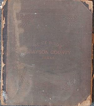
[Grayson County, Texas Atlas] Twentieth Century Plat Book of Grayson County Texas
Published by Jackson Map Company, 1908
Seller: Barry Lawrence Ruderman, La Jolla, CA, U.S.A.
Seller rating 5 out of 5 stars
Hardcover. Condition: good. The Only Pre-World War I Texas County AtlasThis is a rare folio atlas that documents the land ownership, town layouts, and administrative boundaries of Grayson County at the beginning of the twentieth century.Compiled du. Folio. Publisher's leather over cloth boards. Binding worn, cloth torn away from front cover exposing bare boards. Front cover detached. 58 maps. [10],23-110,[1],120-182 pages plus 2 folding maps (on one sheet). Numerous portraits of local residents on pages 157-182. Folding map with some expertly repaired tears. Some marginal dampstaining and minimal edge nicks to first two leaves and to the last text and portrait section, but map sheets generally clean and very nice. Additional map laid in: a circa 1974 blue line print plat map of a portion of Grayson County. The Only Pre-World War I Texas County AtlasThis is a rare folio atlas that documents the land ownership, town layouts, and administrative boundaries of Grayson County at the beginning of the twentieth century.Compiled during a period of growing regional development and civic organization, the volume combines full-color cadastral maps, voter precinct boundaries, business advertisements, and local biographical information into a single reference work designed for use by county officials, landowners, and real estate interests.The atlas includes a large folding map of Texas, attractively color-coded by county and bordered with engraved portraits of Texas governors and an illustration of the State Capitol. It also includes maps of the United States and the world, offering broader geographic context.The atlas sheets comprise a map of Grayson County showing its division into thirty-seven voting precincts. Each subsequent map sheet depicts a specific town or precinct in greater detail, with color washes used to differentiate blocks and land parcels. Landowners are identified by name, and features such as streets, rail lines, and public buildings are carefully delineated. In addition to the maps, the volume contains a biographical section with portraits of local figures, a brief history of the state of Texas, and an alphabetical listing of land surveys and original grantees. Advertisements from local banks, attorneys, merchants, seed companies, and undertakers appear throughout, reflecting both the commercial networks active in Grayson County and the financial support that enabled the atlas s publication.This work holds particular historical significance as the only pre World War I county atlas known to have been produced for any part of Texas. While such plat books were common in the Upper Midwest and Plains states during the late nineteenth and early twentieth centuries, this is the only such atlas for Texas. As a result, this volume provides a unique visual and documentary record of Texas land ownership and civic geography in the early twentieth century. Its combination of cadastral maps, local directories, advertisements, and portraits makes it an important resource for the study of North Texas land tenure, rural development, and community life during this period.RarityWe note a single example offered for sale in the past 50 years (Swann 1992) and an incomplete example currently on the market as of 2025. Not in Raines, Jenkins, Graff, or any other standard Texas or Western Americana bibliographies. Book.
-
Twentieth Century Plat Book of Grayson County, Texas
Published by St. Joseph, MO, St. Joseph, MO, 1908
Seller: High Ridge Books, Inc. - ABAA, South Deerfield, MA, U.S.A.
Association Member: ABAA ESA ILAB SNEAB
Seller rating 5 out of 5 stars
Original 1/2 leather, worn, boards detached and worn, leather at corners nearly perished. 55(of 58) maps, lacking double page maps of Texas, the United States and the World. This is the only pre-World War I atlas of any county in Texas. While the missing maps are unfortunate, none contain detailed information unique to this atlas. All maps of the county and its towns are present, as are the ads, directory information, and portraits of leading citizens. This is an important piece for any collection of Texas maps as there are no other Texas county atlases. OCLC 9182393 (13 loc., 4 outside of Texas) LeGear L3260.
-
Map of Walla Walla City. For a copy of this map -- free of charge -- go to Green and Jackson Drug Co. . . .
Published by 19 West Main Street, [ca. 1910]., Walla Walla, WA:, 1910
Seller: Zephyr Used & Rare Books, Vancouver, WA, U.S.A.
Association Member: ABAA CBA ESA ILAB
Seller rating 5 out of 5 stars
First Edition
Oblong folio. 17 x 13.5 in. One map printed in red & black on gold-coloured paper, most streets named, red lines marking trolley & rail lines, fold creases as issued (minor dustsoiling, wear, rubbing, 1 minor closed tear nearly repaired) still VG- copy, w/ pencil annotations indicating further streets above the map, and route within. First edition, thus, of this promotional advertising pocket map for Walla Walla in the Progressive Era, carefully delineating for their potential customers on the map just how far a certain address would be located from their Main Street Store. As this map shows the Walla Walla Valley Railway interurban line to Milton-Freewater which opened in 1907, and also includes the O.W.R. & N. Depot, which became that after the Union Pacific established the Oregon-Washington Railroad & Navigation Co. as a subsidiary in 1910. Jackson had moved to Walla Walla in 1899 to partner with Green in their Drug Co. on 19 West Main Street, and both worked until selling the business in 1926. No copies in Worldcat.
-

1893 Map of Jackson Park Showing Proposed Improvements for Worlds Columbian Exposition
Seller: New World Cartographic, Chicago, IL, U.S.A.
Seller rating 4 out of 5 stars
Map
By:UnknownDate: 1893Dimensions: 21.5 x 14.5 inches (54 x 37 cm)A tastefully designed and cleanly laid out display of Jackson Park published near the occasion of the Worlds Columbian Exposition. Full of great textures laid out in greyscale, this map details lakefront improvements and proposed costs to bolster the experience of the Worlds Fair.Condition: B+ condition with original folds and slight toning to the edges. Full margins with light bumps at corners.Inventory #127751200 W. 35th St. #425 Chicago, IL 60609 | P: (312) 496 - 3622.
-

Jackson Co.
Publication Date: 1880
Seller: Geographicus Rare Antique Maps, Brooklyn, NY, U.S.A.
Association Member: ABAA ESA ILAB
Seller rating 4 out of 5 stars
Map
Very good. Even toning. Repairs and reinforcements on the verso to marginal tears. Small hole at top-center in the plot marked 'No. 23 Archibald S. White.' Handwritten annotations in pencil provide updated or corrected information on property ownership. Size 23 x 19.75 Inches. A rare 1880 plat map of Jackson County, Texas, produced by the Texas General Land Office and printed (lithographed) by August Gast. It depicts the county on the eve of an important transformation brought by the railroad. A Closer Look Jackson County is situated midway down the Texas coast, about midway between Houston and Corpus Christi. Much of the county originally consisted of coastal prairies and the rivers and bays seen here provide access to the Gulf of Mexico. By the time this map was produced, Jackson had been in existence for nearly 50 years, having been founded in 1836 (named for Andrew Jackson) as a municipality within Mexican Texas and then as one of the original counties of the independent Republic of Texas. As such, it was an early site of settlement for members of the 'Old Three Hundred' families who purchased parcels of land from Stephen Austin's land grant in the early 1820s. As with the wider region around the old Spanish Presidio La Bah�a, Jackson County had originally been home primarily to Karankawa people, who had a difficult relationship with the Spanish before being driven out of the area by settlers in the 1820s - 1850s. During the Texas Revolution, many residents fled and their farms were burned by Santa Anna's troops. Compared to a contemporary map of neighboring Calhoun County recently sold by us (CalhounCounty-texasglo-1879), there are more Anglos and less Tejanos among the landowners of Jackson County. As in Calhoun County, there does appear to have been noticeable but not absolute spatial segregation between the two groups. In this case, Tejanos mostly reside west of the Lavaca River and Anglos to the east. Unsurprisingly, some landowners owned property in both counties. Notable among the landholders indicated here are Texas founding fathers Stephen Austin and Sam Houston, both long deceased by the time this map was published, but their property had presumably been retained by descendants. Though no railroad existed at this time in the county, the International-Great Northern Railroad owned tracts of land in the county. However, it was another company, the New York, Texas and Mexican Railway, that first built a railroad there. In the mid-19th century, Texana emerged as the main town in the county, but the overall population remained small and agrarian, with as much as one-half of the county's population being enslaved, tasked with growing cotton and sugarcane. In the years immediately following this map's publication, the Italian-born railroad entrepreneur Joseph (Guiseppe) Telfener built the New York, Texas and Mexican Railway through Jackson County. The residents of Texana were ambivalent about the project because they thought it would threaten the town's maritime shipping, so a station was built to the west, closer to the Lavaca River. Edna, named for one of Telfener's daughters, quickly outgrew Texana as a result, and was made the county seat in 1883. By 1884, Texana was a virtual ghost town and today only exists as a historical site within Edna. Publication History and Census This map was prepared by the Texas General Land Office and printed by August Gast in 1880. We note it among the holdings of the University of Houston, the Library of Congress, and Texas A and M University, and it has no known history on the market. A later edition was published in 1896 and is similarly scarce. References: OCLC 171015562, 796918326 (1896 edition).
-

Economic map of portions of Wyoming, Idaho and Utah.
Publication Date: 1879
Seller: Geographicus Rare Antique Maps, Brooklyn, NY, U.S.A.
Association Member: ABAA ESA ILAB
Seller rating 4 out of 5 stars
Map
Good. Wear and some uneven toning along fold lines. Size 20.5 x 36 Inches. An impressive, large-scale 1879 map of the border region between Idaho, Utah, and Wyoming illustrating economic growth factors. Though similar in appearance to other geological maps produced by the USGGST, it focuses on 'economic' factors such as coal and arable land. It was produced by Ferdinand Vandeveer Hayden and the U.S. Geological and Geographical Survey of the Territories (USGGST), the forerunner to the U.S. Geological Survey. A Closer Look Ranging from the Snake River Plains and the 'Bannack' (now the Fort Hall Shoshone-Bannock) Reservation in the west to the Rattle Snake Mountains and the area around Rawlins in the east, this map takes in the Green River Basin, Bear Lake, Jackson Hole, and the Wind River Shoshone Reservation. Mountains and settlements (with their elevations), waterways, roads, railroads, and more are indicated. Though still quite remote, the development of towns in the region is apparent, especially along roads, rail lines, and waterways. Color shading indicates the nature of the land (arable land, forest, rock, grass, sage) and the location of coal deposits. The U.S. Geological and Geographical Survey of the Territories The U.S. Geological and Geographical Survey of the Territories (also known as the Hayden Survey) was created under the U.S. Department of the Interior in 1870, with Hayden as its director. It operated through 1879. The first year the Survey operated in Wyoming on a budget of $25,000 with twelve assistants and eight teamsters and cooks. The following year (1871), the Survey received $40,000 and employed thirty-two individuals, including artist Thomas Moran and photographer W. H. Jackson. That year they launched from Ogden, Utah (which the Union Pacific Railroad had reached) and spent the summer in what is now Yellowstone National Park. The work conducted by the survey that year played a critical role in convincing the U.S. Senate to create Yellowstone, the first U.S. National Park. The Survey worked in Colorado from 1873 through 1876 because of hostilities between white settlers and Native Americans in Wyoming. The team returned to the Yellowstone in 1877 and 1878. Then, in 1879, the Hayden Survey, along with surveys led by John Wesley Powell (the Colorado River and the Grand Canyon) and Clarence King (Fortieth Parallel Survey), were merged to create the U.S. Geological Survey. Publication History and Census This map was produced by the USGGST, led by Ferdinand Vandeveer Hayden. Though dated April 1879, it appeared in the Twelfth Annual Report of the USGGST for the year 1878 (the map is also sometimes dated to 1883 as the 1878 report was not published by the Government Printing Office until 1883). Due to these discrepancies over publication date, as well as cataloging variations in the title and attribution of authorship, and the co-mingling of digital and physical copies, the map appears in eight listings in the OCLC. All told, it is independently cataloged among the holdings of some twelve institutions worldwide, while the entire 1878 Annual Report is somewhat more widely distributed.
-

Geological map of portions of Wyoming, Idaho and Utah.
Publication Date: 1878
Seller: Geographicus Rare Antique Maps, Brooklyn, NY, U.S.A.
Association Member: ABAA ESA ILAB
Seller rating 4 out of 5 stars
Map
Very good. Wear and toning along fold lines. Verso repairs to one fold intersection. Size 20.5 x 36.5 Inches. A colorful 1878 geological map of the border region between Wyoming, Idaho, and Utah produced by the U.S. Geological and Geographical Survey of the Territories (USGGST). It was one of several such maps to appear in the Twelfth Annual Report of the USGGST, representing the first detailed geological surveys undertaken in this portion of the American West. A Closer Look Coverage extends from the Snake River and Utah and Northern Railroad at left to the Seminoe and Rattle Snake Mountains at right, and north from the Jackson Lake region (including 'Jackson's Hole') south to Bear Lake and environs. The geological era and types of rock are indicated by bright colors, while mountains, rivers, lakes, stagecoach roads, railroads, Indian Reservations, and settlements are noted in detail. The U.S. Geological and Geographical Survey of the Territories The USGGST (also known as the Hayden Survey) was created under the U.S. Department of the Interior in 1870, with Ferdinand Vandeveer Hayden as its director. It operated through 1879. The first year the Survey operated in Wyoming on a budget of $25,000 with twelve assistants and eight teamsters and cooks. The following year (1871), the Survey received $40,000 and employed thirty-two individuals, including artist Thomas Moran and photographer W. H. Jackson. That year they launched from Ogden, Utah (which the Union Pacific Railroad had reached) and spent the summer in what is now Yellowstone National Park. The work conducted by the survey that year played a critical role in convincing the U.S. Senate to create Yellowstone, the first U.S. National Park. The Survey worked in Colorado from 1873 through 1876 because of hostilities between white settlers and Native Americans in Wyoming. The team returned to Yellowstone in 1877 and 1878. Then, in 1879, the Hayden Survey, along with surveys led by John Wesley Powell (the Colorado River and the Grand Canyon) and Clarence King (Fortieth Parallel Survey), were merged to create the U.S. Geological Survey. Publication History and Census This map was prepared by Albert Charles Peale, Orestes St. John, and Frederick Miller Endlich, and produced by the USGGST. Though surveyed in 1877, the map is usually dated to 1878 as it appeared in the Twelfth Annual Report of the USGGST for the year 1878 (it is also sometimes dated to 1883 as the 1878 report was not published by the Government Printing Office until 1883). It is independently cataloged by 23 institutions worldwide, while the entire Twelfth Annual Report is well represented in institutional collections. References: Rumsey 5948.000. OCLC 27658853, 953570022.
-
Jackson Hole Picture Map.
Publication Date: 1986
Seller: Geographicus Rare Antique Maps, Brooklyn, NY, U.S.A.
Association Member: ABAA ESA ILAB
Seller rating 4 out of 5 stars
Map
Very good. Light wear along original fold lines. Size 17 x 34.25 Inches. This is a 1986 Chris King pictorial map of Jackson Hole, Wyoming - a mecca for outdoor enthusiasts with easy access to Grand Teton National Park and Yellowstone National Park. A Closer Look The town of Jackson, Wyoming, occupies most of the foreground, with hotels, restaurants, shops, and more illustrated in profile. 'Signs' label businesses that occupy the same building, such as the Trading Post Mall and Cache Creek Square. Other locations are numerically marked and correspond with the business directory on the verso. The Rocky Mountains occupy the background, with Teton Village, Spring Creek Ranch, and Wagon Wheel Village illustrated. Verso Content A local business directory occupies most of the verso, and advertisements create a border. A highway map of Jackson Hole situates the city in relation to Grand Teton National Park and Yellowstone National Park. Publication History and Census This map was created by Chris King and published in 1986. Published annually for tourists visiting the region, it is likely not many survive today. 4 examples of the 1986 edition are cataloged in OCLC: Pennsylvania State University, Frostburg State University, Michigan State University, and the University of Wyoming. References: OCLC 1060553511.
-

A Hysterical Map of the Jackson Hole Country and Grand Teton National Park. Slightly Cockeyed.
Publication Date: 1948
Seller: Geographicus Rare Antique Maps, Brooklyn, NY, U.S.A.
Association Member: ABAA ESA ILAB
Seller rating 4 out of 5 stars
Map
Very good. Slight wear on old fold lines. Size 22 x 17 Inches. A blend of the comic and the practical, this is a 1948 Jolly Lindgren larger format pictorial map of Jackson Hole and Grand Teton, Wyoming. This is one of the rarer of Lindgren's 'Hysterical' map series, which gained popularity against the grim backdrop of first the Great Depression and World War II. A Closer Look The map is loosely centered on the Cathedral Group, with Jackson Lake just north of center. 'Hysterical' vignettes and captions throughout provide humorous commentary on Grand Teton, Jackson Hole, and the vicinity. On the more serious side, Lindgren marks hotels, campsites, ranger stations, shops, mountains, trails, and other key locations. There are several references to hamburgers, including 'Hamburgers (on the hoof) and 'Jackson Hamburgers'. Grand Teton National Park Grand Teton National Park was established in 1929 in northwestern Wyoming. It is renowned for its stunning mountain landscapes and diverse wildlife. The park dates back to efforts by conservationists like John D. Rockefeller Jr., who played a crucial role in expanding the park. Initially, only the Teton Range and some surrounding lakes were protected, but in the 1940s, Rockefeller quietly purchased over 35,000 acres of land in the Jackson Hole Valley and donated it to the federal government. This led to the park's expansion in 1950, two years before this map was made, creating the Grand Teton National Park as it is known today. The park preserves not only the dramatic Teton Range but also the cultural history of Native Americans, early pioneers, and fur trappers who once inhabited the region. Lindgren's 'Hysterical' Maps Between roughly 1930 and 1950, Hjalmer 'Jolly' Lindgren (1895 - September 1952) and his brother Oscar 'Ott' Lindgren (1893 - 1967) issued a series of 'Hysterical Maps' detailing American national parks and monuments. Jolly was the artist while his brother, Oscar, ran the business. Jolly imagined the maps as comic relief, as well as a reminder of the world's most beautiful places during both the Great Depression and the subsequent World War II (1939 - 1945) Era. He wrote, 'What this country needs now is something to put a smile on people's faces.' The maps are graphically interesting and intended, as the titles suggest, to amuse. The brothers focused on producing maps of popular tourist attractions, and the great national parks of the West were an obvious choice. They produced maps of Yellowstone, the Grand Canyon, Glacier, Zion, Bryce Canyon, and others through the early 1940s. Some were also issued as postcards. Today, Lindgren's larger maps are highly desirable, and many are extremely rare. There is no complete census of Lindgren's full corpus. Publication History and Census This map was created by Jolly Lindgren and first published by Lindgren Brothers in 1948. Lindgren made multiple maps of Jackson Hole, and while some of the humor persists throughout the series, each is unique, reflecting the regional developments between 1935 and 1950. The first map appeared in 1935, with a red-bordered variation following in 1936. In 1947, a new map was issued, extending coverage. In 1948, this map, another new production, was issued. References: Rumsey 9945.000. OCLC 43328780.


![Seller image for [Grayson County, Texas Atlas] Twentieth Century Plat Book of Grayson County Texas for sale by Barry Lawrence Ruderman](https://pictures.abebooks.com/inventory/md/md32251554406.jpg)