Red Map (23 results)

Seller: Hennessey + Ingalls, Los Angeles, CA, U.S.A.Hennessey + Ingalls
Contact seller4-star sellerCondition: New
US$ 7.95
US$ 6.50 shippingShips within U.S.A.Quantity: 1 available
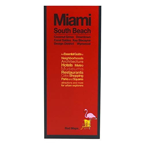
Folded. Condition: New. The newest edition of Las Vegas features over 350 of the best shopping at the Forum Shops, The Crystals City Center, Grand Canal Shoppes, Palazzo, Bellagio and more along with the best hotels on and off the strip, over 230 restaurants, and what to do and see on Fremont Street and Las Vegas Blvd. We give y…ou the best of Vegas shows and entertainment along with Art spaces, hiking, golfing and top attractions.
Seller: Hennessey + Ingalls, Los Angeles, CA, U.S.A.Hennessey + Ingalls
Contact seller4-star sellerCondition: New
US$ 9.95
US$ 6.50 shippingShips within U.S.A.Quantity: 1 available
Folded. Condition: New.

Seller: Hennessey + Ingalls, Los Angeles, CA, U.S.A.Hennessey + Ingalls
Contact seller4-star sellerCondition: New
US$ 9.95
US$ 6.50 shippingShips within U.S.A.Quantity: 2 available
Folded. Condition: New. Highlighting the historical landmarks of the Capital. Includes the cultural center of the city, The Mall â" home to the Smithsonian Museums and the iconic memorials of Lincoln, Washington and Jefferson. Also, Historic Georgetown, trendy Dupont Circle and politically driven Capital Hill. The best shopping,… restaurants, hotels, as well as the important government centers and cultural institutions.

Published by Red Map January 2007 2007
Seller: Hennessey + Ingalls, Los Angeles, CA, U.S.A.Hennessey + Ingalls
Contact seller4-star sellerFolded. Condition: New. 11th edition.
Published by Red Map January 2007 2007
Seller: Hennessey + Ingalls, Los Angeles, CA, U.S.A.Hennessey + Ingalls
Contact seller4-star sellerFolded. Condition: New.
 More images
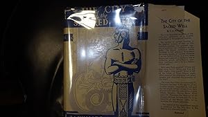
The City of the Sacred Well: being a narrative of the discoveries and excavations of Edward Herbert Thompson in the Ancient City of Chi-Chen-itza with some discourse on. . . the Mayan civilization. . . . . in Blue & Beige DJ of Barechested Indian with a
T. A. Willard, Inner Flap Dj PriceClipped but red price code of 125125 Intact, Green & Black Illustrated Map Endpapers, Blank Flyleaf Former owner Inscription, FORMER OWNER STAMP Back Blank Flyleaf , Glossy B/W Frontispiece a Last Forward Spring & the Bri
Published by Grosset & Dunlap, Century Vagabond Books 1926
- Hardcover
Seller: Bluff Park Rare Books, LONG BEACH, CA, U.S.A.Bluff Park Rare Books
Contact seller4-star sellerAssociation member: IOBA
Condition: Used - Very good
US$ 33.00
US$ 8.85 shippingShips within U.S.A.Quantity: 1 available
Hardcover. Condition: Very Good. Dust Jacket Condition: Fair. First Thus. Glossy B/W Frontispiece a Last Forward Spring & the Bride of Yum Chae hurtles far out over the Well. PREFACE, Includes: Illustrations, Maps, Portraits, Plates ,in Blue & Beige DJ of Barechested Indian with arms Folded cover art of Mayan priest w/ hieroglyp…hs in the bkgrnd ,This book "is primarily an attempt to recount the many thrilling experiences of Edward Herbert Thompson in his lifelong quest for archaeological treasures in the ancient and bandoned city of Chi-chen Itza, for centuries buried beneath the jungle of Yucatan.
Published by no publisher stated.(us u.s. army map service?) ud 1940s?, No Place stated pub 1940
- Softcover
Seller: WONDERFUL BOOKS BY MAIL, CHICO-CA, CA, U.S.A.WONDERFUL BOOKS BY MAIL
Contact seller5-star sellerCondition: Used - Very good
US$ 50.00
US$ 3.75 shippingShips within U.S.A.Quantity: 1 available
paperback. Condition: Very Good. Original ed. VERY GOOD Condition. CORENERS SOME ROLL PAPERBACK; (AERONAUTICAL CHART).printed in fine detail on both sides of nice SILK CLOTH.Similar to items used in World War TWo as part of rescue & trade item for flliers first aid kits. cloth is 23x21" neatly folded down to 3x3". PORTA TO MADRI…D BOTTOM ONE SIDE.BILBOA to BEZIERS other side top.No date to LEGEND CHART, .Map is on bright white silk cloth, with 1" wide tan border all around. NOT TORN, NOT FREYED, NOT MARKED UP.NOT STAINED.BUT OBVIOUSLY WORLD WAR TOW ERA ITEM. ; 1 LARGE SHEET pages; VERY LAGE, COLORFUL MAP SHOWING MUCH EUROPE SOUTH OF FRANCE.This a nice item since it covers the European theater. Quite nice, no tears, no marks. CLEAN. Illustrated by black, blue,red with much land in shades of orange (illustrator).
Monk's Hood ,Medieval Novel of Suspense, Brother Cadfael Mystery #3, An Eerie Tale of Revenge & a Special Kind of Love Story, At the monastery in Shrewsbury in 1138, Brother Cadfael's workshop shelves boast all sorts of medication for every kind of Ai
Ellis Peters AKA Edith Pargeter, She Lives in England, Inner Flap DJ Original Price of $9.95 Intact with Some Browning, FORMER OWNER STAMP Back Blank Flyleaf, Glue RESIDUE on Red endpapers, Fontispiece B/W Map Drawing Shrewsbury Abbey & Town Showin
Published by WM. Morrow William 1981
- Hardcover
- First Edition
Seller: Bluff Park Rare Books, LONG BEACH, CA, U.S.A.Bluff Park Rare Books
Contact seller4-star sellerAssociation member: IOBA
Condition: Used - Very good
US$ 45.00
US$ 8.85 shippingShips within U.S.A.Quantity: 1 available
Hardcover. Condition: Very Good. Dust Jacket Condition: Very Good. 1st Edition. Fontispiece B/W Map Drawing Shrewsbury Abbey & Town showing Bonel's House, Back DJ Photo of Author Taken by Marjory Dressler,HBDJ, Stated 1ST US EDITION, 1981 on Title & Copyright Pg, VG/VG+, AS-IS, , Slight Lean to Book, Grey Boards with White Cloth… Spine Titled in Gold Gilt, Interior nice, Tight Clean, Light Fox, Wear, 224 pgs, DJ Protected by Clear Mylar, the Third ( 3rd ) Brother Cadfael Mystery ( Medieval ) First U.S. Printing with the 1 in the number line, original $9.95 cover price remains intact, ,Brother Cadfael's workshop shelves boast all sorts of medication for every kind of ailment. When Gervase Bonel is poisoned with one of them, the monk finds suspicion has fallen on someone he is certain is innocent, A guest of the abbey is suddenly taken ill and Cadfael recognizes the symptons of poisoning, a fatal dose. Eerie tale of revenge and the woman Cadfael once loved. Last numbered page is 223.

Published by Meulenhoff Educatief, 1e e druk, 7e oplage 1978 1978
- Hardcover
Seller: Handled With Care, Bocholt, BelgiumHandled With Care
Contact seller3-star sellerCondition: Used - Very good
US$ 8.21
US$ 53.54 shippingShips from Belgium to U.S.A.Quantity: 1 available
Hardcover/Hardback. Condition: Very Good. In zeer goede staat. Hardcover. Rijkelijk geà llustreerd.
Jerry Todd & The Waltzing Hen Series #4 ( Has 3 Internal Illustrations ) Includes Section From Our Chatter-Box in Front of Book
Leo Edwards, Decorated Endpapers in Red Orange & White Map of Tutter, Illinois , GLOSSY Frontispiece, Illustrated By Bert B. N. Salg
Published by Grosset & Dunlap 1925
- Hardcover
Seller: Bluff Park Rare Books, LONG BEACH, CA, U.S.A.Bluff Park Rare Books
Contact seller4-star sellerAssociation member: IOBA
Condition: Used - Very good
US$ 65.00
US$ 8.85 shippingShips within U.S.A.Quantity: 1 available
Hard Cover. Condition: Very Good. Dust Jacket Condition: Very Good. HBDJ,1925, Later Edition, decorated Bright Red cloth lettered in Black WITH Fish on Front, VG/VG , AS-IS, Cover minor rub & Wear ,Nice & Tight Light Soil Cover & tiny white stain on Spine,226 pgs, plus 6 pgs of publ ads in back, DJ light rub, wear & Tiny Small C…hips Extremities, Interior Nice tight Clean light FoX & Wear, Mended small Tape Repair Back Edge DustJacket, Lists to Tuffy Bean Funny Bone Farm plus 4 other ads on the same page. The pages are nice, clean, and tight with a glossy B&W frontispiece and glossy B&W internals. There is a little foxing along the outer edges of the pages. The exterior has wear at the top and bottom of the spine, edges, and corners-small tears on the top and bottom of the spine-with some fading along the spine-some discoloration on the binding-fading spots on the binding, In the back it lists to Tuffy Bean Lost Fortune with 3 other ads on that page and it has 10 other pages of ads-if you need the listings of any please email me. The dust jacket has chipping along the edges-a couple of small closed tears-tape on the top of the back corner-scuffing, It has a description of the story on the front flap, it lists to Buffalo Bill Bathtub on the back flap, and it lists to Poppy Ott Hits The Trail on the back cover. This is a fairly nice copy.

- Hardcover
Seller: Gert Jan Bestebreurtje Rare Books (ILAB), Vianen, NetherlandsGert Jan Bestebreurtje Rare Books (ILAB)
Contact seller5-star sellerCondition: Used
US$ 23.23
US$ 38.45 shippingShips from Netherlands to U.S.A.Quantity: 1 available
(Bussum, Fibula-Van Dishoeck, 1976). Boards, with dust-jacket. With maps. 243 pp. Contributions by S. Arasaratnam on Ceylon and Coromandel, A. Das Gupta on Suratte and the Malabar coast, H.K. s'Jacob on the Malabarcoast, L.Y. Andaya on Malay, John E. Wills on Taiwan, China and Batavia, M. Kanai on Japan.
 More images
Jerry Todd Up-The-Ladder Club ( Up the Ladder ) Includes Section More Fun For You in Front of Book, Series # 14 , a Lighthearted Mystery Series. This Book Includes Information on Starting Your Own Up-the-ladder Club By Writing to the Author to Obtain Pe
Leo Edwards, decorated endpapers in Red Orange & White Map of Tutter , Illinois with FoXing , B/W Frontispiece, Illustrated By Myrtle Sheldon
Published by Grosset & Dunlap 1937
- Hardcover
Seller: Bluff Park Rare Books, LONG BEACH, CA, U.S.A.Bluff Park Rare Books
Contact seller4-star sellerAssociation member: IOBA
Condition: Used - Very good
US$ 95.00
US$ 8.85 shippingShips within U.S.A.Quantity: 1 available
Hard Cover. Condition: Very Good. Dust Jacket Condition: Good. HBDJ,1937, Later Edition, Bright Red cloth lettered in Dark Blue or Black on Front & Spine, VG+/G , AS-IS, Cover minor rub & Wear ,Nice & Tight Solid Cover ,235 pgs, plus ads in back, DJ light rub, wear & Tiny Small Chips Extremities + large Piece out of top of Spine… DJ 1 1/4 in. , Interior Nice tight Clean light FoX & Wear, Mended small Tape Repair Back DustJacket, It lists to Poppy Ott Hidden Dwarf with 2 other ads on the same page in the front. The pages are nice, clean, and tight with a little foxing. The exterior has some wear at the top and bottom of the spine, edges, and corners , In the back it lists to Gridiron Number 44 with 2 other pages of ads , The dust jacket has some pieces missing at the top of the spine, corners, and side of spine-chipping along the edges-a couple of Small closed tears-creasing, It has a description of the story on the front flap, it lists to Hardy Boys Flying Express on the back flap, and it lists to Jerry Todd Cuckoo Camp on the back cover. . Rare & Hard to Find Title.
Language: English
Seller: K Books Ltd ABA ILAB, York, YORKS, United KingdomK Books Ltd ABA ILAB
Contact seller5-star sellerCondition: Used - Very good
US$ 61.18
US$ 25.74 shippingShips from United Kingdom to U.S.A.Quantity: 1 available
No Binding. Condition: Very Good. A splendid map. . In very good condition. Printed circa 1809. Chart of the Red Sea, showing Abyssinia from the Straits of Babel, Mandeb to Salaka, from observations taken from the Honourable Company's Cruiser Panther.
 More images
Published by (Circa1968)., Hangzhou 1968
Seller: Asia Bookroom ANZAAB/ILAB, Canberra, ACT, AustraliaAsia Bookroom ANZAAB/ILAB
Contact seller5-star sellerCondition: Used
US$ 213.03
US$ 21.25 shippingShips from Australia to U.S.A.Quantity: 1 available
Communist party revolutionary handout of a transport route diagram map of Hangzhou welcoming revolutionary teachers and students. Paper slightly foxed with some soiling on edges and folds on the reverse. One panel a little browned. Good condition. 39 x 23.8cm. Cultural Revolution period double sided handout, apparently printed b…y Red Guards. Transport map of Hangzhou with transport route numbers indicated. Two lines of Chairman Mao's quotations printed in red upper margin. On the reverse, a list of schools and receiving areas with addresses and travel directions. One of Chairman Mao's quotations printed in red upper margin together with a warm welcome to teachers and students who have come to Hangzhou to make revolutionary connections.
 More images
Algemene Kaart van Nederlandsch Oostindie.
1842 Derfelden 9-Sheet Map of the East Indies (cased in red leather)
- Hardcover
- Map
Seller: Geographicus Rare Antique Maps, Brooklyn, NY, U.S.A.Geographicus Rare Antique Maps
Contact seller4-star sellerCondition: Used
US$ 10,640.00
US$ 17.00 shippingShips within U.S.A.Quantity: 1 available
Hardcover. Excellent. Each sheet measures 34x27in, dissected and laid on linen 16 sections. Each sheet housed separately in handsome matching red leather slipcases. 9 sheets total (8 Map sheets, 1 index sheet). Size 69 x 108 Inches. This expansive 1842 8-sheet map of the East Indies compiled by Gijsbert Franco von Derfelden van…Hinderstein is the largest and most important map of the East Indies made in the mid-19th century. Compiled from 1820 to 1840, it is the first map to depict the administrative divisions of the Dutch East Indies as the islands progressively came under Dutch administration. The current example is handsomely housed in 9 gilt-stamped leather slipcases. A Closer Look The map consists of 8 sheets and an index sheet. Coverage embraces from Sumatra to New Guinea and from the Gulf of Siam to Java, thus including Malaya, Singapore, Sumatra, Borneo, the Celebes, Timor, western New Guinea, and countless smaller islands. There are 26 insets, most offering hydrographic details. Significant insets include a large detail map of western Sumatra and a city plan of Batavia. Singapore island appears as 'Singapore' with the young city, founded in 1819, marked. Construction of the Map The development of the map spanned two decades, from 1827 to 1847. In 1828, Von Derfelden received a commission from King William I (1772 - 1843) to complete a comprehensive cartography reassessment of the increasingly Dutch-dominated East Indies. With support from his friend Godert Alexander Van der Capellen (1778 - 1848), the former Governor-General of the Dutch East Indies, and J.C. Baud, an official at the Ministry of Colonies, Von Derfelden amassed as much recent and comprehensive information as possible covering the entire archipelago. This included approximately 160 maps on loan, and an additional 170 maps via the Ministry. Furthermore, Van der Capellen's network provided access to around 30 manuscripts from various surveyors operating within the archipelago. Von Derfelden also utilized English and French printed maps from his personal collection. He meticulously created faithful copies or extracts of the manuscript maps as needed. Von Derfelden's manuscript drafts survive at the Bibliothèque nationale de France; his annotations on these materials provide insight into his meticulous methodology. The diverse scales and longitudinal references of the sourced materials required careful standardization to the desired scale and longitude. As the project progressed, the Ministry of Colonies adjusted its requirements for the map. Initially planned as a map measuring 30 x 46 in, covering latitudes from 10°N to 12°S and longitudes from 95° to 134°E, the project evolved through several iterations. The final version measured 63 × 95 in, encompassing latitudes from 10°N to 12°S and longitudes from 95° to 141°E. From 1827 to 1837, Von Derfelden dedicated himself to the master manuscript. Due to the continuous influx of more precise data, the project underwent several revisions to ensure accuracy and comprehensiveness. In 1838, Von Derfelden's manuscripts were delivered to the Topographic Bureau for drafting, after which, from 1840 to 1843, the copperplates were engraved. It was subsequently printed in 1000 copies. Publication History and Census This map was compiled by Gijsbert Franco von Derfelden van Hinderstein. OCLC notes just four examples in the United States: Yale, Connecticut State Library, Boston Public, and Library of Congress. Additional examples in Europe are located at the Muséum National d'Histoire Naturelle in Paris, Universitaire Bibliotheken Leiden, Tresoar Frisian Historical and Literary Centre, and the British Library. No market history. References: OCLC 880913974, 879638176.

Published by [Ottoman Empire, 2 April 1911 CE =] 20 March 1327 (Rumi). 1911
Seller: Antiquariat INLIBRIS Gilhofer Nfg. GmbH, Vienna, A, AustriaAntiquariat INLIBRIS Gilhofer Nfg. GmbH
Contact seller5-star sellerCondition: Used
US$ 32,853.15
US$ 34.17 shippingShips from Austria to U.S.A.Quantity: 1 available
Hand-drawn and hand-coloured Ottoman Turkish map, 536 x 778 mm. Scale 1:1,000.000. Unique hand-drawn map of western Yemen, southern Arabia and the southern Red Sea, reaching from Aden, Djibouti's Gulf of Tadjoura, and the Bab-el-Mandeb in the south and as far north as Mecca, Jeddah, and Rabigh. The legend identifies the various…symbols used in the map to show features of the land: fortresses, railroads ("simendüfer", chemin-de-fer), international and Sanjak borders, simple roads, and causeways ("sose", chaussée). Apart from a few miles of rails inland from Hodeidah, no railways are shown in Arabia (the Hejaz railway had reached Medina in 1908 and not proceeded further), but several tracks are illustrated on the African side, some dubious. Dated 20 March 1327 (2 April 1911 CE), the map is signed with an unidentified monogram and inscribed as a gift to "Tevfik Bey Efendi, my comrade in misfortune" ("Refik-i felaketim Tevfik Beyefendi'ye yadigarimdir"). In the right margin, a series of pencil notes enumerate the various konaks (one-day travel stage posts) of the laborious land journey from Hodeidah to Sana'a. - The Sublime Porte had long sought to assert its authority in Yemen, and in 1872 had succeeded in establishing the Yemen Vilayet as an administrative division of the Ottoman Empire, though the vast area proved almost impossible to rule and continued to be plagued by insurrections. In early 1911 the Imam of Yemen, frustrated by the lack of progress in negotiations that had lasted for fully five years, began another revolt against the Ottomans: armed rebel bands arrived in Sana'a on 12 January 1911 and took over the city. The rebellion collapsed near the end of April, followed in October with the signing of the Treaty of Daan, which made Yemen a vassal state of the Ottoman Empire. It is very likely that the draughting of the present map was occasioned by the various Ottoman administrative and military operations taking place in Yemen during early April 1911. - Traces of folds which show a few insignificant paper and edge flaws. Drawn on high-quality Austrian "carta di disegno" paper with drystamp in one corner.

American Red Cross Clubs in Central London.
1943 U.S. Army Engineers Map of Central London American Red Cross Clubs
- Map
Seller: Geographicus Rare Antique Maps, Brooklyn, NY, U.S.A.Geographicus Rare Antique Maps
Contact seller4-star sellerVery good. Light wear along original fold lines. Size 8 x 9.25 Inches. This is an August 1943 World War II era U.S. Army Engineers map of American Red Cross clubs in central London. Published for American servicemen stationed in England during World War II (1939 - 1945), this map and others like it acted as a helpful aid to visi…ting GIs, many of whom had never before been outside the U.S. A Closer Look Bright red boxes highlight 15 American Red Cross clubs across central London. Among the labeled clubs is Rainbow Corner near Piccadilly Circus. Rainbow Corner was the most famous American Red Cross Club in the European Theater of Operations. It was open 24 hours a day, every day, to American servicemen from November 11, 1942, until January 9, 1946. Its largest single-day attendance was over 70,000 for the club's First Birthday party on December 5, 1943. Two African-American Red Cross clubs are identified here: Liberty near Euston Station and Duchess north of Oxford Circus. Although African-American soldiers could not enjoy white-only Red Cross Clubs, white soldiers were welcome at the African American Clubs and frequently visited, only civilians were barred. Publication History and Census This map was compiled by the Mapping Section, Intelligence Division, U.S. Army Corps of Engineers, and printed by the 952nd Aviation Engineer Topographic Company in August 1943. This is the only known cataloged example.

- Map
Seller: Geographicus Rare Antique Maps, Brooklyn, NY, U.S.A.Geographicus Rare Antique Maps
Contact seller4-star sellerVery good. Some toning and wear along original centerfold. Minor foxing. Original platemark visible. Size 12 x 17 Inches. A beautiful example of Rigobert Bonne's 1771 map of Nubia and Abyssinia. Covers from Aswan, Egypt south along the Nile river to include all of modern day Sudan, Ethiopia, Eretria, Djibouti and Somalia. Also i…ncludes parts of neighboring Arabia across the Red Sea. This is a fairly advanced map revealing the cartographic sophistication of the Abyssinian Empire. Shows the Blue Nile flowing correctly into Lake Dambea (Lake Tana) from the south. Notes numerous important cataracts on the Blue Nile. The White Nile, who's course is more mysterious, acts as a kind of western border for this map, with only vague notations regarding the African empires lying on its western shores. Names numerous Nubian and Ethiopian cities and monasteries as well as the location of Mecca across the Red Sea. A fine map of the region. Drawn by R. Bonne in 1771 for issue as plate no. A 29 in Jean Lattre's Atlas Moderne . References: Rumsey 2612.063. Phillips (Atlases) 664. National Maritime Museum, 215.

- Map
Seller: Geographicus Rare Antique Maps, Brooklyn, NY, U.S.A.Geographicus Rare Antique Maps
Contact seller4-star sellerVery good. Closed tear and reinstated margin along left border. Size 16 x 11.5 Inches. This is a c. 1728 Joseph Stocklein map of northeastern Egypt and the Red Sea. This beautifully engraved map illustrates the course followed by the Israelites as they fled captivity in Egypt. The tale, as recounted in Exodus, is one of the most… dramatic in the Bible, including such events as Moses' parting of the Red Sea, illustrated at top center. The map's coverage extends from Nile River east to the Red Sea. Cities and oases are identified, including Cairo, Memphis, and Heliopolis. Vignettes of African animals, including crocodiles and ostriches, adorn the map as well. The route the Israelites traveld in their trek to the Red Sea is noted. In the lower quadrants supplementary maps illustrate the 'Cloister of St. Pauli' and the 'Cloister of Saint Einsidles Antonij. Publication History and Census This map was created and published by Joseph Stocklein c. 1728. It was engraved by Christoph Dietell in Graz. It is not cataloged in OCLC.

- Map
Seller: Geographicus Rare Antique Maps, Brooklyn, NY, U.S.A.Geographicus Rare Antique Maps
Contact seller4-star sellerVery good. Even overall toning. Verso repairs to fold separations. Light transference. Blank on verso. Size 14.5 x 14.5 Inches. This is an extremely rare c. 1810 Porlier map of the Red River system in northern Vietnam and the Gulf of Tonkin. The map depicts part of northern Vietnam concentrated around the Red River system (Fleuv…e Fou Teang Kiang) and Tong-tou (most likely modern-day Hanoi), marked as the capital of Tonkin (Capitale du Tunquin). Numerous other towns and villages are labeled, as are several islands in the Red River delta and along the coastline. Parts of Ha Long Bay are also illustrated. Census and Publication History We know that a very similar earlier map was compiled from Jesuit sources by Jean Dominique Etienne Canu for publication in Yves Mathurin Marie Treaudet de Querboeuf's Lettres Edifiantes et Curieuses . We believe that this map was published in the 1810 edition of Lettres Edifiantes . We have not found any known examples in institutional collections or on the private market.

1854 -1856 / 1861 Map and Profile No.1. From the Red River to the Rio Grande. - 32nd Parallel
Map and Profile No.1. From the Red River to the Rio Grande. Pope, 1861
- Map
Seller: New World Cartographic, Chicago, IL, U.S.A.New World Cartographic
Contact seller4-star sellerBy: Captain John PopeDate: 1854-6 / 1861 (published) Washington D.C.Dimensions: 28 x 57 inches (71 x 145 cm)This is anintriguingmap representing mid-19th century exploration of Texas by Captain John Pope.Presenting a variety of wagon trails, springs, rivers, physical topography, Native American trails, military forts, and settle…ments, this map offers remarkable insight as to the level of understanding of the cartographic makeup of much of Texas less than 10 years after adding the independent republic to the Union.It wasunder the provisions of the Army Appropriation Act of 1853 that the Secretary of War, Jefferson Davis directed the largest (to date) government funded surveying project for potential transcontinental railroad routes. Of the four main east-west routes under survey, it was the most southern route along the 32nd parallel that Jefferson Davis favored most.This was in part due to the fact that the U.S. had just added525,000 square miles of land that made up the American Southwest with the signing of the treaty of Guadaloupe Hidalgo in 1848. Construction of a transcontinental railroad near the new border would provide a strategic military advantage should the U.S. ever need to defend its new southern border.Popes Expeditions, Finding Water and Fording RiversIn February of 1853, John Pope began his surveying expedition of the eastern half of the proposed 32nd parallel route. Contrary to the what the map title suggests, Pope led group of approximately 75 officers, scientific specialists, teamsters and escort troops, fromDoña Ana, New Mexico, to the Red River just north of Dallas. Popes line of travel with nights of encampment from February 29th to May 15th is delineated and the map extends as far south to include San Antonio and east to include Fulton Arkansas. The most challenging portions of a route along the 32nd parallel wasthe area between the Pecos River and the headwaters of the Colorado River, a difficult part of the Llano Estacado that contained very little water.Pope argued, that the best solution for attaining a reliable water source would be to drillartesian wells along the east side of the Pecos River. Artesian wells which arewells from which water flows under natural pressure without pumping. After submitting this information in a report to congress in 1854, Pope was ordered to return to the Pecos in search of these underground water sources.John Pope would spend over three yearsunsuccessfully searching forwater and exploring the region, documenting newly discovered flora and fauna as well as fordable river crossings. One such crossing (noted on the map) was Horsehead Crossing, which got its name from a series of horse sculls found along the bank that were likely left by the Comanche as a trail marker.Historically, it was a major landmark on the trail west as one of a few fordable sections of the Pecos in West Texas, and as the first reliable source of water for about 75 miles on the route from the east. In 1866, Charles Goodnight and Oliver Loving blazed their famous cattle trail, which came to this point before heading north along the eastern slope of the Rocky Mountains through Denver and into Wyoming and South Dakota.Though Popewas largely unsuccessful in finding Artesian wells, much of his route would be built upon by the Union Pacific Railroad company, connecting El Paso with Dallas / Fort Worth. His time spent in the Pecos region and Llano Estacado further opened a part of the country to emigrant travelers and cattle drivers that was otherwise out-of-reach due to its location in the heart of Comanche territory, the harsh weather conditions, and lack of fresh water sources. This map, along with the elevation profile at the bottom is an important piece in the history of Texas cartography.Condition: This map is in A condition, professionally linen-backed for preservation and presentation purposes. It is extremely clean with very little paper toning and or fold separations.Inventory #122361200 W. 35th S.

Plan Shewing The Proposed Route From Lake Superior To Red River Settlement.
1858 Hind Map of the Red River Settlement, Minnesota, Saskatchewan, Manitoba
- Map
Seller: Geographicus Rare Antique Maps, Brooklyn, NY, U.S.A.Geographicus Rare Antique Maps
Contact seller4-star sellerVery good. Dissected and laid on linen. Some infill along right border. Multiple sheets, as joined by publisher. Old handwriting on verso partially visible on recto. Size 37.75 x 62.75 Inches. A historically significant 1858 map of the Canadian region stretching from Lake Winnipeg and the Red River Settlement to the western shor…es of Lake Superior. It is based on surveys by Simon James Dawson and William Napier drawn during a Canadian government-sponsored expedition undertaken the previous year and was published in Henry Youle Hind's Report on a Topographical and Geological Exploration of the Canoe Route Between Fort William, Lake Superior, and Fort Garry, Red River. The expedition's work, along with a concurrent British-financed expedition over some of the same territory, greatly stimulated interest in both London and Ottawa for Canada's westward expansion, which was realized in the following decades. A Closer Look Coverage ranges from Fort William on Thunder Bay, Lake Superior to Fort Garry, future Winnipeg, a Hudson Bay Company trading post at the confluence of the Red and Assiniboine Rivers. This territory includes portions of what is now Ontario and Manitoba (with part of northern Minnesota), but was then Rupert's Land, managed by the Hudson Bay Company. As waterways were the easiest means of travel, they are noted in considerable detail, including Lake Winnipeg, the Winnipeg River, Lake of the Woods, the Rainy River and Lake, Lake Superior, and many smaller lakes and rivers. An inset map appears at top right, a reduced scale printing of Dawson's map of the area between Lake of the Woods and the Red River. Two routes to Fort Garry are displayed, one through Lac Platt that appears on the main map and a 'Proposed Line of Road,' a 'colonization road' which was constructed soon after this map's publication, with Dawson himself overseeing the work. At bottom, Hind's 'Profile of Canoe Route' demonstrates the sometimes-abrupt changes in elevation along the route between Lake Superior and the Red River. Being a geologist, among other talents, Hind was able to indicate the types of rock and soil along the route travelled. New Selkirk or the Red River Settlement The Red River Settlement, also known as New Selkirk, roughly corresponds with modern-day Manitoba. Thomas Douglas (1771 - 1820) unexpectedly became the 5th Earl of Selkirk in 1799. He was an unlikely heir, as his ascension to that title required the death of his father and all six brothers! Douglas was concerned with the plight of Scottish and Irish crofters then being displaced by landlords, who were reclaiming their lands for more profitable sheepherding. Selkirk determined to resettle the homeless crofters in the New World. He initially used his wealth and estate to acquire lands in Prince Edward Island and in Upper Canada (Ontario). These lands proved insufficient, and Selkirk lobbied for more lands farther west. He reached out to the Hudson Bay Company, who had enormous territorial holdings in central and northern Canada - Rupert's Land. Although initially rebuffed, he leveraged his connections and wealth to acquire 40% of the HBC, putting them in no position to refuse. Selkirk received a grant for the entire Red River Valley, an area southwest of Lake Winnipeg nearly five times as large as Scotland, and extending into present day Minnesota and North Dakota. This area was at the very edge of HBC holdings and was thus also the stomping ground of the rival Montreal-based North West Company. Major NWC trade routes and supply chains ran directly through Selkirk's Grant. While initially friendly with the NWC, when food ran short, the Selkirk colonists shut down exports and trade, particularly of pemmican, a frontier food staple made from dried and powdered Buffalo meat. This led to the Pemmican War (1812 - 1821), between the HBC and NWC. Fought at frontier way-stations, over rough forts, and between American Indian allies, the war lasted for nearly 10 years until the Hudson.

- Map
Seller: Geographicus Rare Antique Maps, Brooklyn, NY, U.S.A.Geographicus Rare Antique Maps
Contact seller4-star sellerVery good. Mounted poster-style on linen. Size 23.75 x 36.75 Inches. This 1962 Lucien Boucher pictorial map of the world celebrates the 100th anniversary of the Red Cross. Red crosses, red crescents, and a red lion with sun (Iran) symbols incised in white circles mark Red Cross, Red Crescent, and the Red Lion and Sun Societies.…Red circles mark 'colonial' Red Cross outposts in Hong Kong, the Caribbean, Indonesia, and Polynesia. Pictorial vignettes highlight world cultures, including New York's skyline, llamas in South America, camels in North Africa, the Giza Pyramids and the Sphinx in Egypt, and kangaroos in Australia. Planes and ships marked with red crosses travel worldwide. A pictorial border surrounds the entire map and is made up of scenes of Red Cross, Red Crescent, and Red Lion and Sun Society workers, volunteers, and vehicles caring for individuals from every corner of the world. Flags of countries with Red Cross chapters line the top and bottom border. The Red Cross and Red Crescent The International Red Cross and Red Crescent Movement is a global humanitarian organization dedicated to preventing and alleviating human suffering. The Red Cross was founded in 1864 following the First Geneva Convention as a politically neutral humanitarian effort to bring medical care to war-torn areas. The organization originally included chapters in 12 countries, but by the end of the 19th century had resonated around the world. Alternate terminology, including the 'Red Crescent', 'Red Lion', and 'Red Diamond' were adopted to conform to regional religious and political affiliations. The organization is generally associated with wartime hospital care and was active in both World War I and World War II, but also provides aid in most global health crises. Today the Red Cross operates in nearly every country in the world and is a major force in global health and aid work. Publication History and Census This map was created by Lucien Boucher and published by the Danish Red Cross in 1962. We are aware of two editions. The first was published by the League of Red Cross Societies in Geneva in French. The present Danish example was published after the French edition. This map is not cataloged in OCLC, and this is the only known surviving example of the Danish variant - although others may exist.


