
Order Total (1 Item Items):
Shipping Destination:

Searle Compilers (2 results)
Skip to main search results
Search filters
Product Type
- All Product Types
- Books (2)
- Magazines & Periodicals (No further results match this refinement)
- Comics (No further results match this refinement)
- Sheet Music (No further results match this refinement)
- Art, Prints & Posters (No further results match this refinement)
- Photographs (No further results match this refinement)
- Maps (No further results match this refinement)
- Manuscripts & Paper Collectibles (No further results match this refinement)
Condition Learn more
- New (No further results match this refinement)
- As New, Fine or Near Fine (No further results match this refinement)
- Very Good or Good (1)
- Fair or Poor (No further results match this refinement)
- As Described (1)
Binding
- All Bindings
- Hardcover (2)
- Softcover (No further results match this refinement)
Collectible Attributes
- First Edition (1)
- Signed (No further results match this refinement)
- Dust Jacket (No further results match this refinement)
- Seller-Supplied Images (1)
- Not Print on Demand (2)
Language (2)
Free Shipping
- Free Shipping to U.S.A. (No further results match this refinement)
Seller Location
Seller Rating
-
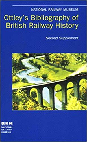
Ottley's Bibliography of British Railway History Second Supplement 12957-19605
Language: English
Published by National Railway Museum, York, 1998
ISBN 10: 1872826105 ISBN 13: 9781872826103
US$ 11.05
US$ 15.42 shipping
Ships from United Kingdom to U.S.A.Quantity: 1 available
Add to basketHardcover. Condition: Very Good. No Jacket. National Railway Museum, York, 1998. Pictorial soft cover. Book condition : Very good to near fine. Appears little read. Heavy book may incur extra postage. Book will be sent by UK postal service Inventory #RO021815.
-
Map of Eastern Kansas by E.B. Whitman & A. D. Searl General Land Agents Lawrence, Kansas.
Publication Date: 1856
Seller: Maggs Bros. Ltd ABA, ILAB, PBFA, London, United Kingdom
Association Member: ABA ILAB PBFA
Seller rating 5 out of 5 stars

First Edition
US$ 10,356.66
US$ 36.20 shipping
Ships from United Kingdom to U.S.A.Quantity: 1 available
Add to basketHand-coloured lithographed map measuring 690 by 535mm with three vignettes. Folded into publisher's burgundy blindstamped covers, "Township Map of Eastern Kansas" gilt to upper cover, lightly sunned, a little rubbed, some expert reinforcement to folds on the verso. Boston, J. P. Jewett and Co.; lithographed by L. H. Bradford & Co., An excellent copy of this rare map, which confirms the breadth and ambition of abolitionist activities in the antebellum period. It's one thing to write pamphlets, petition government, and raise funds, but trying to effect immigration patterns is quite another. � The 1854 Kansas-Nebraska Act allowed settlers to decide whether these new territories would be slave-holding or not. There was much dissension between the pro- and anti-slavery factions (the latter called both Free State or Free Soil) in Kansas which erupted into such violence it became known as Bleeding or Bloody Kansas. Indeed, Lawrence - a key anti-slavery seat in the 30 March, 1855 elections - was inundated by pro-slavery forces trying to effect the outcome and whom eventually ransacked the town a year later. This map was published shortly thereafter in a bid to encourage anti-slavery settlers to move to Kansas and redress the balance between factions. � Of real interest, these tensions are recorded on the map itself - specifically, the three encampments of divisions of Shannon's Posse along the Kansas River (dated 10 Dec. 1855) with one opposite Lawrence. These pro-slavery forces were organized by Governor William Shannon in order to suppress what were deemed illegal activities by anti-slavery factions. Migration is very much a theme in this map. It spans from a sliver of Nebraska Territory in the north to the abandoned Fort Scott in the south, and from Wyandotte, Kansas in the east to a portion of the Arkansas River in the west. Importantly, thirteen Native American reservations are highlighted in either blue or pink and occupy about twenty percent of the area. These belong to the Pottawatomies, Kickapoos, Shawnees and others. Kansas was one of several sites for the Kickapoo. Prior to European contact they were in Ohio and southern Michigan, then migrated to Wisconsin, Illinois, and Missouri, before settling in Kansas in 1832. Similarly, the Shawnee lived in Pennsylvania before moving to Ohio, Indiana, Illinois, Missouri and arrived in Kansas in 1821. As a result of the 1833 Treaty of Chicago, the Illinois Pottawatomie were removed to Nebraska and the Indiana Pottawatomie to Kansas. The notorious Pottawatomie Massacre occurred on 24-25 May, 1856. (The printed note on the inside cover of this map is dated 15 June.) The influx of settlers advocated by this map would only jeopardise these reservations. � Also featured on the map are numerous creeks and rivers, roads (including the Santa Fe trail, and trails to California, Oregon, etc.), post offices, forts (both abandoned and in use), newly-established post offices, Indian villages, and towns including Lawrence (marked by a red circle and an American flag) and Topeka (both towns established in 1854), the latter identified as the ?Temporary State Capitol.? In the lower-left corner is a large, detailed inset of the Government Reservation at Fort Riley and its vicinity, identified as "The Geographical Centre of U.S. Possessions." Three vignettes are located in the lower margin: two depict Eldridge House (also known as the Free State Hotel) before and after it was razed by pro-slavery forces during the sacking of Lawrence, and Constitution Hall in Topeka, Kansas. A key in the upper right corner identifies symbols for towns, trading posts, post offices, missions, forts, Indian villages, etc. � On the inside cover is a printed note by E.B. Whitman (a known abolitionist and agent of the National Kansas Committee) and Searle. It promotes their services as complete emigration agents, offering to find plots, supply information to interested parties, and complete surveys. Whitman was also active af.
