Order Total (1 Item Items):
Shipping Destination:

Senex, First Edition (13 results)
Author:
senex
Refine with Advanced Search
Skip to main search results
Search filters
Product Type
- All Product Types
- Books (11)
- Magazines & Periodicals (No further results match this refinement)
- Comics (No further results match this refinement)
- Sheet Music (No further results match this refinement)
- Art, Prints & Posters (No further results match this refinement)
- Photographs (No further results match this refinement)
- Maps (2)
- Manuscripts & Paper Collectibles (No further results match this refinement)
Condition Learn more
- New (No further results match this refinement)
- As New, Fine or Near Fine (No further results match this refinement)
- Very Good or Good (10)
- Fair or Poor (1)
- As Described (2)
Binding
Collectible Attributes
Language (2)
Free Shipping
Seller Location
Seller Rating
-
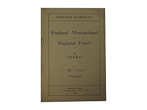
England Monopolised or England Free?
Published by Freedom Press, London, 1920
Seller: Zetetic Books, Berkhamsted, United Kingdom
Association Member: PBFA
Seller rating 5 out of 5 stars

First Edition
US$ 20.76
US$ 40.32 shipping
Ships from United Kingdom to U.S.A.Quantity: 1 available
Add to basketPaper Covers. Condition: Good. First Edition. 16pp, stapled as issued. Staples rusted, with small amounts of tearing around staples, corners creased, internally clean. Price reduction stamp to upper cover. Slienger 'Checklist' 41; Burazerovic 1256. Four locations in COPAC Size: 12mo. Pamphlet.
-

Old Glasgow and It's Environs, Historical and Topographical; together with The Rise and Progress of The City of Glasgow, Comprising an Account of It's Public Buildings, Charitable Institutions and Other Establishments Till The Year MDCCCXX
Language: English
Published by David Robertson and John Smith & Son, Glasgow, 1864
First Edition
US$ 207.64
US$ 10.75 shipping
Ships from United Kingdom to U.S.A.Quantity: 1 available
Add to basketHalf Leather. Condition: Very Good. No Jacket. 1st Edition. Two historical accounts of Glasgow, bound together into one volume. Brown buckram cloth to boards and brown leather at spine, and corners of boards. Gilt title on black label on spine. Blind stamp decoration and gilt decoration on banding of spine. Slight rubbing to extremities. A fascinating item. The first section comprises of Senex's Old Glasgow and It's Environs etc., which is an 1864 first edition and comprises 417 pages, including three maps, the first being a fold out map of Low Green, Glasgow, plus 'Clue Map', and 'Candleriggs in 1760. The fold out map has some light splitting along folds. All pages and maps are clean and tidy, and firm. 'Senex' was the pseudonym of antiquarian Robert Reid (1773 - 1865 ). The second portion of the volume follows on and comprises 296 pages, including a fold out chart of Glasgow Sunday Schools etc., and there is one map of the country between the Forth and the Clyde. This work has no edition listed, but is dated 1829 and deals with the history of Glasgow up to 1820.
-
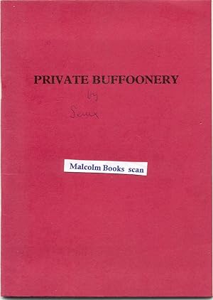
Private Buffoonery (or From Ploverleigh to Barataria ? ) + Extra
Published by Not Published, Norfolk, 1993
First Edition Signed
US$ 48.45
US$ 37.63 shipping
Ships from United Kingdom to U.S.A.Quantity: 1 available
Add to basketPaperback. Condition: Good. Privately Printed , Not for Sale. 1+ 38 pages, Paperback binding very good with ink authors name. Contents good, clean & tight, just lots of ink inscriptions and signed/dedicated inscription from Senex dated 1993 to the author Olga Sinclair (see below). Also in ink Printed by Roger Buck of North Walsham Parish Church. Also extra ink information etc. At least 2 sections written by M. C. Sanders. + Extra is a large printed page Ad Venerabiles by M. C. Sanders (aged 80?) with ink notes & to rear includes M. C. Sanders alias Senex. Olga Sinclair, wrote fiction, local history, and for children was President of Norwich Writers' Circle, a member of East Anglian Writers Circle, The Society of Authors, The Romantic Novelists Association, and The Society of Women Writers and Journalists. Title to Front Private Buffoonery but found another item titled "Private Buffoonery or From Ploverleigh to Barataria" so I added it to title as may be the same printed item. Lots of mainly Norfolk based stories/ditties with added ink information including names of people not named etc. Unusual, and a unique Norfolk item, with the extra information. 15 x 21cm Approx. Signed /dedicated by Author. Unique?
-
THE PROVINCE OF ARTOIS AND THE COUNTRY ADJACENT
Language: English
Published by JOHN SENEX, London, UK, 1713
First Edition
US$ 173.03
US$ 33.60 shipping
Ships from United Kingdom to U.S.A.Quantity: 1 available
Add to basketNo Binding. Condition: Very Good. 1st Edition. Edition of 1713. 1st edition. Price: �125 Publisher: John Senex, London. Publication Date: 1713 Format: Original copper engraving with early hand-colouring. Condition: Very good. Sheet Size: 64.7cm x 51.9cm Location: Map Drawer C: FS: Folder 1009: 002293 Description: A fine and detailed map showing the Artois region. Minor staining to the upper margin, which slightly affects the map. Minor age-toning, spotting and creasing but generally very bright and clean with very good margins. A very good, strong impression. Overall in very good, bright, clean condition. Why Buy From Us? At Hornseys, we are dedicated to offering items that meet the highest standards of quality and authenticity. Our collection of antique maps is meticulously curated to ensure each piece is a valuable and authentic historical document. Here's what sets us apart: Authenticity and Provenance: Every map is researched, collated, and verified for authenticity. Expert Curation: Each map is selected with a keen eye for historical significance, condition, and rarity, ensuring a collection that is both diverse and distinguished. Customer Satisfaction: We strive to provide an exceptional customer experience, from detailed descriptions and provenance to secure and prompt delivery of your purchase. Returns Policy: We offer an unconditional guarantee on every item. If you wish to make a return, items may be sent back to us within fourteen days of receipt for any reason. We request advance notification of returns, and items must be returned in the same condition as sent for a full refund. Explore Our Collection: Visit Hornseys to explore our fine collection of rare and antique maps. Whether you are an avid collector or looking for a unique historical piece, our selection offers something truly exceptional. Located in the picturesque Yorkshire Dales, our Ripon gallery has been a haven for map enthusiasts, historians, and collectors since 1976.
-
A MAP OF OLD AND NEW CASTILE FROM THE OBSERVATIONS OF RODRIGO MENDES SILVA AND OTHERS
Language: English
Published by JOHN SENEX, London, UK, 1714
First Edition
US$ 311.46
US$ 33.60 shipping
Ships from United Kingdom to U.S.A.Quantity: 1 available
Add to basketNo Binding. Condition: Very Good. 1st Edition. Edition of 1714. 1st edition. 2nd state. Price: �225 Publisher: John Senex, London. Publication Date: 1714-28 Format: Original copper engraving with early hand-colouring. Condition: Very good. Sheet Size: 62.7cm x 49.7cm Location: Map Drawer C: FS: Folder 1009: 002292 Description: A fine and detailed map showing the Castille region of Spain. Old, professional archive repair to the reverse of the lower margin, not affecting the map. Minor age-toning, spotting and creasing but generally very bright and clean with very good margins. A very good, strong impression. Scarce and in very good, bright, clean condition. Why Buy From Us? At Hornseys, we are dedicated to offering items that meet the highest standards of quality and authenticity. Our collection of antique maps is meticulously curated to ensure each piece is a valuable and authentic historical document. Here's what sets us apart: Authenticity and Provenance: Every map is researched, collated, and verified for authenticity. Expert Curation: Each map is selected with a keen eye for historical significance, condition, and rarity, ensuring a collection that is both diverse and distinguished. Customer Satisfaction: We strive to provide an exceptional customer experience, from detailed descriptions and provenance to secure and prompt delivery of your purchase. Returns Policy: We offer an unconditional guarantee on every item. If you wish to make a return, items may be sent back to us within fourteen days of receipt for any reason. We request advance notification of returns, and items must be returned in the same condition as sent for a full refund. Explore Our Collection: Visit Hornseys to explore our fine collection of rare and antique maps. Whether you are an avid collector or looking for a unique historical piece, our selection offers something truly exceptional. Located in the picturesque Yorkshire Dales, our Ripon gallery has been a haven for map enthusiasts, historians, and collectors since 1976.
-
Old Glasgow; And Its Environs Historical And Topographical
Published by David Robertson & Longman & Co, 1864, London & Glasgow, 1864
First Edition
US$ 117.66
US$ 29.57 shipping
Ships from United Kingdom to U.S.A.Quantity: 1 available
Add to basketHardcover. Condition: Good+. Dust Jacket Condition: Na. 1st Edition. 1864. Description: Three quarter brown leather binding with maroon cloth boards. Five ridged decorated spine with floral design to panels and brown title plate. Frontis and fold out map of Low Green (section of map mounted on cloth) in 1760 and two other smaller maps of Bridge Street ("Clue map") and Candlerigg in 1760. Language: English. Book Condition> Good+: Wear and rubbing to leather corners and spine ends and edges. Heavier wear to spine panels. Tightly bound with lightly tanned intact endpapers. Lightly tanned pages with occasional mark, spot, tick or cross to margins. DJ Condition> Na. PLEASE ASK for additional photographs if required.
-

The Rector of St. Jacob's
Published by Stephen Swift,, London, 1911
Seller: Victoria Bookshop, BERE ALSTON, DEVON, United Kingdom
Seller rating 4 out of 5 stars

First Edition
US$ 147.82
US$ 13.24 shipping
Ships from United Kingdom to U.S.A.Quantity: 1 available
Add to basketHardcover. Condition: Very Good. First Edition. 319 p. ; 8� "Mr. Arthur Ransome, has in his 80th year pro- duced, his first novel. "The Rector of St.-Jacob's.". Book.
-
Glasgow. Past and Present: Illustrated in Dean of Guil Court Reports, and in the Reminiscences and Communications of Senex, Aliquis. J. R.
Published by Printed by Private Subscription. James MacMan, Glasgow, Scotland, 1851
Seller: Loudoun Books Ltd, GALSTON, AYRSH, United Kingdom
Seller rating 5 out of 5 stars
First Edition
US$ 193.80
US$ 87.36 shipping
Ships from United Kingdom to U.S.A.Quantity: 1 available
Add to basketLeather Binding. Condition: Very Good. Dust Jacket Condition: Without Dust Wrapper (As Issue. 1st Edition. Very Good - Two volume set in three quarter green leather with 5 raised bands and gilt decoration down the spine, green cloth boards, marbled endpapers with gilt at the head of the text block. Corners bumped and rounded, wear to the extremities of the leather with small blemishes of volume I, title page on volume I has what appears to be a stain across the top but this is not present on any other pages, rest of contents of both volumes clean, bright and tight. As this item weighs over 1kg when packed additional postage will be required for delivery outside of the United Kingdom.
-
A new map of the Provinces of Hainault, Namur and Cambray
Published by John Senex, London, 1710
Seller: Victoria Bookshop, BERE ALSTON, DEVON, United Kingdom
Seller rating 4 out of 5 stars
First Edition
US$ 1,108.73
US$ 13.24 shipping
Ships from United Kingdom to U.S.A.Quantity: 1 available
Add to basketPaperback. Condition: Very Good. First Edition. John Senex, was one of the leading cartographers of the 18th century. Born around 1680 he died at his London home in 1740. In 1728, Senex was elected a Fellow of the Royal Society of London. This may be from his 1711 Atlas of 20 maps published without a title. The Universal geographer. [plate 13] or The English Atlas. 43 x 65 cm. Charles Price also credited in the literature. This appears to be rare. Book.
-
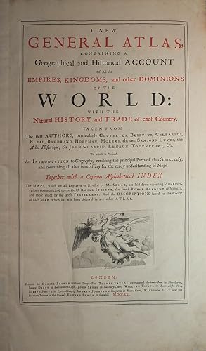
A New General Atlas, containing a Geographical and Historical Account of all the Empires, Kingdoms and other Dominions of the World
Published by London: Daniel Browne, Thomas Taylor, John Darby, John Senex and others, 1721., 1721
Seller: Arader Galleries - AraderNYC, New York, NY, U.S.A.
Seller rating 5 out of 5 stars
First Edition
Folio (21 x 13 inches). Letterpress title-page printed in red and black with engraved vignette, list of subscribers. 13 engraved plates showing the arms of the subscribers, 34 double-page or folding engraved maps and plates, the maps with contemporary colour in outline, plans of London, Amsterdam and Rome uncoloured (Maps of Germany, France, and Spain with early repairs to verso and with top edges partially renewed). 19th-century half crimson morocco, marbled boards, gilt (rebacked preserving the original spine). Provenance: with the engraved armorial bookplate of Richard Griffin [formerly Richard Aldworth Neville], second Baron Braybrooke (1750-1825), dated 1798 the date he succeeded to the Braybrooke title, on the front paste-down. "THE MOST ELEGANT ENGLISH ATLAS OF ALL TIME" (Worms) First edition. Of the maps in the "New General Atlas", ten are apparently new plates (Europe; Moscovy; Amsterdam; France; Sicily; England; Ireland; India; Africa; Louisiana); two originated with Morden (English Empire in America; Golden Islands & Darien, the latter engraved by Moll), the first map of France also possibly, eight from Browne's stock (Denmark; Scandinavia; Spain; Rome; Bernard Randolph's Greece; Virginia; West Indies and Scotland, this latter commenced by Morden and completed by Browne), and possibly also the Spanish Netherlands, Switzerland and Savoy. Of the maps of uncertain attribution five are engraved by John Harris, who worked both for Morden and Browne (Poland; Italy; Savoy; Hungary; America), and one by Samuel Parker (London), and eight without any attribution at all (World; Germany; United Provinces; Spanish Netherlands; France; Switzerland; Asia; Turkey). Including many important maps relating to America: "New Map of the World"; "Virginia, Maryland, and the improved parts of Pennsylvania & New Jersey"; "The English Empire in the Ocean of America or West Indies"; "Louisiana and of the River Mississipi"; and the "Isthmus of Darien in America". Bookseller, publisher and maker of maps and globes, Senex was "long concerned in the production of maps and atlases. Between 1707 and 1711 he worked with Price (and later Maxwell) on a large atlas series, issuing in 1707 broadside 'Proposals for a new sett of correct mapps' advertising the partners as 'Geographers to the Queen' and promising work that 'shall in correctness, and all other particulars, far exceed any yet done'. Senex and Price subsequently went their separate ways but Senex at length produced (with Maxwell) an augmented version of these maps as "The English Atlas" (1714), the bulk of the work engraved by himself. His portable version of the road maps of John Ogilby, published as "An Actual Survey of All the Principal Roads of England and Wales" in 1719, was a popular success, staying in print for many years, while his "A New General Atlas" (1721) remains the most elegant English world atlas of the time. "The Atlas maritimus & commercialis" (1728), a work to which Halley lent his assistance and the text for which is said to have been written by Defoe, featured maps drawn on a new 'globular' projection patented in 1721, which Senex had himself devised in association with John Harris and Henry Wilson. NMM 3:434; Phillips Atlases 563; Sabin 79124; Shirley, British Library T.SEN-2a. Catalogued by Kate Hunter.
-
A New Map of England from the Latest Observations
Published by [1721], London, 1721
Seller: Renaissance Books, ANZAAB / ILAB, Dunedin, New Zealand
Association Member: ANZAAB ILAB
Seller rating 5 out of 5 stars
Map First Edition
Map. Condition: Good. Dust Jacket Condition: No Dust Jacket. First Edition. Double page map of England. Hand-colouring to borders of the counties, and coasts of Ireland, Scoland, and France. Dimensions: 593 x 503mm. Elaborate engraved cartouche in upper right. Trimmed very close to borders. Small 3/8" chips along upper border. ; Map.
-

South America corrected from the Observations communicated to the Royal Society's of London & Paris
Published by London, 1710
Seller: Clive A. Burden Ltd., Chalfont St. Giles, BUCKS, United Kingdom
Seller rating 5 out of 5 stars
Map First Edition
US$ 986.30
US$ 29.77 shipping
Ships from United Kingdom to U.S.A.Quantity: 1 available
Add to basketNo binding. Condition: Fair. 960 x 655 mm., in early outline and wash colour, with extended margins backed on linen, with lower edge tear repaired, surface abrasion upper left, ink offset lower half, otherwise in good condition. The first state of a fine large-scale map of the continent of South America. It was engraved by John Senex with H. Hulsburgh engraving the ornate title cartouche. The map is dedicated by Senex to Edmund Halley, Professor of Geometry in Oxford and Fellow of the Royal Society. The map combines some of the latest information and traces the routes of various voyages including those of Bartholomew Sharp's return in 1681. Also depicted are Sr. la Roche in 1675, Ferdinand Magellan in 1520 and even earlier Amerigo Vespucci in 1502. The course of Edmond Halley himself in 1700 is also displayed. The voyage in the 'Paramore' is famous for producing a map of the Atlantic Ocean recording the variation of compass north from true north. It was the first attempt at solving the problem of longitude. The map bears several legends.John Senex (c.1678-1740) was geographer to Queen Anne and a Fellow of the Royal Society. He began his career as a book seller later becoming an engraver and publisher. Around 1710 he published a set of Proposals for a large folio 'English Atlas'. At first, he was in partnership with John Price but by the time sufficient maps had been completed for the first edition in 1714, Price had left, and John Maxwell had become his partner. The large folio atlas was followed by the folio 'New General Atlas' of 1721. Provenance: Juan and Peggy Rada Collection. Phillips (1909-) 550; Shirley (2004) T.Sen 1b no. 6.
-

Moscovy. Corrected from ye Observations communicated to the Royal Society of London and Paris
Published by John Senex, London, 1712
Seller: William Chrisant & Sons, ABAA, ILAB. IOBA, ABA, Ephemera Society, Fort Lauderdale, FL, U.S.A.
Association Member: ABAA ESA ILAB
Seller rating 5 out of 5 stars
First Edition
First Edition. Large two panel conjoined full original color map published during the reign of Peter the Great. Archival reinforcement at folds.