

Order Total (1 Item Items):
Shipping Destination:

Tanner Warr (2 results)
Skip to main search results
Search filters
Product Type
- All Product Types
- Books (1)
- Magazines & Periodicals (No further results match this refinement)
- Comics (No further results match this refinement)
- Sheet Music (No further results match this refinement)
- Art, Prints & Posters (No further results match this refinement)
- Photographs (No further results match this refinement)
- Maps (1)
- Manuscripts & Paper Collectibles (No further results match this refinement)
Condition Learn more
- New (No further results match this refinement)
- As New, Fine or Near Fine (No further results match this refinement)
- Very Good or Good (No further results match this refinement)
- Fair or Poor (No further results match this refinement)
- As Described (2)
Binding
- All Bindings
- Hardcover (No further results match this refinement)
- Softcover (No further results match this refinement)
Collectible Attributes
- First Edition (No further results match this refinement)
- Signed (No further results match this refinement)
- Dust Jacket (No further results match this refinement)
- Seller-Supplied Images (2)
- Not Print on Demand (2)
Language (1)
Price
- Any Price
- Under US$ 25 (No further results match this refinement)
- US$ 25 to US$ 50 (No further results match this refinement)
- Over US$ 50
Free Shipping
- Free Shipping to U.S.A. (No further results match this refinement)
Seller Location
Seller Rating
-
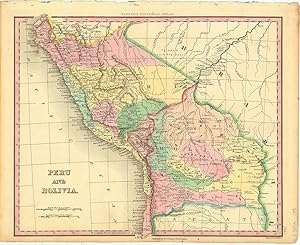
Peru and Bolivia.
Published by PhiladelphiaTanner. -46, 1836
Seller: Robert Frew Ltd. ABA ILAB, London, United Kingdom
Association Member: ABA ILAB PBFA
Seller rating 5 out of 5 stars

Map
US$ 101.98
US$ 13.20 shipping
Ships from United Kingdom to U.S.A.Quantity: 1 available
Add to basket29 x 35 cm. Original colour. Single page map of Peru and Bolivia. Very good condition.
-
Egypt &c
Published by Philadelphia, 1842
Seller: Argosy Book Store, ABAA, ILAB, New York, NY, U.S.A.
Seller rating 5 out of 5 stars
unbound. W. W. Warr (illustrator). Map. Engraving with hand coloring. Image measures 14 1/2 x 11 1/2" Lovely map of Egypt divided into counties with a plethora of notations on ruins, trails, and pyramids, reflecting Egyptomania of the Victorian period. Shows towns, major routes and geographic features. The gulf of Suez and the Red Sea are included as well as Gaza and the Dead Sea in Palestine. This map is in very good condition, with minor overall toning and some stains. Henry Schenck Tanner (1786-2858) was an American cartographer and statistical geographer. Born in New York, he moved to Philadelphia where he established his well-known publishing company with his brother. Tanner was the first American to publish a map of Texas, which subsequently went through eight editions. However, he is best known and most renowned for his New American Atlas.

