

Order Total (1 Item Items):
Shipping Destination:

Vorzet (30 results)
Author:
vorzet
Refine with Advanced Search
Skip to main search results
Search filters
Product Type
- All Product Types
- Books (6)
- Magazines & Periodicals (No further results match this refinement)
- Comics (No further results match this refinement)
- Sheet Music (No further results match this refinement)
- Art, Prints & Posters (1)
- Photographs (No further results match this refinement)
- Maps (23)
- Manuscripts & Paper Collectibles (No further results match this refinement)
Condition Learn more
- New (No further results match this refinement)
- As New, Fine or Near Fine (12)
- Very Good or Good (3)
- Fair or Poor (No further results match this refinement)
- As Described (15)
Binding
- All Bindings
- Hardcover (3)
- Softcover (No further results match this refinement)
Collectible Attributes
- First Edition (2)
- Signed (No further results match this refinement)
- Dust Jacket (No further results match this refinement)
- Seller-Supplied Images (19)
- Not Print on Demand (30)
Language (2)
Price
- Any Price
- Under US$ 25 (No further results match this refinement)
- US$ 25 to US$ 50
- Over US$ 50
Free Shipping
- Free Shipping to U.S.A. (No further results match this refinement)
Seller Location
Seller Rating
-

Plan de Paris.
Published by Paris, Delgrave., 1878
Seller: Manfred Nosbuesch, Kuchenheim, Germany
Seller rating 4 out of 5 stars

Kolorierter lithographischer Faltplan (72 x 100 cm.) mit Beiheft (Nomenclature, 19 S.) in OLwd-Mappe mit Deckeltitel. Plan auf Leinwand aufgezogen, Mappen-Rücken angeplatzt.
-
Les Montagnes
Language: French
Published by Alfred Mame et Fils, Editeurs, Tours, 1873
Seller: Madoc Books (ABA-ILAB), Llandudno, CONWY, United Kingdom
Association Member: ABA ILAB IOBA PBFA
Seller rating 5 out of 5 stars

First Edition
US$ 81.77
US$ 39.69 shipping
Ships from United Kingdom to U.S.A.Quantity: 1 available
Add to basketHardcover. Condition: Very Good. DUMAS-VORZET. RIOU. BAYARD. WEIL. etc (illustrator). 1st Edition. First edition, 1873, in quarter red morocco over red embossed cloth, corners worn, some marks. Spine, raised bands, decorative gilt tooling & titles, top edge bumped. Internally, complete with half title, B&W frontis, title page with vignette, [8], [1], 2-640 pp, [1] map list, [1] errata, [1], 7 maps (coloured & 4 folding), 175 B&W illustrations (including 33 full page). a.e.g., silk end pages, some light spotting & edge browning. (242*155 mm).
-
Paris 1867 [ Plan dressé d'après les Cartes de la Triangulation de la Ville de Paris ]
Language: French
Published by Librairie du Petit Journal, 1867
rigide. Condition: Bon. 1 carte dépliante entoilée, en couleurs, format 113,5 x 75,7 cm, sous sa chemise percaline éditeur d'origine, Librairie du Petit Journal, 112 rue Richelieu, au coin du Boulevard Montmartre, 1867, échelle métrique au 1/12800, gravé sur acier le trait et la lettre par Langevin Belle carte dépliante en couleurs des 20 arrondissements parisiens (créés en 1859), bien conservée sous sa chemise d'origine, très décorative. Langue: Français.
-

Côte Septentrionale d'Afrique. Partie comprise entre Zarzis et Tripoli.
Language: French
Published by Depot des Cartes et Plans de la Marine, Paris, 1892
Map
US$ 204.42
US$ 46.31 shipping
Ships from United Kingdom to U.S.A.Quantity: 1 available
Add to basketNo Binding. Condition: Very Good. Engraved chart on vellum double sheet, 91 x 62 cm, engraved by Cornelis, written by Er. Dumas Vorzet, drawn in 1876 by E. Mouchez, publie au Depot des Cartes et Plans de la Marine, 1878, corrected in 1892 by 3 small rectangles tipped-in and measuring approximately 4 x 3.5 cm, small smudge lower right, otherwise in very good condition. #36178.
-
Carte de l'Amérique du Sud (Sud). N°81
Published by HACHETTE & Cie, 1897
Map
Pas de couverture. Condition: bon. RO20045385: 1897. In-Plano. En feuillets. Très bon état, Couv. convenable, Dos satisfaisant, Intérieur frais. Carte couleurs, en double-planches hors-texte de 68/55 cm. . . . Classification Dewey : 912-Atlas, cartes et plans.
-
Carte de l'Asie Politique. N°44 bis.
Published by HACHETTE & Cie, 1900
Map
Pas de couverture. Condition: bon. RO20045392: 1900. In-Plano. En feuillets. Très bon état, Couv. convenable, Dos satisfaisant, Intérieur frais. Carte couleurs en double-planches hors-texte, de 68/55 cm. . . . Classification Dewey : 912-Atlas, cartes et plans.
-
Carte de l'Australie. N°83
Published by HACHETTE & Cie, 1897
Map
Pas de couverture. Condition: bon. RO20045387: 1897. In-Plano. En feuillets. Très bon état, Couv. convenable, Dos satisfaisant, Intérieur frais. Carte couleurs, en double-planches hors-texte, de 68/55 cm. . . . Classification Dewey : 912-Atlas, cartes et plans.
-
Carte de l'Amérique du Sud ( Ouest) N°79
Published by HACHETTE & Cie, 1893
Pas de couverture. Condition: bon. RO20045383: 1893. In-Plano. En feuillets. Très bon état, Couv. convenable, Dos satisfaisant, Intérieur frais. Carte couleurs en double-planches hors-texte, de 68/55 cm. . . . Classification Dewey : 914-Géographie de l'Europe.
-
Carte de l'Amérique du Sud Politique. N°76 bis
Published by HACHETTE & Cie, 1898
Map
Pas de couverture. Condition: bon. RO20045380: 1898. In-Plano. En feuillets. Bon état, Couv. convenable, Dos satisfaisant, Intérieur frais. Carte couleurs en double-planches hors-texte, de 68/55 cm. . . . Classification Dewey : 912-Atlas, cartes et plans.
-
Carte de l'Amérique du Sud (Est). N°80
Published by HACHETTE & Cie, 1897
Map
Pas de couverture. Condition: bon. RO20045384: 1897. In-Plano. En feuillets. Très bon état, Couv. convenable, Dos satisfaisant, Intérieur frais. Carte couleurs, en double-planches hors-texte, de 68/55 cm. Avec Serpente. . . . Classification Dewey : 912-Atlas, cartes et plans.
-
Carte de l'Amérique du Sud. Nord-Ouest. N°77
Published by HACHETTE, 1894
Map
Pas de couverture. Condition: bon. RO20045381: 1894. In-Plano. En feuillets. Très bon état, Couv. convenable, Dos satisfaisant, Intérieur frais. Carte couleurs, en double-planches hors-texte de 68/55 cm, avec serpente. . . . Classification Dewey : 912-Atlas, cartes et plans.
-
Carte de l'Amérique du Sud (Nord-Est) N°78
Published by HACHETTE & Cie, 1891
Map
Pas de couverture. Condition: bon. RO20045382: 1891. In-Plano. En feuillets. Très bon état, Couv. convenable, Dos satisfaisant, Intérieur frais. Carte couleurs en double-planches hors-texte, de 68/55 cm, avec serpente. . . . Classification Dewey : 912-Atlas, cartes et plans.
-
Carte de l'Amérique du Sud Physique. N°76
Published by HACHETTE & Cie, 1898
Map
Pas de couverture. Condition: bon. RO20045379: 1898. In-Plano. En feuillets. Bon état, Couv. convenable, Dos satisfaisant, Intérieur frais. Carte couleurs en double-planches hors-texte, avec serpente, de 68/55cm. . . . Classification Dewey : 912-Atlas, cartes et plans.
-

(Konvolut von 4 Landkarten) Italie Ancienne. & Prossessions de Carthage. & L' Empire Romain et Les Barbares. & L' Empire Romain dans sa plus grande etendue a la mort de Trajan.
Published by Paris, Imp. Fraillerie o, J. ( um 1800), 1800
Map
Kein Einband. Condition: Gut bis sehr gut. 11 x 13.5 cm, grave par A. Martin, mit kleinem Stadtplan von Rom, 11 x 13 cm, grave par A. Martin, mit kleiner Karte : Environs de Carthage, 11.5 x 13.5 cm, grave par Schmidt et Martin, 11 x 13.5 cm, grave par Delattre, kleiner Kartenausschnitt von Grece, Macedoine, Thrace, Asie, alle teilcoloriert, gefaltet, gering stockfleckig,
-
Carte des principaux Archipels d'Océanie. N°84
Published by HACHETTE & Cie, 1897
Map
Pas de couverture. Condition: bon. RO20045388: 1897. In-Plano. En feuillets. Très bon état, Couv. convenable, Dos satisfaisant, Intérieur frais. Carte couleurs, en double-planches hors-texte, de 68/55 cm. . . . Classification Dewey : 912-Atlas, cartes et plans.
-
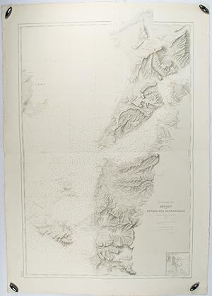
Abords et Entrée des Dardanelles. Mer Mediterranée.
Published by Service hydrographique et océanographique de la marine 1883, but1894., (Paris)., 1883
Seller: Asia Bookroom ANZAAB/ILAB, Canberra, ACT, Australia
Association Member: ANZAAB ILAB
Seller rating 5 out of 5 stars
Engraved hydrographical chart on watermarked double sheet, 99 x 63 cm, soundings in metres, lighthouses picked out in yellow and red, inset map of the port and town of Tenedos, central fold, a few very slight edge tears (to the generous margins), light spotting and surface soiling, but in very good condition. Fine and impressive large naval chart of this strategically important strait, then still under the control of the Ottoman Empire. From a private collection; "Lord John Fitzroy, Royal Yacht Squadron" in manuscript on the verso.
-
Paris 1867
Published by Librairie du Petit Journal, 1867
Seller: Librairie Le Feu Follet, Paris, France
Association Member: ILAB
Seller rating 5 out of 5 stars
Art / Print / Poster First Edition
Pas de couverture. Librairie du Petit Journal | Paris 1867 | 107.50 x 71 cm | une feuille repliée | Edition originale. Plan de Paris divisé en 20 arrondissements, lesquels furent créés en 1859. Bel exemplaire avec les vingt quartiers entièrement aquarellés à l'époque. Carte habilement consolidée aux pliures du verso. | [ENGLISH DESCRIPTION FOLLOWS] First edition. Map of Paris divided in 20 arrondissements, wich were created in 1859. A very good copy with the 20 districts totally heightened in colors by a contemporary hand. The map is skillfully reinforced at the back. *.
-

Côte Septentrionale d'Afrique. Partie comprise entre Tripoli et le Cap Misratah.
Publication Date: 1877
Map
US$ 136.28
US$ 46.31 shipping
Ships from United Kingdom to U.S.A.Quantity: 1 available
Add to basketNo Binding. Condition: Very Good. Engraved map on vellum double sheet, 91 x 62 cm, engraved by Cornelis, written by Er. Dumas Vorzet, drawn in 1876 by E. Mouchez, in very good condition, publiee au Depot des Cartes et Plans de la Marine. #36180.
-
Cote Est de l'Asie. Iles et mers du Japon. Mer Jaune. D'après les documents les plus récents
Grand carte gravée par Vavasseur et Dumas-Vorzet mesurant 102x72cm (quelques déchirures en bordure des pliures). Grande carte du Japon et de la mer du Japon dressée en 1906 par le Service Hydrographique de la Marine et ici dans sa version de Mars 1915. Le carte indique les principales villes et les lignes maritimes. Malgré des déchirures marginales, plutôt bon état.
-

Belmont. / Pea Ridge. / Hampton Roads. / Ile No. 10 et ses abords.
Publication Date: 1890
Seller: Geographicus Rare Antique Maps, Brooklyn, NY, U.S.A.
Association Member: ABAA ESA ILAB
Seller rating 4 out of 5 stars
Map
Very good. Mounted on linen. Size 13.25 x 10 Inches. This is Ernest Dumas-Vorzet's 1890 map of the battles of Belmont, Pea Ridge, and Island No. 10, and the naval battle of Hampton Roads, prepared for his Histoire de la Guerre Civile en Amérique . A Closer Look The sheet documents four battles, three on land and one at sea, that took place in late 1861 or early 1862, and collectively pointed to future developments in the war (such as Union advances in the West, compared to tragic ineffectiveness in the Eastern Theater, and new tactics and weapons). In each case, cities and towns, roads, railroads, fortifications, terrain, and topographic features are detailed. The battles referred to are: The Battle of Belmont (Missouri) - November 7, 1861. Most notable as the first battle of the Civil War in which Ulysses S. Grant was in command of a large force, in the District of Southeast Missouri of the Union Army. Launching from their stronghold on the Mississippi River of Cairo, Illinois, Grant's troops used steamboats to surprise the Confederate camp at Belmont, but the Confederates regrouped and were reinforced by a much larger garrison, armed with heavy artillery, across the river at Columbus, Kentucky, forcing Grant's troops to retreat. The battle was inconclusive but did amount to a rare Union attack on Confederate positions early in the war. By raising Grant's prominence and giving him and his troops battle experience, it helped set the stage for further advances in the following months, culminating in the Battle of Shiloh in April 1862. The Battle of Pea Ridge (or Elkhorn Tavern) on March 7-8, 1862, which marked a decisive Union victory that helped secure control of northern Arkansas. By early 1862, Confederate forces had been effectively expelled from Missouri and pursued into Arkansas. Gen. Earl Van Dorn, recently appointed head of the Confederate Trans-Mississippi District, hoped a decisive counter-attack could turn the tide in the region. But a series of strategic and tactical mistakes caused the attack to falter, and the Confederates suffered heavy casualties while being repulsed. The battle is also notable for the high degree of participation (more than half of the Union force) of German immigrant troops, led by Franz Sigel, a Forty-Eighter revolutionary leader who had emigrated to the United States and become an influential voice in the German-American community. The Battle of Island Number Ten was a siege and associated battles between February 28 and April 6, 1862. The area is home to a prominent bend in the Mississippi River near New Madrid, Missouri, where the borders of Kentucky, Tennessee, and Missouri meet. Given the Union's 'Anaconda' war plan to control the Mississippi River, the bend could serve as a choke point, allowing the Confederates to frustrate the overall Union strategy if it could be held. Fortunately for the Union side, taking towns on the Missouri side of the river, including New Madrid, was accomplished very quickly, with Confederate troops retreating to Island Number Ten. Union engineers dug a canal east of New Madrid, though it was too shallow for ironclad gunboats, proving useful for troop transports and supply ships nonetheless. Instead, two gunboats made successful daring nighttime runs past the Confederate positions (presaging those that would be used to similar effect at Vicksburg the following year), allowing the Union to have boats both up and downriver of Confederate positions, subjecting them to a withering bombardment. By this time, Union troops were in a position to cut off any retreat to the south, causing the entire Confederate force of some 7,000 to surrender. The island for which the battle is names no longer exists, having been eroded in the years since by the flow of the Mississippi River. The Battle of Hampton Roads on March 8-9, 1862, perhaps the most famous of the battles presented here, known for its legendary confrontation between the Monitor and the Merrimack , the first batt.
-

Murfreesborough (Tennessee). / Iuka (Mississippi). / Chickasaw Bayou (Mississippi).
Publication Date: 1890
Seller: Geographicus Rare Antique Maps, Brooklyn, NY, U.S.A.
Association Member: ABAA ESA ILAB
Seller rating 4 out of 5 stars
Map
Very good. Mounted on linen. Size 13.25 x 10.5 Inches. This is Ernest Dumas-Vorzet's 1890 map of Murfreesboro, Tennessee, and Iuka and Chickasaw Bayou in Mississippi, prepared for the 1890 book Histoire de la Guerre Civile en Amérique . A Closer Look The sheet is divided into three sections, with the right half being a map of Murfreesborough (now spelled Murfreesboro) in Tennessee and the left half divided into a top and bottom section, depicting Iuka and Chickasaw Bayou (near Vicksburg), Mississippi, respectively. Roads, railways, waterways, terrain, elevation, towns, farms, and other buildings and properties are noted throughout. The Battles The maps on this sheet refer to three battles in the early part of the war. They are: The Battle of Iuka - September 19, 1862, the opening phase of the Iuka-Corinth Campaign. Fought in the northeast corner of Mississippi, near the border with Tennessee and Alabama, was a confrontation between the Union Army of the Mississippi and the Confederate Army of the West. Although the Union battle plan devised by Ulysses S. Grant was thwarted, troops under the command of William Rosecrans still managed to drive off their opponents. The Battle of Iuka set up the Second Battle of Corinth two weeks later, which was also a Union victory. The Battle of Chickasaw Bayou, December 26 - 29, 1862, in the opening phase of the Vicksburg Campaign. Union forces under William T. Sherman landed near the Yazoo River (Chickasaw Bayou is a tributary of the Yazoo River, which is itself a tributary of the Mississippi River) in an attempt to approach Vicksburg from the northeast. After progressing through swampland, Sherman's troops ran into well-prepared Confederate defenses (drawn here) at the Walnut Hills, and had to retreat after a costly failed attack. The Battle of Stones River or the Second Battle of Murfreesboro, December 31, 1862 - January 2, 1863. This is an oft-forgotten but strategically significant battle that was also the deadliest of the war in terms of percentage of casualties in a major battle - nearly one-third of troops engaged were killed, wounded, captured, or missing, including four brigadier generals killed. In the battle, Gen. Rosecrans, reassigned from the Army of the Mississippi to the Army of the Cumberland, faced the Confederate Army of Tennessee under Braxton Bragg. A quick Confederate flanking attack almost broke the Union line on the first day of battle, but the defenders were able to rally along the Nashville Turnpike ('Grand Route Nashville' here) and repulse several more attacks. Fearing Union reinforcements, Bragg withdrew, giving the Union side a costly victory, but one which was welcome after the disastrous Battle of Fredericksburg two weeks prior. Publication History and Census This sheet was drafted by Ernest Dumas-Vorzet, engraved by Louis Wuhrer, printed by Becquet, and published by Michel Lévy in Paris for the 1890 French edition of Philippe d'Orléans' Histoire de la Guerre Civile en Amérique . The atlas supplement, of which this map was part, was issued only with the 1890 French publication and was not included in any of the earlier English editions. The entire work, in this edition, is uncommon in institutional collections, with only 3 being identified in OCLC, and is scarce to the market. Most examples lack the atlas, which in OCLC appears only at the Boston Athenaeum. Very little market history. References: OCLC 877854530, 877854592, 877854597 (one sheet cataloged three times; dated 1875).
-

Brashear City (Louisianie) / Nashville (Tennessee) / Galveston (Texas).
Publication Date: 1890
Seller: Geographicus Rare Antique Maps, Brooklyn, NY, U.S.A.
Association Member: ABAA ESA ILAB
Seller rating 4 out of 5 stars
Map
Very good. Mounted on linen. Size 13.75 x 10 Inches. This sheet, including three detailed maps, was prepared by Ernest Dumas-Vorzet for the 1890 work Histoire de la Guerre Civile en Amérique . It maps battles at Nashville, Galveston, and Brashear City, three important battles in the Western and Trans-Mississippi Theaters of the U.S. Civil War. A Closer Look Despite their different subjects and scales, all three maps emphasize the topography and terrain of the battlefields in question while also noting roads, railways, settlements, waterways, shoals, and other terrestrial and maritime features. Galveston was the site of two battles: a confused but ultimately bloodless Union capture of the city in October 1862 and a successful Confederate counter-attack on New Year's Day 1863. The Battle of Brashear City (now Morgan City) on June 22 - 23, 1863, was, like the first engagement at Galveston, fairly unusual. In this case, a small Confederate force snuck to the outskirts of the city at night. It attacked the much larger Union garrison the next morning, taking them by surprise and capturing hundreds of enemy soldiers and weapons with very light casualties. But the Battle of Nashville in 1864 was the most influential of the three depicted here. After falling to Union troops in February 1862, Nashville had been the target of Confederate hopes for a revival in the Western Theater, which had gone quite badly for them. Late in the war, in mid-December 1864, as Sherman was completing his 'March to the Sea,' Confederate General John Bell Hood tried to draw out Union forces at Nashville in a desperate attempt to turn the tide of the war. However, the Union forces were overwhelming and routed Hood's army, scoring one of the more lopsided Union victories of the conflict and effectively ending the war in the Western Theater. Publication History and Census This map was drafted by Ernest Dumas-Vorzet, engraved by Louis Wuhrer, printed by Becquet, and published by Michel Lévy in Paris for the 1890 French edition of Philippe d'Orléans' Histoire de la Guerre Civile en Amérique . The atlas supplement, of which this map was part, was issued only with the 1890 French publication and not included in any of the earlier English editions. The entire work, in this edition, is uncommon in institutional collections, with only 3 being identified in OCLC, and is scarce to the market. Most examples lack the atlas, which in OCLC appears only at the Boston Athenaeum. Very little market history. References: LC Civil War Maps (2nd ed.), 80. OCLC (one sheet cataloged three times) 877854532, 877854531, 877854598.
-

Kentucky et Tennessee.
Publication Date: 1890
Seller: Geographicus Rare Antique Maps, Brooklyn, NY, U.S.A.
Association Member: ABAA ESA ILAB
Seller rating 4 out of 5 stars
Map
Good. Laid on contemporary linen. Slight toning on original centerfold. Size 17.5 x 24.75 Inches. This impressive 1890 map of Kentucky, Tennessee, and portions of neighboring states was prepared by Ernest Dumas-Vorzet for his Histoire de la Guerre Civile en Amérique . Among the larger maps in the atlas volume of the work, it highlights a large portion of the Western Theater, a bright spot for the Union early in the war. A Closer Look Coverage ranges from Cincinnati, Ohio, and Vandalia, Illinois (the state's capital from 1818 to 1837) at the top to the northern portions of Mississippi, Alabama, and Georgia at the bottom, and from the Mississippi River in the west to the Great Smokey Mountains and Cumberland Mountains in the east. Cities, towns, waterways, mountains, railways, roads, forts, and other features are recorded in tremendous detail. This region corresponds to much of the Western Theater of the U.S. Civil War, where the Union saw significantly better results than in Virginia in the early part of the war. A small inset at the top-left displays the battlefield of Mill Springs (here as Mill Spring), at the center towards the right, one of the first Union victories of the war. The Battle of Mill Springs The Battle of Mill Springs, also known as the Battle of Fishing Creek, the Battle of Logan's Cross Roads, or the Battle of Somerset, took place in southeastern Kentucky along the Cumberland River on January 19, 1862. Although the conflict had begun months before and had seen large battles in the east in the summer of 1861, the Western Theater was defined by much smaller and more haphazard conflicts while armies were slowly mustered or built out of ragtag outfits. By the start of 1862, the Union was ready to attempt to secure the border state of Kentucky, the loss of which would have posed a major problem for the Union (as President Lincoln stated at the time, 'to lose Kentucky is nearly the same as to lose the whole game'). Union forces under Gen. George H. Thomas moved to drive the Confederates across the Cumberland River. Similar to the Battle of Shiloh four months later, albeit on a smaller scale, at Mill Springs the Confederates tried to quickly attack Thomas' troops before they were fully reinforced and resupplied, making progress early before running into stiff resistance, facing a Union counterattack, and having to retreat. The battle was one of the first, arguably the first notable Union victory of the war, providing a badly-needed morale boost to the Union cause. Afterward, Union forces moved into Tennessee and gained further victories at Forts Henry and Donelson and then at Shiloh. Publication History and Census This map was drafted by Ernest Dumas-Vorzet, engraved by Louis Wuhrer, printed by Becquet, and published by Michel Lévy in Paris for the 1890 French edition of Philippe d'Orléans' Histoire de la Guerre Civile en Amérique . The atlas supplement, of which this map was part, was issued only with the 1890 French publication and not included in any of the earlier English editions. The entire work, in this edition, is uncommon in institutional collections, with only 3 being identified in OCLC, and is scarce to the market. Most examples lack the atlas, which in OCLC appears only at the Boston Athenaeum. Very little market history. References: LC Civil War Maps (2nd ed.), 80. OCLC 877854568.
-

Fort Henry Fort Donelson Shiloh.
Publication Date: 1890
Seller: Geographicus Rare Antique Maps, Brooklyn, NY, U.S.A.
Association Member: ABAA ESA ILAB
Seller rating 4 out of 5 stars
Map
Very good. Laid down on contemporaneous linen. Size 13 x 10.5 Inches. This sheet includes three highly detailed 1890 Dumas Vorzet maps of Fort Henry, Fort Donelson, and Shiloh, Tennessee, sites of early battles in the Western Theater of the American Civil War. It was issued to illustrate the scarce atlas volume of the French edition of Philippe d'Orléans' Histoire de la Guerre Civile en Amérique . A Closer Look The maps, set at different scales and orientations, display the sites of three important early battles in the U.S. Civil War, all taking place in the Western Theater, which was generally a bright spot for the Union compared to the fairly disastrous operations in Virginia around the same time. The namesake forts and towns are illustrated in considerable detail and were situated at strategic points along the Tennessee and Cumberland Rivers. Topographic features, roads, buildings, foliage, fortifications, and other elements are recorded throughout. The Union capture of Forts Henry and Donelson in February 1862 resulted from effective coordination between Ulysses S. Grant and naval officer Andrew Hull Foote. Their relatively quick and easy seizure opened up a waterborne route of advance into Tennessee. These victories helped bring Grant to the attention of his superiors and earned him a reputation as a capable commander of large operations. These Union victories set the stage for the Battle of Shiloh (discussed below), an important if costly Union victory that shocked contemporaries with the high numbers of casualties on both sides. The Battle of Shiloh (April 6 - 7, 1862) The Battle of Shiloh, also known as the Battle of Pittsburg Landing, was fought in the Western Theater during the American Civil War. The battle occurred in southwestern Tennessee and pitted the Union Army of the Tennessee under the command of Major General Ulysses S. Grant (April 27, 1822 - July 23, 1885) against the Confederate Army of Mississippi under General Albert Sidney Johnston (February 2, 1803 - April 6, 1862). Grant and his army were marching south toward the Confederate stronghold at Corinth, Mississippi, when the Confederate Army surprised them at Pittsburg Landing on the morning of April 6. Fierce fighting ensued, and stiff resistance from a handful of Union troops allowed the rest of the Union force to regroup and withstand the attack. The following day, April 7, Grant and his army counterattacked. This attack forced the Confederates to retreat and ended any Confederate hope of blocking the Union advance into northern Mississippi. The Battle of Shiloh was the bloodiest battle of the war up to that point and saw 13,047 Union casualties (killed, wounded, and missing) and 10,699 Confederate casualties. Today, the battlefield is preserved as the Shiloh National Military Park. Despite winning the battle, Grant faced negative publicity at the time (planted by his rivals in the Union ranks), in large part because the public was horrified at the number of casualties from the battle, the highest in any battle on American soil to that time, though considerably less than some large battles later in the conflict (especially Gettysburg). Publication History and Census This map was drafted by Ernest Dumas-Vorzet, engraved by Louis Wuhrer, printed by Becquet, and published by Michel Lévy in Paris for the 1890 French edition of Philippe d'Orléans' Histoire de la Guerre Civile en Amérique . The atlas supplement, of which this map was part, was issued only with the 1890 French publication and not included in any of the earlier English editions. The entire work, in this edition, is uncommon in institutional collections, with only 3 being identified in OCLC, and is scarce to the market. Most examples lack the atlas, which in OCLC appears only at the Boston Athenaeum. Very little market history. References: LC Civil War Maps (2nd ed.), 80. OCLC 877854482, 877854545, 877854486 (same sheet cataloged three times).
-

Environs de Richmond.
Publication Date: 1890
Seller: Geographicus Rare Antique Maps, Brooklyn, NY, U.S.A.
Association Member: ABAA ESA ILAB
Seller rating 4 out of 5 stars
Map
Good. Some centerfold discoloration. Laid on old linen. Size 22 x 14.5 Inches. This highly-detailed Dumas Vorzet map depicting Richmond and environs in eastern Virginia was issued to illustrate the scarce 1890 atlas volume of the French edition of Philippe d'Orléans' Histoire de la Guerre Civile en Amérique . This region was the site of multiple important battles, including the Peninsular Campaign of 1862 and the Overland Campaign of 1864. A Closer Look This map covers Richmond, Virginia, and environs as far north as the Pamunkey River and south as far as the James River estuary. The street grid of Richmond is noticeable at the left, while individual properties are labeled in rural areas. Roads, railways, forts, rivers, forests, areas of elevation, courthouses, and other features are labeled throughout. At the top-right are inset maps of Gaines Mill, Fair Oaks, and Glendale, sites of engagements during the 1862 Peninsula Campaign. A note at the top explains the map reflects the situation in 1862, though with fortifications as of 1864 included, and that several forests noted here were cut down by 1864 to build fortifications. The Peninsula and Overland Campaigns The 1862 Peninsula (or Peninsular) Campaign was a failed Union effort to march on the Confederate capital of Richmond. Led by George McClellan, Union troops landed at Fort Monroe near the tip of the Virginia Peninsula and engaged in weeks of maneuvers and minor engagements with Confederate forces led by Joseph E. Johnston. Important engagements took place at Drury's Bluff, due south of Richmond, Seven Pines east of Richmond, and Hannover Court House near the top. Eventually, Johnston launched a surprise attack on McLellan on June 25. The entire area east and southeast of Richmond, from Mechanicsville to Malvern Hill, was the site of engagements in the resulting Seven Days Battles. Although indecisive, these battles resulted in Union Armies being driven away from the Confederate capital. Perhaps as importantly, Johnston was wounded in the battle, leaving Robert E. Lee in command of the Army of Northern Virginia, where he quickly emerged as the most effective commander of the conflict. Later in the war, in early June 1864, the Battle of Cold Harbor took place near that town and Mechanicsville and was part of Ulysses S. Grant's Overland Campaign. Although the Confederates repulsed Grant's flanking effort (it is often seen as Lee's final victory), they could not impose a defeat significant enough to drive Union troops from Virginia. Instead, Grant continued to move southwards and laid siege to the rail junction of Petersburg, just to the south of this map. Richmond held out until nearly the end of the conflict, but the Confederate government and defending garrison evacuated at the start of April 1865 as Petersburg fell. Publication History and Census This map was drafted by Ernest Dumas-Vorzet, engraved by Louis Wuhrer, printed by Becquet, and published by Michel Lévy in Paris for the 1890 French edition of Philippe d'Orléans' Histoire de la Guerre Civile en Amérique . The atlas supplement, of which this map was part, was issued only with the 1890 French publication and not included in any of the earlier English editions. The entire work, in this edition, is uncommon in institutional collections, with only 3 being identified in OCLC, and is scarce to the market. Most examples lack the atlas, which in OCLC appears only at the Boston Athenaeum. Very little market history. References: LC Civil War Maps (2nd ed.), 80. Library of Congress G1201.S5 P3 1890. OCLC 877854546.
-

Virginie et Maryland.
Publication Date: 1890
Seller: Geographicus Rare Antique Maps, Brooklyn, NY, U.S.A.
Association Member: ABAA ESA ILAB
Seller rating 4 out of 5 stars
Map
Good. Wear and toning along original centerfold. Mounted on linen. Size 14.25 x 20.25 Inches. This highly detailed topographic map of Virginia and Maryland was prepared by Ernest Dumas-Vorzet. It appeared in the scarce 1890 atlas volume of the French edition of Philippe d'Orléans' Histoire de la Guerre Civile en Amérique . A Closer Look Covering the theater of most of the significant land battles of the war, this map includes the entirety of Virginia (with West Virginia) and Maryland, along with portions of Pennsylvania, New Jersey, Ohio, Kentucky, Tennessee, and North Carolina. Topography is clearly illustrated and shaded, demonstrating the distinct division of the region created by the Appalachian Mountains. Cities, towns, forts, roads, railways, waterways, and other features are noted throughout. The Battles of Carnifex Ferry and Leesburg Insets detailing Carnifex Ferry and Leesburg, battles in September and October 1861, respectively, are situated at the top-left. Although both battles were small, the results were strategically important. The Union side won at Carnifex Ferry (around Summerville, east of Charleston), driving the Confederates out of Western Virginia and laying the groundwork for the creation of the new state of West Virginia in 1863. Meanwhile, the Confederate victory at Leesburg (also known as the Battle of Ball's Bluff, along the Potomac northwest of Washington) was a rout of Union forces, who mistakenly believed they were attacking an unsuspecting Confederate camp. The battle is notable for leading to the death of Edward Baker, a sitting U.S. Senator and friend of President Lincoln. The overall disaster of the battle led to the creation of the Congressional Joint Committee on the Conduct of the War, which dragged many (admittedly often fairly incompetent) Union commanders before a closed-door committee that questioned their leadership and decision-making. Publication History and Census This map was drafted by Ernest Dumas-Vorzet, engraved by Louis Wuhrer, printed by Becquet, and published by Michel Lévy in Paris for the 1890 French edition of Philippe d'Orléans' Histoire de la Guerre Civile en Amérique . The atlas supplement, of which this map was part, was issued only with the 1890 French publication and not included in any of the earlier English editions. The entire work, in this edition, is uncommon in institutional collections, with only 3 identified in OCLC, and is scarce to the market. Most examples lack the atlas, which in OCLC appears only at the Boston Athenaeum. Very little market history. References: OCLC 877854567.
-

Missouri et Arkansas.
Publication Date: 1890
Seller: Geographicus Rare Antique Maps, Brooklyn, NY, U.S.A.
Association Member: ABAA ESA ILAB
Seller rating 4 out of 5 stars
Map
Good. Backed on old linen. Original centerfold exhibits some toning and wear. Size 24.75 x 18 Inches. This map of Missouri and Arkansas during the U.S. Civil War was prepared by Ernest Dumas-Vorzet for the scarce 1890 atlas volume of Philippe d'Orléans' Histoire de la Guerre Civile en Amérique . A Closer Look Arkansas and Missouri south of the Missouri River are displayed, as well as portions of neighboring states and territories, with roads, railroads, cities, towns, waterways, mountains, and other features recorded in great detail. Two inset maps appear at the bottom-left, with the first presenting Lexington, Missouri. A city on the Missouri River east of Kansas City, Lexington was the site of two of the largest battles west of the Mississippi River during the Civil War, in September 1861 and October 1864, respectively. The second inset map presents the battlefield of Wilson's Creek or White Oak south of Springfield, the first major battle of the war west of the Mississippi River, which took place on August 10, 1861. Missouri and Arkansas in the U.S. Civil War Missouri and Arkansas were part of the Trans-Mississippi Theater of the U.S. Civil War, but the states' experience of the war was also somewhat distinct from fighting in Tennessee, Mississippi, and Louisiana, since they lay west of the Mississippi River. Being a border state that saw intense violence even before any southern states seceded, Missouri played a complex and pivotal role in the U.S. Civil War. Though a slave state, it remained in the Union, making it a battleground for both Confederate and Union forces. The state's divided loyalties led to intense guerrilla warfare, with pro-Union and pro-Confederate groups fighting throughout the region and often committing atrocities against perceived sympathizers of the other side. (After the war, many Confederate 'bushwhackers' turned to banditry, including the notorious James-Younger Gang.) Missouri's government, backed by the Union, was often at odds with secessionist factions within the state. The state's position was crucial for both sides, given its key geographic location along the Mississippi River and its access to vital transportation routes. Missouri's internal conflict was marked by significant violence and unrest, including the infamous 1863 raid on Lawrence, Kansas, by Confederate guerrillas, which killed 164 civilians. The Lawrence raid was a reprisal for a smaller pro-Union raid on Osceola that had killed 9 pro-Confederate civilians. (Lawrence had also been sacked before the war, in 1856, by pro-slavery raiders. That confrontation resulted in one death.) For its part, Arkansas was still mostly a sparsely populated frontier when the Civil War broke out. With less of a slave-holding elite or vested reliance on the slave trade, the state was less enthusiastic about secession. Nonetheless, some pro-Confederate hotheads attacked the Federal Arsenal in Little Rock in February 1861. The state initially seemed inclined to stay in the Union before seceding in May 1861 in the fallout from the rebels' capture of Fort Sumter. Arkansas' strategic location along the Mississippi River made it vital for Confederate efforts to control the western part of the Confederacy and secure supplies, such as food and timber, for the Confederate war effort. The state was the site of several important battles, including the Battle of Pea Ridge (or Elkhorn Tavern) in March 1862 (a decisive Union victory that helped secure control of northern Arkansas). After a series of Union victories and the eventual fall of Little Rock in 1863, Arkansas was largely under Union control by the war's end. It had even mustered units for the Union cause, drawing on a degree of residual opposition to secession. At the same time, Confederate sympathies remained strong in parts of the state, and Union troops fared poorly in the field after capturing Little Rock, especially during the disastrous Red River Campaign in the Spring of 1864. Publication Histor.
-

Yorktown et Williamsburg (Virginie) / Environs de Yorktown.
Publication Date: 1890
Seller: Geographicus Rare Antique Maps, Brooklyn, NY, U.S.A.
Association Member: ABAA ESA ILAB
Seller rating 4 out of 5 stars
Map
Very good. Mounted on linen. Size 10.5 x 13.25 Inches. An impressive map of Yorktown, Williamsburg, and environs in eastern Virginia, prepared by Ernest Dumas-Vorzet for the 1890 book Histoire de la Guerre Civile en Amérique . It depicts the terrain on which eponymous battles took place during the U.S. Civil War in 1862, part of the Peninsula Campaign, a failed Union march on Richmond. A Closer Look Covering from an area just west of Williamsburg eastwards to Tue (Toos) Point, where the York River feeds into the Chesapeake Bay, the map provides a remarkable level of detail on topography, terrain, roads, and fortifications (including Fort Magruder, an important stronghold in the Battle of Williamsburg, discussed below). Even individual buildings are recorded, including the 'college' at Williamsburg: the College of William and Mary. An inset map at the bottom-left focuses more closely on the area near Yorktown, highlighting the fortifications of the Warwick Line. The Peninsula Campaign The 1862 Peninsula (or Peninsular) Campaign was a failed Union effort to march on the Confederate capital of Richmond. Led by George McClellan, Union troops landed at Fort Monroe near the tip of the Virginia Peninsula and engaged in weeks of maddening maneuvers and minor engagements with Confederate forces led by Joseph E. Johnston. The Battle of Yorktown, which took place near the site of the more determinative 1781 Siege of Yorktown, was a month-long series of probes and skirmishes between two defensive lines that resulted in an inconclusive Confederate redeployment to a new defensive line near Williamsburg. With McClellan pursuing the Confederates, the two armies clashed in a more conventional battle outside Williamsburg. This battle was also inconclusive; though the Confederates retreated towards Richmond, they had succeeded in further delaying McClellan, allowing time for formidable defenses to be constructed around the Confederate capital. In the following weeks, after more maneuvers, a series of battles took place south and east of Richmond, which were costly but also indecisive. Yet they resulted in a de facto Confederate victory as Richmond remained unconquered, and McClellan was forced to withdraw his troops to a more defensible position further from Richmond, ending the threat to the Confederate capital. Perhaps as importantly, Johnston was wounded at the Battle of Seven Pines on May 31, leaving Robert E. Lee in command of the Army of Northern Virginia, where he quickly emerged as the most effective Confederate commander of the war. Publication History and Census This map was drafted by Ernest Dumas-Vorzet, engraved by Louis Wuhrer, printed by Becquet, and published by Michel Lévy in Paris for the 1890 French edition of Philippe d'Orléans' Histoire de la Guerre Civile en Amérique . The atlas supplement, of which this map was part, was issued only with the 1890 French publication and not included in any of the earlier English editions. The entire work, in this edition, is uncommon in institutional collections, with only 3 being identified in OCLC, and is scarce to the market. Most examples lack the atlas, which in OCLC appears only at the Boston Athenaeum. Very little market history. References: LC Civil War Maps (2nd ed.), 80. OCLC 877854487.
-

Environs de Corinth (Mississippi) / Winchester (Virginie) / Suffolk (Virginie).
Publication Date: 1890
Seller: Geographicus Rare Antique Maps, Brooklyn, NY, U.S.A.
Association Member: ABAA ESA ILAB
Seller rating 4 out of 5 stars
Map
Very good. Some marginal soiling. Laid on old linen. Size 10.5 x 13.75 Inches. This sheet includes three intricate 1890 Dumas Vorzet maps of Corinth, Mississippi, and Winchester and Suffolk, Virginia, sites of battles during the American Civil War (1861 - 1865). It was issued to illustrate the scarce atlas volume of the French edition of the exiled french prince Philippe d'Orléans' Histoire de la Guerre Civile en Amérique . A Closer Look The sheet is divided into three maps, with the largest of the three occupying the left half of the sheet, depicting the city of Corinth, Mississippi, and its surroundings. Roads, railways, rivers, bridges, elevation, and military encampments are illustrated down to the individual building and labeled, as with the other maps in the atlas, using an idiosyncratic combination of English and French (Quartier General de Halleck, Ouvrages des Confédérés). At the bottom right is a closer-scale map of Corinth and its immediate surroundings. The right half of the sheet includes two maps of Winchester and Suffolk, Virginia, respectively. Winchester sits in northwestern Virginia and is only about 25 miles, as the crow flies, from Harper's Ferry. It was drawn into the 1859 raid by John Brown and his comrades on Harper's Ferry. It remained strategically important throughout the war because of its proximity to the arsenal there and because several rail lines passed through or near the city. Winchester served as a staging ground for armies, especially Confederate ones, during multiple operations, including the Gettysburg Campaign. Suffolk, near Norfolk in southeastern Virginia, was the site of a formidable Union garrison that could be used as the base for any Union attempt to capture Richmond. In April and early May 1863, Confederate forces under James Longstreet besieged the Union garrison, retreating once a relief force of Union troops arrived. Though the siege did not capture the garrison, it did manage to distract and divert Union forces from other potential uses. Corinth in the Civil War Though a fairly small town today, Corinth, Mississippi was an important strategic point during the American Civil War due to its being the intersection of two rail lines, the Memphis and Charleston Railroad and the Mobile and Ohio Railroad, control of which would be a major asset to either side in the Western Theater of the war. On April 6-7, 1862, the Union forces under Ulysses S. Grant scored a costly but important victory against the Confederates at the Battle of Shiloh in southern Tennessee (just beyond the scope of the map). Effectively rebounding from a surprise Confederate attack, the battle was one of the few Union victories early in the war and one that demonstrated Grant's effectiveness as a commander. (However, this was not immediately clear, as Grant faced negative news reports planted by his rivals and because the public was shocked at the number of casualties from the battle, the highest in any battle on American soil to that time.) After the battle, the Confederate Army of Mississippi retreated to Corinth (their staging area for the Battle of Shiloh) and was besieged by Union forces for a month before retreating. An attempt by the Confederates to recapture the city in October 1862 failed, leaving them in a weakened position in the West and opening the door to further Union advances, namely the Union assault on Vicksburg (captured July 4, 1863), which gave them complete control of the Mississippi River. Publication History and Census This map was drafted by Ernest Dumas-Vorzet, engraved by Louis Wuhrer, printed by Becquet, and published by Michel Lévy in Paris for the 1890 French edition of Philippe d'Orléans' Histoire de la Guerre Civile en Amérique . The atlas supplement, of which this map was part, was issued only with the 1890 French publication and not included in any of the earlier English editions. In this edition, the entire work is uncommon in institutional collections, with only 3 being id.
-

Charleston (Caroline due Sud).
Publication Date: 1890
Seller: Geographicus Rare Antique Maps, Brooklyn, NY, U.S.A.
Association Member: ABAA ESA ILAB
Seller rating 4 out of 5 stars
Map
Very good. Some marginal soiling. Laid on old linen. Size 10.5 x 13.75 Inches. This is an 1890 Dumas Vorzet map of the city and harbor of Charleston, South Carolina, issued to illustrate the scarce atlas volume of the French edition of the French prince and Civil War veteran Philippe d'Orléans' Histoire de la Guerre Civile en Amérique . A Closer Look The main map displays Charleston Harbor, including Fort Sumter and the nearby forts of Moultrie and Johnson, which played a pivotal role in the Battle of Fort Sumter in April 1861, which is generally seen as the start of the Civil War. Gun batteries and individual buildings are also illustrated and, in many cases, labeled, while roads and railways are traced. Although the Confederates captured Fort Sumter at the start of the conflict, Charleston itself suffered severely as the war continued. It was first blockaded by Union ships, then forts in the harbor, and the city itself were subject to continuous bombardment. While the city was largely reduced to rubble, it did not surrender until February 1865, when troops of William Tecumseh Sherman occupied it. At the bottom-right is an inset map of Fort Pulaski, which is not in Charleston but in Savannah, Georgia. The state of Georgia seized this fort in February 1861 but was subject to a long Union siege (based on Tybee Island) beginning the following April. The 112-day siege ended with the Confederate forces surrendering with little loss of life but with no hope of relief. The Union seizure of the fort was important for two reasons: first, it cut off Savannah from the sea, greatly impacting its economy and usefulness as a port for the Confederacy, and second, because the siege demonstrated the effectiveness of rifled artillery, one of their first uses in battle, proving its superiority over smooth-bore cannons. Publication History and Census This map was drafted by Ernest Dumas-Vorzet, engraved by Louis Wuhrer, printed by Becquet, and published by Michel Lévy in Paris for the 1890 French edition of Philippe d'Orléans' Histoire de la Guerre Civile en Amérique . The atlas supplement, of which this map was part, was issued only with the 1890 French publication and not included in any of the earlier English editions. In this edition, the entire work is uncommon in institutional collections, with only 3 being identified in OCLC, and is scarce to the market. Most examples lack the atlas, which in OCLC appears only at the Boston Athenaeum. Minimal market history. References: OCLC 877854489. LC Civil War Maps (2nd ed.), 80. Library of Congress G1201.S5 P3 1890.


![Seller image for Paris 1867 [ Plan dressé d'après les Cartes de la Triangulation de la Ville de Paris ] for sale by Librairie du Cardinal](https://pictures.abebooks.com/inventory/md/md31460505158.jpg)


