
Order Total (1 Item Items):
Shipping Destination:

Prussia by Dower (7 results)
Skip to main search results
Search filters
Product Type
- All Product Types
- Books (5)
- Magazines & Periodicals (No further results match this refinement)
- Comics (No further results match this refinement)
- Sheet Music (No further results match this refinement)
- Art, Prints & Posters (No further results match this refinement)
- Photographs (No further results match this refinement)
- Maps (2)
- Manuscripts & Paper Collectibles (No further results match this refinement)
Condition Learn more
- New (No further results match this refinement)
- As New, Fine or Near Fine (No further results match this refinement)
- Very Good or Good (1)
- Fair or Poor (No further results match this refinement)
- As Described (6)
Binding
- All Bindings
- Hardcover (No further results match this refinement)
- Softcover (No further results match this refinement)
Collectible Attributes
- First Edition (1)
- Signed (1)
- Dust Jacket (No further results match this refinement)
- Seller-Supplied Images (6)
- Not Print on Demand (7)
Language (3)
Price
- Any Price
- Under US$ 25 (No further results match this refinement)
- US$ 25 to US$ 50
- Over US$ 50
Free Shipping
- Free Shipping to U.S.A. (No further results match this refinement)
Seller Location
Seller Rating
-

No Binding. Condition: Very Good. A small map of Prussia by John Dower. Taken from 'A School Atlas' by James Cornwell, published in London in 1862. Image size 84 x 139 mm approx. Very Good - light handling wear and marks.
-
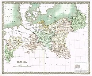
PRUSSIA.
Published by Orr & Comp Amen Corner Paternoster Row Ca1870, 1870
Seller: PROCTOR / THE ANTIQUE MAP & BOOKSHOP, DORCHESTER, United Kingdom
Association Member: PBFA
Seller rating 5 out of 5 stars

US$ 29.93
US$ 26.41 shipping
Ships from United Kingdom to U.S.A.Quantity: 1 available
Add to basketSize of engraved surface: 25cm x 30cm. In very good condition. Some coloured underlining Uncoloured.
-
Prussia. Sch�ne handkolorierte Landkarte von Preu�en. Stahlstich von J. Dower 1831
Published by London: Henry Teesdal, 1831
Seller: historicArt Antiquariat & Kunsthandlung, Wiesbaden-Breckenheim, Germany
Seller rating 5 out of 5 stars
Map First Edition Signed
1. Original-Stahlstich von Dower (in der Platte signiert) auf r�ckseitig unbedrucktem B�ttenblatt mit dekorativ abgesetztem Plattenrand, unter dem Titel britischer und preu�ischer Meilenzeiger, bildliche Darstellung ca. 34 x 42 cm, Blattgr��e ca. 37 x 48 cm, von alter Hand sch�n kolorierte Landesfl�chen in frischem Kolorit, B�tten mit gro�em Wasserzeichen (J. Whatman 1831), in der unteren Bugfalte kleiner hinterklebter Einriss, ansonsten sehr gut erhalten 2100 gr.
-

ca. 29,5 x 24 cm. Original-Landkarte, Prussia v. J. Dower, hrsg. London, Orr & Comp, ca. 1850, Formt 29,5 x 24 cm, Stahltich grenzkoloriert, sehr guter Zustand, genuine map Sprache: Deutsch Gewicht in Gramm: 550.
-

Prussia, with Part of Poland
Published by London. 1831, 1831
Seller: Peter Harrington. ABA/ ILAB., London, United Kingdom
Association Member: ABA ILAB PBFA
Seller rating 5 out of 5 stars
US$ 129.23
US$ 29.06 shipping
Ships from United Kingdom to U.S.A.Quantity: 1 available
Add to basketCovers most of modern day Poland and large parts of Germany. A New General Atlas of the World. Published by Henry Teesdale. Copper engraving. In good, clean condition. Split to lower edge near centrefold, with minute loss to margins, Closed tear at lower edge of centrefold Original colour. Size: 40.5 x 33 cm.
-

Prussia, with part of Poland. 17.
Published by A New General Atlas of the World,. Henry Teesdale & co. 302, High Holborn,. 1835, 1835
Seller: Peter Harrington. ABA/ ILAB., London, United Kingdom
Association Member: ABA ILAB PBFA
Seller rating 5 out of 5 stars
US$ 163.24
US$ 29.06 shipping
Ships from United Kingdom to U.S.A.Quantity: 1 available
Add to basketA simple but effective map of Prussia and part of Poland, from A New General Atlas of the World, published by Henry Teesdale & Co. With coloured margins of countries. Shows cities, place names, roads, rivers, lakes, and islands Copper engraving. Very good condition. Original colour. Size: 43 x 35 cm.
-

Prussia, with part of Poland. 17
Published by London. 1831, 1831
Seller: Peter Harrington. ABA/ ILAB., London, United Kingdom
Association Member: ABA ILAB PBFA
Seller rating 5 out of 5 stars
US$ 163.24
US$ 29.06 shipping
Ships from United Kingdom to U.S.A.Quantity: 1 available
Add to basketBeautiful map of Prussia and Poland divided into regions. Major railways and rivers are shown. Highland regions are shown in relief. A New General Atlas of the World, published by Henry Teesdale & Co. Steel engraving. Good condition and wide margins. Small brown stains at bottom, but does not detract from this lovely map. Original colour. Size: 41 x 33.5 cm.

