

Order Total (1 Item Items):
Shipping Destination:

Regnum Borussiae (46 results)
Skip to main search results
Search filters
Product Type
- All Product Types
- Books (12)
- Magazines & Periodicals (No further results match this refinement)
- Comics (No further results match this refinement)
- Sheet Music (No further results match this refinement)
- Art, Prints & Posters (7)
- Photographs (No further results match this refinement)
- Maps (27)
- Manuscripts & Paper Collectibles (No further results match this refinement)
Condition Learn more
- New (No further results match this refinement)
- As New, Fine or Near Fine (1)
- Very Good or Good (5)
- Fair or Poor (No further results match this refinement)
- As Described (40)
Binding
- All Bindings
- Hardcover (No further results match this refinement)
- Softcover (No further results match this refinement)
Collectible Attributes
- First Edition (1)
- Signed (No further results match this refinement)
- Dust Jacket (No further results match this refinement)
- Seller-Supplied Images (40)
- Not Print on Demand (46)
Language (3)
Free Shipping
- Free Shipping to U.S.A. (No further results match this refinement)
Seller Location
Seller Rating
-

Regnum Borussiae : (Ost- und Westpreußen, um 1710)
Published by Pfaehler, Bad Neustadt, 1989
Seller: Margret Hamann Versandantiquariat, Hamburg, Germany
Seller rating 5 out of 5 stars

1 Karte plano 57 x 48 cm gutes Exemplar.
-
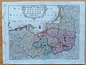
Lotter Original Map Prussia Poland - Borussiae Regnum
Published by Augsburg, Wagner für Lobeck, 1755
Map
Kein Einband. Condition: Gut. Original engraving from: Lotter/Lobeck: Atlas portatilis. Augsburg, 1755. Sheetsize: 14 x 10.5 cm. Condition: please see photo.
-
Borussiae Regnum.
Published by Augsburg, presso C.Lotter s.d. (ma 1744), 1744
Seller: Libreria Ex Libris ALAI-ILAB/LILA member, Roma, RM, Italy
Seller rating 5 out of 5 stars
Map
Incisione originale su rame (cm. 27x20,5 più margini). Coloritura coeva all'acquarello. Ottimo esemplare.
-

Karte von Preußen / Ostpreußen: Regnum Borussiae Gloriosis auspiciis Serenissimi et Princip Friderici III. Gestochene Karte mit Grenz- und Flächenkolorierung. Links oben mit großer emblematischer Dartsellung. Gerahmt, unter Glas und Passepartout.
Published by Nürnberg. Homann (ca 1710)., 1710
Seller: Galerie Hentrich & Shrivastava, Berlin, Germany
Seller rating 5 out of 5 stars
Bildgröße ca 48 x 57 cm / gerahmt 60 x 67 cm. Mit hinterlegtem Mittelfalz und winz. Quetschfalte. / Johann Baptist Homann (geb. 20. März 1664 in Oberkammlach, Unterallgäu; gest. 1. Juli 1724 in Nürnberg) war ein deutscher Kartograph, Verleger, Kupferstecher und fertigte Globen. Sprache: deutsch.
-
Borussiae Regnum sub fortissimo Tutamine et justissimo Regimine Serenissimi ac Potentissimi Principis Friderici Wilhelmi I.
Published by S.t., Augsburg., 1756
Carta geografica incisa in rame, con confini e riquadro a colori, di cm. 48 x 57. Pregevolissimo cartiglio animato, in alto al centro, con ritratto di Friderici Qilhelmi I, e i suoi stemmi. In alto a sinistra riquadro raffigurante "Principatus Neocomensis seu Neufchatel ad Borussiae Regem". Scala in basso a destra.
-
Regnum Borussiae Gloriosis auspiciis Serenissimi e Potentissimi Priv. Friderici III. - [Ostpreußen]. -
Published by Nürnberg: Homann [um ], 1720
Seller: Antiquariat Tautenhahn, Lübeck, Germany
Association Member: GIAQ ILAB VDA
Seller rating 5 out of 5 stars
Art / Print / Poster
Altkolorierte Kupferstichkarte von J.B. Homann, 48,5 x 57 cm. Blattgröße 52 x 63,5 cm. Im oberen Bildbereich ausladende, dekorative Kartusche mit Engeln, heraldischen Elementen. einem Portrait und einer kleinen Landkarte. Unter dem Titel Druckerprivileg. In der unteren rechten Bildecke eine Tafel mit Entfernungsmaßstäben. - Das Altkolorit von Karte und Kartusche leuchtend und sorgfältig. Einige Randeinrisse alt hinterklebt, am oberen Blattrand minimal wasserrandig und ein unschöner Klebestreifen außerhalb des Plattenrandes. Trotz der beschriebenen Mängel ordentliches Exemplar.
-
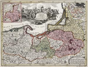
Borussiae Regnum cum adjacentisbus Regionibus mappa Geographica.
Published by Artist: Seutter Matthias ( - 1757 ) Augsburg ca : 1720, 1678
Seller: Antique Sommer& Sapunaru KG, München, Germany
Seller rating 3 out of 5 stars

Technic: Copper print, colorit: original colored, condition: Very good, size (in cm): 19 x 25,5 cm, Map shows the whole of Prussia, two partial maps of Neufchate and Silesia. Furthermore, a title and a mileage indicator cartouche in black and white. Engraved by Andr. Silbereisen, edited by Matthias Seutter.
-

Regnum Borussiae gloriosis auspicijs Seerenissimi et Potentissimi Princip Friderici III. Primi Borussiae Regis March. et Elect. Brandenburg. inauguratum die 18 Jan. A. 1701. Geographice cum vicinis Regionibus adumbratum a Ioh. Baptista Homanno Norimbergae.
Published by Nürnberg; Homann; J. B., 1701
Seller: Antiquariat Reinhold Berg eK Inh. R.Berg, Regensburg, Germany
Seller rating 5 out of 5 stars
Map
Other. Original antique copper engraving in full contemporary hand color in wash and outline when published. Old colored antique map of East Prussia by Johann Baptist Homann. Shows the coast of the Baltic Sea from Gdansk via Königsberg to Memel. With an impressive title cartouche with Friedrich I, the first Prussian king. In the text the date of the coronation on January 18, 1701. In excellent conditon. 479 by 562mm (18 by 22 inches). 479 by 562mm (18 by 22 inches).
-
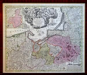
Borussiae Regnum sub fortissimo Tutamine et justissimo Regimine Serenissimi ac Potentissimi Princips Friderici Wilhelmi. Altkolor. Kupferstich, mit Nebenkarte des Fürstentums Neuchatel, üppiger heraldischer Titelkartusche mit dem allegor. überhöhten Portr. Friedrich Wilhelms I., Meilenzeiger u. kleiner Windrose.
Published by Augsburg, [ca. ], 1730
Seller: Antiquariat Reinhold Pabel, Hamburg, Germany
Association Member: BOEV
Seller rating 5 out of 5 stars
Map
Augsburg, [ca. 1730]. 49,5 x 58 cm im Rahmen (57 x 66 cm). (Mit handschriftl. Pagina 22 (oben rechts) von alter Hand. Sandler 151. - Kräftiger Abzug (des 2. Zustands) von scharfgratiger Platte mit feiner Flächen- und Grenzkolorierung. - Die Karte des Homann-Schülers Matthaeus Seutter (1678-1757), gestochen wohl von Andreas Silbereisen, umfasst neben Ostpreußen auch Westpreußen, die Danziger Rhede u. das Kurische Haff mit Memel. Das Brustbild des preuß. Königs (nach links) beherrscht die Kartusche in der oberen Mitte des Blattes, zu beiden Seiten von Göttern und allegor. Figuren umgeben, die wiederum jeweils von 2 wappentragenden Putti gesäumt sind. Maritime u. militär. Staffage füllt die Ostsee aus. - Alt gerahmt. - Leicht gebräunt, mit kurzem Einriss am rechten oberen Rand (bis in die Einfassungslinie hinein) u. kleiner, unter der Presse entstandener Quetschfalte am Kopfsteg. Im Ganzen gutes Exemplar der eindrucksvollen, schmückenden Karte.
-
Regnum Borussiae Gloriosis auspiciis Serenissimi et Potentissimi Prin Friderici III Primi Borussiae Regis, March, Er Elect. Bran inauguratum die 18 Ian A. 1701 Geographice cum vicinis Regionibus adumbratum
Published by Nuremberg, , c.1732., 1732
Seller: Alexandre Antique Prints, Maps & Books, Toronto, ON, Canada
Seller rating 5 out of 5 stars
Size: 492mm x 585mm, 19 3/8" x 23". Original Hand Coloring, Very Good; lower fold reinforced.
-

Regnum Borussiae Gloriosis auspicys Serenissimi et Potentissimi Prin Friderich III
Published by Nuremburg c. 1720, Nuremburg, 1720
Seller: High Ridge Books, Inc. - ABAA, South Deerfield, MA, U.S.A.
Association Member: ABAA ESA ILAB SNEAB
Seller rating 5 out of 5 stars
Gorgeous map of the Baltic region, from Memel to Pomerania, extending south to Poland and including most of modern Lithuania. Centered on Dantzig, Konigsberg, Heilsperg, etc. Magnificent ornate cartouche. A gorgeous full color example. This example includes the extraordinary early cartouche employed by Homann for this map--one of the most elaborate of all of his cartouches, with the portrait of Frederick III, not the eagle used on the later, smaller, version of the cartouche. A striking dark impression of this rare early edition of Homann's map, pre-dating Homann's receipt of his Priviledge.
-

Regnum Borussiae gloriosis auspiciis Serenissimi et Potentissimi Prinip Friderici III. Primi Borussiae Regis March et Elect. Bran. inauguratum die 18 Jan. A. 1701. Geographice cum vicinis Regionibus adumbratum a Ioh. Baptista Homanno Norimbergae
Published by J. B. Homann, Nürnberg, 1701
Seller: Antiquariat Reinhold Berg eK Inh. R.Berg, Regensburg, Germany
Seller rating 5 out of 5 stars
Map
Other. Copper engraving, hand colored in outline and wash. With a great figure title-cartouche with a coat-of-arms and a cartouche with an inset map behind the portrait of Frederic III. A map of the duchy of Prussia with the city of Kaliningrad (Königsberg). In excellent condition. 483 by 572mm (19 by 22½ inches).
-

Borussiae Regnum compectens Circulos Sambiensem, Natangiensem, et Hockerlandiae Nee non Borussia Polonica,.
Published by Artist: Lotter Tobias Conrad ( - 1777 ) Augsburg : 1740, 1717
Seller: Antique Sommer& Sapunaru KG, München, Germany
Seller rating 3 out of 5 stars
Technic: Copper print, colorit: original colored, condition: Perfect condition, size (in cm): 49 x 56,5 cm, Splendid map of Prussia with an expansive title cartouche, the coat of arms of the Kingdom of Prussia, an index cartouche and a mileage scale cartouche.
-

Regnum Borussiae gloriosis auspicijis Serenissimi e Potentissimi?
Published by Artist: Homann Johann Babtiste ( - 1724 ) Nuremberg ca : 1710, 1664
Seller: Antique Sommer& Sapunaru KG, München, Germany
Seller rating 3 out of 5 stars
Technic: Copper print, colorit: original colored, condition: Perfect condition, size (in cm): 48 x 56,5 cm, Splendid map of Prussia with an expansive title cartouche, the coat of arms of the Kingdom of Prussia and a mileage cartouche.
-

Borussiae Regnum sub fortissimo Tutamine et justissimo Regimine Serenissimi ac Potentissimi Princips Friderici Wilhelmi.
Published by Artist: Seutter Matthias ( - 1757 ) Augsburg ca : 1735, 1678
Seller: Antique Sommer& Sapunaru KG, München, Germany
Seller rating 3 out of 5 stars
Technic: Copper print, colorit: original colored, condition: Very good, size (in cm): 49 x 57,5 cm, Map shows the whole of Prussia with the Ostesse coast and a magnificent cartouche with a portrait, depictions of ships and a coat of arms. On a partial map Neuchâtel with coat of arms.
-

Condition: ACEPTABLE. [Un] Mapallevado a cabo porMatthäus Seutter (Augsburgo, 1678-1757), un destacado cartógrafo alemán de mediados del siglo XVIII. Aunque se formó inicialmente para ser cervecero, se convirtió en aprendiz de grabador bajo la tutela de Johann Baptist Homann en Núremberg. De hecho, en el año 1727 se le concedió el título de Geógrafo Imperial, y hoy día su obra más reconocidaes el "Atlas Novus Sive Tabulae Geographicae" de c.1730, publicada en dos volúmenes. Y siempre tomó como referencia trabajos anteriores de otros cartógrafos ilustres como Homanns, Delisles y de Fer. ["Sub fortissimo et justissimo Regimine Serenissimi ac Potentissimi Principis Friderici Wilhelmi [.] Cura et Suntibus. Matth. Seuteri, Sac. Caes. Maj. Geographi. Aug." ; "Cum Gratia et Privil. S.R.I. Vicariatg in partib."] . Cartela en blanco y negro. Incluye un pequeño mapa : "Principatus Neocomensis seu Neufchatel ad Borussiae Regem". Formato (cm): 59x50.
-
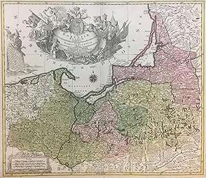
Borussiae Regnum Circulos Sambiensem, Natangiensem et Hockerlandiae Nec non Borussia Polonica
Published by Augsburg, 1759
Seller: Argosy Book Store, ABAA, ILAB, New York, NY, U.S.A.
Seller rating 5 out of 5 stars
unbound. Map. Engraving with hand coloring. 20 1/2" x 25 3/4". Beautifully designed map of Northern Poland. Spans from Pomerania and Palatinatus to Lithuania and Belarus, and shows the coast on the Baltic Sea. Includes cities and towns, mountains, forests, bodies of water, and other topographical features. Notes each voivodeship. Two lavish title cartouches with float in the Baltic centered on a portrait of Frederick the Great. Tobias Conrad Lotter was a German mapmaker based in Augsburg. His work dates to the revival of mapmaking in 18th century Germany that was spurred in large part by the work of Matthäus Seutter. Lotter, who married Seutter's daughter, worked on behalf of the Seutter firm as a master engraver and took over half of the printing house upon Seutter's death. His individual work, combined with his republication of Seutter's maps under his own imprint, allowed Lotter to match, if not surpass, his predecessor's reputation as one of the most prominent German cartographers of the period.
-
Regnum Borussiae Gloriosi auspicys Serenissimi e Potentissimi Princip. Friderici III. Primi Borussiae Regis March et Elect Brandenburg inauguratum die 18 Jan. !. 1701. Geographice cum vicinis Regionibus adumbratum
Published by J.B. Homann, Nuremburg, 1738
Seller: Alexandre Antique Prints, Maps & Books, Toronto, ON, Canada
Seller rating 5 out of 5 stars
Map
Title cartouche with raven bearing a shield marked "R", being crowned by two winged putti, meanwhile a king and queen bearing spears look on., Size : 493x588 (mm), 19.41x23.15 (Inches), Original Hand Coloring Very Good; laid down on old canvas for long-term preservation. A small piece of lower margin is replaced not effecting the map.
-
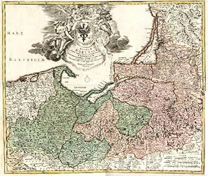
Regnum Borussiae. Flächenkolorierte Kupferstichkarte mit unkolorierter Kartusche.
Language: German
Published by Nürnberg, Joh. Bapt. Homann, um 1740., 1740
Art / Print / Poster
49,0 x 58,0 cm. Ecke unten links mit leichtem Wasserrand, rechter weißer Rand etwas fleckig. [SW - Landkarte, Landkarten].
-
Borussiae Regnum sub fortissimo Tutamine et justissimo Regimine Serenissimi ac Potentissimi Principis Friderici Wilhelmi : Altkolorierter Kupferstich : Ost- und Westpreußen, Danziger Rhede, Kurisches Haff, Nebenkarte: Fürstentum Neuchatel :
Language: Latin
Published by Augsburg, 1730
Seller: avelibro OHG, Dinkelscherben, Germany
Association Member: BOEV
Seller rating 5 out of 5 stars
Map
Gerahmt. Condition: Sehr gut. 1 Karte Erscheinungsjahr geschätzt; die Karte (49,5x58cm) von Matthäus Seutter umfasst Ost- wie Westpreußen, die Danziger Rhede, das Kurische Haff und in Form einer Nebenkarte das Fürstentum Neuchatel; dekorative Kartusche, allegorische Darstellung mit Brustbild des preußischen Königs; Karte mit Flächen- und Grenzkolorierung; in Holzrahmen späterer Zeit, dieser noch gut erhalten und als Beigabe zu verstehen; die Karte weist an den unbeduruckten Rändern minimale Lagerungsspuren auf, sowie die schwache Spur einer früheren Mittenfaltung; sie ist am oberen unbedruckten Rand von fremder Hand (in Bleistift) bezeichnet: "Ost- u. Westpreußen / Seutter um 1740" - schöner und sammelwürdiger Erhaltungszustand B07-02-06A la Gewicht in Gramm: 2046.
-

Kupferstich- Karte, v. Lobeck b. Lotter, "Borussiae Regnum .".
Language: German
Seller: Antiquariat Clemens Paulusch GmbH, Berlin, Germany
Seller rating 5 out of 5 stars
Map
mit altem Grenz- und Flächenkolorit, 1762, 9,2 x 12,2 Jäger, Nr. 178. Mit zwei kleinen Kartuschen.
-
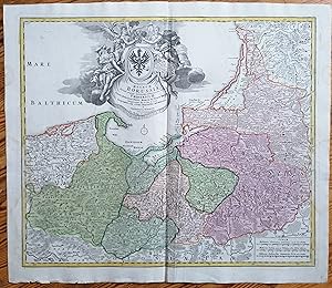
Kein Einband. Condition: Gut. Original Kupferstich von: Homann: Regnum Borrusiae. Um 1740. Blattgröße: ca. 62 x 53 cm. Etwas fleckig, leichte Gebrauchsspuren. Leichte Quetschfalten. Original engraving from: HomannPublished approx. 1740. Sheetsize: approx. 62 x 52 cm. Slight staining, some wrinkling in places.
-

Borussiæ Regnum cum adjacentibus Regionibus mappa Geographica.
Publication Date: 1744
Seller: Altea Antique Maps, London, United Kingdom
Association Member: ABA ILAB PBFA
Seller rating 5 out of 5 stars
Map
US$ 304.94
US$ 47.10 shipping
Ships from United Kingdom to U.S.A.Quantity: 1 available
Add to basketAugsburg, c.1744. Original body colour. 195 x 265mm. An uncommon small version of Seutter's map, engraved by Lotter for the 'Atlas Minor', with a martial title cartouche and inset maps of Silesia and Neuchâtel, a Swiss canton that was controlled by Prussia from 1707 to 1848.
-
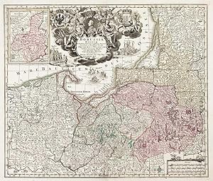
Borussiæ Regnum.
Publication Date: 1730
Seller: Altea Antique Maps, London, United Kingdom
Association Member: ABA ILAB PBFA
Seller rating 5 out of 5 stars
Map
US$ 540.58
US$ 47.10 shipping
Ships from United Kingdom to U.S.A.Quantity: 1 available
Add to basketAugsburg, c.1730, Original colour, 495 x 580mm Bottom centerfold repaired, otherwise a very fine example. Showing the Baltic coast of Poland, Kaliningrad and part of Lithuania, from the 'Atlantis Geographicus Maior' engraved by Tobias Conrad Lotter, and marking topography and settlements, with an inset of Neufchatel. The elaborate title cartouche which depicts personifications of Justice, War and Prudence, is surmounted by a portrait of Friedrich Wilhelm I of Prussia (1688-1740) who resettled East Prussia after a devastating plague in 1709. He was also the sovereign prince of the Principality of Neuchâtel in Western Switzerland, hence its inclusion here as an inset. Also in the title cartouche can be seen a depiction of Friedrich Wilhelm's famous regiment of taller than average soldiers, known as the 'Potsdam Giants', entry to which required a minimum height of 6ft 2.
-

Regnum Borussiae: Gloriosis auspicys Serenissimi et Potentissimi Prin Friderici III. Primi Borussiae Regis, March. et Elect. Bran. inauguratum die 18. Ian. A. 1701. Geographice cum vicinis Regionibus adumbratum a Ioh. Baptista Homanno Norimbergae Cum Privilegio Sac: Caes: Maijestatis.
Publication Date: 1728
Seller: Geographicus Rare Antique Maps, Brooklyn, NY, U.S.A.
Association Member: ABAA ESA ILAB
Seller rating 4 out of 5 stars

Map
Very good. Faint toning at centerfold. Original wash and outline color. Size 19 x 22.5 Inches. This is Homann's 1728 map of the Kingdom of Prussia, produced to commemorate the day (January 18, 1701) on which Elector Friedrich III of Brandenburg, Crowned himself King Friedrich I in Prussia in Königsberg. The map displays the borders of the Kingdom in Prussia at its inception, presents a portrait of the new king framed by an ornate allegorical cartouche. A Closer Look The map reaches from the Baltic Sea to as far south as Toru? on the Vistula River, and spans from the Duchy of Pomerania in the west to part of the Duchy of Samogitia in the east. The region here marked Prussiae Regnum constituted Eastern Prussia; this includes what is now the Kaliningrad Oblast of Russia, and the northeastern portions of Poland (here termed collectively 'Prussia Polonica.') These are divided on the map into the regions Circulus Hockerlandiae, Circulus Natangiensis and Circulus Sambiensis. The map also includes the Pomeranian Voivodeship, and the regions of Mirachowo, Puck, Cz?uchów, ?wiecie, Tuchola, ?ukowo, Che?mno Voivodeship, Micha?owo, and the Malbork Voivodeship. A Baroque Allegorical Cartouche The Baltic Sea is filled here with an elaborate cartouche teeming with imagery. It is centered on a portrait of Frederick III, the Electorate of Brandenburg and King of Prussia; his motto ' Suum Cuique ' appears at his head. To the left, a quartet of putti support the arms of the Kingdom of Prussia; at the right, with its attendant cudgel-bearing, helmeted putti are the arms of the Prince-Elector of Brandenberg. To the right of Frederick's portrait is a map representing the Electorate of Brandenberg in Germany, which remained his domain and would be the western part of the new Kingdom of Prussia. The new king is here attended on the left by Minerva (goddess of wisdom-in-war); Hermes, (messenger of the gods and patroin of commerce) hovers to the right. Above Frederick, a crown is suspended jointly between the allegories of Fame and Modesty. Publication History and Census This map's printing history is convoluted. We have identified this map in no fewer than six separate plates engraved over the course of the eighteenth century, either by Homann and his heirs. The first of these was engraved as early as 1707; we see it appearing in Homann atlases dated 1710 and 1716. An copy of this map, to a second plate, is dated 1724 by the Bibliotheque National de France. The present example, which we are classifying as a third plate, is the first to include Homann's Imperial privilege; this leads us to date it roughly at 1728. A fourth plate replaces the portrait of Frederick III with that of his heir, Frederick William I. This, too, is held by the Bibliotheque National de France, whose dating of 1724 is suspect; we have seen what may be two separate states of this plate, the second of which is the first to include notable geographic improvements, primarily in the eastern extremes of the map. Rumsey's collection has two further versions of the map, dated 1754 and 1788, with a new cartouche lacking either a portrait or a privilege. The map appears to be well represented in institutional collections in its various iterations, but it is difficult to determine specific versions from catalog listings. The map appears on the market from time to time. References: OCLC 315375414. Not in Rumsey.
-

PREUSSEN 1710 HOMANN Titel: Regnum Borussiae ; Gloriosis auspicys Serenissimi et Potentissimi Prin. Friderici III Primi Borussiae Regis, March. Et Elect. Bran. inauguratum die 18. Ian. A. 1701 Geographice cum vicinis Regionibus adumbratum a Ioh. Baptista Homanno
Published by Homann ca. 1710, Nürnberg, 1710
Seller: ANTIQUARIAT.WIEN Fine Books & Prints, Wien, Austria
Seller rating 5 out of 5 stars
Map
Landkarte, map, original Kupferstich, Kupferst., flächen- u. grenzkol., Maßstab in graph. Form (Milliaria Germanica communia, Milliaria Gallica quae et Polonica). - Titelkartusche oben Mitte, Platte ca. 58 x 50 cm Die Karte erschien erstmals im Atlas von hundert Charten zwischen 1707 bis 1712. Unser Exemplar vor der Ernennung Johann Bapt. Homanns zum kaiserl. Geographen. vgl. Sandler: Johann Baptista Homann S. 59 Nr. 100 de 500 Landkarte.
-
Borussiae Regnum sub fortißimo Tutamine et justißimo Regimine Serenißimi ac Potentißimi Principis Friderici Wilhelmi laetißimis incrementis efflorescens cum adjacentib. Regionibus mappa Geographica delineatum Cura et sumtibus Matth. Seuteri, Sac. Caes. Maj. Geographi. Aug.
Seller: Antiquariat Peter Fritzen, Speicher, Germany
Seller rating 5 out of 5 stars
Map
Kupferstich-Karte von M. Seutter, um 1740, alt grenz- und flächenkoloriert. Ca. 48,5 x 57 cm. Jäger, Prussia, Nr. 113. Zeigt Ostpreussen, das Gebiet um die Danziger Rhede und das Kurische Haff. Oben in der Mitte dominiert eine prachtvolle Titelkartusche die Darstellung. Die Götter und Personifikationen Mars, Justitia, Fama, Merkur und Sapientia umgeben das Titelfeld, Putti tragen zwei Wappen. Oben befindet sich das Porträt-Medaillon Friedrich Wilhelms I. Links oben ist eine Insetkarte mit dem in der Schweiz gelegenen Fürstentum Neuchatel dargestellt. Darunter ist das Privileg vermerkt. Unten rechts befinden sich Meilenzeiger. Gradnetz und maritime Staffage. Alt gerahmt. The map shows Eastern Prussia. At the center of the top we find a gorgeous title cartouche. The lords and personifications of Mars, Justitia, Fama, Mercure and Sapientia surround the title field, Putti carry two crests. At the top we find the portrait medallion of Friedrich Wilhelm I. At the left top we find an insetmap with the princedom Neuchatel. At the right bottom we find the benchmarks. Graticule and maritime figures. Nice contemporary colour!
-

Regnum Borussiae: Gloriosis auspicys Serenissimi et Potentissimi Prin Friderici III. Primi Borussiae Regis, March. et Elect. Bran. inauguratum die 18. Ian. A. 1701. Geographice cum vicinis Regionibus adumbratum a Ioh. Baptista Homanno Norimbergae.
Publication Date: 1710
Seller: Geographicus Rare Antique Maps, Brooklyn, NY, U.S.A.
Association Member: ABAA ESA ILAB
Seller rating 4 out of 5 stars
Map First Edition
1st Edition. Very good. Light wear and discoloration along centerfold, mostly confined to bottom margin. Some soiling in bottom-right margin. Size 19 x 22.75 Inches. This is first edition Johann Baptist Homann's c. 1710 map of the Kingdom of Prussia, produced to commemorate the day (January 18, 1701) on which Elector Friedrich III of Brandenburg crowned himself King Friedrich I in Prussia in Königsberg. The map displays the borders of the Kingdom of Prussia at its inception and presents a portrait of the new king framed by an ornate allegorical cartouche. A Closer Look The map reaches from the Baltic Sea to as far south as Toru? (Thorn) on the Vistula River and spans from the Duchy of Pomerania in the west to part of the Duchy of Samogitia in the east (today's Lithuania). The region here marked Prussiae Regnum constituted Eastern Prussia; this includes what is now the Kaliningrad Oblast of Russia and the northeastern portions of Poland ('Prussia Polonica'). These are divided on the map into the regions Circulus Hockerlandiae, Circulus Natangiensis, and Circul Sambiensis. The map also includes the Pomeranian Voivodeship and the regions of Mirachowo, Puck, Cz?uchów, ?wiecie, Tuchola, ?ukowo, Che?mno Voivodeship, Micha?owo, and the Malbork Voivodeship. A Baroque Allegorical Cartouche The Baltic Sea is filled with an elaborate cartouche teeming with imagery. It is centered on a portrait of Frederick III, the Electorate of Brandenburg and King in Prussia; his motto ' Suum Cuique ' appears at his head. To the left, a quartet of putti support the arms of the Kingdom of Prussia; at the right, with its attendant cudgel-bearing, helmeted putti are the arms of the Prince-Elector of Brandenberg. To the right of Frederick's portrait is a map representing the Electorate of Brandenberg in Germany, which remained his domain and would be the western part of the new Kingdom of Prussia. The new king is here attended on the left by Minerva (goddess of wisdom-in-war); Hermes (messenger of the gods and patron of commerce) hovers to the right. Above Frederick, a crown is suspended jointly between the allegories of Fame and Modesty. The Emergence of Prussian Power Given the kingdom's subsequent importance and even centrality to German history, the historical origins of Prussia are surprisingly modest. The territory began as a relatively poor and unimportant duchy in vassalage to the Polish crown in the 16th century. It began to take shape under the leadership of the Hohenzollern family, Electors of Brandenberg, who inherited the duchy in 1618 and gained its sovereignty in the Second Northern War (1665 - 1660). Prussia's status as a rising power was confirmed in the early 18th century when it was allowed to elevate itself to a kingdom and Frederick to become 'King in Prussia' (not 'King of Prussia'). This specific terminology was a loophole, circumventing the restriction on kingdoms within the Holy Roman Empire, created by Emperor Leopold I (r. 1658 - 1705) to secure Prussia's support in the War of the Spanish Succession (1701 - 1715). Although Prussia was outside of the Holy Roman Empire, Brandenburg was within it; thus, the Hohenzollern rulers operated with two separate titles until the end of the Holy Roman Empire during the Napoleonic Wars. More tangibly, Prussia's neighborhood was transformed by the Great Northern War (1700 - 1721), which saw Swedish power in northeastern Europe recede and Russia's increase. Joining the war in its latter years, Prussia gained territory and developed a strong emphasis on administrative and military modernization, led by Crown Prince and then King Frederick William I (r. 1713 - 1740). His son, Frederick II ('Frederick the Great,' r. 1740 - 1786), was the embodiment of a philosopher-king, a brilliant military strategist, and an ally of the Enlightenment. By the end of his reign, Prussia had significantly expanded its territory and was one of the leading powers in Europe. Publication History and Census This map's printing histo.
-

Regnum Borussiae.Friderici III. (Map of the Baltic including Poland).
Seller: Henry Sotheran Ltd, London, United Kingdom
Association Member: ABA ILAB PBFA
Seller rating 5 out of 5 stars
US$ 1,039.58
US$ 53.83 shipping
Ships from United Kingdom to U.S.A.Quantity: 1 available
Add to basketOriginal copper engraved map with later hand colouring as published in Nuremberg, c.1720. 540 x 615 mm.With one of Homann's most elaborate Cartouche's.
-
Kein Einband. Condition: Befriedigend. OSTPREUSSEN: Kupferstich- Karte, in 5 ( v. 6 ) Blatt von und nach Johann W. v. Kupferstich- Karte, in 5 ( v. 6 ) Blatt von und nach Johann W. v. Suchodoletz und M. Lilienthal bei der Berliner Akademie. dat. 1763, je 44,5 x 55,5 Jäger, Prussia - Karten, Nr. 183. Siehe auch Johannes Dörflinger in Imago Mundi, vol. 33, "the first Austrian World Atlases: Schraembl and Reilly" - Es fehlt das Blatt 1 (Stadtplan von Königsberg). - Laut Jäger (a.a. Ort) wurde die Zeichnung für diese Karte schon 1732 von Suchodoletz angefertigt. Der Titel der Karte war als Kopftitel auf den Blättern Folio I ( fehlt hier ) und Folio II. "Regnum Borussiae episcopatus Warmiensis, Palatinatus Mariaeburgensis et Culmensis cum terrritorio Dantiscano et ichnographia urbis Regiomontis" ( =Königsberg). Der Kartenteil ist mit den vorliegenden Blättern komplett. Alle Karten sind sehr gut erhalten und zusammengesetzt. Grösse: 114 x 140 cm.


![Seller image for Regnum Borussiae Gloriosis auspiciis Serenissimi e Potentissimi Priv. Friderici III. - [Ostpreußen]. - for sale by Antiquariat Tautenhahn](https://pictures.abebooks.com/inventory/md/md30775718032.jpg)


