
Order Total (1 Item Items):
Shipping Destination:

Atlantic Ocean (29 results)
Skip to main search results
Search filters
Product Type
- All Product Types
- Books (18)
- Magazines & Periodicals (No further results match this refinement)
- Comics (No further results match this refinement)
- Sheet Music (No further results match this refinement)
- Art, Prints & Posters (No further results match this refinement)
- Photographs (No further results match this refinement)
- Maps (9)
- Manuscripts & Paper Collectibles (2)
Condition Learn more
Binding
Collectible Attributes
Language (3)
Free Shipping
Seller Location
Seller Rating
-

Food Notebook -Ingredients 1- Yellow: Food Notebook -Ingredients 1 - Yellow - No Bleed
Language: English
Published by Independently published, 2020
ISBN 10: 1661346677 ISBN 13: 9781661346676
US$ 11.47
US$ 13.33 shipping
Ships from United Kingdom to U.S.A.Quantity: 1 available
Add to basketPaperback. Condition: Brand New. 120 pages. 8.25x6.00x0.28 inches. In Stock.
-

The Alvyn Brighton Place and Atlantic Avenue Ocean City N. J. Postcard
Published by 1920 CIRCA, 1920
Seller: Princeton Antiques Bookshop / Ruffolo Enterprises, Atlantic City, NJ, U.S.A.
Seller rating 5 out of 5 stars

Condition: GOOD. new, unused DATE PUBLISHED: 1920 CIRCA EDITION:
-

Atlantic Salmon in Maine
Language: English
Published by National Academies Press, 2004
ISBN 10: 0309091357 ISBN 13: 9780309091350
Soft cover. Condition: Near Fine. Crisp and clean and near pristine!
-
-

-
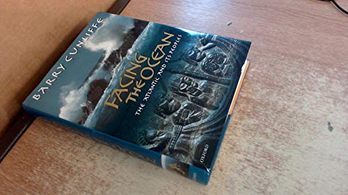
Facing the Ocean: The Atlantic and its Peoples, 8000 BC to AD 1500 Cunliffe, Barry
Language: English
Published by Oxford University Press, 2001
ISBN 10: 0199240191 ISBN 13: 9780199240197
Condition: New.
-

Compiled and Drawn in the Cartographic Section of the National Geographic Society for the National Geographic Magazine. John Oliver LaGorce, Editor. Map supplement to The National Geographic Magazine, Vol.CVIII, No.6.
Language: English
Published by Washington, National Geographic Society, December 1955., 1955
Seller: Antiquariat Gerber AG, ILAB/VEBUKU/VSAR, Basel, Switzerland
Association Member: ILAB VEBUKU
Seller rating 4 out of 5 stars

Map First Edition
Mehrfach gefaltete Karte, farbig // Multiple folded map in color. With inset: Distances across the Atlantic, Submarine Topography of the Atlantic /// Fast neuwertig // Nearly perfect condition. Sprache: Englisch Gewicht in Gramm: 50 15 x 24 cm (entfaltet/unfolded 98,5 x 71 cm).
-
Collection of 19 reprints on fishes from the Atlantic Ocean published in the Proceedings of the U.S
Seller: Backhuys Biological Books, Kerkwerve, Netherlands
Seller rating 5 out of 5 stars
US$ 17.81 30% offUS$ 12.47
US$ 21.62 shipping
Ships from Netherlands to U.S.A.Quantity: 1 available
Add to basketNational Museum 0.0.
-
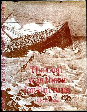
The Coal Was There For Burning
Published by Published by Marine Media Management Ltd., 76 Mark Lane, London First Edition . 1975., 1975
Seller: Little Stour Books PBFA Member, Canterbury, United Kingdom
Association Member: PBFA
Seller rating 5 out of 5 stars
First Edition
US$ 20.60
US$ 40.00 shipping
Ships from United Kingdom to U.S.A.Quantity: 1 available
Add to basketCondition: Very Good. First edition hard back binding in publisher's original burgundy cloth covers, gilt title and author lettering to the spine, end paper maps. Quarto 10'' x 7�''. During the ship's 19th voyage, on 1 April 1873, she struck rocks and sank off the coast of Nova Scotia, Canada, killing at least 535 people. It remained the deadliest civilian maritime disaster in the North Atlantic Ocean until the sinking of SS La Bourgogne on 2 July 1898 and the greatest disaster for the White Star Line prior to the loss of Titanic in April 1912. Contains [xiii] 77 printed pages of text with maps, archive monochrome illustrations throughout. Fine condition book in Very Good condition dust wrapper with small chips across the top edge. Dust wrapper supplied in archive acetate film protection. Member of the P.B.F.A. ISBN 0900976500 TITANIC (White Star Line).
-
![Seller image for Report on the PICAO Conference of North Atlantic States on Ocean Weather Observation Stations in the North Atlantic, London, September 17th-25th, 1946 / Provisional International Civil Aviation Organization. 1946 [LeatherBound] for sale by S N Books World](https://pictures.abebooks.com/inventory/md/md32213643242.jpg)
LeatheBound. Condition: New. BOOKS ARE EXEMPT FROM IMPORT DUTIES AND TARIFFS; NO EXTRA CHARGES APPLY. Leatherbound edition. Condition: New. Leather Binding on Spine and Corners with Golden leaf printing on spine. Bound in genuine leather with Satin ribbon page markers and Spine with raised gilt bands. Pages: 78. A perfect gift for your loved ones. Reprinted from 1946 edition. NO changes have been made to the original text. This is NOT a retyped or an ocr'd reprint. Illustrations, Index, if any, are included in black and white. Each page is checked manually before printing. As this print on demand book is reprinted from a very old book, there could be some missing or flawed pages, but we always try to make the book as complete as possible. Fold-outs, if any, are not part of the book. If the original book was published in multiple volumes then this reprint is of only one volume, not the whole set. IF YOU WISH TO ORDER PARTICULAR VOLUME OR ALL THE VOLUMES YOU CAN CONTACT US. Resized as per current standards. Sewing binding for longer life, where the book block is actually sewn (smythe sewn/section sewn) with thread before binding which results in a more durable type of binding. Language: English Pages: 78.
-
![Seller image for International agreement on North Atlantic Ocean weather stations, with annex, London, 12th May 1949 1949 [LeatherBound] for sale by S N Books World](https://pictures.abebooks.com/inventory/md/md32213535578.jpg)
International agreement on North Atlantic Ocean weather stations, with annex, London, 12th May 1949 1949 [LeatherBound]
Language: English
Publication Date: 2025
LeatheBound. Condition: New. BOOKS ARE EXEMPT FROM IMPORT DUTIES AND TARIFFS; NO EXTRA CHARGES APPLY. Leatherbound edition. Condition: New. Leather Binding on Spine and Corners with Golden leaf printing on spine. Bound in genuine leather with Satin ribbon page markers and Spine with raised gilt bands. Pages: 14. A perfect gift for your loved ones. Reprinted from 1949 edition. NO changes have been made to the original text. This is NOT a retyped or an ocr'd reprint. Illustrations, Index, if any, are included in black and white. Each page is checked manually before printing. As this print on demand book is reprinted from a very old book, there could be some missing or flawed pages, but we always try to make the book as complete as possible. Fold-outs, if any, are not part of the book. If the original book was published in multiple volumes then this reprint is of only one volume, not the whole set. IF YOU WISH TO ORDER PARTICULAR VOLUME OR ALL THE VOLUMES YOU CAN CONTACT US. Resized as per current standards. Sewing binding for longer life, where the book block is actually sewn (smythe sewn/section sewn) with thread before binding which results in a more durable type of binding. Language: English Pages: 14.
-
![Seller image for Oceanic internal waves from ship, aircraft, and spacecraft : a report on the New York-to-Bermuda remote sensing experiment / John R. Proni . [et al], Ocean Remote Sensing Laboratory, Atlantic Oceanograhic and Meteorological Laboratories, Environmental Research Laboratories, National Oceanic and Atmospheric Administration. 1978 [LeatherBound] for sale by S N Books World](https://pictures.abebooks.com/inventory/md/md31376298823.jpg)
Oceanic internal waves from ship, aircraft, and spacecraft : a report on the New York-to-Bermuda remote sensing experiment / John R. Proni . [et al], Ocean Remote Sensing Laboratory, Atlantic Oceanograhic and Meteorological Laboratories, Environmental Research Laboratories, National Oceanic and Atmospheric Administration. 1978 [LeatherBound]
Language: English
Publication Date: 2025
LeatherBound. Condition: New. BOOKS ARE EXEMPT FROM IMPORT DUTIES AND TARIFFS; NO EXTRA CHARGES APPLY. Leatherbound edition. Condition: New. Leather Binding on Spine and Corners with Golden leaf printing on spine. Bound in genuine leather with Satin ribbon page markers and Spine with raised gilt bands. Pages: 144. A perfect gift for your loved ones. Reprinted from 1978 edition. NO changes have been made to the original text. This is NOT a retyped or an ocr'd reprint. Illustrations, Index, if any, are included in black and white. Each page is checked manually before printing. As this print on demand book is reprinted from a very old book, there could be some missing or flawed pages, but we always try to make the book as complete as possible. Fold-outs, if any, are not part of the book. If the original book was published in multiple volumes then this reprint is of only one volume, not the whole set. IF YOU WISH TO ORDER PARTICULAR VOLUME OR ALL THE VOLUMES YOU CAN CONTACT US. Resized as per current standards. Sewing binding for longer life, where the book block is actually sewn (smythe sewn/section sewn) with thread before binding which results in a more durable type of binding. Language: English Pages: 144.
-
"Contributions to Terrestrial Magnetism. No. IX." In: Philosophical Transactions.
Publication Date: 1849
Seller: JF Ptak Science Books, Hendersonville, NC, U.S.A.
Seller rating 5 out of 5 stars
Soft cover. Condition: Good. With a large folding magnetic declination map of the Atlantic Ocean.[++] Edward Sabine, "Contributions to Terrestrial Magnetism. No. IX. In: Philosophical Transactions, 1849, pp [173]-234, with a large folding map of the magnetic declination of the Atlantic Ocean. This is the full paper, disbound from alarger bound volume. Nice copy GOOD condition. The map was signifcant for the times (following in the many footsteps leading back to the first such map made by Edmund Halley in 1701) because accurate knowledge of magnetic declination was crucial for navigation in correcting compass readings.
-
Trip to Mars Vol.2
Language: German
Published by Spv Record (Spv), 1994
Seller: Versandantiquariat Felix M�cke, Grasellenbach - Hammelbach, Germany
Seller rating 5 out of 5 stars
Audio CD. Condition: Befriedigend. H�lle mit Gebrauchsspuren, CDs selbst in gutem Zustand, Artikel stammt aus Nichtraucherhaushalt! NB1-4126 Sprache: Deutsch Gewicht in Gramm: 80.
-
Work of Vivian B. Smith, Architect. Hotel Flanders, Hotel Breakers, Hotel Donato, Elk's Club, City Hall, Ocean City High School
Published by GUARANTEE TRUST BUILDING, 1924
Seller: Princeton Antiques Bookshop / Ruffolo Enterprises, Atlantic City, NJ, U.S.A.
Seller rating 5 out of 5 stars
PAPERBACK BROWN. General wear, plastic outer layer raised in some areas causing air bubbles in covers, front right cover corner and base of spine torn and partially missing, contains BW plates, creases on corners and vertically down rear cover, taped text block to cover Exterior and Interior Photographs: Hotel Flanders, Ocean City, N.J. Patio and Pool, Hotel Flanders Exchange and Dining Room Corridor, Hotel Flanders Fireplace in Exchange, Hotel Flanders Detail Marble Fireplace, Hotel Breakers, Atlantic City, N.J Hotel Breakers, Atlantic City, N.J. Boardwalk Entrance, Hotel Breakers Louis XVI Restaurant, Hotel Breakers Elevator Entrance, Hotel Breakers Detail Marble Stairway, Hotel Breakers Detail Entrance Lobby, Hotel Breakers Terrace Restaurant, Hotel Breakers Detail in Lobby, Hotel Breakers Hotel Donato, Atlantic City, N.J. Detail in Lobby, Hotel Donato Dining Room, Hotel Donato Elk's Club, Atlantic City, N.J City Hall, Ocean City, N.J. Front and Rear View, Ocean City High School, Ocean City, N.J. Detail--Main Entrance, Ocean City High School Detail--Auditorium, Ocean City High School Troy Ave. School, Ventnor, N.J. Oxford Ave. School, Ventnor N.J. Ventnor Community Church (Congregational), Ventnor N.J. Interior Detail--Main Auditorium, Chelsea Baptist Church, Atlantic City, N.J. Interior--Main Auditorium, Chelsea Baptist Church Freeman Building, Atlantic City, N.J. Building for Hurley-Jones Co., Atlantic City, N.J. Building for Ernest Beyer, Atlantic City, N.J. The Crailsheim Apartments, Atlantic City, N.J. Store and Apartment Building for Mr. Oscar Van Sant, Atlantic City, N.J. Weingart Residence, Ventnor, N.J. Godshall Residence, Ventnor, N.J. Residence of Eleanor Du Pont Tauner, Ventnor, N.J. Residence of Nicholas Hampton, Esq., Northfield, N.J. Residence of A.P. Rosenberger, Esq., Ventnor, N.J. Residence of G.J. Costello, Esq., Ventnor, N.J. Group of Buildings for Society for Foreign Mission Welfare, Ventnor, N.J. DATE PUBLISHED: 1924 EDITION:
-
['He walked across Africa': Verney Lovett Cameron, the first European to cross equatorial Africa from coast to coast.] Autograph Signature to conclusion of a letter: 'V. Lovett Cameron / Commander R. N.'
Published by Without date or place
Seller: Richard M. Ford Ltd, London, United Kingdom
Seller rating 5 out of 5 stars
Manuscript / Paper Collectible
US$ 104.38
US$ 6.00 shipping
Ships from United Kingdom to U.S.A.Quantity: 1 available
Add to basketSee his entry in the Oxford DNB. A good large bold signature, with the autograph valediction of a letter. On one side of a 20 x 9 cm piece of wove paper. In good condition, lightly aged. Reads: 'Your's [sic] very truly / V. Lovett Cameron / Commander R. N.' See Image.
-
Chart of the South Atlantic Ocean from the Equator to 65� South Latitude, from the most recent British, French and Braziln. Authorities [mounted together with] Chart of the South Atlantic Ocean from the Equator to 65� South Latitude, from the most recent British Authorities. Sheet II
Published by United States Hydrographic Office, Washington, 1882
Seller: Michael Treloar Booksellers ANZAAB/ILAB, Adelaide, SA, Australia
Association Member: ANZAAB ILAB
Seller rating 5 out of 5 stars
Map
Condition: Fair. Washington, United States Hydrographic Office, 1882/ 1868 and 1869. A very large engraved chart in two sheets (combined size approximately 940 � 1230 mm, overall total size 954 � 1252 mm), with minimal hand-colouring, mounted together on linen. Some foxing and light soiling, with a few light stains and creases, and trifling surface loss from insect damage; light wear to the edges; verso of the linen backing a little waterstained; overall, a working map in decent condition. A large United States Navy Hydrographic Office chart, with five inset charts showing the anchorages of Walwich Bay (Walvis Bay), Angra Pequena (L�deritz Bay) and St Helena, and channels through the Abrolhos and Manoel Luiz Banks. The two sheets incorporate corrections to December 1881 and January 1882 respectively. Pencil annotations show the tracks of three voyages, two south-east towards the Cape of Good Hope in March-April and November-December 1883, and one in the opposite direction in April-May 1886 (this is identified in the right-hand margin as part of a voyage from Hong Kong to London, made by one J.B. Newcomb). A further partial track is given in purple ink, dated only 'Route in October, November and December'. Lighthouses are highlighted with spots of red and yellow colouring.
-
![Seller image for Report on the PICAO Conference of North Atlantic States on Ocean Weather Observation Stations in the North Atlantic, London, September 17th-25th, 1946 / Provisional International Civil Aviation Organization. (1946) [LeatherBound] for sale by S N Books World](https://pictures.abebooks.com/inventory/md/md31918909979.jpg)
LeatheBound. Condition: New. Leatherbound edition. Condition: New. Leather Binding on Spine and Corners with Golden leaf printing on spine. Bound in genuine leather with Satin ribbon page markers and Spine with raised gilt bands. A perfect gift for your loved ones. Reprinted from 1946 edition. NO changes have been made to the original text. This is NOT a retyped or an ocr'd reprint. Illustrations, Index, if any, are included in black and white. Each page is checked manually before printing. As this print on demand book is reprinted from a very old book, there could be some missing or flawed pages, but we always try to make the book as complete as possible. Fold-outs, if any, are not part of the book. If the original book was published in multiple volumes then this reprint is of only one volume, not the whole set. IF YOU WISH TO ORDER PARTICULAR VOLUME OR ALL THE VOLUMES YOU CAN CONTACT US. Resized as per current standards. Sewing binding for longer life, where the book block is actually sewn (smythe sewn/section sewn) with thread before binding which results in a more durable type of binding. Pages: 78 Language: English Pages: 78.
-

Atlantic Ocean.
Publication Date: 1835
Seller: Geographicus Rare Antique Maps, Brooklyn, NY, U.S.A.
Association Member: ABAA ESA ILAB
Seller rating 4 out of 5 stars
Map First Edition
1st Edition. Very good. Original platemark visible. Minor spotting at places. Blank on verso. Size 10.5 x 8.5 Inches. This is a fine 1835 map of the Atlantic Ocean by the important American mapmaker T. G. Bradford. It covers the Atlantic Ocean from the Baffin Bay south as far as the Antarctic Circle and from the Gulf of Mexico east past the Mediterranean Sea. The map identifies deserts, rivers, islands and important cities in the United States, Canada, South America, Africa and Europe. Does not show Antarctica, but does identify South Shetland just north of the Antarctic Circle. Elevation is rendered by hachure. This map was published as plate no. 80 in Thomas G. Bradford's 1835 Comprehensive Atlas Geographical, Historical and Commercial . Bradford's atlas, published in 1835 was an important work on many levels. First, it was one of the first American atlases to follow an encyclopedic format, offering readers extensive geographical and statistical tables to supplement the maps themselves. Second, it was published in Boston and influenced the city's rise as a publishing center later in the 19th century (at the time most publishing in the United States was restricted to New York and Philadelphia). Third, this atlas was the first to contain a separate and specific map showing the Republic of Texas. Fourth and finally, Bradford's atlas in some instances broke the Euro-centric mold regarding atlas production. Among other things, Bradford focused his atlas on the Americas and abandoned the classical decoration common in European atlases in favor of a more informational and inherently American approach. Bradford published this atlas in several editions and with various partners. The first edition was published by William D. Ticktor and did not contain the iconic Republic of Texas map (although we have in fact seen Ticktor examples with a Texas map, suggesting, against conventional wisdom, that there may have been two Ticktor editions). The second official edition, published in the same year by the American Stationers Company, was the first to contain the Republic of Texas map, which is based on Austin's map, with two pages of descriptive text. A third edition was issued in 1836, also by American Stationers (though still dated 1835), and contained an unaltered Republic of Texas map with only a single page of descriptive test. A fourth edition appeared later, possibly 1837, and included an updated and revised map of Texas that replaces the old Mexican land grants with new inchoate counties. The maps from this atlas are an important addition to any collection focusing on early American cartography and Republic of Texas cartography. All maps in this atlas, though not specifically noted as such, were most likely engraved by G. W. Boynton of Boston, who also engraved most of the maps for Bradford's later publication. References: Rumsey 2643.090 (1838 edition).
-
Pacific Railroad and Telegraph . Report . 1856 [Leather Bound]
Publication Date: 2025
Leather Bound. Condition: New. Language: English. Language: English. Presenting an Exquisite Leather-Bound Edition, expertly crafted with Original Natural Leather that gracefully adorns the spine and corners. The allure continues with Golden Leaf Printing that adds a touch of elegance, while Hand Embossing on the rounded spine lends an artistic flair. This masterpiece has been meticulously reprinted in 2025, utilizing the invaluable guidance of the original edition published many years ago in 1856. The contents of this book are presented in classic black and white. Its durability is ensured through a meticulous sewing binding technique, enhancing its longevity. Imprinted on top-tier quality paper. A team of professionals has expertly processed each page, delicately preserving its content without alteration. Due to the vintage nature of these books, every page has been manually restored for legibility. However, in certain instances, occasional blurriness, missing segments, or faint black spots might persist. We sincerely hope for your understanding of the challenges we faced with these books. Recognizing their significance for readers seeking insight into our historical treasure, we've diligently restored and reissued them. Our intention is to offer this valuable resource once again. We eagerly await your feedback, hoping that you'll find it appealing and will generously share your thoughts and recommendations. Lang: - English, Pages:- 86, Print on Demand. If it is a multi-volume set, then it is only a single volume. We are specialised in Customisation of books, if you wish to opt different color leather binding, you may contact us. This service is chargeable. Product Disclaimer: Kindly be informed that, owing to the inherent nature of leather as a natural material, minor discolorations or textural variations may be perceptible. Explore the FOLIO EDITION (12x19 Inches): Available Upon Request. 86 86.
-
CYRUS W. FIELD (1819-92) amerikanischer Finanzier und Ingenieur, lie� das 1. Kabel zwischen Amerika und Europa legen und baute die N.Y.'er Hochbahn / American businessman and financier who, along with other entrepreneurs, created the Atlantic Telegraph Company and laid the first telegraph cable across the Atlantic Ocean in 1858
Manuscript / Paper Collectible Signed
Kleine AUTOGRAMMKARTE mit eigenh�ndiger Unterschrift in Tinte signiert (1882).
-

Chart Showing the Positions of the Dredgings Deeper than 100 Fathoms Made by the U.S. Fish Commission Steamship Albatross in the North Atlantic Ocean, Caribbean Sea, and around South America from 1883 to 1888.
Publication Date: 1900
Seller: Geographicus Rare Antique Maps, Brooklyn, NY, U.S.A.
Association Member: ABAA ESA ILAB
Seller rating 4 out of 5 stars
Map Signed
Very good. Exhibits light wear along original fold lines. Left side remargined. Size 23.35 x 16.5 Inches. This is a 1900 C. H. Townsend and U.S. Fish Commission map of Atlantic Ocean Caribbean Sea floor samplings deeper than 100 fathoms. Red numbers identify these dredging locations and can be correlated with detailed data in USS Albatross archives. Stretching from Gulf of St. Lawrence south to northern South America including the Greater and Lesser Antilles and the Bahamas, dredgings marked were collected by the Albatross between 1883 and 1888. A large inset along the right border illustrates the entirety of South America and notes dredgings taken by the Albatross off the coast of Brazil and Chile. A smaller inset focuses on the Gulf of Mexico from New Orleans along the U.S. Gulf Coast to the Florida Keys and south to the Yucatan, with dredgings noted in the Gulf south of Mobile and around the Yucatan Peninsula. The USS Albatross This USS Albatross , also known as the USFC Albatross in scientific papers, was the first specifically built marine research vessel. Albatross operated in the Atlantic between December 1882 and November 1887, when she began her voyage to the Pacific Ocean. She arrived at the Straits of Magellan on January 23, 1888, and then continued up the coast of South America, stopping in the Galapagos briefly in April 1888. She operated along the U.S. Pacific coast and as far north as the Bering Sea and as far south as Panama between 1888 and 1898, when she was converted into an auxiliary cruiser for service during the Spanish-American War. After this work was finished, she sailed for Mexico, but did not see combat before peace treaties were signed. She immediately underwent conversion back to being a research vessel. After the retrofit, Albatross left San Francisco on August 23, 1899 and spent the next few months in the Central and South Pacific, before arriving in Yokohama, Japan, on March 4, 1900. Albatross continued her research work until she was transferred to the Navy on May 2, 1917, for service during World War I. She served with the American Patrol Detachment as a gunboat and protected tankers transporting oil and petroleum in the Caribbean and the Gulf of Mexico. After World War I, Albatross returned to research work, until she was decommissioned on October 29, 1921. She was sold to Thomas Butler and Company of Boston in June 1924, without her library, equipment, or instruments. Butler converted her into a school ship, then refitted her as a training ship for 'nautical students and cadets'. She left for Europe with 119 students on board on July 12, 1927. However, the students filtered off the ship at a succession of ports and by the time the Albatross reached Hamburg the crew demanded that she be auctioned off to satisfy their salaries. The paper trail goes cold in 1928 and her ultimate fate is unknown. Publication History and Census This map was created under the supervision of Charles Haskins Townsend for the U.S. Fish Commission. It was published in the 1900 U.S. Fish Commission report to Congress and printed by the Norris Peters Company. Neither the separate map nor the report in which it was printed are cataloged in OCLC. Signed by Author(s).
-

Chart Showing the Locations of the Dredgings in Less Than 100 Fathoms Made by the U.S. Fish Commission Steamship Albatross in the Atlantic and Pacific Oceans from 1883 to 1900.
Publication Date: 1900
Seller: Geographicus Rare Antique Maps, Brooklyn, NY, U.S.A.
Association Member: ABAA ESA ILAB
Seller rating 4 out of 5 stars
Map Signed
Very good. Exhibits light wear along original fold lines. Left side remargined. Size 19.75 x 24.25 Inches. This is a 1900 C. H. Townsend and U.S. Fish Commission map of Atlantic and Pacific Ocean floor samplings less than 100 fathoms. Red numbers identify these dredging locations and can be correlated with detailed data in USS Albatross archives. Stretching from Japan to the Azores and from the Bering Sea to Cape Horn, dredgings marked were collected by the Albatross between 1883 and 1900. Unlike other maps in this series, dredging locations are marked in red but in many places dredging data is grouped geographically. Each grouping is labeled, including 'Bering Sea', 'Off Cal.', 'Off Washington' 'Off Col[ombia], and G. of Mex. And Vicinity. The USS Albatross This USS Albatross , also known as the USFC Albatross in scientific papers, was the first specifically built marine research vessel. Albatross operated in the Atlantic between December 1882 and November 1887, when she began her voyage to the Pacific Ocean. She arrived at the Straits of Magellan on January 23, 1888, and then continued up the coast of South America, stopping in the Galapagos briefly in April 1888. She operated along the U.S. Pacific coast and as far north as the Bering Sea and as far south as Panama between 1888 and 1898, when she was converted into an auxiliary cruiser for service during the Spanish-American War. After this work was finished, she sailed for Mexico, but did not see combat before peace treaties were signed. She immediately underwent conversion back to being a research vessel. After the retrofit, Albatross left San Francisco on August 23, 1899 and spent the next few months in the Central and South Pacific, before arriving in Yokohama, Japan, on March 4, 1900. Albatross continued her research work until she was transferred to the Navy on May 2, 1917, for service during World War I. She served with the American Patrol Detachment as a gunboat and protected tankers transporting oil and petroleum in the Caribbean and the Gulf of Mexico. After World War I, Albatross returned to research work, until she was decommissioned on October 29, 1921. She was sold to Thomas Butler and Company of Boston in June 1924, without her library, equipment, or instruments. Butler converted her into a school ship, then refitted her as a training ship for 'nautical students and cadets'. She left for Europe with 119 students on board on July 12, 1927. However, the students filtered off the ship at a succession of ports and by the time the Albatross reached Hamburg the crew demanded that she be auctioned off to satisfy their salaries. The paper trail goes cold in 1928 and her ultimate fate is unknown. Publication History and Census This map was created under the supervision of Charles Haskins Townsend for the U.S. Fish Commission. It was published in the 1900 U.S. Fish Commission report to Congress and printed by the Norris Peters Company. An example of the separate map is cataloged in OCLC and is part of the collection at the New York Botanical Garden. The report in which it was printed are cataloged in OCLC. Signed by Author(s).
-

Chart of North Atlantic Ocean : with tracks of the shipping to West Indies, North America etc.
Publication Date: 1815
Seller: Geographicus Rare Antique Maps, Brooklyn, NY, U.S.A.
Association Member: ABAA ESA ILAB
Seller rating 4 out of 5 stars
Map First Edition
1st Edition. Very good. Toning along fold line. Noticeable offsetting. Size 20 x 25 Inches. A lovely 1815 map of the Atlantic Ocean, including tracks of recent voyages, produced for the first edition of John Thomson's New General Atlas in 1817. It provides considerable useful information for mariners while also including some speculative features. A Closer Look Focusing on the North Atlantic, broadly defined (including the Mediterranean and Caribbean), this chart denotes the routes commonly taken by ships across the ocean, as well as those of recent notable voyages, such as the U.S.S. Insurgent or the track of Horatio Nelson in pursuit of the French fleet commanded by Pierre-Charles Villeneuve in the lead-up to the Battle of Trafalgar. Soundings, hazards, shoals, and information on winds are provided throughout. Unusually close attention is paid to confirmed and possible small islands, banks, rocks, and other features in the open ocean that might aid navigators. Even some of the features not noted as speculative turned out to be cartographic myths, such as 'St. Matthew Island' near bottom and 'Lake Atelukounipi' in Canada. But on the whole, a detailed and accurate overview of Transatlantic travel in the early 19th century. Publication History and Census This map was prepared and engraved in 1815 by J. (likely John) Moffat in Edinburgh for inclusion in the 1817 first edition of John Thomson's New General Atlas . It differs from most other maps in the atlas, which list John Menzies or Samuel John Neele as engraver. The individual listed here appears distinct from James Moffat, another Scottish engraver from Edinburgh, who spent most of his life in India and was known for his prints of daily life in Calcutta. The present map is not independently cataloged in the OCLC, while Thomson's entire atlas is well-represented in institutional collections. References: Rumsey 1007.056.
-
A Chart of the Coasts of Great Britain, Ireland, Frace, Spain, Portugal, and c. Showing the whole Navigation from Feroe and Orkney Isles to Gibraltar, Barcelona, Algeries, etc.
Publication Date: 1858
Seller: Geographicus Rare Antique Maps, Brooklyn, NY, U.S.A.
Association Member: ABAA ESA ILAB
Seller rating 4 out of 5 stars
Map
Good. Some 19th century repairs on verso, including stitched sailor repair in the lower left. Some soiling and tallow stains, upper left and below title. Working nautical chart. Pencil annotations here and there. Size 39.25 x 53.25 Inches. This is an expansive west-oriented 1858 J. H. Hobbs nautical map of the eastern Atlantic Ocean, covering England, Ireland, Scotland, the Faroe Islands, the English Channel, and the Bay of Biscay. The chart was likely intended to serve the late 19th-century British Herring Boom. A Closer Look Oriented to the east and centered on the British Isles, coverage embraces a vast swath of the eastern Atlantic Ocean from north of the Faroe Islands to northern Spain and part of the North Sea east of the British Isles. Countless depth soundings appear throughout, as well as annotations regarding shoals and other undersea dangers. Some nonspecific manuscript annotations here and there reference use at sea. There is a large inset in the lower right detailing the Pentland Firth. Inset of Pentland Frith During the 19th century, the Pentland Firth, a strait located between the northeastern tip of mainland Scotland and the Orkney Islands, was renowned for its treacherous waters and powerful tidal currents. It presented challenges to navigation, especially for the expanding fleets of herring boats capitalizing on the 19th-century British Herring Boom. The Firth was a critical passage for vessels moving between the Atlantic Ocean and the North Sea, making it strategically vital. Furthermore, its surrounding areas, influenced by the sea's bounty, saw communities grow and thrive on fishing, while tales of shipwrecks and sea lore became woven into the local cultural tapestry. Herring Boom From the mid to late 19th century, northern Europe experienced the Herring Boom, a period when vast shoals of Atlantic herring provided one of the most important and lucrative fisheries of the age. Herring had long been a dietary staple and export commodity, but improvements in catching methods - particularly the adoption of drift nets and later steam-powered vessels - allowed for much larger harvests. British ports in particular flourished as seasonal herring capitals. The trade supported thousands of fishermen, coopers, curers, and traders, while towns swelled with migrant workers, especially women who gutted and salted the fish for preservation and export to markets in Germany, Russia, and beyond. The boom reached a peak in the second half of the century, with herring dubbed the 'silver darlings' for their economic value. Yet it also brought cycles of overfishing, fluctuating stocks, and eventual decline, foreshadowing the ecological pressures that would later transform global fisheries. Blueback Charts Blueback nautical charts began appearing in London in the late 18th century. Bluebacks, as they came to be called, were privately published large-format nautical charts known for their distinctive blue paper backing. The backing, a commonly available blue manila paper traditionally used by publishers to wrap unbound pamphlets, was adopted as a practical way to reinforce the low-quality paper used by private chart publishers in an effort to cut costs. That being said, not all blueback charts are literally backed with blue paper; some are unbacked or backed with linen. Moreover, blueback charts, which were typically composed of multiple sheets, were designed in a modular fashion so that multiple charts could be joined to create truly massive custom maps suited for specific voyages. The earliest known blueback charts include a 1760 chart issued by Mount and Page, and a 1787 chart issued by Robert Sayer. The tradition took off in the early 19th century, when British publishers like John Hamilton Moore, Robert Blachford, James Imray, William Heather, John William Norie, Charles Wilson, David Steel, R. H. Laurie, and John Hobbs, among others, rose to dominate the chart trade. Bluebacks became so popular that the convention was embrac.
-

Carta General del Oceano Atlantico Septentrional que comprende desde el Ecuador hasta 55� 35' de latitud norte, y entre la longitud de 93� 45' al Oeste, y 17� al Este del meridiano de Cadiz.
Publication Date: 1851
Seller: Geographicus Rare Antique Maps, Brooklyn, NY, U.S.A.
Association Member: ABAA ESA ILAB
Seller rating 4 out of 5 stars
Map
Very good. Pencil marks recording c. 1867 trans-Atlantic voyage. Size 25 x 37.25 Inches. This is a rare 1837 / c. 1851 Direccion Hidrograf�a nautical chart or maritime map of the Atlantic Ocean with manuscript notations relating to an 1864 voyage from Cadiz to Havana. Coverage extends from Labrador and the North Sea to the Equator, and from the Gulf of Mexico to the Mediterranean. The chart offers meticulous coastal detail throughout, as well as interesting annotations regarding sighting of rocks, banks, and reefs sighted along the central route between Europe and America. Such charts were used for broad voyage planning and open sea, smaller more detailed charts were then used for approaches to land. The Voyage of the Andaluza Pencil marks trace the route of the February - March 1865 voyage of the Andaluza , a Covadonga class Screw Schooner in the Spanish Navy built specifically for the Cuba route - decommissioned in 1865. There appear to have been two ships that left Cadiz at the same time and voyaged mostly within sight of one another as far as the Virgin Islands. This 'caravanning' was a common maritime practice, as it offered ships the opportunity to support one another on the long passage, and additional defense against piracy. It is possible at this point that the ships parted ways, as afterwards, the track of only one ship is recorded as it makes its way to Havana, then between Florida and the Bahamas before setting out for open sea and Europe. Publication History and Census This large nautical chart was first published in 1837 by the Spanish Direccion Hidrograf�a. The map was drawn by Jos� Espejo Y Carr� and engraved in Madrid by Clemente Noguera, with lettering added by Manuel Giraldos. Although no further publication date appears on the map, we note updates to about 1851. Appears from time to time on the market.
-

Nieuwe Wassende Grade Paskaart. Vertoonde t Westelykste deel der Zee Kusten van Europa.
Seller: Vangsgaards Antikvariat Aps, Copenhagen, Denmark
Seller rating 5 out of 5 stars
Decorative engraved nautical chart of the Atlantic Ocean from Morocco in the South to the Faroe Islands in the North with the coastline of Western Europe and the British Islands. The Western border is marked with the socalled Vlaamse Eylanden, the South with the Canary Islands. Amsterdam c. 1720. 60x102 cm. With margins. Contemporary hand-colouring. With 4 compass-roses. Large vignette showing Neptune. Framed in golden frame. Slightly browned.(Grafik/Prints). (Landkort/Maps). * Impressive, large and informative sea chart of the North Atlantic, extending from Iceland to the Canary islands. It depicts part of North Africa, Spain, Portugal, France, The British Islands and the Southern coast of Iceland.
-
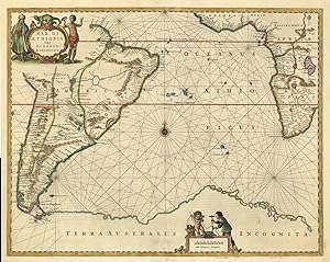
'Mar Di Aethiopia Vulgo Oceanus Aethiopicus.':.
Language: German
Seller: Antiquariat Norbert Haas, Bedburg-Hau, Germany
Seller rating 5 out of 5 stars
Map
kolorierter Kupferstich b. Johannes Janssonius (Jansson) in Amsterdam, 1650, 43,5 x 55 van der Krogt, Koeman's Atlantes Neerlandici, Vol. I, S. 567, 0102:1. (1. latin edition) - Seekarte des Atlantischen Ozean mit dem Gebiet zwischen S�dwest Afrika und S�damerika. - Oben links Titelkartusche. - Am unteren Rand Kartusche mit Meilenzeiger und Vermesser. - Die Karte erschien in nur 6 verschiedenen Janssonius-Ausgaben. A handsome chart decorated with figurative title cartouche, distance scale and compass rose. - It covers most of South America and the southwestern portion of Africa. - Tierra del Fuego is separated from the continent and a huge Terra Australis Incognita appears in the south. - Some small restaurations in the medium-fold.
-
Leather Bound. Condition: New. Language: English. Language: English. Presenting an Exquisite Leather-Bound Edition, expertly crafted with Original Natural Leather that gracefully adorns the spine and corners. The allure continues with Golden Leaf Printing that adds a touch of elegance, while Hand Embossing on the rounded spine lends an artistic flair. This masterpiece has been meticulously reprinted in 2025, utilizing the invaluable guidance of the original edition published many years ago in 1978. The contents of this book are presented in classic black and white. Its durability is ensured through a meticulous sewing binding technique, enhancing its longevity. Imprinted on top-tier quality paper. A team of professionals has expertly processed each page, delicately preserving its content without alteration. Due to the vintage nature of these books, every page has been manually restored for legibility. However, in certain instances, occasional blurriness, missing segments, or faint black spots might persist. We sincerely hope for your understanding of the challenges we faced with these books. Recognizing their significance for readers seeking insight into our historical treasure, we've diligently restored and reissued them. Our intention is to offer this valuable resource once again. We eagerly await your feedback, hoping that you'll find it appealing and will generously share your thoughts and recommendations. Lang: - English, Pages:- 146, Print on Demand. If it is a multi-volume set, then it is only a single volume. We are specialised in Customisation of books, if you wish to opt different color leather binding, you may contact us. This service is chargeable. Product Disclaimer: Kindly be informed that, owing to the inherent nature of leather as a natural material, minor discolorations or textural variations may be perceptible. Explore the FOLIO EDITION (12x19 Inches): Available Upon Request. 146 146.

![Seller image for Chart of the South Atlantic Ocean from the Equator to 65� South Latitude, from the most recent British, French and Braziln. Authorities [mounted together with] Chart of the South Atlantic Ocean from the Equator to 65� South Latitude, from the most recent British Authorities. Sheet II for sale by Michael Treloar Booksellers ANZAAB/ILAB](https://pictures.abebooks.com/inventory/md/md32331407297.jpg)
![Seller image for Pacific Railroad and Telegraph . Report . 1856 [Leather Bound] for sale by Gyan Books Pvt. Ltd.](https://pictures.abebooks.com/inventory/md/md31222218845.jpg)

![Seller image for Oceanic internal waves from ship, aircraft, and spacecraft a report on the New York-to-Bermuda remote sensing experiment / John R. Proni . [et al.], Ocean Remote Sensing Laboratory, Atlantic Oceanograhic and Meteorological Laboratories, Environmental Research Laboratories, National Oceanic and Atmospheric Administration. 1978 [Leather Bound] for sale by Gyan Books Pvt. Ltd.](https://pictures.abebooks.com/inventory/md/md31223569889.jpg)