
Order Total (1 Item Items):
Shipping Destination:

Map Bartholomew (38 results)
Skip to main search results
Search filters
Product Type
- All Product Types
- Books (21)
- Magazines & Periodicals (No further results match this refinement)
- Comics (No further results match this refinement)
- Sheet Music (No further results match this refinement)
- Art, Prints & Posters (11)
- Photographs (No further results match this refinement)
- Maps (6)
- Manuscripts & Paper Collectibles (No further results match this refinement)
Condition Learn more
- New (No further results match this refinement)
- As New, Fine or Near Fine (3)
- Very Good or Good (21)
- Fair or Poor (No further results match this refinement)
- As Described (14)
Binding
Collectible Attributes
- First Edition (20)
- Signed (No further results match this refinement)
- Dust Jacket (No further results match this refinement)
- Seller-Supplied Images (27)
- Not Print on Demand (38)
Language (2)
Free Shipping
Seller Location
Seller Rating
-
Condition: Very Good. 1753696296. 7/28/2025 9:51:36 AM.
-

Bartholomew World Travel Map: China: scale : 1 : 4, 500, 000
Published by Edinburgh: John Bartholomew & Son Ltd., 1977
ISBN 10: 0851526403 ISBN 13: 9780851526409
First Edition
First Edition. Near fine folding map. Remains well preserved overall; tight, bright, clean and sharp-cornered. Physical description; 1 folded map : text, col. map ; 25 cm. Subjects; China ; Maps. E0732900 E1344600 N0533300 N0175700. Scale 1:4,500,000. (E 73�29'00"--E 134�46'00"/N 53�33'00"--N 17�57'00"). Genre; Map. 3 Kg.
-

Bartholomew's Revised "Half-inch" Contoured Maps, Oxfordshire
Language: English
Published by Edinburgh Geographical Institute, Edinburgh
Seller: J J Basset Books, bassettbooks, bookfarm.co.uk, Peter Tavy, United Kingdom
Seller rating 4 out of 5 stars

US$ 13.73
US$ 26.67 shipping
Ships from United Kingdom to U.S.A.Quantity: 1 available
Add to basketColour Paperback. Condition: VERY GOOD ( AVERAGE). No Jacket. Colour Map (illustrator). Revised Edition. Map is mounted on cloth. The name H. Elliott is signed on back cover.please e-mail for further details. Size: 12mo - over 6�" - 7�". Name Inscribed.
-
Bartholomew's Revised "Half-inch" Contoured Maps Sussex
Language: English
Published by Edinburgh Geographical Institute, Edinburgh
Seller: J J Basset Books, bassettbooks, bookfarm.co.uk, Peter Tavy, United Kingdom
Seller rating 4 out of 5 stars
US$ 13.73
US$ 26.67 shipping
Ships from United Kingdom to U.S.A.Quantity: 1 available
Add to basketColour Paperback. Condition: VERY GOOD ( AVERAGE). No Jacket. Colour Map (illustrator). Revised Edition. Map is MOUNTED ON CLOTH.The name H. Elliott is signed on back cover.please e-mail for further details. Size: 12mo - over 6�" - 7�". Name Inscribed.
-
Bartholomew's Revised "Half-inch" Contoured Maps Essex
Language: English
Published by Edinburgh Geographical Institute, Edinburgh
Seller: J J Basset Books, bassettbooks, bookfarm.co.uk, Peter Tavy, United Kingdom
Seller rating 4 out of 5 stars
US$ 13.73
US$ 26.67 shipping
Ships from United Kingdom to U.S.A.Quantity: 1 available
Add to basketColour Paperback. Condition: VERY GOOD ( AVERAGE). No Jacket. Colour Map (illustrator). Revised Edition. Map is mounted on cloth.please e-mail for further details. Size: 12mo - over 6�" - 7�". Not Signed or Inscribed.
-
Bartholomew's Revised "Half-inch" Contoured Maps Warwickshire
Language: English
Published by Edinburgh Geographical Institute, Edinburgh
Seller: J J Basset Books, bassettbooks, bookfarm.co.uk, Peter Tavy, United Kingdom
Seller rating 4 out of 5 stars
US$ 13.73
US$ 26.67 shipping
Ships from United Kingdom to U.S.A.Quantity: 1 available
Add to basketColour Paperback. Condition: VERY GOOD ( AVERAGE). No Jacket. Colour Map (illustrator). Revised Edition. Map is mounted on cloth.The name H. Elliott is signed on front cover.please e-mail for further details. Size: 12mo - over 6�" - 7�". Name Inscribed.
-
Bartholomews clan map: Sotland of old. The lands, the arms, the crests.
Language: English
Published by John Bartholomew & son Ltd., Edinburgh, without date (about 1970), 1970
Seller: Antiquariat Carl Wegner, Berlin, B, Germany
Association Member: GIAQ
Seller rating 5 out of 5 stars

First Edition
Softcover. 101 x 76 cm. Original color map, folded several times to a large octavo. The margins are printed with numerous colored coats of arms. Clean, good condition. -- Farbige originale Karte, mehrfach auf gr.-8� gefaltet. Die R�nder sind mit zahlreichen farbigen Wappenabbildungen bedruckt. Sauberer, guter Zustand. contains: the arms of the realm and ancient local principalities of Scotland / ancient territories of scottish clans or considerable families, with arms of their chiefs or heads -- Bitte Portokosten au�erhalb EU erfragen! / Please ask for postage costs outside EU! / S ' il vous plait demander des frais de port en dehors de l ' UE! // Bitte beachten Sie auch unsere Fotos! / Please also note our photos! / Veuillez noter nos photos -- Nehmen Sie sich ein gutes Buch mit auf die Sommerwiese. Bei uns werden Sie f�ndig! -- Wir kaufen Ihre werthaltigen B�cher! K25399-436598.
-
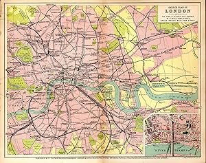
MAP: "Sketch Plan of London (England)'.from the Australian Handbook, 1906
Published by Gordon & Gotch, Australia, 1906
Seller: Dorley House Books, Inc., Hagerstown, MD, U.S.A.
Seller rating 4 out of 5 stars
Art / Print / Poster First Edition
Unbound. Condition: Very Good. Colored Map (illustrator). 1st. lovely colored map (1906), showing railways, streets, etc with circles indicating miles from St. Paul's Cathedral. Size: 9.5" x 11.75".
-

Bartholomew World Travel Map: China: scale : 1 : 4, 500, 000
Published by Edinburgh: John Bartholomew & Son Ltd., 1977
ISBN 10: 0851526403 ISBN 13: 9780851526409
First Edition
First Edition. Near fine folding map. Remains well preserved overall; tight, bright, clean and sharp-cornered. Physical description; 1 folded map : text, col. map ; 25 cm. Subjects; China ; Maps. E0732900 E1344600 N0533300 N0175700. Scale 1:4,500,000. (E 73�29'00"--E 134�46'00"/N 53�33'00"--N 17�57'00"). Genre; Map. 1 Kg.
-
ARABIAN PENINSULA, Travel Map, Scale 1: 3000000. *
Published by John BARTHOLOMEW & SON Ltd., * * * * *, 1982
Map
Soft cover. Condition: Fine. 1982 Map, In Fine/ Condition (illustrator). Map, In Fine/ Condition $35.14 ARABIAN PENINSULA, Travel Map, Scale 1: 3000000. John BARTHOLOMEW & SON Ltd. John BARTHOLOMEW & SON Ltd. 1982 Green Colored Front Cover Folder With Title In Black And White Letters, Soft Cover Folder: Near Fine/, Containing One Soft Folding Map, In Fine/, Condition. Were Lightly Viewed, Clean And Tight To The Spine, Printed On Off White Paper, In Fine/ Condition. Had Light Use. No Book Plate Or Prior Owner's Name Inside. D/j: None. Description Applies To This B0K, Only, Which Is Hard To Find, And Will Be = Packaged And Shipped Carefully, To Avoid Shipping Damage And Will Make It, An Excellent Addition To Your Own Personal Library Collection, Or As A Gift For The Collector / Reader. WORLD WIDE SHIPPING, AVAILABLE.
-
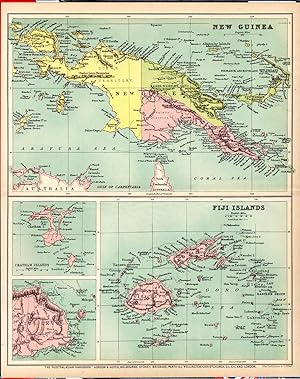
MAP: 'New Guinea & Fiji Islands'.from the Australian Handbook, 1906
Published by Gordon & Gotch, Australia, 1906
Seller: Dorley House Books, Inc., Hagerstown, MD, U.S.A.
Seller rating 4 out of 5 stars
Art / Print / Poster First Edition
Unbound. Condition: Very Good. Colored Map (illustrator). 1st. Two lovely little maps on double pg showing New Guinea & Fiji Islands in 1906 with small insets of Chatham Islands & Viti Levu. Suitable for framing Size: 9.5" x 11.75".
-
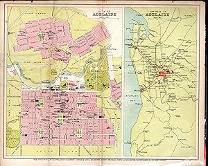
MAP: 'City of Adelaide: Environs of Adelaide'.from the Australian Handbook, 1906
Published by Gordon & Gotch, Australia, 1906
Seller: Dorley House Books, Inc., Hagerstown, MD, U.S.A.
Seller rating 4 out of 5 stars
Art / Print / Poster First Edition
Unbound. Condition: Very Good. Colored Map (illustrator). 1st. Two lovely little maps side by side showing City & Environs of Adelaide in 1906 Size: 9.5" x 11.75".
-
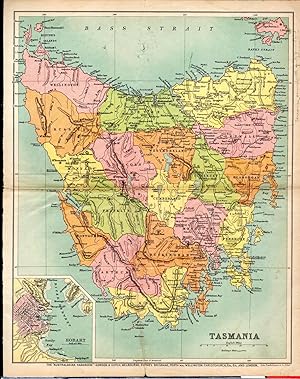
MAP: 'Tasmania.from the Australian Handbook, 1906
Published by Gordon & Gotch, Australia, 1906
Seller: Dorley House Books, Inc., Hagerstown, MD, U.S.A.
Seller rating 4 out of 5 stars
Art / Print / Poster First Edition
Unbound. Condition: Very Good. Colored Map (illustrator). 1st. Lovely little map showing the area of Tasmania in 1906 with a small inset of Hobart. Suitable for framing Size: 9.5" x 11.75".
-
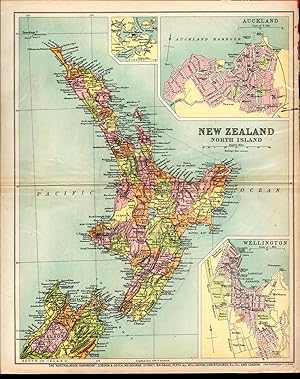
MAP: 'New Zealand: North Island'.from the Australian Handbook, 1906
Published by Gordon & Gotch, Australia, 1906
Seller: Dorley House Books, Inc., Hagerstown, MD, U.S.A.
Seller rating 4 out of 5 stars
Art / Print / Poster First Edition
Unbound. Condition: Very Good. Colored Map (illustrator). 1st. Lovely little map showing the North Island of New Zealand 1906 with small insets of Auckland & Wellington, suitable for framing Size: 9.5" x 11.75".
-
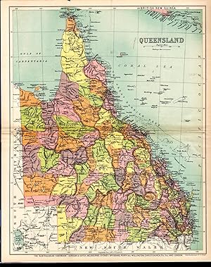
MAP: 'Queensland'.from the Australian Handbook, 1906
Published by Gordon & Gotch, Australia, 1906
Seller: Dorley House Books, Inc., Hagerstown, MD, U.S.A.
Seller rating 4 out of 5 stars
Art / Print / Poster First Edition
Unbound. Condition: Very Good. Colored Map (illustrator). 1st. Lovely little map showing the area of Queensland, Australia in 1906.Single sheet suitable for framing Size: 9.5" x 11.75".
-
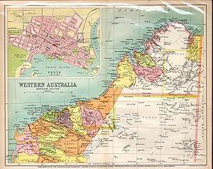
MAP: 'Western South Australia'.from the Australian Handbook, 1906
Published by Gordon & Gotch, Australia, 1906
Seller: Dorley House Books, Inc., Hagerstown, MD, U.S.A.
Seller rating 4 out of 5 stars
Art / Print / Poster First Edition
Unbound. Condition: Very Good. Colored Map (illustrator). 1st. Lovely little map showing the northern section of Western Australia of 1906 with a 3.5 x 5' inset of Perth.Single sheet suitable for framing Size: 9.5" x 11.75".
-
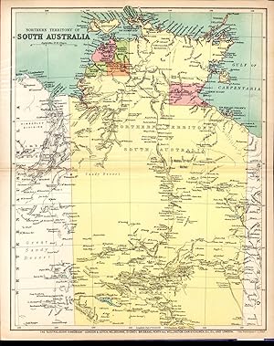
MAP: 'Northern Territory of South Australia'.from the Australian Handbook, 1906
Published by Gordon & Gotch, Australia, 1906
Seller: Dorley House Books, Inc., Hagerstown, MD, U.S.A.
Seller rating 4 out of 5 stars
Art / Print / Poster First Edition
Unbound. Condition: Very Good. Colored Map (illustrator). 1st. Lovely little map showing the northern territority of South Australia of 1906.1 page, suitable for framing Size: 9.5" x 11.75".
-
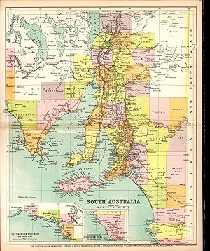
MAP: 'South Australia'.from the Australian Handbook, 1906
Published by Gordon & Gotch, Australia, 1906
Seller: Dorley House Books, Inc., Hagerstown, MD, U.S.A.
Seller rating 4 out of 5 stars
Art / Print / Poster First Edition
Unbound. Condition: Very Good. Colored Map (illustrator). 1st. Lovely little mapo showing South Australia of 1906 with small insets of southern and western tips.1 page, suitable for framing Size: 9.5" x 11.75".
-
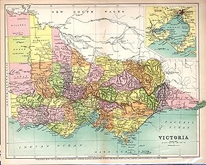
MAP: 'Victoria'.from the Australian Handbook, 1906
Published by Gordon & Gotch, Australia, 1906
Seller: Dorley House Books, Inc., Hagerstown, MD, U.S.A.
Seller rating 4 out of 5 stars
Art / Print / Poster First Edition
Unbound. Condition: Very Good. Colored Map (illustrator). 1st. Lovely little mapo showing Victoria of 1906 with a small inset of Melbourne and Port Philip area. Size: 9.5" x 11.75".
-
Bartholomew's World Layered Series Map of France And The Low Countries Northern Section In Layer Colouring With Roads And Distances Scale 1:1,000,000
Language: English
Published by John Bartholomew & Son Ltd, Edinburgh
Seller: K Books Ltd ABA ILAB, York, YORKS, United Kingdom
Association Member: ABA ILAB PBFA
Seller rating 5 out of 5 stars
US$ 13.73
US$ 26.00 shipping
Ships from United Kingdom to U.S.A.Quantity: 1 available
Add to basketNo Binding. Condition: Very Good. One folding linen backed colour map, with khaki card covers, scale of 1 : 1,000,000, some pen markings where places have been circled and small tears but o/w good condition, John Bartholomew & Son Ltd, Edinburgh, circa.
-

MAP: 'Minerals Map of New South Wales'.from the Australian Handbook, 1906
Published by Gordon & Gotch, Australia, 1906
Seller: Dorley House Books, Inc., Hagerstown, MD, U.S.A.
Seller rating 4 out of 5 stars
Art / Print / Poster First Edition
Unbound. Condition: Very Good. Colored Map (illustrator). 1st. very nicely colored small map showing mineral deposits. Lovely, and suitable for framing Size: 9.5" x 11.75".
-
Crimea - Antiquarian Coloured Map
Language: English
Published by A Fullarton & Co., London & Edinburgh
Seller: K Books Ltd ABA ILAB, York, YORKS, United Kingdom
Association Member: ABA ILAB PBFA
Seller rating 5 out of 5 stars
US$ 20.60
US$ 26.00 shipping
Ships from United Kingdom to U.S.A.Quantity: 1 available
Add to basketNo Binding. Condition: Very Good. Drawn By J.Bartholomew (illustrator). An original antique map of Crimea, according to Huot & Demidoff, ca. 1860. Mounted and ready to frame. Partly coloured on outline. In excellent condition, decorative and impressive.
-

Map of South Africa and Madagascar in Contour Colouring Showing Roads, Boundaries, etc. Scale 1: 4,000,000
Published by John Bartholomew & Son Ltd. [ca.1900], Edinburgh, 1900
Paperback. Condition: Very Good-. Illustrated by Color map. (illustrator). VG- in wraps (some wear; minor foxing) 8vo Large folding color map, linen-backed, with pamphlet covers. Size: 8vo - over 7�" - 9�" tall. Book.
-
EGYPT, Between Cairo and the Suez Canal - An Antique Coloured Map Printed Circa 1882
Language: English
Published by William Mackenzie, Edinburgh, 1882
Seller: K Books Ltd ABA ILAB, York, YORKS, United Kingdom
Association Member: ABA ILAB PBFA
Seller rating 5 out of 5 stars
US$ 27.47
US$ 26.00 shipping
Ships from United Kingdom to U.S.A.Quantity: 1 available
Add to basketNo Binding. Condition: Very Good. J Bartholomew (illustrator). An attractive original antique coloured map . Mounted - matted - and ready to frame . Very good condition . Somewhat uncommon . Shows the area of Egypt between Cairo and the Suez Canal to illustrate military operations of 1882. Unobtrusive central fold.
-
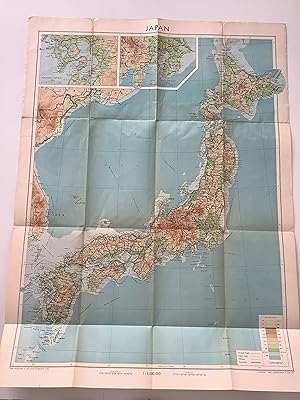
Japan. With Boundaries, Roads and Railways.
Published by Edinburgh, Bartholomew., 1954
Seller: Michael Steinbach Rare Books, Wien, Austria
Association Member: ILAB VDA VDAO
Seller rating 5 out of 5 stars
53 : 71 cm., resp. 22 : 13 cm. One many-folded map. Original wrappers. Bartholomew's Worl Series. - Scale 1 : 3,000,000.
-

Birmingham
Published by Published by A. Fullarton & Co. [1860], London & Edinburgh, 1860
Seller: Keoghs Books, Skipton, United Kingdom
Association Member: PBFA
Seller rating 5 out of 5 stars
Map First Edition
US$ 27.47
US$ 37.33 shipping
Ships from United Kingdom to U.S.A.Quantity: 1 available
Add to basket, paper map folded at centre, hand-coloured in outline, scale of half a mile to an inch, upper left Smethwick, upper right Aston, lower left Harbourne, lower right Bordesley First Edition thus , lightly foxed around margins and a few patches to map, in good condition 35 x 26.5 cm Paperback ISBN:
-

The Channel Islands; General Map of the Islands, Alderney & The Casquets, Guernsey and Sercq, Jersey
Published by Published by A. Fullarton & Co [1860], London, 1860
Seller: Keoghs Books, Skipton, United Kingdom
Association Member: PBFA
Seller rating 5 out of 5 stars
Map First Edition
US$ 34.33
US$ 37.33 shipping
Ships from United Kingdom to U.S.A.Quantity: 1 available
Add to basket, 4 maps on one sheet, folded at centre, hand-coloured in outline, diferent scales for each of the 4 maps First Edition , some light spots at margins, maps clean, neat edge repair, in good+ condition 35 x 26.5 cm Paperback ISBN:
-

Canada (North West Provinces).
Published by Bartholomew. [1886]., 1886
Seller: Asia Bookroom ANZAAB/ILAB, Canberra, ACT, Australia
Association Member: ANZAAB ILAB
Seller rating 5 out of 5 stars
Small map of the north west provinces of Canada from the British Colonial Pocket Atlas. Printed colour, tiny barely visible hole in one place along the centrefold. 16 x 12 cm. A map of the Canadian prairies and British Columbia, showing the defunct districts of Assiniboia, Athabasca, and Keewatin.
-
Philips' Series of Travelling Maps. South Australia [cover title on the cloth case of a linen-backed folding map]
Published by George Philip, London, 1861
Seller: Michael Treloar Booksellers ANZAAB/ILAB, Adelaide, SA, Australia
Association Member: ANZAAB ILAB
Seller rating 5 out of 5 stars
Map First Edition
Hardcover. Condition: Fine. First Edition. London, George Philip, [late 1861]. A full-colour map, printed surface 610 � 510 mm, cut into 20 panels mounted on linen (as issued), folded, and mounted in the publisher's gilt-decorated cloth case (external dimensions 190 � 118 mm). Slight wear to the corners of the case, with minimal restoration to the spine; light erasures to the pastedown and paper-lined verso of the exposed panel of the folded map; the map is lightly marked in one spot, but is essentially in fine condition. There are two interesting rubber-stamps on one cloth panel, that of 'W.C. Rigby, Newsagent, Adelaide' and 'Archiv. Provinciae Austriae S. J.'; the erasures mentioned above appear to have removed a couple of examples of the Jesuit Archive stamp. Philips' Authentic Maps of the Australian Colonies, Number 6 (according to the information printed on the front pastedown). Tooley 974 (basic details of the map only, not noting the Travelling Maps series). Pertinent details printed on the map that provide evidence of the date of publication include 'Burke & Wills 1860-61', and the locations where King, and the bodies of Gray, Burke and Wills, were found (King was found in September 1861). The latest reference to Stuart is 'Stuart's Route 1860' (presumably his fifth expedition, from November 1860 to September 1861). The entire region of South Australia west of about 133 degrees east longitude and north of the coastline is described as 'Unexplored Country added to South Australia in 1861'; the Act to annex this land was passed in Great Britain in August 1861. Historians of Australian bookselling will know that William Charles Rigby commenced trading as a bookseller and newsagent in Adelaide in late 1859.
-
China In Provinces; Independent Seng Maio Si
Published by John Bartholomew, Edinburgh, 1862
Seller: The First Edition Rare Books, LLC, Cincinnati, OH, U.S.A.
Association Member: ABAA ILAB IOBA MWABA
Seller rating 5 out of 5 stars
Framed Map. Condition: Fine. Colored Map of the Provinces of China: Independent Seng Maio Si by John Bartholomew of Edinburgh, published in 1862. (illustrator). Atlas Map. Previously folded along centerline. Framed by DuPage Framing Center of Wheaton, Illinois. Museum glass, decorative antique wood frame. Includes beige cloth matte, full piece measures 32" x 26.5". A beautiful piece. This map was taken from Black's General Atlas of the World: A Series in Fifty-Six Maps, published by Adam and Charles Black of Edinburgh.


![Seller image for Philips' Series of Travelling Maps. South Australia [cover title on the cloth case of a linen-backed folding map] for sale by Michael Treloar Booksellers ANZAAB/ILAB](https://pictures.abebooks.com/inventory/md/md14916534518.jpg)
