
Order Total (1 Item Items):
Shipping Destination:

Maps Germany, First Edition (22 results)
Skip to main search results
Search filters
Product Type
- All Product Types
- Books (19)
- Magazines & Periodicals (No further results match this refinement)
- Comics (No further results match this refinement)
- Sheet Music (No further results match this refinement)
- Art, Prints & Posters (2)
- Photographs (No further results match this refinement)
- Maps (1)
- Manuscripts & Paper Collectibles (No further results match this refinement)
Condition Learn more
- New (1)
- As New, Fine or Near Fine (3)
- Very Good or Good (4)
- Fair or Poor (No further results match this refinement)
- As Described (14)
Binding
Collectible Attributes
Language (2)
Free Shipping
Seller Location
Seller Rating
-

The Tourist's Atlas of Germany In Special Maps ( With Detailed Descriptions of Sights, Scenery, Sports, and Many Other Features )
Published by Kartographisches Insitut und Verlag Hans Konig, Frankfurt / Main
Seller: Barbers Book Store Online, Fort Worth, TX, U.S.A.
Seller rating 5 out of 5 stars

First Edition
Hardcover. Condition: Fine. No Jacket. 1st Edition. A beautifully conceived and made atlas useful for many purposes. There are apprx 40 key maps of interesting areas of the country accompanied by a one page discussion of history and scenery followed by road maps printed in an accordian arrangement. Apprx 6 1/2 x 9 1/2" 104 pages, cloth spine, stiff, piictorial card covers in near fine condition. No D/J, as issued. Language: eng.
-
The GERMANY OF I CORPS DISTRICT IN LEGEND AND BATTLE [ INCLUDES FULL DETAILS OF THE WW2 BATTLES BETWEEN AACHEN AND THE RHINE WITH 2 FOLDING MAPS RE TO THE BATTLES foughjt in 1759
Language: English
Published by PRINTING AND STATIONERY SERVICE I CORPS DISTRICT, 1946
Seller: K Books Ltd ABA ILAB, York, YORKS, United Kingdom
Association Member: ABA ILAB PBFA
Seller rating 5 out of 5 stars
First Edition
US$ 10.90
US$ 25.80 shipping
Ships from United Kingdom to U.S.A.Quantity: 1 available
Add to basketSoft cover. Condition: Good. 1st Edition. The GERMANY OF I CORPS DISTRICT IN LEGEND AND BATTLE [ INCLUDES FULL DETAILS OF THE BATTLES BETWEEN AACHEN AND THE RHINE fought in 1759 WITH 2 FOLDING MAPS RE TO THE BATTLES] . THE printed covers are a little tatty - with 3 fine folding maps .
-
MEDIEVAL CIVILIZATION IN GERMANY 800~1273. 60 Photographs. 39 Line Drawings. 14 Maps
Published by NY & Washington. 1969. Frederick A. Praeger. Ancient Peoples And Places series 67., 1969
First Edition
purple cloth hardcover 8vo. (octavo) with purple topstained top edge. dustwrapper in protective plastic book jacket cover. fine cond. binding square & tight. covers clean. edges clean. contents free of markings. dustwrapper in fine cond. minor wrinkling at spine top, not torn or price clipped. nice clean copy. no library markings, store stamps, stickers, bookplates, no names, inking, underlining, remainder markings etc~. first edition. first printing (Pu1969 & NAP). 230p. chronological table. genealogical table. notes to the text. bibliography. notes on the plates. index. medieval history. history of christianity. history of germany. architecture. art history. medieval literature. ~ To this critical assessment of German history and culture from the coronation of Charlemagne as Emperor of the West in 800 to the election of Rudolf of Habsburg to the Imperial throne in 1273, the author brings a keen analytical mind. This was a period of crucial importance for Western civilization, and it is in its European context that Professor Bauml treats early medieval Germany. He examines the foreign influences that worked so fruitfully upon Germany, and brings an illuminating awareness of the medieval outlook to his discussions of political affairs, social and economic developments, art, literature and philosophy. As he points out, during these turbulent centuries~when the Imperial crown was being worn ( often uneasily) by the heads of German dynasties~Germany was torn between opposites: between centralized government by a king, and feudal rule by princes; between the Imperialism inherited from Rome, and the native tribal tradition; between Christianity and German paganism. Yet Germany's contribution to the arts~given its initial powerful impetus under Charlemagne's rule and patronage~was extremely rich. Professor Bauml discusses it at length, ranging from the exquisite illuminated manuscripts of the Ottonian period to the architecture of Hildesheim and Speyer and the sculpture of Strassburg; from Walther von der Vogelweide and the poets of courtly love to the great epics~the Parzival of Wolfram of Eschenbach, the Tristan of Gottfried of Strassburg, and the Nibelungenlied. The author enhances the value of his commentary by giving his own translations of excerpts from the literary works, and by summarising the plots. The art and architecture he discusses are abundantly illustrated.
-

Germany's defeat in the East: the Soviet armies at war, 1941-1945: with twenty-nine sketch maps / by Colonel E. Lederrey
Published by London: The War Office, 1955
First Edition
First Edition. Library copy with minor remarks. Very good copy in the original gilt-blocked cloth. Spine bands and panel edges slightly dust-toned and rubbed as with age. Pages tanned as with age. Remains particularly well-preserved overall. Physical description: xviii, 232, [29] p: 29 maps; 25 cm. Notes: Bibliography: p. xv-xvi. Subjects: World War (1939-1945). World War, 1939-1945 Campaigns Eastern Front. Military campaigns. Eastern Front (World War (1939-1945). Genre: History. 3 Kg.
-

The Political Fragmentation of Germany. Formation of German states by Infrastructures, Maps, and Movement, 18151866.
Language: English
Published by Cham, Springer International Publishing., 2019
ISBN 10: 303019826X ISBN 13: 9783030198268
Seller: Universit�tsbuchhandlung Herta Hold GmbH, Berlin, Germany
Association Member: GIAQ ILAB VDA
Seller rating 4 out of 5 stars

First Edition
1st ed. 2019. 15 x 21 cm. XVIII, 278 S. XVIII, 278 p. 24 illus., 10 illus. in color. Sprache: Englisch.
-
Map Collectors' Circle Series, Fourth Volume (Vol. IV), No. 35 : Maps of Germany with Marginal Town Views
Published by Map Collectors' Circle, London, 1967
First Edition
Paperback. Condition: Near Fine condition. First Edition. London: Map Collectors' Circle, 1967. Near Fine condition. Clean and unmarked. NOT a library discard. NO owner's name or bookplate. Describes 44 maps from 1607 to 1680. 2 indexes. Illustrated with 22 plates. Bound in the original tan wraps, printed in black. 7.25" wide by 9.75" tall. First Edition. Softcover. Near Fine condition. 43pp. Great Packaging, Fast Shipping.
-

Germany's defeat in the East: the Soviet armies at war, 1941-1945: with twenty-nine sketch maps / by Colonel E. Lederrey
Published by London: The War Office, 1955
First Edition
First Edition. Library copy with minor remarks. Very good copy in the original gilt-blocked cloth. Spine bands and panel edges slightly dust-toned and rubbed as with age. Pages tanned as with age. Remains particularly well-preserved overall. Physical description: xviii, 232, [29] p: 29 maps; 25 cm. Notes: Bibliography: p. xv-xvi. Subjects: World War (1939-1945). World War, 1939-1945 Campaigns Eastern Front. Military campaigns. Eastern Front (World War (1939-1945). Genre: History. 1 Kg.
-
The 84th Infantry Division in the Battle of Germany, November 1944 - May 1945: Maps and Drawings by Sgt. Walter H. Chapman; Foreword by Major General A. R. Bolling
Published by Viking Press, Newy, 1946
First Edition
Hardcover. Condition: Good. 1st Edition; 1st Printing. Hardcover, no jacket, first printing of this unit history, illustrated with maps, photos and fold-out color illustrations, the Dedication page states "To the Railsplitters who Never Came Back," the beige cloth cover is tanned, The "Units" page and the following Illustrated page at the beginning of the book are present but loose ; 259 pages.
-

Southern Germany (Baden, Black Forest, Wurtemberg, and Bavaria) : handbook for travellers / by Karl Baedeker ; with 118 maps and plans
Published by Leipzig, 1929
First Edition
First Edition. Very good copy in the original gilt-blocked cloth. Spine bands and panel edges somewhat dust-toned and rubbed as with age. Remains well-preserved overall. Physical description: xxviii, 547 pages, approximately 90 leaves of plates : illustrations, color maps ; 16 cm. Subjects; Karl Baedeker Firm. Germany Guidebooks. Baden Germany Guidebooks. Black Forest Germany Guidebooks. W�rttemberg Germany Guidebooks. Bavaria Germany Guidebooks. Travel Guidebooks. 3 Kg.
-

Southern Germany (Baden, Black Forest, Wurtemberg, and Bavaria) : handbook for travellers / by Karl Baedeker ; with 118 maps and plans
Published by Leipzig, 1929
First Edition
First Edition. Very good copy in the original gilt-blocked cloth. Spine bands and panel edges somewhat dust-toned and rubbed as with age. Remains well-preserved overall. Physical description: xxviii, 547 pages, approximately 90 leaves of plates : illustrations, color maps ; 16 cm. Subjects; Karl Baedeker Firm. Germany Guidebooks. Baden Germany Guidebooks. Black Forest Germany Guidebooks. W�rttemberg Germany Guidebooks. Bavaria Germany Guidebooks. Travel Guidebooks. 1 Kg.
-
The Political Fragmentation of Germany: Formation of German states by Infrastructures, Maps, and Movement, 1815-1866
Seller: Kennys Bookshop and Art Galleries Ltd., Galway, GY, Ireland
Seller rating 5 out of 5 stars
First Edition
US$ 122.23
US$ 12.05 shipping
Ships from Ireland to U.S.A.Quantity: Over 20 available
Add to basketCondition: New. 2019. 1st ed. 2019. hardcover. . . . . .
-
Landforms and landform evolution in West Germany, With illustrations, figures and maps,
Published by Cremlingen-Destedt, Catena ,, 1989
ISBN 10: 3923381182 ISBN 13: 9783923381180
First Edition
EA, 347 S., OPbd., neuwertig, Catena Supplement 15 Sprache: Englisch. Aufgrund der EPR-Regelung kann in folgende L�nder KEIN Versand mehr erfolgen: Bulgarien, Finnland, Frankreich, Griechenland, Luxemburg, �sterreich, Polen, Rum�nien, Schweden, Slowakei, Spanien.
-
Napoleon's Last Campaign in Germany, 1813 with 17 Maps and Plans
Published by The Bodley Head / The John Lane Co. / Bell & Cockburn, 1912
First Edition
Hardcover. Condition: Good. No Jacket. 1st Edition. Type: Book xiii, 403, [20 publisher's catalog] pp. + four large fold-out maps in pocket at rear are accounted for. Binding is tight and sound, TEG, no foxing, repair to head of spine, now in a 3mil protective hard mylar cover. Photo scan available. Shipments to USA, USPS via Canada Post Express; FREE OF CUSTOMS OR DUTY CHARGE.
-
Denmark and Germany since 1815. With four maps.
Published by London: John Murray., 1862., 1862
Seller: Spike Hughes Rare Books ABA, Innerleithen, United Kingdom
Seller rating 5 out of 5 stars
First Edition
US$ 61.33
US$ 34.40 shipping
Ships from United Kingdom to U.S.A.Quantity: 1 available
Add to basketFIRST EDITION. 8vo, frontis. map and 3 other maps, pp. xvi, 459, [1], 32 page publisher's adverts. at end, orig. blind-stamped brown cloth, by Edmonds and Remnants, lightly rubbed, spine sunned.
-

Ausgrabungen in Deutschland | Ge�rdert von der Deutschen Forschungsgemeinschaft 1950-1975 Katalog und F�hrer durch die Ausstellung von Horst W. B�hme im Kurf�rstlichen Schloss zu Mainz; Bands 1, 2, 3, und 4 Katalog Karten und Modelle | B�nde. Teil 1: Vorgeschichte, R�merzeit; Teil 2: R�mische Kaiserzeit im freien Germanien, Fr�hmittelalter I; Teil 3: Fr�hmittelalter II, Arch�ologie und Naturwissenschaften, Katalog, Karten und Modelle; Teil 4: Beilagen 1-50. (Excavations in Germany | Funded by the Deutsche Forschungsgemeinschaft 1950-1975 Catalogue and Guide to the Exhibition by Horst W. B�hme in the Electoral Palace in Mainz; Volumes 1, 2, 3, and 4 Catalogue Maps and Models | Part 1: Prehistory, Roman Times; Part 2: Roman Empire in Free Ger
Published by Published by Verlag des R�misch-Germanischen Zentralmuseums, Mainz First Editions . 1975., 1975
Seller: Little Stour Books PBFA Member, Canterbury, United Kingdom
Association Member: PBFA
Seller rating 5 out of 5 stars
First Edition
US$ 102.21
US$ 39.69 shipping
Ships from United Kingdom to U.S.A.Quantity: 1 available
Add to basketCondition: Fine. Uniform matching first edition hard back binding in publisher's original raspberry cloth covered boards, blocked and lettered in black to the spines and front covers. 4to. 12'' x 8�''. Contains German text with monochrome and colour illustrations, figures, maps and archive photographs throughout. Surface mottling to the board covers, contents in Fine condition. Heavy volume quartet weighing 8 kg, extra postage will be requested over and above our default setting for destinations outside of the UK. Member of the P.B.F.A. GERMANY [Language, History].
-
TRAVELS THROUGH HOLLAND, GERMANY, SWITZERLAND, AND OTHER PARTS OF EUROPE; BUT ESPECIALLY ITALY. [MAPS, CT 3 VOLS]
Published by W. Strahan for John Noon and R. Dodsley 1743-1745, 1743
Seller: poor man's rare books (mrbooks) IOBA NJB, Vineland, NJ, U.S.A.
Association Member: IOBA
Seller rating 4 out of 5 stars
First Edition
Hardcover. Condition: Very Good with no dust jacket. First Edition. 14 lbs 18th Century; MAPS; Maps; 4to 11" - 13" tall; xii, 753, [14; xvii, 917, [18]; xv, 595[ pages; Travels through Holland, Germany, Switzerland, and other parts of Europe; but especially Italy. [maps, ct 3 vols]. 4 folding engraved maps. 3 heavy volumes. 4to, contemporary calf, rebacked. All Published- Pine-Coffin 707. Transl by George Turnbull, Wm Godfrey. Ct, solid, contemporary armorial bookplate of Robert Parker EAS.
-

EVERY TRAVELLER'S GUIDE TO THE RAILWAYS OF ENGLAND, SCOTLAND, IRELAND, BELGIUM, FRANCE, AND GERMANY; Containing Correct Time and Fare Tables of Every Railway. Illustrated with Maps of the Country Through which the Railway Lines traverse. Compiled from Original Sources.
Published by London: Published at the Railway Times Office., 1843
Seller: LUCIUS BOOKS (ABA, ILAB, PBFA), York, United Kingdom
Association Member: ABA ILAB PBFA
Seller rating 5 out of 5 stars
First Edition
US$ 1,022.12
US$ 39.69 shipping
Ships from United Kingdom to U.S.A.Quantity: 1 available
Add to basketFirst edition, first printing. Publisher's original decorative card wrappers with titles in black to the upper cover. Illustrated with a charming woodcut frontispiece of a train crossing a viaduct and nine railway maps (eight of them folding). A very good copy, the binding a little fragile (although remains secure) with the spine largely perished, a few marks to the covers and a little wear to the corners. The contents with some scattered foxing and creasing to page corners are otherwise in good order with the maps largely clean and free from damage (three of the maps have a little more foxing, and one has a small marginal tear). Pleasingly, the timetable displays signs of contemporary use, with its original owner crossing out 'Every Traveller's' from the title page and neatly inserting his own name. He has also underlined some train times and added an annotation to one page: "Coaches leave Reading for Basingstoke at 10.10am 4.5pm", presumably for clarification purposes. An ambitious and well-illustrated early railway guide, covering several continental railways in addition to those of Britain. As Tuck declares in the preface: "No apology need be offered for presenting to the public this little compendium. Railways will ultimately become the highways of the world; already may the traveller between the rising and setting of the same sun, breakfast in London and sleep in Paris, while Rome will soon be brought within six days journey of the metropolis of England, and this being so, [this work] must be indispensable to the traveller for commerce, and the tourist for pleasure". It is unclear how far the contemporary owner of the present copy made it, but even if it was ultimately only just to Basingstoke, it is still very satisfying to find such an early guide with signs of personal use and engagement. Rare, only four copies listed on Copac (LSE, Nat. Rail Museum, Oxford, Aberdeen), not in the BL. Further details and images for any of the items listed are available on request. Lucius Books welcomes direct contact with our customers.
-
Military Operations Egypt & Palestine : From the Outbreak of War with Germany to June 1917+ From June 1917 to the End of the War Part I-2 . Three Volumes of Text, Two of Maps, 5 Volumes
Published by H. M. S. O. London 1928, 1928
Seller: Andrew Barnes Books / Military Melbourne, Melbourne, VIC, Australia
Seller rating 4 out of 5 stars
First Edition
1st edition orig. cloth Very Good octavo xviii + 445, xxiii + 394 + xiv, 395-748pp., b/w pls., fldg. pls., maps, indexes, Some fading to red clotho/w a nice tight set with all maps present in boxes. Scarce.
-
![Seller image for 2 Maps of Germany [Allemagne du Sud and du Nord from Migeon's Geographie Universelle] for sale by Keoghs Books](https://pictures.abebooks.com/inventory/md/md30791617310.jpg)
2 Maps of Germany [Allemagne du Sud and du Nord from Migeon's Geographie Universelle]
Published by Published by Migeon, Paris, 1864
Seller: Keoghs Books, Skipton, United Kingdom
Association Member: PBFA
Seller rating 5 out of 5 stars
Map First Edition
US$ 47.70
US$ 37.05 shipping
Ships from United Kingdom to U.S.A.Quantity: 1 available
Add to basketCondition: Very Good. Maps 36 and 37 from Migeon's Geographie Universelle featuring Allemagne du Sud and Allemagne du Nord First Edition Thus , central fold, slight rubbing and tanning to edges, maps in very good condition , 39 cm x 52 cm Map.
-

Maps of Germany with Insets of German People
Published by Amsterdam, 1718
Seller: Trillium Antique Prints & Rare Books, Franklin, TN, U.S.A.
Seller rating 3 out of 5 stars

Art / Print / Poster First Edition
Condition: Fine. 1st Edition. This originally hand-colored engraving is from Henri Abraham Chatelain's Atlas Historique. The work was published by the author in Amsterdam between 1718 and 1720.The text was compiled by Gueudeville & Garillon. The maps were completed by Chatelain with some influenced by Guillaume de l'Isle's work.The work was published in several editions with the second edition the first to include additional maps not found in the first including a map of the world, Americas, Europe, Asia, and Africa. These engravings come from mixed editions. Those from volumes 5 to 7 are first edition. The engravings from volumes 1 to 4 are from early ediitons.Atlas Historique was a highly ambitious and groundbreaking work covering genealogy, cosmography, topography, heraldry, and chronology. It was intended for the general public and the increased fascination with the recently conquered colonies and the new discoveries. Chatelain's maps are an outstanding example of the golden age of French mapmaking. --- The work is in good to excellent condition overall. There can be occasional offset, toning, or some separation to fold out plates. There may be a few minor imperfections or faint marks to be expected with age. Please review the image carefully for condition and contact us with any questions. --- Paper Size ~ 19 1/2" by 17 1/2" (Fold Out).
-
The Treaty of Peace between the Allied and Associated Powers and Germany. The Protocol annexed thereto, the Agreement respecting the military occupation of the territories of the Rhine, and the Treaty between France and Great Britain respecting assistance to France in the event of unprovoked aggression by Germany. Signed at Versailles, June 28th, 1919. (With Maps and Signatures in facsimile.)
Published by London: His Majesty's Stationery Office, 1919, 1919
Seller: Peter Harrington. ABA/ ILAB., London, United Kingdom
Association Member: ABA ILAB PBFA
Seller rating 5 out of 5 stars
First Edition Signed
US$ 10,221.19
US$ 29.11 shipping
Ships from United Kingdom to U.S.A.Quantity: 1 available
Add to basketFirst edition, presentation copy, inscribed warmly on a preliminary blank by David Lloyd George: "For the Henry Richard Library from one of his admiring countrymen, D. Lloyd George, July 26th 1927". The Henry Richard Library of the Peace Society was named after its long-serving secretary, the Welsh MP of that name. "CertainlyLloyd Georgehad his full share of responsibility for the harsher features of the treaty. He took a strongly nationalist position on issues deemed to be affecting Britain's national security or other interests YetLloyd Georgewas also the most flexible of the peacemakers, sometimes taking an intermediate line between the nationalism ofClemenceauand the sometimes high-flown generalities ofWoodrow Wilson Lloyd Georgefiercely, though unavailingly, condemned decisions such as the so-called Polish corridor, the Saarland, or placing the Sudeten Germans under the regime of the new hybrid Czechoslovakia He urged the dangers of creating a sense of mass grievance at a time when Russia and perhaps Europe were gripped by 'the spirit of revolution' [as he put it] On his return,Lloyd Georgehailed a peace with honour Nevertheless, both in terms of frontier settlements and of reparations, the Versailles treaty appeared harsh and vindictive to many observers" (ODNB). Most controversially, the treaty enshrined the concept of German "War Guilt". Article 231, printed here, stipulated that "Germany accepts the responsibility of Germany and her allies for causing all the loss and damage to which the Allied and Associated Governments and their nationals have been subjected as a consequence of the war imposed upon them by the aggression of Germany and her allies". This clause and its associated reparations led John Maynard Keynes to declare the treaty a "Carthaginian Peace". In 1923, Lloyd George published The Truth about Reparations and War-Debts, and in 1938, one of his two "massive works of reminiscence" (ODNB), The Truth About the Peace Treaties. At the time of presentation, the secretary of the Henry Richard Library was another Welshman, Herbert Dunnico (1875-1953, Labour MP, knighted in 1938), with whom Lloyd George conducted a lengthy correspondence. One of Dunnico's initiatives was the launch of thePeace Negotiations Committeein March 1916, "which met regularly, organized meetings, and promoted a petition that attracted hundreds of thousands of signatures.Dunnicoaddressed hundreds of meetings in the final years of the war, and, following a speech at Aberdare in January 1918, was summoned under theDefence of the Realm Act, charged with attempting to cause disaffection among the civilian population, though the case was dropped" (ODNB). Small folio in eights (336 x 200 mm). With 9 double-sided leaves of facsimile signatures and 5 folding maps (depicting West and East Germany, the Saar Basin, Danzig, and Schleswig); parallel text in English and French. Contemporary blue calf, spine with five gilt-decorated raised bands, gilt lettered direct in second and fourth compartments, remaining compartments with gilt foliate lozenge, covers with border of gilt paired fillets enclosing blind scrolling roll, gilt lettered on front cover, blind edge roll and turn-ins, gilt-veined blue marbled endpapers. A few scratches and abrasions to binding neatly refurbished, scattered foxing, some short tears to folding maps. A handsome copy.
-
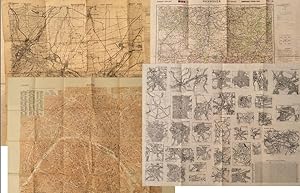
Allied Operational Maps of Germany and France, 1943-1944: A U.S. Soldier's Archive Used in the Liberation of Europe, materially linking frontline navigation, aerial bombardment, liberation campaigns, and the geopolitical reconfiguration of Europe under the expanding Soviet Bloc
Publication Date: 1943
Seller: Max Rambod Inc, Woodland Hills, CA, U.S.A.
Association Member: ABAA ILAB PADA
Seller rating 5 out of 5 stars
Art / Print / Poster First Edition
First Edition. Archive of nine large original World War II maps used by a United States Army soldier in the European Theater of Operations during the Allied liberation of Western Europe. Lithographed military maps, variously issued by U.S. Army and War Office agencies, 1943-1944. Large formats ranging from approximately 19" x 24" to 42" x 34". These maps document the cartographic infrastructure of Allied ground and air operations in the climactic campaigns of 1944-1945. The German sheets-many designated for "Army/Air" or restricted War and Navy Department use-reflect the intensive aerial reconnaissance, bombing coordination, and mechanized advance into the industrial and administrative heartland of the Third Reich. Cities such as Berlin, Magdeburg, Kassel, and D�sseldorf were central to armaments production, rail networks, and military command, making accurate and rapidly updated mapping indispensable. The Paris map corresponds to the Allied advance culminating in the Liberation of Paris in August 1944, marking the symbolic reclamation of a major European capital from Nazi control. Several sheets note reliance on prewar German cartography (1938 editions) supplemented by wartime intelligence, underscoring how Allied forces repurposed and revised enemy geographic data for invasion and occupation planning. Crucially, these maps also capture a political geography that was almost immediately transformed by postwar settlement and Soviet expansion into Central and Eastern Europe. Within two years of their issue, Germany was divided into occupation zones and, by 1949, into separate states aligned with Western and Soviet blocs. Cities such as Berlin, Halle (Saale), Magdeburg, and Wernigerode fell within the Soviet zone and subsequently the German Democratic Republic, fundamentally altering administrative boundaries, transportation networks, and the ideological framing of space. Cartographic production in these regions shifted accordingly, with new editions reflecting socialist state structures and restricted internal mapping policies characteristic of the emerging Eastern Bloc. Thus, these 1943-1944 sheets preserve a transitional moment: Nazi Germany still territorially intact on paper, yet already subjected to Allied military penetration, and poised on the brink of partition. As artifacts carried by an American soldier, they embody both the tactical prosecution of total war and the immediate redrawing of Europe into Cold War spheres of influence. The archive includes operational maps of Magdeburg (Sheet M.53, 1:250,000, "First Edition," 1943, with manuscript annotation), Kassel (Sheet L52, "Emergency Road Map," First Edition, color, based on 1938 mapping with wartime intelligence updates), D�sseldorf (Sheet K52, similar issue, with fading, highlighting, and manuscript marks), Hanover (Sheet L53, 1943), Berlin (Sheet N53, "Army/Air," 1943), Halle (Saale) (Sheet M52, marked "War and Navy Department Agencies only. Not for sale or distribution," 1943), Wernigerode (Sheet 4130, First Edition, War Office, 1944), J�lich (G.S.G.S. No. 4507, War Office, 1944, 35" x 30"), and a large U.S.-issued map of Paris (42" x 34", 1944). All were retained by the soldier following his service. Very good overall, with expected wartime folds and handling; several sheets with manuscript annotations, highlighting, fading, or moderate water exposure (notably Wernigerode, stiffened from dampness); no major losses observed. A substantial and research-rich archive of original Allied operational maps, materially linking frontline navigation, aerial bombardment, liberation campaigns, and the swift geopolitical reconfiguration of Germany and Europe under the expanding Soviet Eastern Bloc.


![Seller image for TRAVELS THROUGH HOLLAND, GERMANY, SWITZERLAND, AND OTHER PARTS OF EUROPE; BUT ESPECIALLY ITALY. [MAPS, CT 3 VOLS] for sale by poor man's rare books (mrbooks) IOBA NJB](https://pictures.abebooks.com/inventory/md/md32033811300.jpg)
