Order Total (1 Item Items):
Shipping Destination:

Maps Makers, First Edition (76 results)
Skip to main search results
Search filters
Product Type
- All Product Types
- Books (76)
- Magazines & Periodicals (No further results match this refinement)
- Comics (No further results match this refinement)
- Sheet Music (No further results match this refinement)
- Art, Prints & Posters (No further results match this refinement)
- Photographs (No further results match this refinement)
- Maps (No further results match this refinement)
- Manuscripts & Paper Collectibles (No further results match this refinement)
Condition Learn more
- New (No further results match this refinement)
- As New, Fine or Near Fine (11)
- Very Good or Good (25)
- Fair or Poor (3)
- As Described (37)
Binding
Collectible Attributes
Language (3)
Free Shipping
Seller Location
Seller Rating
-

1st Edition. Fine cloth copy in a near-fine, very slightly edge-dulled dust wrapper, now mylar-sleeved. Remains particularly well-preserved overall; tight, bright, clean and strong. Physical description: 192 pages: illustrations (some color), maps (some color); 29 cm. Subjects: Maps. Cartography History. Cartography. 3 Kg.
-
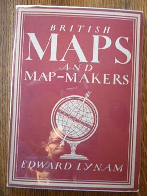
British Maps and Map-Makers (Britain in Pictures #73)
Language: English
Published by Collins, London, England, 1947
Seller: Gargoyle Books, IOBA, La Mesa, CA, U.S.A.
Association Member: IOBA
Seller rating 5 out of 5 stars

First Edition
Hardcover. Condition: Near Fine. Dust Jacket Condition: Fine. First Edition First Printing. A lovely copy! Describes early English maps & their intricate relationship to British history & culture. Author was head of the Map Room at the British Library & President of the Hakluyt Society. Originally published in 1944, this is the (stated) Third Impression (Revised) from 1947, in 48 pages with 8 lovely full-color plates & 26 black & white illustrations. Slim red & white hardcover with cover illustration that matches DJ is Near Fine: very clean & binding tight; creamy pages with very mild tanning to exterior edge, but completely unmarked; endpapers show dark offsetting. are heavily tanned in areas. Slight mustiness & slight warping. NO writing, highlighting or underlining. NOT ex-lib. The unclipped DJ is in Fine condition: nearly flawless, no creasing; nicely protected in new clear mylar cover free! Our photos depict the Exact book you will receive, never "stock" images of books we don't actually have. Same day shipping on all orders received Weekdays by 2 pm (Pacific time); later orders, weekends, & holidays ship very next business day.
-

MAPS AND MAP-MAKERS
Published by B.T. Batsford Ltd, London, 1949
Seller: R & A Petrilla, Booksellers & Appraisers, Roosevelt, NJ, U.S.A.
Seller rating 4 out of 5 stars

First Edition
Hardcover. Condition: Very Good. First Edition. pp: viii, 128 with index; 8 color plates, 87 b&w full-page and text illustrations. Bound in tan cloth, red lettering on spine. 10" x 7.5".
-

1st Edition. Fine cloth copy in a near-fine, very slightly edge-dulled dust wrapper, now mylar-sleeved. Remains particularly well-preserved overall; tight, bright, clean and strong. Physical description: 192 pages: illustrations (some color), maps (some color); 29 cm. Subjects: Maps. Cartography History. Cartography. 1 Kg.
-

Hardcover. Condition: Very Good. Dust Jacket Condition: Very Good. First Edition. Hardback with dust jacket. Not a library copy.
-
Maps and map-makers of the Aegean
Language: English
Published by Olkos Ltd, 1985
Seller: Resource for Art and Music Books, Ivoryton, CT, U.S.A.
Seller rating 5 out of 5 stars
First Edition
Hardcover. Condition: Fine. Dust Jacket Condition: Good. First Edition. Bright, sharp, square copy with no ownership markings. DJ scuffed with tear to front panel, not clipped: Well packaged in a box, ships with tracking.
-
TALES FROM THE MAP ROOM Facts and Fiction About Maps and Their Makers
Language: English
Published by BBC Books, London, UK, 1993
ISBN 10: 0563367849 ISBN 13: 9780563367840
Seller: Riverow Bookshop, Owego, NY, U.S.A.
Seller rating 5 out of 5 stars
First Edition
Hardcover w/DJ. Condition: Good+/Very Good. Black & White/Color Illus. & Photos (illustrator). First Edition. London, UK: BBC Books. Good+/Very Good. 1993. First Edition. Hardcover w/DJ. 4to., 192pp., dust jacket light shelf wear to edges and corners, otherwise very good; cover light shelf wear to edges and corners, lightly bumped corners and spine tips, otherwise quite good; light foxing on edges of text block, otherwise pages clean and unmarked. .
-
Maps and Map-Makers of the Aegean
Language: English
Published by Olkos, Athens, 1985
Seller: Salsus Books (P.B.F.A.), Kidderminster, United Kingdom
Association Member: PBFA
Seller rating 5 out of 5 stars
First Edition
US$ 13.74
US$ 20.01 shipping
Ships from United Kingdom to U.S.A.Quantity: 1 available
Add to basketHardcover. Condition: Very Good. Dust Jacket Condition: Very Good. 1st Edition. 263pp hardback, brown cloth gilt in wrapper well illustrated in colour, decorated end-papers.
-

British Maps and Map-Makers (Britain in Pictures)
Language: English
Published by Collins, London, 1944
First Edition
US$ 10.99
US$ 24.01 shipping
Ships from United Kingdom to U.S.A.Quantity: 1 available
Add to basketHardcover. Condition: Very Good. Dust Jacket Condition: Good +. 1st Edition. Bookplate. Dustwrapper has a piece missing from the rear cover and is protected by a layer of clear, non adhesive plastic.
-
Hardcover. Condition: Fine condition. Dust Jacket Condition: Very Good+ dust jacket. First Edition. Athens: Olkos Ltd., 1985. Fine condition in a Very Good+ dust jacket (lightly rubbed at the corners). NO chips. NO tears. NO fading. Bright, clean, square and tight. Sharp corners. NOT a library discard. NO owner's name or bookplate. NOT a remainder. Pages are crisp and unmarked. 1985 First Edition. Beautifully illustrated with 166 maps, nearly half in full color, and many double page spreads. Spanning the period from the early 15th century to recent times, this excellent history of the cartography of the Greek Archipelago contains a wealth of detail, especially on the lives and works of the early cartographers. Translated from the Greek by G. Cox & J. Solman. Bound in the original gilt-stamped reddish-brown cloth. Complete with dust jacket. Oversize Hardcover. 8.5" wide by 11.5" tall. This large, heavy book will require extra postage for Priority and International shipments, but only the standard charge for media mail. First Edition. Oversize Hardcover. Fine condition/Very Good+ dust jacket. 264pp. Great Packing, Fast Shipping.
-
Maps and Map-Makers of the Aegean
Published by Olkos LTD., Athens Greece, 1985
Seller: Craig Hokenson Bookseller, Dallas, TX, U.S.A.
Association Member: TXBA
Seller rating 5 out of 5 stars
First Edition
Hardcover. Condition: Near Fine. Dust Jacket Condition: Very Good. First Edition/First Printing. In English, translated from the Greek. Nice and solid.
-

First Edition. Very good paperback copy; slightly shadow-stained and edge-bumped. Remains well-preserved overall. Physical description; 72 pages : illustrations, facsimiles, maps, portrait ; 21 cm. Subjects; Cartography England Yorkshire History. Cartographers England Yorkshire History. Yorkshire (England) Maps History. 3 Kg.
-

Hardcover. Condition: Near Fine. Dust Jacket Condition: Very Good. 1st Edition. The familiar Britain in Pictures Series, 8 plates in colour and 22 in b&w. Inlaid article by John Holehouse FRGS,on famous early maps of Hampshire. John Speed 1611. Top and bottom of spine have a little wear.Firm binding and clean text. Slightly age-darkened page edges. Spine of DJ is very worn with a little wear to other edges.
-

OLD MAPS AND THEIR MAKERS
Published by C. E. Goodspeed and Co., Boston, 1925
Seller: poor man's rare books (mrbooks) IOBA NJB, Vineland, NJ, U.S.A.
Association Member: IOBA
Seller rating 3 out of 5 stars

First Edition
Paperback. Condition: Near Fine with no dust jacket. First Edition. We fit archival quality clear acrylic covers for additional protection whenever possible. ; red/b/w plates; 8vo 8" - 9" tall; 52 pages; A well done pamphlet dealing with early geographical maps.
-
Maps and Map-Makers.
Published by B.T. Batsford, London, first edition, 1949, 1949
Seller: Wykeham Books, LONDON, United Kingdom
Seller rating 4 out of 5 stars
First Edition
Cloth, 4to, 26 cm, viii, 128 pp, 95 ills (some colour). Contents: Preface; Introduction; I Pre-Christian Geography to Ptolemy; II Arabic and Mediaeval Geography; III Italy; IV Germany; V Holland and Belgium; VI French Cartography; VII English Map-Makers, English Marine Atlases; VIII The County Maps of England and Wales, a - Large-Scale County Maps of England, b - English County Atlases; IX Scotland and Ireland; X Africa; XI Asia; XII America; XIII Australia; Index. From the blurb - "In Maps and Map-Makers Mr. R. V. Tooley, who is well known as an authority on the history of Cartography, has written the first general work dealing with the whole subject. From the earliest beginnings of Cartography down to the mid-nineteenth century Mr., Tooley traces the development of Map-Making, combining an appreciation, of the popular decorative side of old maps with historical and biographical notes on individual cartographers and their work. Mr. Tooley traces the history of Maps chiefly through the achievements of the great Map-Makers - mainly English and Dutch, but also belonging to Arabia, Italy, France,* Germany and other countries. Each Chapter deals with the maps of a particular country and after each is a list - of particular value to the collector - giving the most important maps of that country and their dates. In the case of England the author goes into rather greater detail, with sections on County Maps, Marine Atlases, Large-Scale Maps and County Atlases. The illustrations are another feature of great value to the collector and amateur of old maps. They are over 100 in number and include eight colour plates, numerous half-tone reproductions, and a selection in line of decorative , cartouches, scales, ornaments, etc. Maps of the British Isles are extensively reproduced, and there are also sections on the maps of the Empire Countries and of America." Name and date on front free endpaper, two cm tear to rear joint, otherwise Good.
-

Maps and Their Makers. An Introduction to the History of Cartography
Published by Hutchinson University Library, 1953
Seller: World of Rare Books, Goring-by-Sea, SXW, United Kingdom
Seller rating 5 out of 5 stars
First Edition
Condition: Fair. 1953. First Edition. 181 pages. This is an ex-Library book. Red and white dust jacket over beige with black lettering to spine. Illustrated with black and white maps. Binding remains firm. Pages are moderately tanned throughout. Moderate tanning to pastedowns and endpapers, with pencil mark and stamp to front endpaper. Library stamp to title page. Illustrations remain bright and clear. Boards have moderate edge wear with rubbing to surfaces. Moderate crushing to spine ends. Bumping to corners. Moderate tanning and foxing to textblock. Library marking to lower spine. Unclipped dust jacket has heavy wear to edges, with large chips, tears and areas of loss to spine ends and corners. Uniform tanning to front, rear and spine.
-
Maps and Map-Makers.
Published by B.T. Batsford, London, first edition, 1949, 1949
Seller: Wykeham Books, LONDON, United Kingdom
Seller rating 4 out of 5 stars
First Edition
Cloth, 4to, 26 cm, viii, 128 pp, 95 ills (some colour). Contents: Preface; Introduction; I Pre-Christian Geography to Ptolemy; II Arabic and Mediaeval Geography; III Italy; IV Germany; V Holland and Belgium; VI French Cartography; VII English Map-Makers, English Marine Atlases; VIII The County Maps of England and Wales, a - Large-Scale County Maps of England, b - English County Atlases; IX Scotland and Ireland; X Africa; XI Asia; XII America; XIII Australia; Index. From the blurb - "In Maps and Map-Makers Mr. R. V. Tooley, who is well known as an authority on the history of Cartography, has written the first general work dealing with the whole subject. From the earliest beginnings of Cartography down to the mid-nineteenth century Mr., Tooley traces the development of Map-Making, combining an appreciation, of the popular decorative side of old maps with historical and biographical notes on individual cartographers and their work. Mr. Tooley traces the history of Maps chiefly through the achievements of the great Map-Makers - mainly English and Dutch, but also belonging to Arabia, Italy, France,* Germany and other countries. Each Chapter deals with the maps of a particular country and after each is a list - of particular value to the collector - giving the most important maps of that country and their dates. In the case of England the author goes into rather greater detail, with sections on County Maps, Marine Atlases, Large-Scale Maps and County Atlases. The illustrations are another feature of great value to the collector and amateur of old maps. They are over 100 in number and include eight colour plates, numerous half-tone reproductions, and a selection in line of decorative , cartouches, scales, ornaments, etc. Maps of the British Isles are extensively reproduced, and there are also sections on the maps of the Empire Countries and of America." Good in a dustwrapper which is edgeworn with slight loss.
-
Maps and Map-Makers of the Aegean
Published by Olkos Ltd, Athens, 1985
Seller: Dale A. Sorenson, Silver Spring, MD, U.S.A.
Association Member: IOBA
Seller rating 5 out of 5 stars
First Edition
Hardcover. Condition: Very Good. Dust Jacket Condition: Very Good. First Edition. Translated from the Greek G. Cox and J. Solman. Athens: Olkos Ltd, 1985. 11.25 x 8.5 in. 264pp, Index. Hardcover, unworn, but has faint damp stain on upper area of rear cover, interior fine; dj moderately worn and rubbed, also shows damp stain on the upper area of the blank side. Catalogue of 166 maps reproduced in color and b&w.; Maps; 11.25 x 8.5 inches; 264 pages.
-

Condition: Very Good. Dust Jacket Condition: Very Good. Hardcover, 263 pages with color, b&w illustrations. Mild wear to bright dust jacket. Record # 415141.
-
Maps and map-makers of the Aegean
Published by Olkos Ltd
Seller: Wonder Book, Frederick, MD, U.S.A.
Seller rating 5 out of 5 stars
First Edition
Condition: Very Good. First edition copy. . Good dust jacket. Card with inscription from Greek Ambassador Dimitri Th. Koulourianos paperclipped to front endpage. (Cartography, Maps, Mediterranean, Greece).
-
Old Maps and Their Makers
Published by Charles E. Goodspeed, Boston, 1925
Seller: Bibliodisia Books, Caxton Club, Chicago, IL, U.S.A.
Association Member: MWABA
Seller rating 5 out of 5 stars
First Edition
Hardcover. Condition: Very Good. First Edition. Covers reinforced with transparent archival tape. Scarce.
-
British maps and map makers
Published by Collins, London, 1944
Seller: Cotswold Internet Books, Cheltenham, United Kingdom
Seller rating 5 out of 5 stars
First Edition
1st ed. Light wear at head & foot of spine; binding tight; dust jacket worn at edges; dust jacket not price-clipped. Used - Good. Good hardback in Good dust jacket Used - Good. Good hardback in Good dust jacket.
-
British maps and map-makers
Published by Collins, London, 1944
Seller: Cotswold Internet Books, Cheltenham, United Kingdom
Seller rating 5 out of 5 stars
First Edition
1st ed. Britain in Pictures series. Owner's name & address on front free end paper; wear at head & foot of spine; press cutting glued to front flap of dust jacket; dj worn at edges with browned spine. Used - Good. Good hardback in Good dustjacket Used - Good. Good hardback in Good dustjacket.
-

First Edition. Very good paperback copy; slightly shadow-stained and edge-bumped. Remains well-preserved overall. Physical description; 72 pages : illustrations, facsimiles, maps, portrait ; 21 cm. Subjects; Cartography England Yorkshire History. Cartographers England Yorkshire History. Yorkshire (England) Maps History. 1 Kg.
-
Hardcover. Condition: Good. Dust Jacket Condition: Good. 1st Edition. 263 pps. Gilt titles: sp. Illust. w/ colour & b/w maps & facsimile docs. (listed). Orange cloth bds. w/ gilt design. Decorative endpapers. Interior leaves are clean and tight. Translated from the Greek. History of the mapping of the Aegean Sea. Includes historical outline, select bibliography & general index. A beautifully illustrated history of the sea maps of the Aegean Sea.
-
British Maps and Map-Makers
Published by William Collins, London, 1944
Seller: Babushka Books & Framers, Isle of Wight, United Kingdom
Seller rating 4 out of 5 stars
First Edition
US$ 10.99
US$ 22.81 shipping
Ships from United Kingdom to U.S.A.Quantity: 1 available
Add to basketHardcover. Condition: Good. Dust Jacket Condition: Good. 8 in Colour and 22 in B/W (illustrator). 1st Edition. .
-
A History of the Mississippi Valley From its Discovery to the End of Foreign Domination. The Narrative of the Founding of an Empire, Shorn of Current Myth, and Enlivened by the Thrilling Adventures of Discoverers, Pioneers, Frontiersmen, Indian Fighters, and Home Makers. With Facsimiles, Illustrations of Historic Places, Maps, and Portraits.
Published by A.S. Clark, New York, 1903
First Edition
Hardcover. Condition: Good. 1st Edition. XXIV chapters; 416pp; Index. Dark green cloth with gilt lettering; top page edges gilded. Former college library volume with customary stamps and labels; clean and complete. Some pencil markings in interior (erasable). Several maps and plates. Inner hinges cracked revealing mesh.
-

British maps and map-makers / Edward Lynam ; with 8 plates in colour and 22 illustrations in black & white
Published by London : William Collins, 1944
First Edition
First Edition. Very good cloth copy in a near-fine, very slightly edge-nicked and dust-dulled dw, now mylar-sleeved. Remains particularly and surprisingly well-preserved overall; tight, bright, clean and strong.; 8vo 8" - 9" tall; 47 pages; Physical description. : 47, [1] p. : ill. , col. Plates, maps ; 23 cm. Subject: Cartographers - Great Britain - History. Cartography - History. Great Britain - Maps - History. Series: Britain in pictures. The British people in pictures. 3 Kg.
-
British Maps and Map-Makers (Britain in Pictures)
Published by William Collins, 1947
Seller: J. Mercurio Books, Maps, & Prints IOBA, Garrison, NY, U.S.A.
Association Member: IOBA
Seller rating 5 out of 5 stars
First Edition
Hardcover. Condition: Near Fine. Dust Jacket Condition: Very Good. 1st Edition. Unclipped DJ in archival cover.
-
![Seller image for Maps and Map-Makers. [With plates.] for sale by MW Books](https://pictures.abebooks.com/inventory/md/md20130479753.jpg)
First Edition. Good copy in the original gilt-blocked cloth. Spine sun-toned and worn as with age. Remains well-preserved; tight, bright and sharp-cornered. Physical description; xii, 128 p. : illus., maps (part col.) ; 26 cm. Notes; Includes bibliographies. Subject; Cartography - History. 4 Kg.